
Cottonwood Canyon Road
![]() version française
version française
Pictures are small in size and grouped in gallery; just a click on it and you'll have all the gallery in bigger size!
Easy navigation with left or right arrow on the keyboard; leaving the gallery photo by Escape.
Do not forget to switch to full screen (F11). Javascript is required.
Journey map

Approximately:
- from Bryce Canyon NP (A) to Grosvenor Arch (B): 35 miles and 1h15 drive on road/dirt road
- from Grosvenor Arch (B) to Cottonwood Narrows North (C): 5 miles and 30 mn drive on dirt road
- from Cottonwood Narrows North (C) to Hackberry (D): 12 miles and 45 mn drive on dirt road
- from Hackberry (D) to Wahweap Hoodoos (E): 23 miles and 1h15 drive on dirt road
- from Wahweap Hoodoos (E) to Old Paria (F): 30 miles
- from Old Paria (F) to Paria Outpost (G): 15 miles
Monday, June 8 (continued)
After refueling, we drive to the CCR (Cottonwood Canyon Road) that will be our lot for the whole day and part of tomorrow. Back to Kodachrome for knowing the state of the track, but the ranger is gone off; a paper posted on the outside gives the same conditions as the other day: good in general, except the end with deep ruts. Ditto for the weather, OK today and 40% "chance" of rain tomorrow afternoon.
So, we begin the dirt road, confident, at 8:40 am and we arrive half an hour later at Grosvenor Arch.
Most of the information I have on this arch considers it's a double arch but ouestusa.fr writes it's a triple arch: we must solve this mystery!

Grosvenor Arch (8 photos)
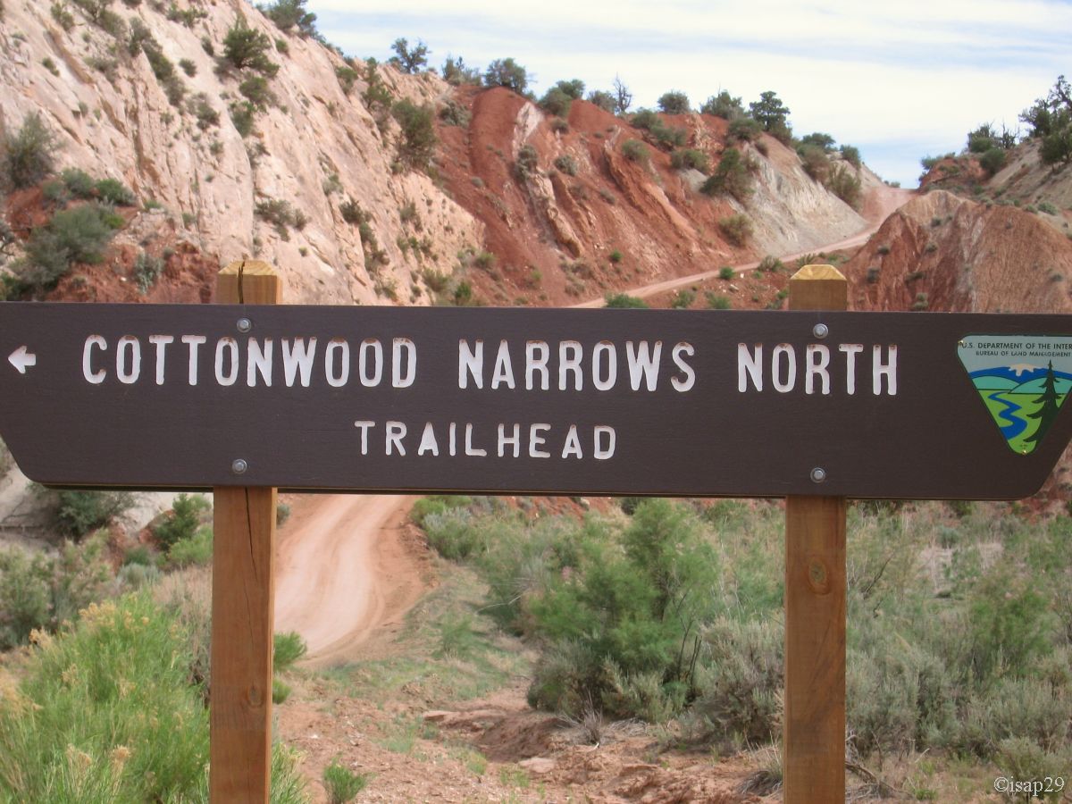
After half an hour of quiet ride, alone, with only 63°F of outside temperature (which shows the interest of getting up early), we leave the arch for
the Narrows we reach a little before 10 am.
Stop on a small parking lot and after the ritual sessions of changing shoes, creaming of faces and legs, taking backpacks, off we went.
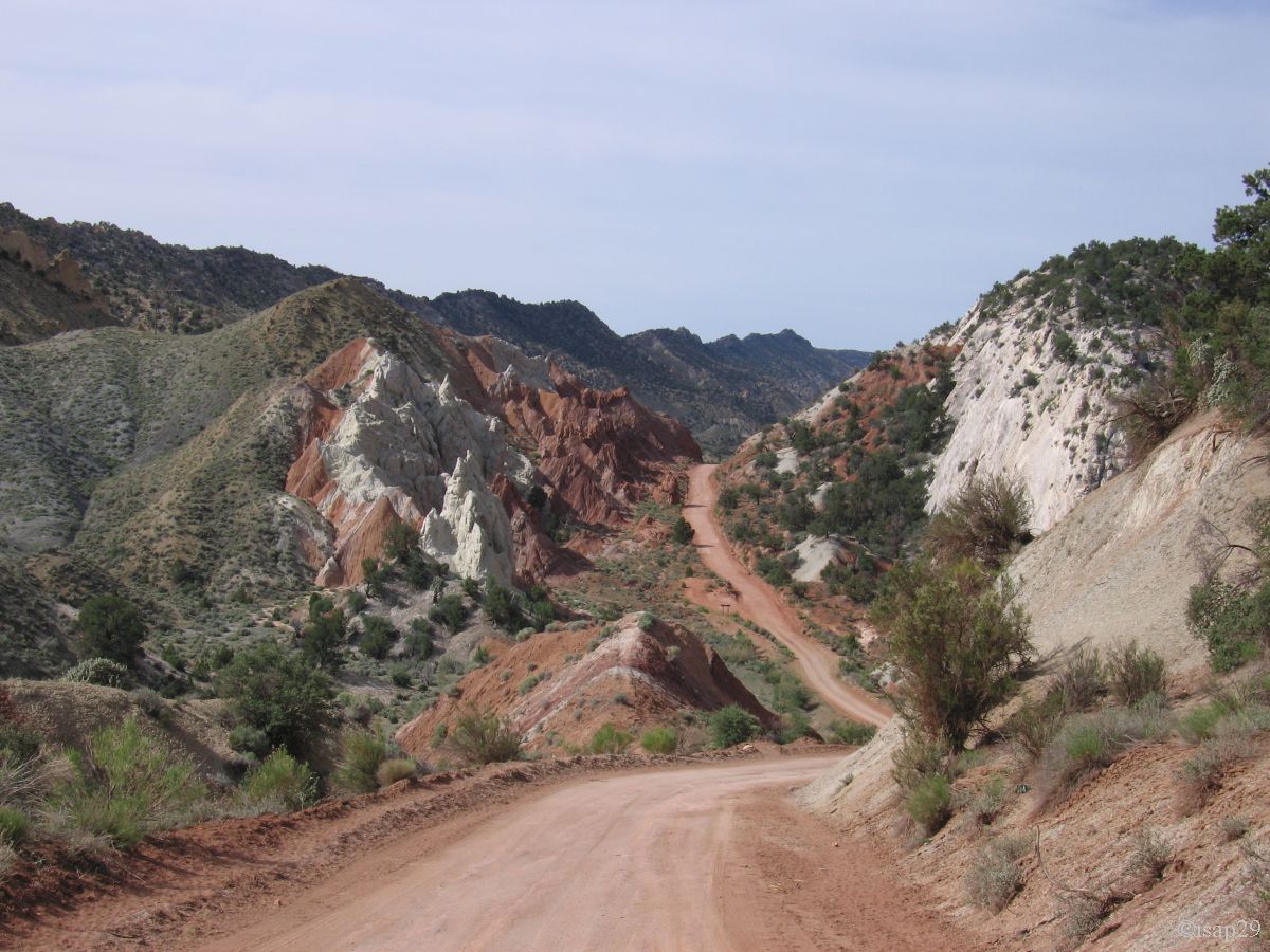
Small hike in the wash on a very sandy soil but partly in the shade as north-south; the Navajo sandstone cliffs are impressive.
We reach the dirt road a little lower and there, on the way back to the car, we find much more attractive landscapes, especially in terms of colors,
colors that are found on the photo of the parking lot, a little higher.
Arrival at our car at 11:30 am with a temperature increase but still bearable: 73°F.
The Narrows (15 photos)
We take the dirt road to Hackberry Canyon that we reach just after noon. As Isabelle didn't like walking in the sand and the sun is burning,
I go alone, just to take a first look. After 10 minutes, I turn back to tell her that there is only sand, thick, making hiking a little tiring.
As Isabelle was a bit tired, I leave alone, and soon entered the canyon. It's given as perennial but I don't see any water.
After a moment, I see water, but that comes to me, going down the wash, flowing quietly on the sand; little by little, the trickle of water becomes
brook and continues to expand, forcing me to jump over several times to go walking in the canyon.
See water going down like that, and growing continuously, makes me immediately think of "flash flood" even if I don't hear the roar of the thunderstorm,
the sky is clouding up. I'm still a bit worried all the same, and arrive at Stone Pillar Rock, easy to recognize. The dinosaur tracks are even further
but I'm going back now, as the stream continues to grow and become stronger later; my documentation also speaks of quicksand!

Back to car at 1:50 pm and, indeed, the stream has well advanced and grown.
The following pictures come from video (screen dump) but you'll know why later; quality is not optimal.

.jpg)
.jpg)
Hackberry Canyon (9 photos)
Quick snack and brainstorming: what to do? Continue as planned, i.e. stay put and make the hike to Yellow Rock, Red Top and Hidden
Cache (up to 5:30 hours), sleep there, then the next day go to the Wahweap Hoodoos via BLM430 and 431?
The risk of storms, the fact of not having a 4WD, lead us to change the program: exit Yellow Rock and spinning directly on the hoodoos
(I especially want to see them). The first time I saw photos of these hoodoos, I literally could not resist: we could not go through
it without seeing these wonders of nature.
So we start at 2:12 pm to arrive at 3:37 pm, after a track not great at all, landscape ugly, dull, deep washs, sometimes difficult to cross;
there was even one wash where we almost get stuck and where our car hit on front and rear at the same time. Luckily I had
anticipated  and took some speed to get through.
n another one, Isabelle came down to guide me, remove (big) rocks here and there to ease the path. A 4WD would surely have been better
for this kind of track, but we still reach the small parking lot and the closed fence (don't forget to close it after passage).
and took some speed to get through.
n another one, Isabelle came down to guide me, remove (big) rocks here and there to ease the path. A 4WD would surely have been better
for this kind of track, but we still reach the small parking lot and the closed fence (don't forget to close it after passage).
We descend into the bed of Wahweap Creek, wide and where hiking is fairly easy (some traces of 4WD despite the ban). The temperature of
79°F doesn't bother us. We arrive in the zone and after a few attempts, we manage to get out of bed of the stream to get close
to the famous "white ghosts"; what a pleasure!
The photos didn't "lied" and I have the same feeling seeing these magnificent hoodoos.
The "hat" of the hoodoos is amazing; it's a conglomeration of gravel and pebbles bound by a red substrate.
The loss of this cap causes the rapid degradation of the monoliths that some call "sugar loaf".
Looking from a little further, one can see very well the two superimposed geological layers: the white layer (Entrada sandstone),
thick, forming the body of hoodoos and the red layer (Dakota sandstone), thinner but more hard, brittle, which protects the previous one.

.jpg)
.jpg)
Wahweap Hoodoos (27 photos)
In preparing the trip, I noticed that the track passed very close to the White Rocks; according to my mapping software, it should be possible to go directly without
having to go around by Churchwell (on my map, vicinity WhiteWah cross).
During the next hour, I will try to prove this possibility.
At each crossing of wash in the area, I park and backpack in case (Isabelle staying in the car), I am gone, down the wash to find THE passage. The soil is very
friable rock (very, very crumbly!), I walk along a coal seam 4 to 8 inches thick, and each time I come, not to a little slope, but to a vertical wall of at least ten yards
and given the fragility of the rock, there is no question of attempting the descent, it would be suicide.
Failure .
We return to the CCR and begin the last part; its deep ruts are there. First gear, slowly and constantly watchful eye are imperative to "surf" from one peak to another
and especially not to fall to the bottom of these ruts. Our ground clearance does not allow it.
A few drops of sweat later, we arrive "safely" on the U.S. 89, phew!
Passing Paria Outpost (Dodson B&B) we booked for the next day, we stop, but there's nobody, just a car registered in California whose passengers are probably
gone hiking with their guide.
As we planned to sleep near Yellow Rock, where to go now? Old Paria is reaching out and we go there. The access track is a bit bumpy but the scenery is beautiful
and worth the trip alone, the evening light (it's almost 8pm and 75°F) illuminates the colors.
Unfortunately, midges in large quantities force us to turn around. We decide to spend the night in the courtyard of Dodson, hoping they don't get angry.
The previous car is gone and there is no telephone network, thus impossible to prevent them. We park there and prepare to eat and sleep.
_B-10.jpg)
.jpg)
Old Paria Station (4 photos)
