
Death Valley
![]() version française
version française
Pictures are small in size and grouped in gallery; just a click on it and you'll have all the gallery in bigger size!
Easy navigation with left or right arrow on the keyboard; leaving the gallery photo by Escape.
Do not forget to switch to full screen (F11). Javascript is required.
Journey map

Approximately:
- from Las Vegas (A) to Furnace Creek (B) : 118 miles and 2h35 drive
- from Furnace Creek (B) to Thousand Oaks (C) : 296 miles and 5h05 drive
Wednesday, June 17
Up at 6:45 am, we go down to breakfast, but find that $18, even if the breakfast is hearty, it's not for us.
We set off at 9:30 with 81°F. The road climbs Mountain Springs and immediately past the pass, we park near a volunteer fire department
(on exercise) to prepare our breakfast (10:10).
We leave at 10:45 with 70°F; the sky is gray with heavy clouds and wind. Soon, large drops crash against the windshield.
Since the departure of Sin City, we found again in the landscape Cholla cacti and Joshua trees, evidence that we're back in a desert area.
At 10:55, it's raining and the temperature dropped to 63°F; on our right, far enough, the sun illuminates the mountains.
As we were aware of fuel prices in the valley, we fill up our gas tank in Pahrump and about noon, I stop as I can no longer keep my eyes open
(Isabelle snoozing on her side), the last night was short.
A small walk in the sand where I picked up two pretty pebbles, a beer and here we go to arrive around 12:30 pm at the entrance of 20 Mule Team Canyon,
our first contact with the park. A friend of ours recommended this little detour.
The scenery is really like a desert area, with here and there a few tufts of grass. The track winds its way between desert hills, with colors mostly
ocher, red, yellow, gray or black, decorated with green spots.

.jpg)
.jpg)
.jpg)
.jpg)
20 Mule Team Canyon (11 photos)
We leave the canyon around 1 pm with an outside temperature of 97°F. The engine temperature gauge is again on the red and we cut
the air conditioner to turn the heating high (what an idea, huh! ) and we head to the VC of Furnace Creek.
Brief stay to restroom, visit the center, talks with a ranger that allows us to sleep on Dante's View parking lot tonight, and we take the car to quickly
find a parking spot in the shade (unexpected).
) and we head to the VC of Furnace Creek.
Brief stay to restroom, visit the center, talks with a ranger that allows us to sleep on Dante's View parking lot tonight, and we take the car to quickly
find a parking spot in the shade (unexpected).
Preparation of snacks; a car pulls very close to us (shadow is a scarce resource) and an Asian-like family settles for lunch almost in our car and on our
knees! Unbelievable! And without saying one word  .
.
After lunch, we fill our jerry cans and take some photos of the famous borax wagons that traversed the 20 Mule Team Canyon pulled by mules, hence its name.

Furnace Creek (17 photos)
We go off to Badwater at 2:40 pm and the thermometer reads 102°F. Fifteen minutes later, we're getting there: 85 meters below sea level; a small pond still contains water, brackish, but where frolic many black larvae (larvae of what?).

- 3(5) images_autop-haute-cylin-tailler.jpg)
Badwater (12 photos)
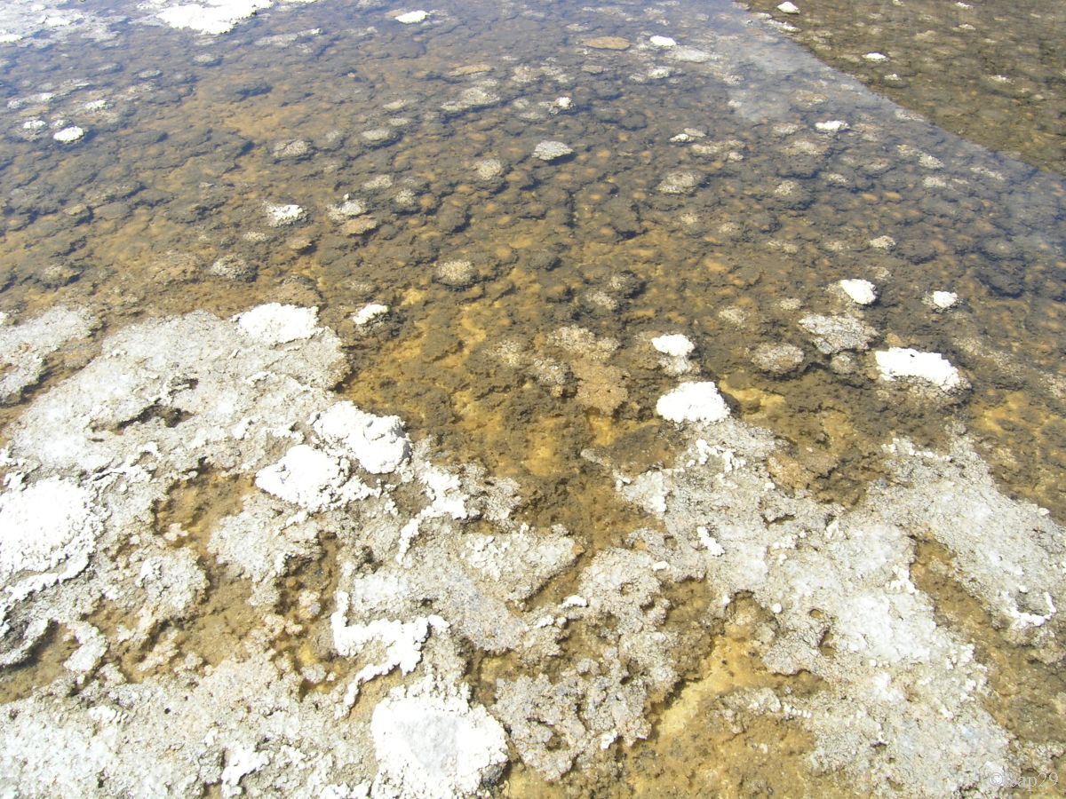
Half an hour later (104°F), we go to Devil's Golf Course, former lake bottom with dryed mud and where salt has crystallized,
giving this "rough" area. Be careful not to fall on these edges, it could hurt you!
The view from the road bodes well for Artist Drive.

.jpg)
.jpg)
Devil's Golf Course (13 photos)
Then, we enter Artist Drive and Artist Palette, one-way road. Here the show comes only from colors of the hills all around us, but what a wonderful show! It's difficult to choose a place to contemplate as the choice is vast. This small stretch of road (and associated hike) will remain one of our best memories.

_ciel corrigé.jpg)
.jpg)
Artist Drive (24 photos)
We enter Golden Canyon at 5:10 pm for a small hike of an hour. We find again the palette of ocher of this morning. As the canyon is rather in the shade, the temperature is bearable. The walk ends with the beautiful red cliffs of Red Cathedral and we go back to our car.

Golden Canyon (15 photos)
We make an unexpected stop at the Furnace Creek General Store to pick up some cold drinks (our cooler can't cool sufficiently) and breathe
a little air conditioning, which is ultimately very enjoyable  .
.
We leave this haven at 6:55 pm to go to Dante's View for the sight and to spend the night there; it's 100°F (we had 106°F at maximum).
Some pictures before leaving the valley while the sun is shining the hills; these pictures are taken while driving.
.jpg)
Road near Furnance Creek Inn (7 photos)
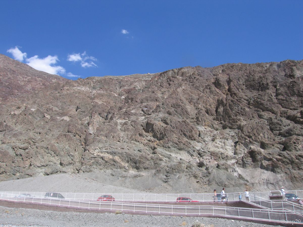
Isabelle drives us to the top of Dante's View, but I see nothing of the road, sleeping almost all the time. We arrive at 7:35 pm and with altitude
(5 476 feet), the temperature is now 75°F, which is very nice.
The sunset is "average" for the sky is very cloudy, but the view of the valley is beautiful and the hills behind us are sometimes well lit.
The storm is rumbling in the distance and in northwest of the valley, the rain seems to fall.

-anc 34_taches.jpg)
Dante's View (10 photos)
Isabelle shows me out a water stain under the car. Suspecting a problem with the radiator, I open the hood, but found nothing. A torch in hand,
I slip under the engine and there, after several minutes of inspection, I discover a "strange object" hanging from an electrical cable. What can it be?
I get out from under the car, re-inspect the engine compartment and finally uncover the mystery: the object dangling at the end of the cable is simply
one of the two fan motors intended to cool the water radiator!
JI immediately checked the second one and find that it's not in its place; its three screws are missing and it is stuck in a corner, blocked and unable to rotate.
So we've finally explain the rise of temperature at Alstrom Point and Las Vegas: when we drive, the surface of the radiator is sufficient so that the "wind speed"
quite cools the engine but as soon as we're slowed down, it's no longer sufficient and the temperature increases.
We went not far from the breakdown of the head gasket! 
But what can be the cause? It's clear that I didn't raise the hood when I took the car, but I think that the tracks we have traveled, including HTRR, and
speed because we don't necessarily drive slowly ,
have probably contributed the problem. 
As I can't remedy this, I close the hood. We must go as is to Los Angeles; our trip back was in any case scheduled for tomorrow.
We prepare our dinner and, almost at the end, our gas cylinder is empty; no breakfast tomorrow morning!
A huge cumulonimbus cloud crosses through the valley and comes right over us; gusts of wind are such that we shut ourselves in
the car for sleeping, not very proud; the car is pretty shaken.
Thursday, June 18
The program of the day, the last of our trip, included Titus Canyon in its entirety but the discovery of the last night puts an end to this idea,
I don't want to risk our lives stupidly in this no man's land.
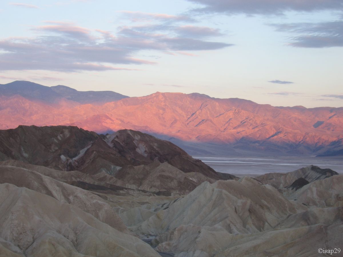
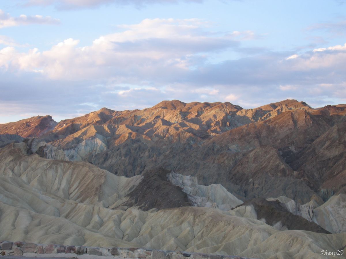
Wake up at 4:30 am with 64°F; 20 minutes later departure for the sunrise over Zabriskie Point, where we arrived half an hour later with already a hot wind.
The parking lot is not empty; we aren't the only ones to be awakened so early.
A small climb to get to the built point of view. The sky is very busy and the sun, still hidden by the mountain, is well reflected in the cloud layer.

_ciel corrigé-recadre.jpg)
.jpg)
.jpg)
.jpg)
Zabriskie Point (9 photos)
These same clouds will prevent us to have beautiful colors on the ochers around us and everyone ends up leaving the site.
We drive towards Stovepipe and we stop at Sand Dunes around 6:45 am for a short stroll before enjoying breakfast at Stovepipe Wells Village (because we're out of
bottled gas since last night). We'll have to wait a little bit as we're the firsts and it's not yet open.
Pleasant meal that we enjoy in a cool and sieved atmosphere.

.jpg)
Stovepipe (5 photos)
After breakfast, we fill up at $ 3.34 per gallon instead of $2.71 the previous day. The difference may seem overwhelming, but we're now
in California and taxes are actually different, the extra cost due to the location isn't so bad!
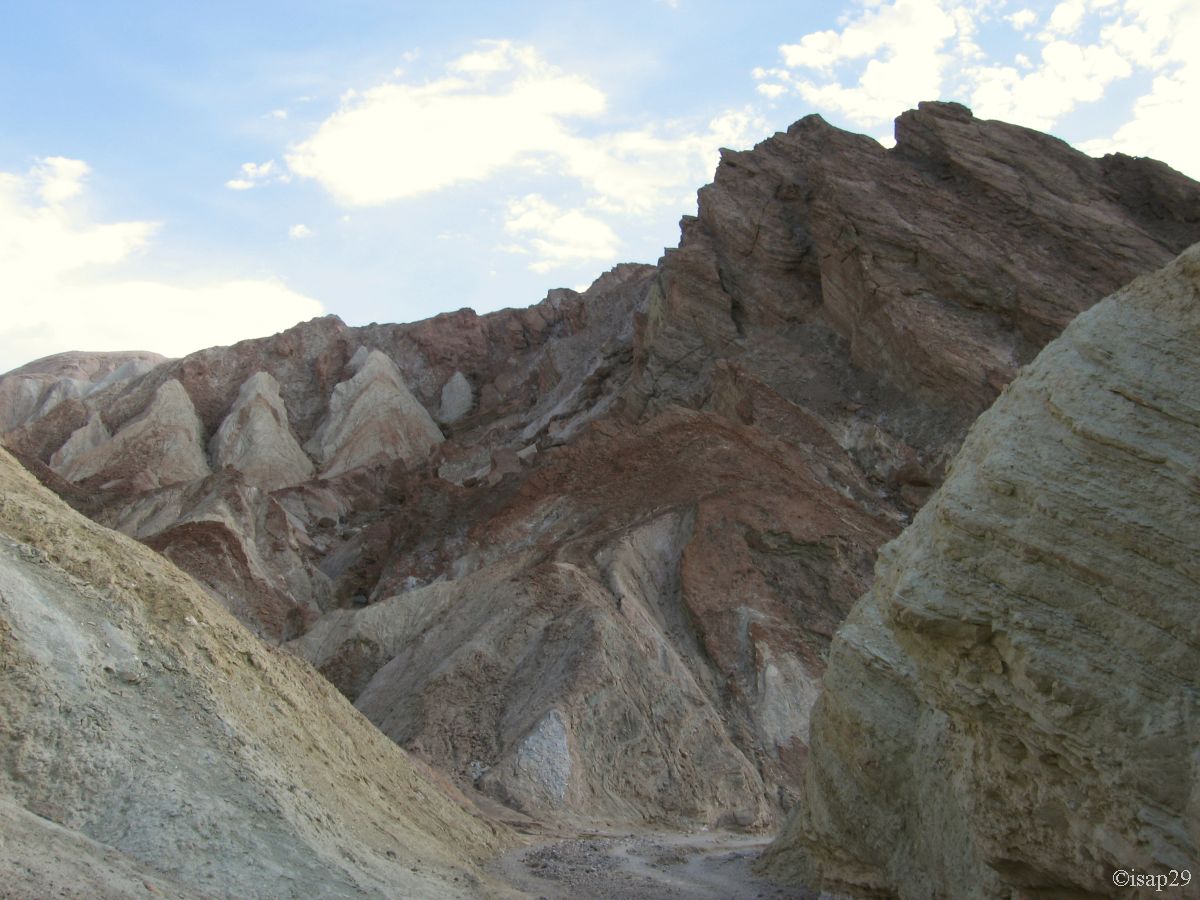
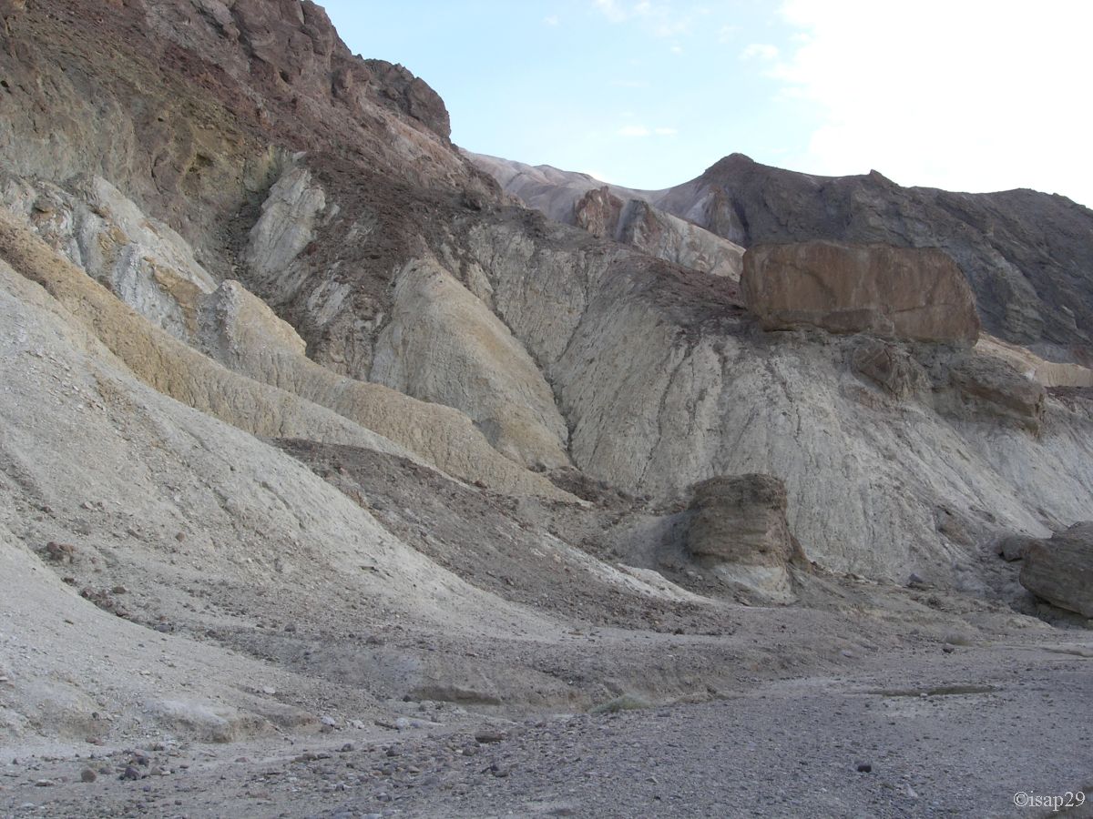
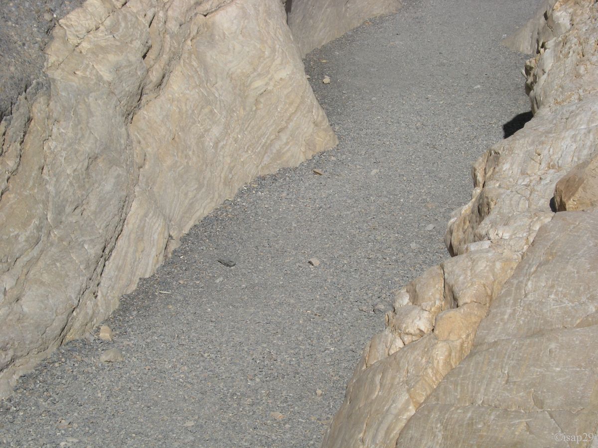
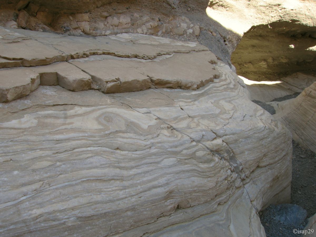
Just out of Stovepipe, we take the track on the left to Mosaic Canyon; the trail is very rocky and takes us to the foothills of Tucki Mountain
and, after about 2 miles, we arrive at the parking lot (8:30 am and 90°F). The walk is nice going up the dry bed of the river framed by steep cliffs.
Soon, the stream bed narrows and winds through layers of polished marble for several meters in height, interspersed with clusters of pebbles (mosaic).
The name of this canyon is from the rock formation called Mosaic Breccia (Breccia is an Italian word meaning fragments).

Mosaic Canyon (31 photos)
We take the road at 9:40 am (91°F) towards Panamint Springs; after a last photo stop at Father Crowley Point Vista, almost lunar landscape, we soon leave the park (elevation about 4,900 feet) downwards to Hwy 395 and then back home of our friends at Thousand Oaks.

Father Crowley Vista Point (1 photo)
During the descent, we find again Joshua Trees. We stop at a gas station in Olancha to freshen up and quench our thirst; fuel at Mojave and we arrive
at our friends' house at 3:10 pm: end of the journey, but not of our stay.
After a frugal breakfast, we begin by emptying our car. Next, thoroughly cleaning inside and outside, it really needs. I ended with the high-pressure cleaner in the engine
compartment where we can still see traces of coolant (no need to draw the eye to the problems of cooling).
At the end of cleaning, the floor in front of the garage is wholly red: it's the proof that we have brought back sand with use .
The car is now ready to go to Los Angeles tomorrow.
The day ends with a cocktail on the edge of the pool to toast, as if we need a reason ,
the end of our 30 days through a small part of the southwest. We'll return!!!

Appetizer (1 photo)
