JavaScript is not enabled.
Needed to see the photo galleries.
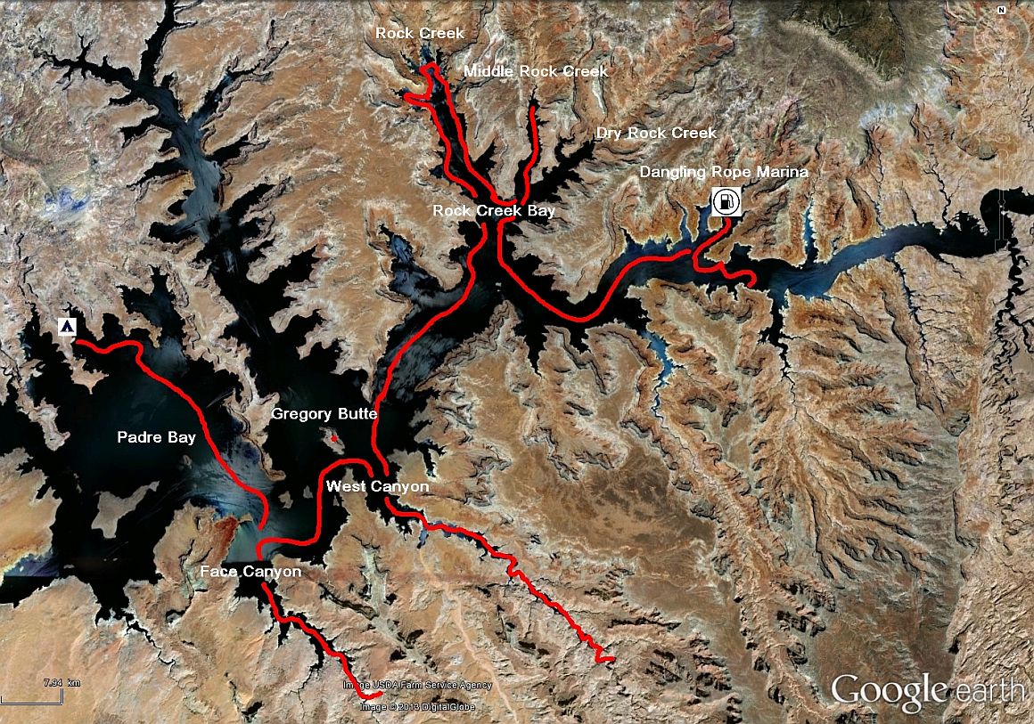
Journey map

J23 - Saturday, June 2
Wake up at 5:30 am; we have slept poorly, the wind didn't stop turning during the night, the boat hitting the sand and the waves lapping against the hull.
Midges of the night before are still there and before they begin to disturb us, we break camp (er, rather weigh the anchors
![]() ). We go a little further down the main channel, just before the entrance to Dangling Rope
Marina. The sky is cloudy, with a fresh breeze, and we even get our first 3 drops of rain. The two anchors dropped, we can take our leisurely breakfast.
). We go a little further down the main channel, just before the entrance to Dangling Rope
Marina. The sky is cloudy, with a fresh breeze, and we even get our first 3 drops of rain. The two anchors dropped, we can take our leisurely breakfast.
But to leave, it is a different story, one of the anchors is still stuck and nothing to do. I put myself in the water and make a small apnea of about 7 yards to lift it.
We arrive at the marina at 7:25 am but it doesn't open until 8am. Anyway, we have no choice, it’s imperative to refuel, tank level being very low.
We talk to Jessica, friendly ranger woman that cares for us and fuel pumps: $ 5.42 a gallon, 71 gallon for a tank of 75
![]() and a bill for $ 384. There is also a small supermarket where we buy one bag of ice 5kg ($ 5.25, everything
is expensive on the lake), our cooler has a little trouble with the heat, being connected only when navigating and we need to recharge the batteries of our
cameras (we didn't take our 12V power strip).
and a bill for $ 384. There is also a small supermarket where we buy one bag of ice 5kg ($ 5.25, everything
is expensive on the lake), our cooler has a little trouble with the heat, being connected only when navigating and we need to recharge the batteries of our
cameras (we didn't take our 12V power strip).
The sun came by and there remain only a few small white clouds; temperature announced by Jessica is 102 ° F and winds up to 18 mph from West South West for the night.
We should be taken it into account tonight.
Dangling Rope (9 photos)
We leave and, shortly after, we enter Rock Creek Bay that we cross, even going swim in its north end near 10:50, very nice because the temperature is high. By cons, we see that it's the weekend and we are less afar of Wahweap Marina as the number of boats and scooters is much higher.
Rock Creek Bay (20 photos)
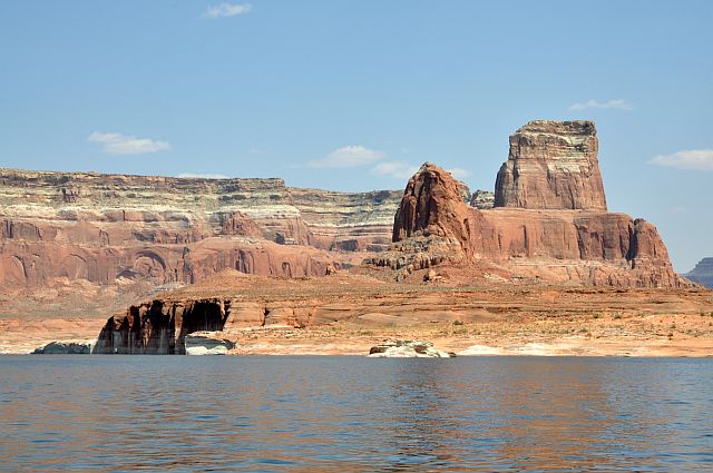
At 11:38 am, we go into West Canyon and after a little browsing among the stunning red cliffs, we drop anchor for lunch in shade. Next to us, a camp empty at this moment, with two dogs to keep it; a boat will come shortly after,
and will leave quickly enough. Some boats go "thoroughly", generating large waves
![]() .
.
We leave at 1:30 pm and just 15 minutes later arrive at the bottom of the canyon. U-turn and soon we find a couple of waterfowl overview on the way there.
We stop for a photo shoot. All information taken, they are Western Grebes.
A little after, a (dry) wash in height shows us, as we can see on the beach below, the damage that water can cause.
At 2:30 pm, at the mouth of West Canyon, we go straight to Face Canyon but be very careful because there is virtually no depth,
so it's idling and base lifted up than we move between Gregory Butte and the left bank. It's this passage that had "intrigued" us on our first day on the lake.
An oncoming boat driver asked us (in English ![]() ) if he can pass. I haven't been very "clear" because he finally makes a u-turn.
This will probably be the main channel in a few hundred years
) if he can pass. I haven't been very "clear" because he finally makes a u-turn.
This will probably be the main channel in a few hundred years ![]() .
.
During our visit, we saw horses, probably Navajo, on the shore.
West Canyon (20 photos)
We pass the buoy of Face Canyon at 2:39 pm; the entrance of the canyon is wide and cliffs quite distant but the show is always so beautiful. The canyon narrows quickly and at 3 pm,
we stop at the end of the left fork, there is no more water. We continue on foot to try to see Diagenetic Arch; we will until the end of this slot canyon and climb a bit to try to see
something. Nothing, except perhaps to the east-southeast, we'll check on our pictures (it was rightly the arch).
Clearly, we should have continued the hike; that shows a slight lack of preparation
![]() , but I found little info on this arch and then, remember,
it's very hot and we walk in the blazing sun
, but I found little info on this arch and then, remember,
it's very hot and we walk in the blazing sun ![]() .
.
Face Canyon (27 photos)
We return to boat and start looking for a beach for the night, well oriented with respect to the announced
(facing southwest) wind. First attempt at mouth (left) of Face Canyon but it's not good, only rock.
We leave to Padre Bay, on next day's program and quickly find a location on the sand, almost between two houseboats in Kane Creek Canyon.
It was still very hot and we swallow 1 liter of orange juice in less than 5 minutes; a bath is good for us and then cocktail, dinner and sleep at 8:30 pm
with a hot wind and with difficulties falling asleep.
Two hours later, a shot of "firecracker" slap dryly: a thunderstorm? We won't know. During the night, the wind eased off slightly.
Padre Bay (9 photos)


