JavaScript is not enabled.

Needed to see the photo galleries.

Flight over Canyonlands


   drapeau français    version française


Pictures are small in size and grouped in gallery; just a click on it and you'll have all the gallery in bigger size!

Easy navigation with left or right arrow on the keyboard; leaving the gallery photo by Escape.

Do not forget to switch to full screen (F11). Javascript is required.


Previous page Next page

Summary USA 2012

Home

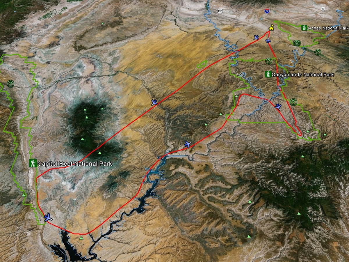
Flight map

carte lac Powell

J34 - Wednesday, June 13

Wake up at 6am. We have an appointment at 10:15 am at the airport for a flight over Canyonlands with Redtail Aviation, so we're in no hurry. Purchasing postcards, trip to the City Market for croissant, donuts and ice cream and we leave for the airport where we arrive at 9:58 with 82°F.
Having met our pilot, Tim Martin, a "grandfather" of at least 72 years, we get to our plane; we're only 3, it's all great! The plane is a small plane (Cessna 172). At the suggestion of Isabelle, I take the front seat with the camcorder, Isabelle the rear seats with our Nikon to be able to shoot right and left.
Take off at 10:40; the pilot is first rather laconic then, as we has shown that we knew a little bit this region and that we were interested (we are not common tourists somehow), ice is broken and he becomes endless, sometimes entering into long explanations which we don't necessarily understand everything wink. But, obviously, he loves his region, its landscapes and we too; it’s fine.

I discover a year later, in writing this page, that Tim is the pilot who crossed Corona Arch with his plane, for example.


We'll fly over the Green River, Canyonlands, the Henry Mountains, the Waterpocket Fold, the upper part of the Lake Powell, Colorado River, the Maze, the Needles and Island in the Sky.
Our pilot sometimes does another passage for Isabelle can photograph an arch from another angle; thank you Tim smile.

We leave the plane at 12:40 pm with a big and large grin smile smile smile, both delighted, ecstatic.
This outing is relatively expensive ($ 594 for two, 2012 price), but we recommend it, it's part of our best memories.
Even now, as we review our photos one year later, the pleasure of this day is still alive, happiness in its purest form.


Bartlett Wash

Just north of Bartlett Wash

Above Tusher Tunnnel

Bartlett Wash

Lost World Butte & The Needles

The beginning of Hell Roaring Canyon

Bowknot Bend

Hell Roaring Canyon, Mineral Canyon & Upheaval Dome n the center right of the photo

Mineral Canyon & Buck Mesa in the foreground, and The Breach opening on Upheaval Dome

Horseshoe Canyon

Old meander of the Green River at the mouth of Horseshoe Canyon

Green River at the mouth (left) of Mineral Canyon

Bighorn Mesa, Steer Mesa & Candlestick Tower

Horsethief Point

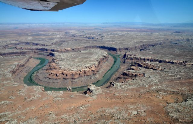
Gooseneck near Fort Bottom

Bighorn Mesa, Potato Bottom Basin, Steer Mesa &t Candlestick Tower on the right

Buttes of the Cross

Horseshoe Canyon, area of the various panels of pictographs

Spur Fork Canyon

Twin Corral Box Canyon, on Coyote Flat or Twin Corral Flats, up a bit to the left, Ekker Butte and at the top left, barely visible, Cleopatra Chair

Sams Mesa Spring

Bull Pasture

Dirty Devil River

Sams Mesa Box Canyon

Dirty Devil River at the mouth of Twin Corral Box Canyon

At the mouth of Twin Corral Box Canyon

Dirty Devil River

Burr Point

Green River & Island in the Sky (30 photos)


Henry Mountains: Mount Ellen & South Summit Ridge

Poison Springs

Bull Mountain

The Hwy95 down and the Henry Mountains; on right, Bull Mountain

Along Hwy95 and Trachyte Point West

Mount Holmes & Freds Ridge

Trachyte ranch & Trachyte creek

Badlands at the foot of the Henry Mountains

Mount Pennell

North of No Man Mesa; in background, the Waterpocket Fold

No Man Mesa

At the foot of No Man Mesa

No Man Mesa & Mount Pennell

Henry Mountains (22 photos)


NOTE: The plot shows the crossing of Henry Mountains between Mount Pennell and Mount Hillers.


Waterpocket Fold, you can see the Burr Trail Road

Waterpocket Fold at The Post

Halls Creek Overlook; on the right, Deer Point

Halls Creek & Deer Point

Waterpocket Fold, you can see the Burr Trail Road

Deer Point

North end of Deer Point

Brimhall (Double) Bridge

Deer Point

Red Slide

Halls Creek Narrows

Millers Creek

Waterpocket Fold (21 photos)


Halls Creek Bay

Bullfrog Bay

Bullfrog Bay & Halls Creek Bay

Bullfrog Marina

Crystal Springs Canyon

Forgotten Canyon 

Smith Fork Canyon

Cedar Canyon and on the left, Good Hope Bay

Cedar Canyon

Colorado River

Ticaboo Creek, Mount Ellsworth

Good Hope Bay & Red Canyon

The Horn

Farley Canyon & White Canyon

Farley Canyon

Colorado, Farley Canyon & White Canyon

Colorado, at the mouth of the Dirty Devil River

Hite Crossing

Lac Powell & Colorado (19 photos)


The Sewing Butte

Andy Miller Flats

Dark Canyon

Cataract Canyon

Bowdie Canyon

The Maze; in background, La Sal Mountains

The Maze: Lizard Rock

In the foreground (small), Chimney Rock

The Maze, near Pictograph Fork

Chocolate Drops

Chocolate Drops; in background, the Green River

Chocolate Drops; on their left, the canyon with Harvest Scene

Green River, White Rim; on the right, Junction Butte

The Maze: Water Canyon

The confluence

The Maze (20 photos)


The Needles - Chesler Park

Elephant Canyon, Virginia Park & Chesler Park

Druid Arch

At east of Butler Wash that can be seen at the top

The Needles; in background, The Six Shooters

Salt Creek

Kirk Arch

Big Pocket

Wedding Ring Arch

North & South Sixshooters

Angel Arch

Castle Arch

The Loop, east & west

Monument Basin, Island in the Sky

Standing Rocks, Monument Basin

Shafer Trail

Basins of potash; in the foreground, Dead Horse Point SP

Merrimac Butte & Monitor Butte

Tim and us

The Needles & Island in the Sky (23 photos)


We hope, after seeing these pictures, you want to make this flight clin d'oeil.


Seeking informations on Tim Martin, I found a website in English, written by a German, who tells the same kind of overview, with the same pilot. The photos are superb.
The original site (but in German). Significantly more photos (~ 125 in 900*600).
You must see it, even if you do not speak German, the photos are in your native language clin d'oeil.
The same site, but with pictures in 1200*800.

And finally, a last link to an almost identical flight that ours.
Rolf Banner