JavaScript is not enabled.
Needed to see the photo galleries.
Pictures are small in size and grouped in gallery; just a click on it and you'll have all the gallery in bigger size!
Easy navigation with left or right arrow on the keyboard; leaving the gallery photo by Escape.
Do not forget to switch to full screen (F11). Javascript is required.
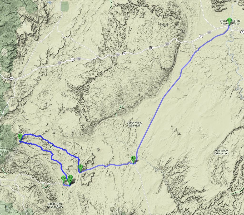
Journey map

Approximately:
- from near Fruita (UT) (A) to ford (C): 2.5 miles and 6' drive on road/dirt road
- from ford (C) to Cathedral Valley campground (E): 26 miles and 1h30 drive on dirt road
- from Cathedral Valley campground (E) to Caineville (F): 30 miles and 1h57 drive on dirt road
- from Caineville (F) to Green River (UT) (H): 75 miles and 1h16 drive on road
J37 - Saturday, June 16
Wake up at 6:15; hesitation. What to do? Go to Torrey looking for a pharmacy? Finally, the state of Isabelle seems to be improving and we still decide to go in Cathedral Valley; our neighbors have not moved yet.
We leave at 7:56 with a pleasant temperature of 70°F; easy crossing of the ford on the Fremont River where Isabelle went recognize the land, crossing on foot.
Then we begin a slow climb up of the track (especially location reported by rangers but no problem for us) to arrive in a fairly large area, consisting mainly of colored clay,
Bentonite Hills. Bentonite, kind of clay coming from the decomposition of volcanic ash, has the tendency to retain water very well, making the track
impassable when it rains, even with a 4WD.
The track does not present any major problems, and fortunately, because we don't meet anyone, just saw some flashes far away (reflections of mirrors?).
The main interesting points are easy to find, especially if you buy the small illustrated guide at Rangers ($ 2.5); no need of GPS unit.
Bentonite Hills (19 photos)
For our next stop, Lower South Desert Overlook, we take a small track on the left (cul de sac), which leads to a view of Lower South Desert, a valley parallel to the Waterpocket Fold; a sandstone monolith, Jailhouse Rock, sites on this view.
Lower South Desert Overlook (18 photos)
Thirteen miles later, after entering in Capitol Reef NP, a small branch to the left leads to Upper South Desert Overlook; Don't stay just at the right point of view next to the parking lot but keep left and make a small climb, the view is worth the effort.
Upper South Desert Overlook (6 photos)
At 12:18 pm, we arrive at Upper Cathedral Valley Overlook and there discover a picnic table with shade
![]() ; the small stretch of track to get there is very rocky but less than I expected.
After discovery of perspective, lunch in the shade but flies, flies....
; the small stretch of track to get there is very rocky but less than I expected.
After discovery of perspective, lunch in the shade but flies, flies....
We left at 1:10 pm and 79°F to finish at Cathedral Campground where we cross our only vehicle of the day (an outfitter with customers).
It's forbidden to collect firewood, but the location we choose is provided, the ban did not have to disturb our predecessors. As there is nothing stated anywhere,
we will do a fire on evening. Meanwhile, a nap would do the most good ![]() ; I install the lounger in the shade,
lie down (Isabelle does the same in the car) but I can't sleep because of insects
; I install the lounger in the shade,
lie down (Isabelle does the same in the car) but I can't sleep because of insects ![]()
![]()
![]() .
In addition, Isabelle begins again to scratch and it looks like its plates hives have grown. Finally, I find a solution, not great, but what else?
We close all the windows of the car, I start the engine and put the air conditioning; the temperature drop seems to do her good.
.
In addition, Isabelle begins again to scratch and it looks like its plates hives have grown. Finally, I find a solution, not great, but what else?
We close all the windows of the car, I start the engine and put the air conditioning; the temperature drop seems to do her good.
A little later, we start to look up a location for the sunset, but finally we find an almost next to our site. Unfortunately, a large cloud will disrupt
the moment and therefore not beautiful colors nor beautiful pictures ![]() .
Evening around the fire, a little disappointed with this influx of bugs. Isabelle goes to sleep while I read, with a good cigar, until the embers are extinguished.
.
Evening around the fire, a little disappointed with this influx of bugs. Isabelle goes to sleep while I read, with a good cigar, until the embers are extinguished.
Upper Cathedral Valley Overlook & campground (12 photos)
J38 - Sunday, June 17
Wake up at 6:20, and just outside, flies and gnats already keep us company. Isabelle seems to go much better, the fresh of yesterday (AC) seems effective.
Starting at 7:50 with 81°F. The track, pretty rocky, goes down into the valley along the hillside. Stroll at Morrel Cabin between 8:10 and 8:29.
Then we hike Cathedrals Trail with beautiful views of Needle Mountain and Cathedral Mountain. End of hike at 9:16 with 0.9 mile on pedometer.
These monoliths are the remains of Entrada sandstone layer and we can also sometimes see, especially on Cathedral Mountain, some remains of the upper layer (Curtis Formation), clearer.
Morrel Cabin & Cathedrals Trail (19 photos)
I continue to ride the track (I say "I" because Isabelle sinks into almost lethargic, sleepy always, it becomes a problem) and arrive at Gypsum Sink Hole; it's not very interesting at all, it's a simple hole in the ground, a vein of dissolved gypsum. By cons there are, everywhere, beautiful basalt rises along cracks in the rock: the dikes. Harder than the surrounding rock, these dikes are less eroded and clearly visible, very photogenic.
Gypsum Sink Hole (11 photos)
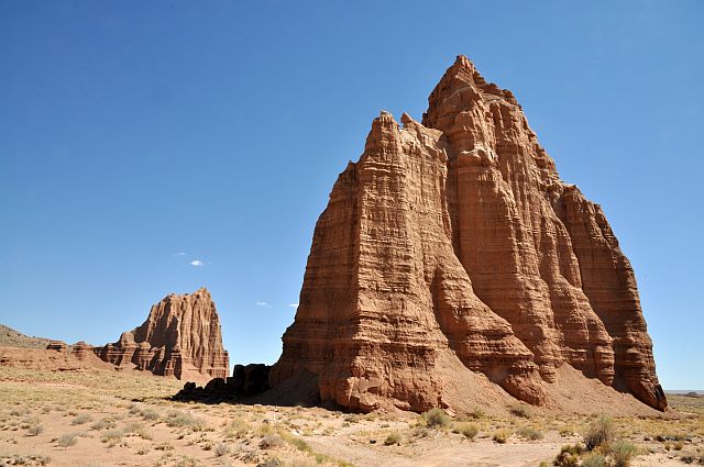
Near Temple of the Sun, Isabelle wakes up a bit, but is unable to take any picture. So, I travel alone this area, passing successively through Glass Mountain, large block of gypsum, Temple of the Sun and Temple of the Moon. These two monoliths that rise from the ground in the middle of (almost) nowhere are superb; they are, as in Cathedrals Trail, the remains of an Entrada sandstone layer.
Temples (12 photos)
I ride again the track, a little worried anyway by Isabelle's state, but apart gain a little time, there is nothing else to do but return to civilization.
I had planned to go back a track along North Caineville Reef but its condition is really too sandy. Back then the UT-24 and towards Hanksville.
There, existential question: what do we do? Having seen a doctor's office in Green River, I decide to go back in case of her health would worsen and to take a room at hotel.
So we forget about Temple Wash, Wild Horse Arch, Crack Canyon, Family Butte, Reds Canyon, Lucky Strike Mine and Rods Valley and carefully make a "health" break.
We take a room at Motel 6 in Green River at 1:55 pm with 99°F on thermometer.
While Isabelle is asleep, I tried in vain to have an Internet connection. By late afternoon, Isabelle gets better and always thinking
about a problem with the laundry, we wash again all our clothes with clean water, no detergent.
Caineville Wash (6 photos)


