JavaScript is not enabled.
Needed to see the photo galleries.
Pictures are small in size and grouped in gallery; just a click on it and you'll have all the gallery in bigger size!
Easy navigation with left or right arrow on the keyboard; leaving the gallery photo by Escape.
Do not forget to switch to full screen (F11). Javascript is required.
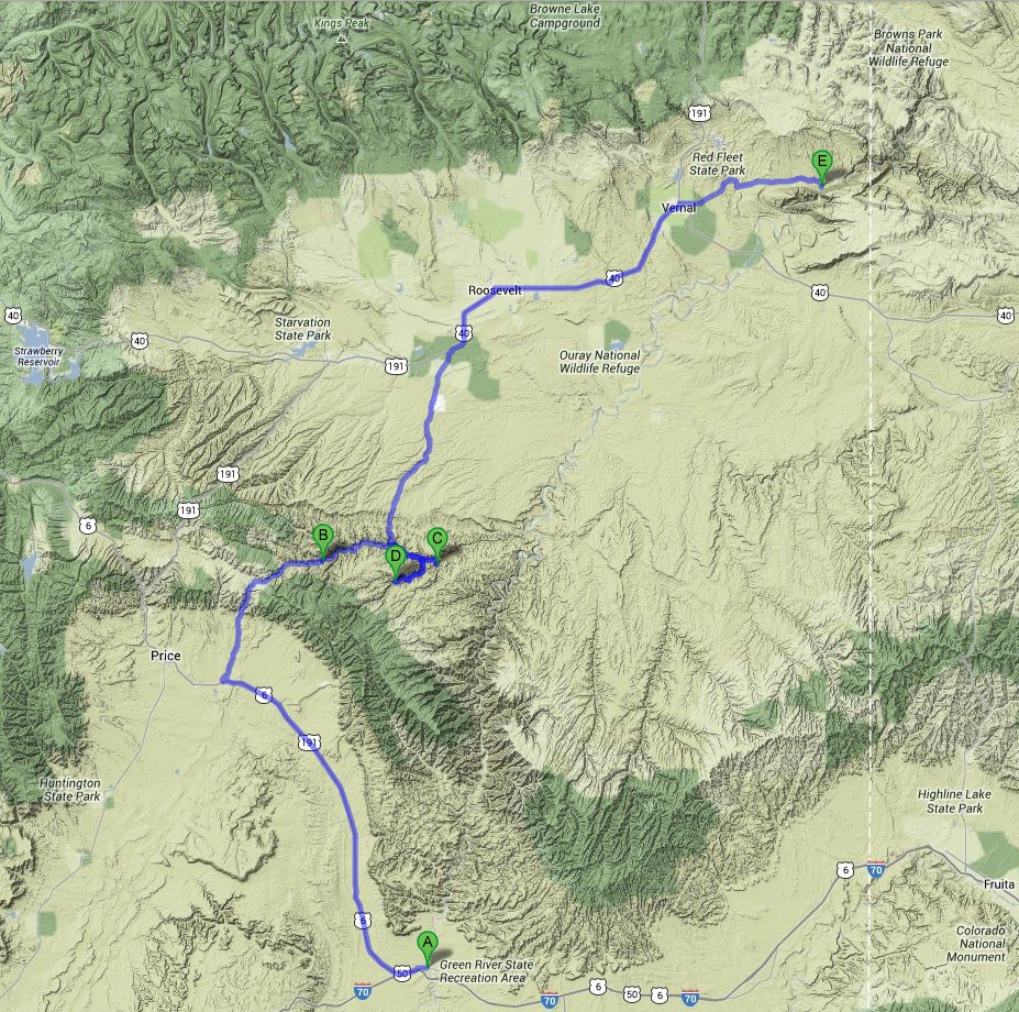
Journey map

Approximately:
- from Green River (A) to 9 Mile Canyon (C): 99 miles and 3h20 on road/dirt road
- from 9 Mile Canyon (C) to Rainbow Park Campground (E): 116 miles and 4h50 on dirt road/road/dirt road (duration largely overestimated)
J42 - Thursday, June 21
Wake up at 6:15; Isabelle's face is almost returned to its original form, but there are still some swellings; so we can consider more serenely
the continuation of our trip ![]() ; it was only once back in France we have learned that could be
treated with cortisone present in our pharmacy.
; it was only once back in France we have learned that could be
treated with cortisone present in our pharmacy.
We leave our room to go buy a cooked chicken and a bag of ice; indeed, the fact of adding ice in our cooler (electric) significantly improves
its cold capacity (given the outside temperature) and allows Isabelle to have good margarita cocktails during 3 evenings ![]() .
We put these cubes in bottles of juice with wide mouth, which eliminates water throughout the cooler.
.
We put these cubes in bottles of juice with wide mouth, which eliminates water throughout the cooler.
Although still in Utah, this page and the next few pages are in the Wyoming part simply for division of text.
Departure for Nine Mile Canyon on US-6 to Wellington hen right on the Soldier Creek Rd. This road is very pretty, climbing to more
than 2,200 yards. It's like in mountain, green, fresh; it changes from the semi-desert region of Moab.
The road becomes quickly enough a track, but passable even in a RV. By cons, many roadworks (laying of PVC "nozzles") slow us down. We arrive in Nine Mile Canyon
at 10:08 am. For those who don't know this site, it's a canyon (weird, right? ![]() ) of about 40 miles long,
with petroglyphs everywhere, everywhere, mainly of Fremont type. I noticed twenty spots to visit, not to mention arches and others.
) of about 40 miles long,
with petroglyphs everywhere, everywhere, mainly of Fremont type. I noticed twenty spots to visit, not to mention arches and others.
Entry of Nine Mile Canyon (15 photos)
In addition to the petroglyphs, the scenery is beautiful. After several stops, we stop at 12:13 pm and 79 °F for lunch at Daddy Canyon Complex where we find a table in the shade and toilet. Small hike after dinner with a photo as aid that facilitates the discovery of the panels.
Daddy Canyon (28 photos)
We continue our short visit of 9 Mile Canyon with a brief intrusion into Cottonwood Canyon Rd with two totally different panels; the temperature remains high at 90 °F.
The tour begins with the panel of Big Buffalo. The path approach is highly visible on Google Earth.
Then, after the representation of the pregnant female buffalo, we must somewhat enter private property (field).
Big Buffalo (12 photos)
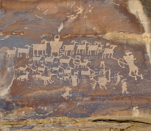
We continue with Great Hunt Panel, one of the most well-known panels of the canyon and also very well marked.
Great Hunt Panel (11 photos)
For our last visit, we enter in Dry Canyon Rd with, on the menu, obviously still some petroglyphs and two arches.
Dry Canyon Rd (14 photos)
We leave at 4:20 pm, 30 minutes blocked by the works, not only roadworks but also the installation of a pipeline;
I have a long talk with a crane operator about problems associated with this type of construction, during one of our imposed stops.
We enter Gate Canyon for up to Myton and Roosevelt on the US-191.
The road gets quickly a little bumpy track but borrowed by semi-trailers; during for almost 5 minutes, we even have, stuck between two trailers, a remake of
"Duel", a Spielberg’s movie ![]() .
.
This track is, according to its state, feasible by a sedan but certainly not by a RV. It's only curve on curve on a fairly bumpy track, going up to the Bad Land Cliffs.
Arrived on the plateau, we cross a roadwork zone, but without work area traffic control signs and with trucks and earthmoving equipments all around, coming on us ,
sometimes playing with our fears.
Just before (14 miles) the end of the 9 Mile Canyon Rd, the road becomes paved and is literally lined with oil pumpjacks and pipelines; we arrive at Roosevelt at 5:30 pm
We make a stop in Roosevelt at 5:35 pm for a cash withdrawal in an ATM; it's 93 °F. Then we head to Vernal (buying a pair of shoes for me, my flip-flops being destroyed)
then towards Island Park Road; I drive fast enough, but this track allows it (track even a RV can take) because I prefer to arrive
at Rainbow Park Campground before dark.
At one point, we follow a rocky ridge, The Reef, which may be likened to the spine of an old dinosaur (we are almost in their park ![]() ).
).
We arrive at 7:40 pm (the time provided by Google Maps is overestimated or on track, I ride faster than what is allowed ![]() );
there is only one tent with two local youth with whom I discussed rather. This tiny primitive camping (free, 5 pitches max, dry toilet) is located on the banks of the Green River
and I take some pictures.
);
there is only one tent with two local youth with whom I discussed rather. This tiny primitive camping (free, 5 pitches max, dry toilet) is located on the banks of the Green River
and I take some pictures.
Sleep at 9pm.
Rainbow Park Campground (9 photos)


