JavaScript is not enabled.
Needed to see the photo galleries.
Pictures are small in size and grouped in gallery; just a click on it and you'll have all the gallery in bigger size!
Easy navigation with left or right arrow on the keyboard; leaving the gallery photo by Escape.
Do not forget to switch to full screen (F11). Javascript is required.
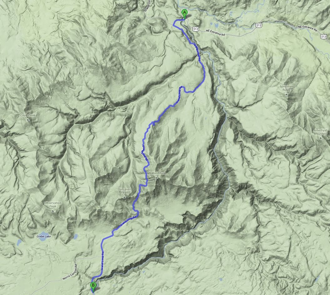
Journey map

Approximately:
- from Junction Butte (A) to Yellowstone River (B): 21 miles and 0h40 on road
J50 - Friday, June 29
Wake up at 6:15, the air is fresh but we are at 6,070 feet and surrounded by mountains; the night was quiet, no impromptu visit ![]() .
After breakfast, it's 50 °F. We start at 7:30 am, southbound. First stop at Calcite Spring Overlook, but the valley is in shade; we will return.
.
After breakfast, it's 50 °F. We start at 7:30 am, southbound. First stop at Calcite Spring Overlook, but the valley is in shade; we will return.
The next stop is the Tower Fall campground where we want to book the next night; bingo, the No. 5 is free, don't be picky. Then the road climbs from 6400 to 9050 feet, up
to Mount Washburn. Shortly after, during a stop, an American tells us he saw, a bit further, a bear; a bear!
Immediate return to our car, and actually a little lower, it jammed. Unlike many drivers, I let Isabelle get out of the car and continue to try to park a little further (in quotes,
it's a mess, everyone stops anywhere) ![]() ).
).
I find a parking lot and walk back but Isabelle joins me quickly: she saw the bear ![]() (so, his hindquarters) but he's gone away; according
to her description, it must be a grizzly. A bison a little further, just on the road side, watching us pass.
(so, his hindquarters) but he's gone away; according
to her description, it must be a grizzly. A bison a little further, just on the road side, watching us pass.
Calcite Spring Overlook & Tower Fall (22 photos)
We arrive at Canyon Village at 10am with only 64 °F, which is very nice. Passage and usual shopping at the VC; we take the road to the other side of the river and
stop near Uncle Tom Overlook.
Many people on the right side: would it be an animal? Bingo, 2 beautiful elks in the shade of bushes, posing for photos. At 11:21, we begin hiking Uncle Tom trail.
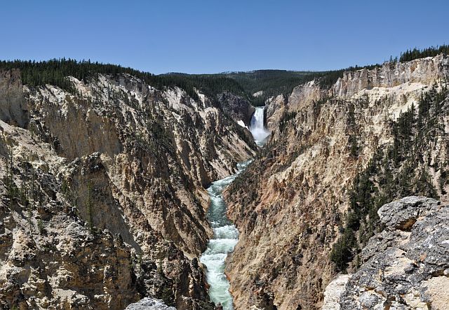
This hike brings us to the foot of the Lower Falls on the Yellowstone River. Beautiful descent, perfectly organized (a bit too much for our taste) with 300 metal
steps down (we'll go up) ![]() ); we are far from being alone and sometimes we have long to wait for taking a
photo
); we are far from being alone and sometimes we have long to wait for taking a
photo ![]() . The landscape is really beautiful, so falls than cliffs with superb colors.
. The landscape is really beautiful, so falls than cliffs with superb colors.
We return to our car, a little breathless but it's probably due to the altitude ![]() ;
it's noon with 70 °F. We continue the road to Artist Point, nice view but so crowded.
;
it's noon with 70 °F. We continue the road to Artist Point, nice view but so crowded.
Uncle Tom & Artist Point (27 photos)
For the rest, I found a trail that leads to Point Sublime and starts virtually at Artist Point parking lot. With a name like that, it must be good, right?
We start at 1pm, the hike follows the Yellowstone River and the scenery is simply beautiful with splendid colors.
Almost halfway, an intersection with another destination (Ribbon Lake?); we continue on the left. Go a hundred yards away only just because, frankly, Point Sublime is not worth
all the sudden; we have not even taken a single photo. An American couple that we met, and that we'll see later at lunch, has exactly the same feeling.
Back to the car at 2:30 pm with 2,660 miles on our pedometer and 75 °F. We leave again and just before the bridge, on the left there is a parking lot with a few tables in the undergrowth.
We find one unoccupied table in shade and can finally lunch, our stomachs crying famine it's 2:50 pm.
To Point Sublime (11 photos)
End of lunch at 3:28 and we start walking on Chittenden Bridge to see closely the river. Then we move to the other side (north rim) with, as first
stop, Brink of Upper Falls. Very short trail that leads right above the first fall, there are a lot of people. On the same parking, a small path leads
to Crystal Falls, but the end is blocked due to a collapse.
And we continue the road that now becomes one-way. At 4:20 pm, we begin the descent to Brink of Lower Falls: ten switchbacks roughly long during 1 mile
on our pedometer. We are almost in front of Uncle Tom seen this morning, but this time on top. Beautiful view of the falls and the valley; if you can
hike only one, it's this one.
Upper & Lower Falls, north rim (21 photos)
Back to the car at 4:55; we pulled up without stopping, not even out of breath ![]() . We chain by Red Rock Point
and Lookout Point (same parking lot) again with beautiful views of the second fall. Back to the car at 5:45 pm with 0.760 mile on pedometer. We conclude with Grand View Point
then Inspiration Point and, at 6:05 pm, hit the road to the campground at Tower Falls. We pass to Calcite Spring Overlook but it's a waste of time,
even less visible than this morning
. We chain by Red Rock Point
and Lookout Point (same parking lot) again with beautiful views of the second fall. Back to the car at 5:45 pm with 0.760 mile on pedometer. We conclude with Grand View Point
then Inspiration Point and, at 6:05 pm, hit the road to the campground at Tower Falls. We pass to Calcite Spring Overlook but it's a waste of time,
even less visible than this morning ![]() .
.
We arrive at campground at 6:50 pm and we begin to empty cards of our cameras and there, problem, the internal hard drive of our laptop is full. We begin to use our USB keys because
it's out of the question to have no backup
Campfire, cocktail and sausages grilled over the coals; sleep at 10:45 after a good and beautiful day.
Lookout Point & Grand View Point (18 photos)


