JavaScript is not enabled.
Needed to see the photo galleries.
Pictures are small in size and grouped in gallery; just a click on it and you'll have all the gallery in bigger size!
Easy navigation with left or right arrow on the keyboard; leaving the gallery photo by Escape.
Do not forget to switch to full screen (F11). Javascript is required.
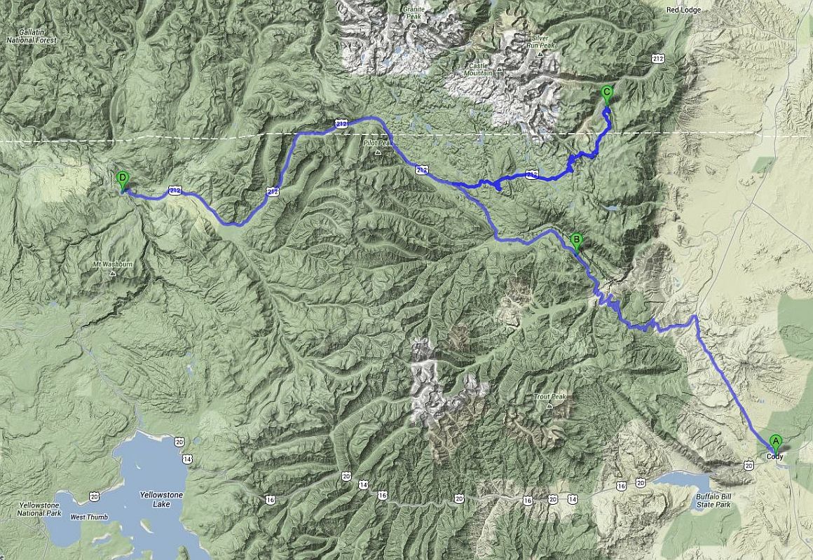
Journey map

Approximately:
- from Cody (A) to Rock Creek Vista (C): 93 miles and 2h05 on road
- from Rock Creek Vista (C) to Junction Butte (D): 76 miles and 1h30 on road
J49 - Thursday, June 28
Wake up at 6am and an one hour later we leave the motel. Departure to Old Trail Town for only a few photos, because we are a bit rushed and pay $ 16 for a very short visit
doesn't seem consistent.
Isabelle thinks too short our visit of Cody, so it will give us a reason to return ![]() .
.
Old Trail Town(5 photos)
We refuel and then take the road at 9:11 with 73 °F. Firstly Hwy 120 towards north, then the Chief Joseph Highway (Hwy 296). As we’re stopped in front of an explanatory panel,
an American with whom we exchange a few words told us we are lucky because the day before the road was closed due to fire.
The road quickly becomes a beautiful mountain road, rising from 4900 to 8000 feet to reach Dead Indian Summit Overlook where we arrive at 10:30. The view is beautiful and
temperature very comfortable as the thermometer shows only 68 °F.
We continue north-west direction, and the road is at an average altitude of 6,900 feet, often along the Yellowstone River, eventually leading to the Bear Tooth Pass
Highway (Hwy212) we reach at 11:42.
Chief Joseph Highway (31 photos)
Our program plans to take this road to Rock Creek Vista Point; so, straight ahead, direction Montana since this view is on the other side of the border. The road profile shows
a steady climb to over 10,800 feet, so laces and slope in perspective ![]() .
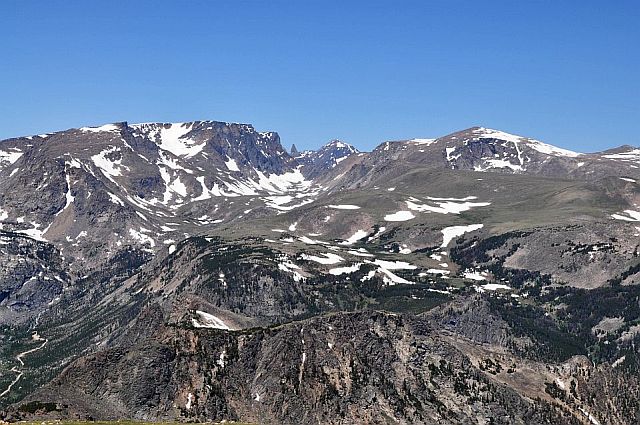
Very quickly we forget everything to devote ourselves solely to the beauty of the landscape: just beautiful, no need superlatives (it seems to have already written that!)
.
Very quickly we forget everything to devote ourselves solely to the beauty of the landscape: just beautiful, no need superlatives (it seems to have already written that!)
![]() ). To much lakes as we not know which way to turn, multiple viewpoints arranged everywhere, snow and even skiers near a ski lift,
Mountain Goats (Oreamnos americanus), unfortunately a little too far; some lakes are still partially covered by ice, giving another charm to the landscape.
The higher we go, the more the temperature drops. At 1:18 pm, we enter in Montana with 64 °F and there is less snow (probably due to orientation).
Arrival at Rock Creek Vista at 1:30 the temperature returns more lenient (70 °F).
). To much lakes as we not know which way to turn, multiple viewpoints arranged everywhere, snow and even skiers near a ski lift,
Mountain Goats (Oreamnos americanus), unfortunately a little too far; some lakes are still partially covered by ice, giving another charm to the landscape.
The higher we go, the more the temperature drops. At 1:18 pm, we enter in Montana with 64 °F and there is less snow (probably due to orientation).
Arrival at Rock Creek Vista at 1:30 the temperature returns more lenient (70 °F).
U-turn around 15 minutes later and we go again in Wyoming at 1:50. We stop for lunch at Beartooth Lake , feet almost in the snow, at 3 yards of us. We end lunch at 3:26 pm, we had
almost cool despite the fleece jackets but, by cons, red wine was at very good temperature ![]() .
The lake empties into the Beartooth Creek with beautiful waterfalls south side of the road.
.
The lake empties into the Beartooth Creek with beautiful waterfalls south side of the road.
Beartooth Pass Highway (36 photos)
After crossing the road we drove on morning (Chief Joseph Hwy), the road continues towards the northeast entrance of Yellowstone NP and there, we understand what would say the American
this morning. Firefighters are still there and we can clearly see the traces of fire; Isabelle also sees beautiful flames.
We refuel in Cooke City (Montana), cautiously, and at 5:10 pm we arrive at the entrance of Yellowstone< National Park, mythical park at least for me. The ranger reports us
that numerous campsites are full, with the nearest place is at Mammoth, I thank but it's out of the question to go so far. I booked only one night on 5 provided in this park. Error?
Next we show that.... ![]()
We stopped successively at campsites identified in advance: Peeble Creek and Slough Creek, near the Lamar River, and finally at Tower Fall but all bear the
fateful sign Full. Despite that, I try the Sedonax's method. But it's a little early and most sites are still empty and few have 2 parking spaces.
Too bad; despite the contrary opinion of Isabelle, we retrace our steps and on the Lamar Valley Rd, just after the bridge over the Yellowstone River,
there is a small stretch of road allowing fishermen to park and being practically invisible from the road. There are 2 cars parked and we wait until their departure.
Finally alone ![]() , we sit (quietly) for the night, hoping not to have the visit of Rangers or bears.
, we sit (quietly) for the night, hoping not to have the visit of Rangers or bears.
![]()
Northeast entrance of Yellowstone NP (16 photos)


