Petrified Forest NP, Painted Desert
& Canyon de Chelly NM
![]() version française
version française
Pictures are small in size and grouped in gallery; just a click on it and you'll have all the gallery in bigger size!
Easy navigation with left or right arrow on the keyboard; leaving the gallery photo by Escape.
Do not forget to switch to full screen (F11). Javascript is required.
Journey map
Approximately:
- from Grand Canyon south rim (A) to Petrified Forest (C): 210 miles and 3:40 on road
- from Holbrook (E) to Canyon de Chelly (F): 125 miles and 2:15 on road
Monday, May 25 (continued)
After leaving Grand Canyon, we fill up gas tank in Cameron and I completely forget to stop by the Trading Post.
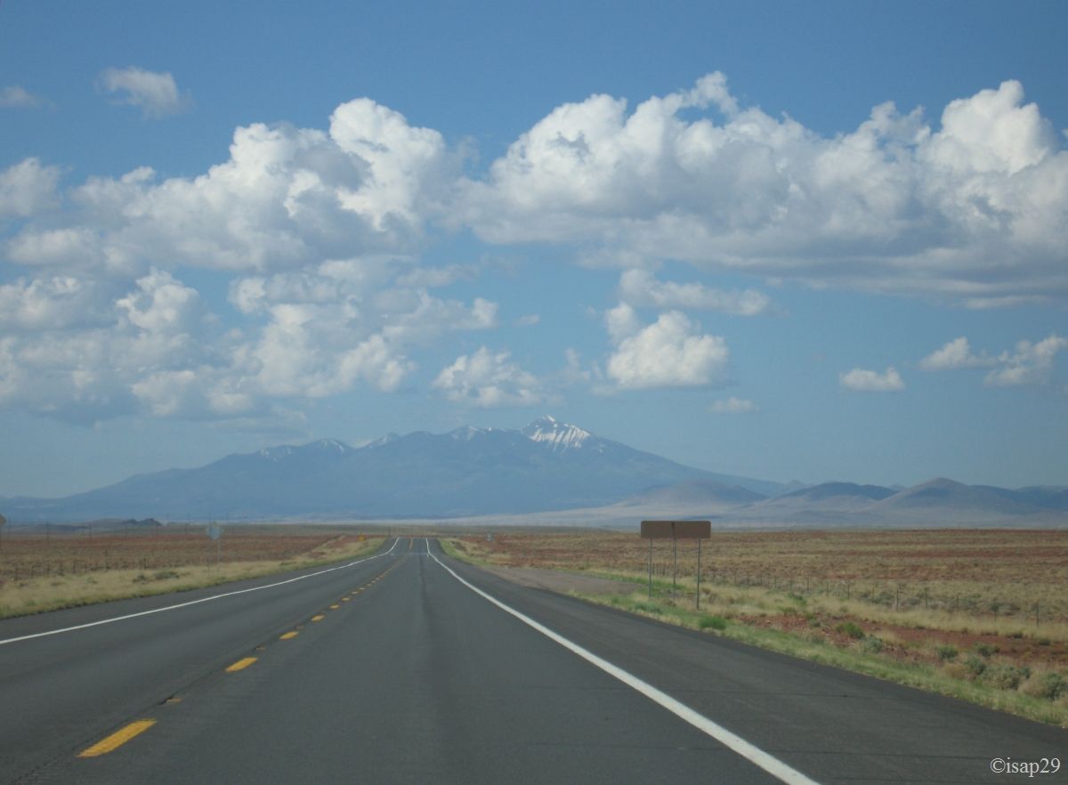
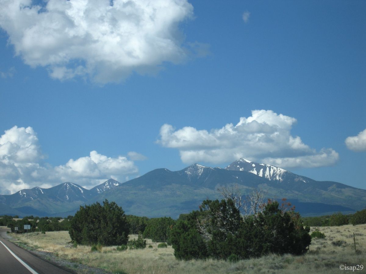
On Hwy 89 towards Flagstaff, we pass close to Humphreys Peak, highest peak in Arizona (12,637 feet) still snowy and
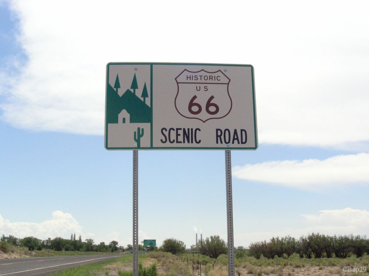
a bit further, we take a small section of Highway 66, just for fun  .
.
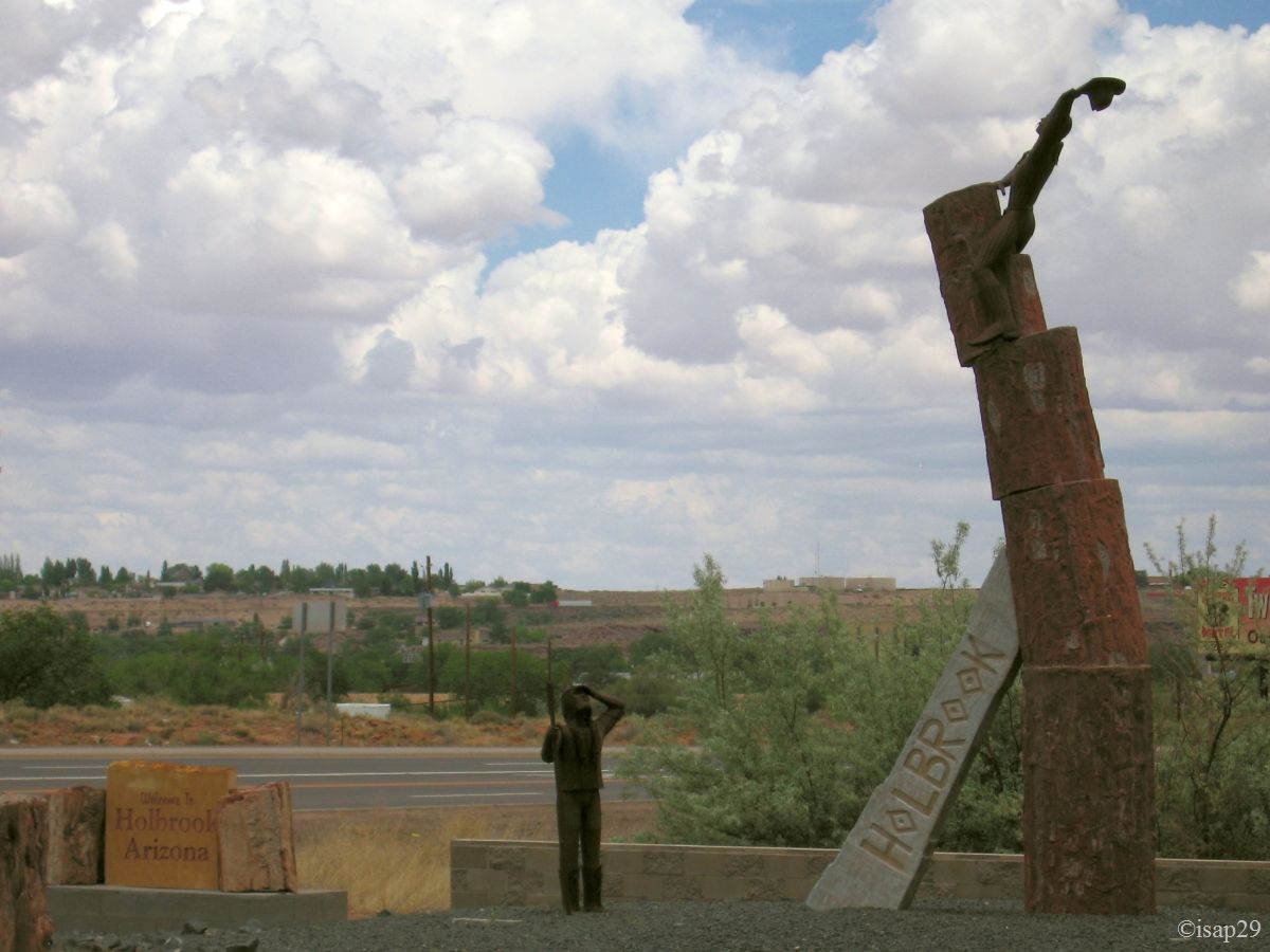
We arrive in Holbrook at 11 am (72°F) and we stop to check the hotel: everything is ok, but too early to have the room.
Towards Holbrook (4 photos)
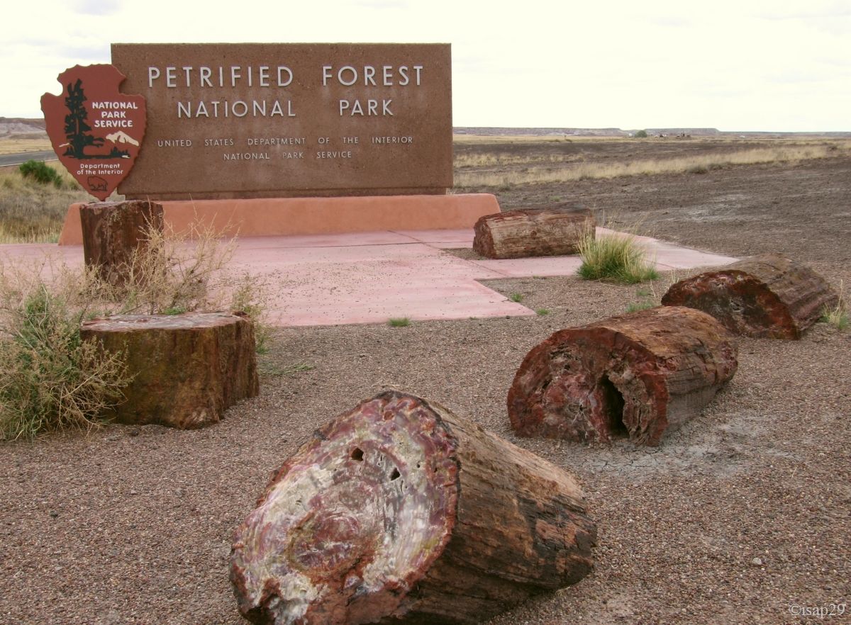
We leave our hotel and we head to Petrified Forest with a brief stop to locate a store, Jim Gray, recommended by the hotel
(but undoubtedly purely commercial  ), where we can buy petrified wood
(it's forbidden to gather up in the park).
), where we can buy petrified wood
(it's forbidden to gather up in the park).
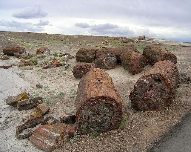
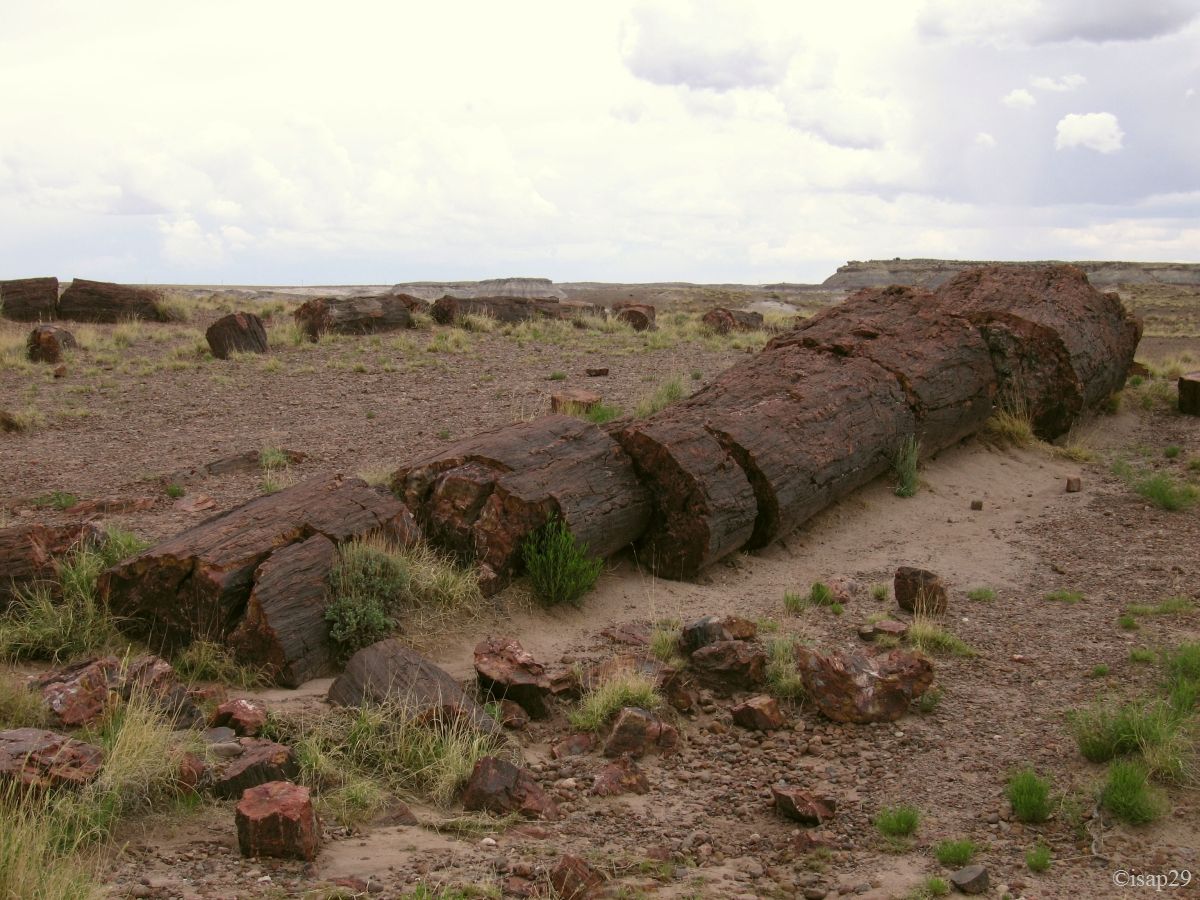
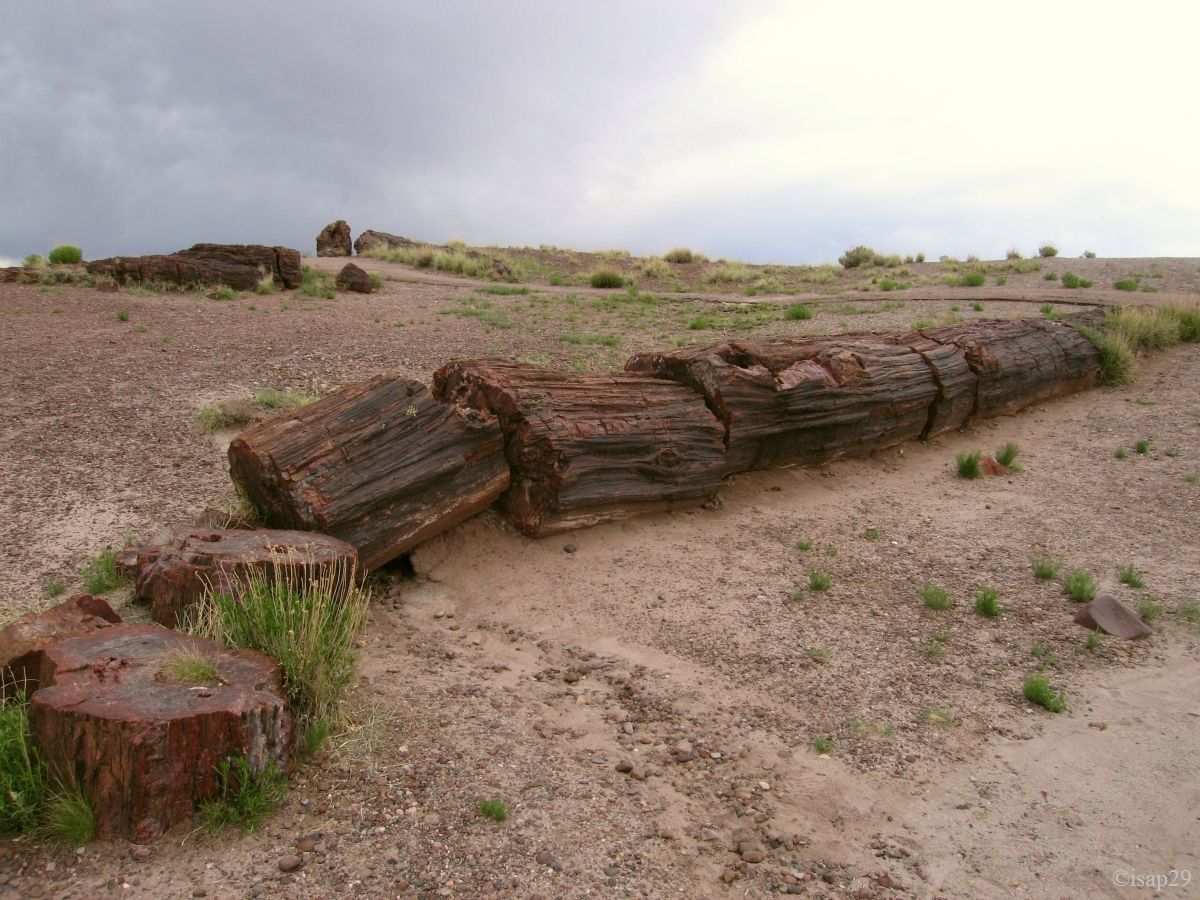
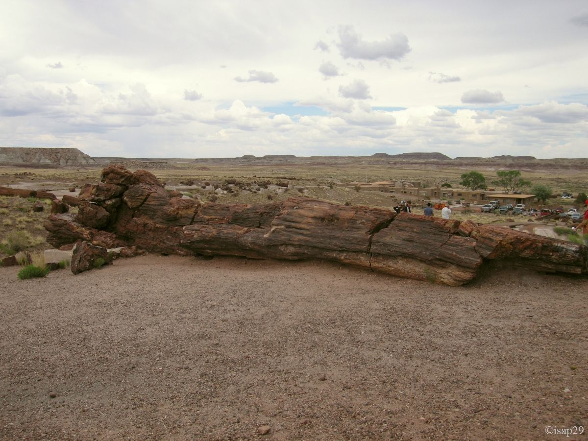
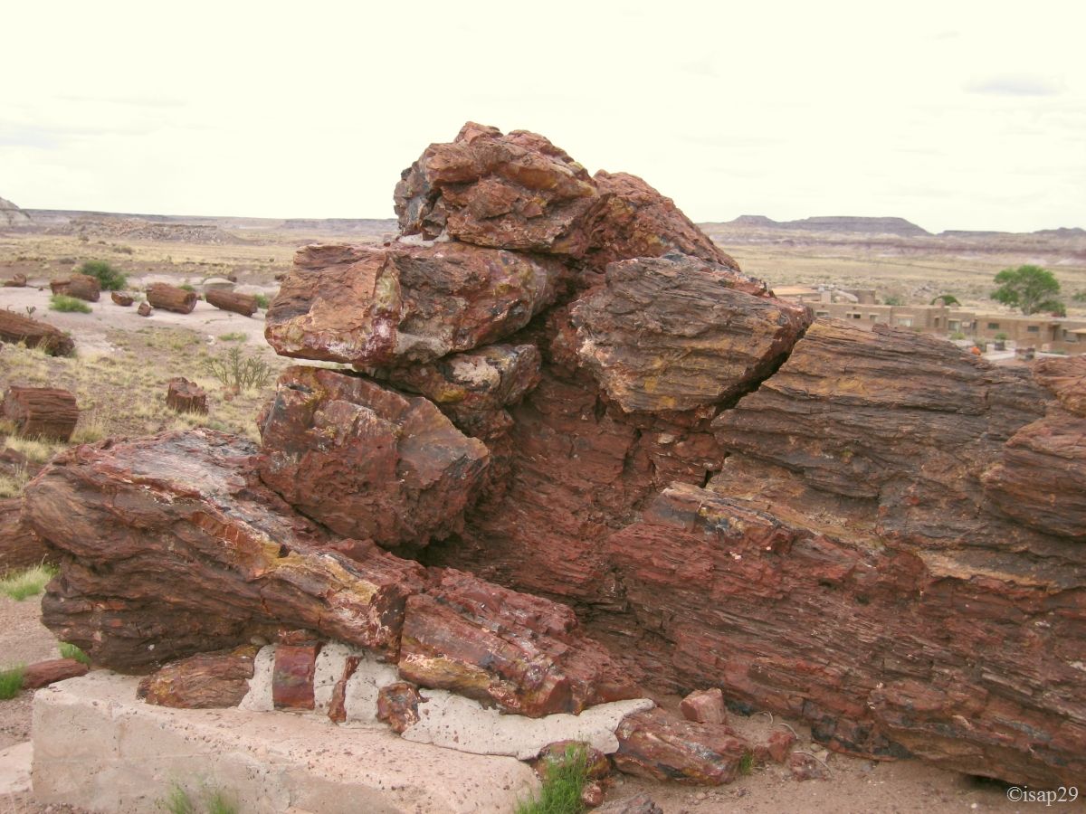
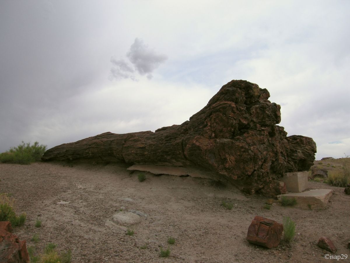
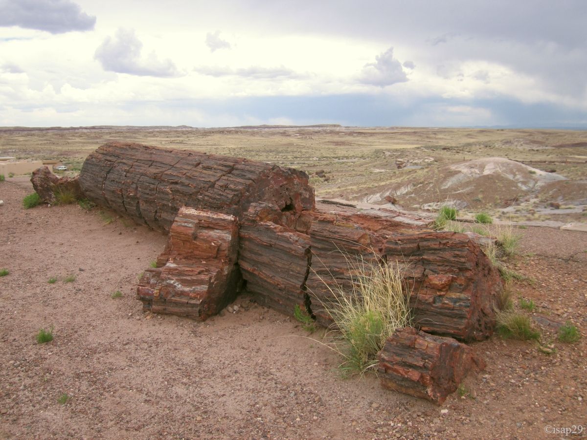
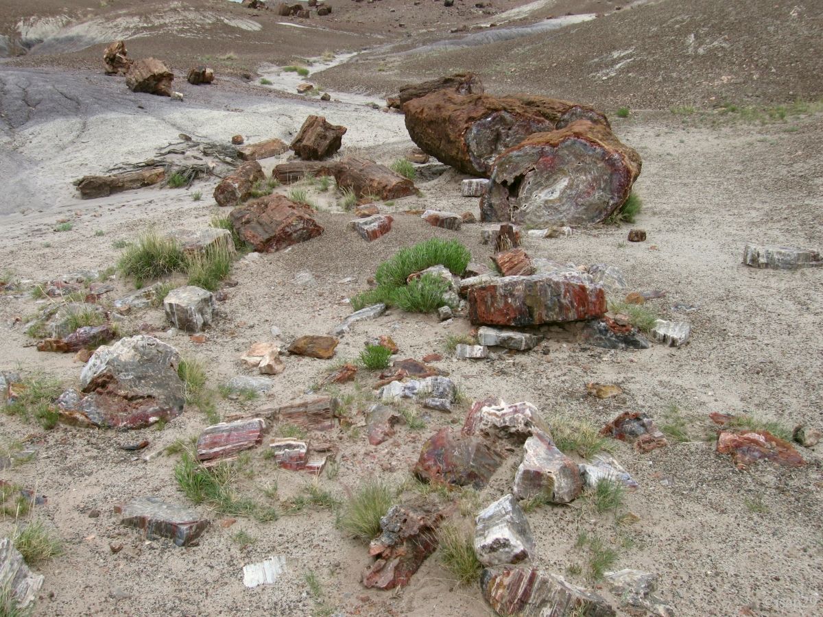
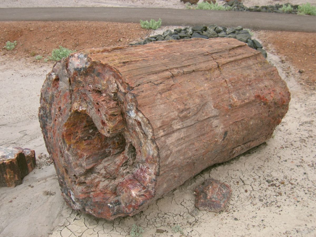
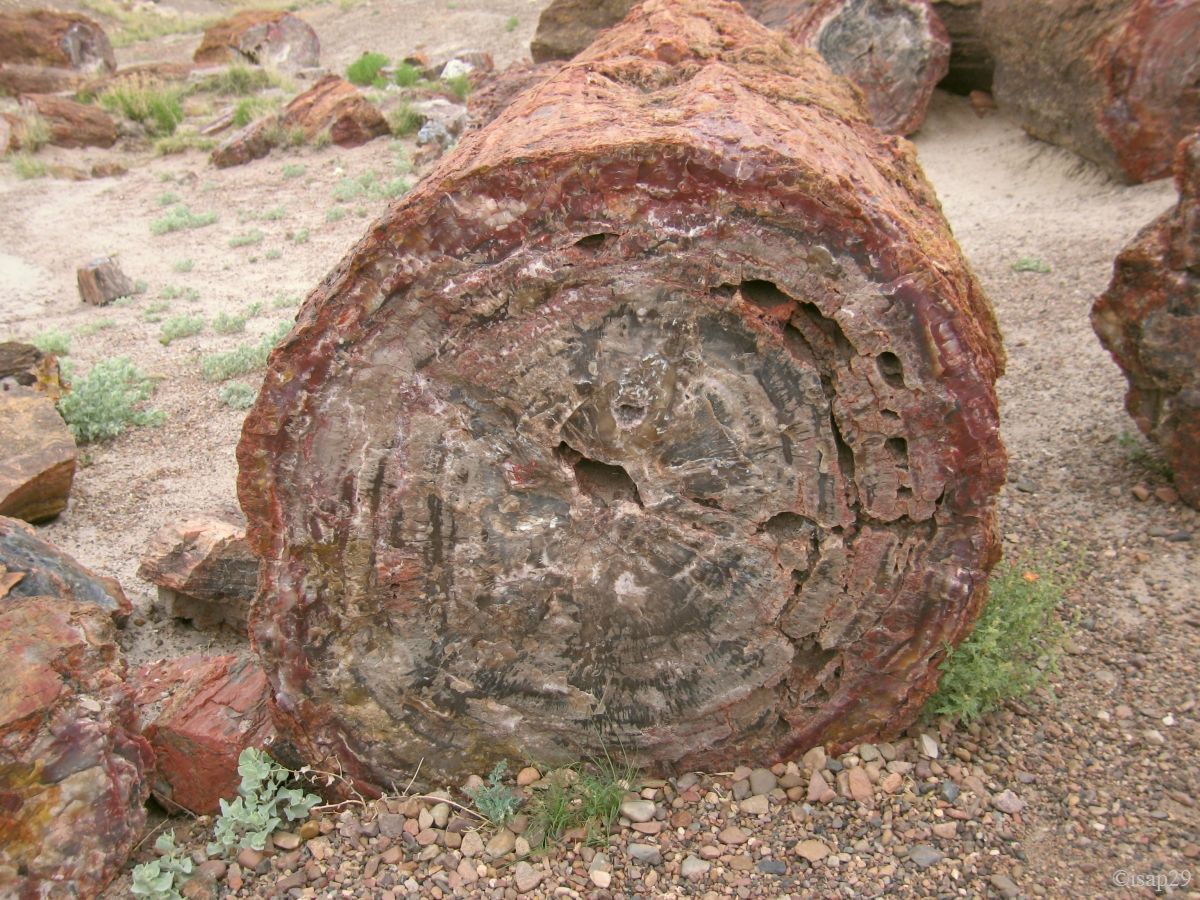
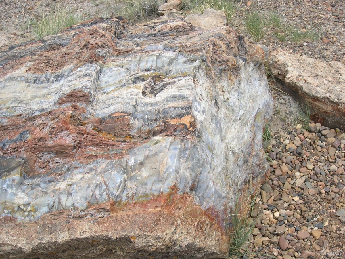
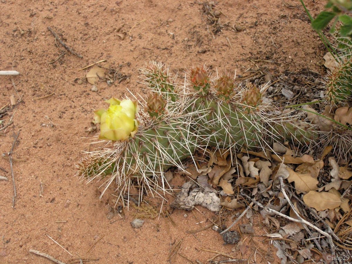
Just entered the park (the Visitor Center is on the Painted Desert side), we start with the short walk to Giant Logs. These fossilized tree trunks are almost an obsession for me since, as very young, I had discovered in pictures. It was not possible to come in this area and not see them.
We're already seeing very well (there is almost nobody) these fossilized tree trunks that we can sometimes admire
in their entirety, tree stump included.
Fortunately that we linger a bit because we zap involuntarily Long Logs; it's what happens when we don't follow our road book
.
Petrified Forest - Giant Logs (10 photos)
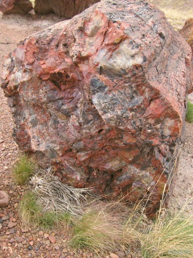
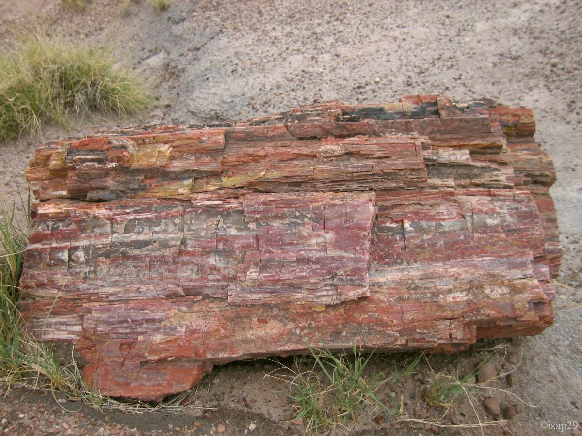
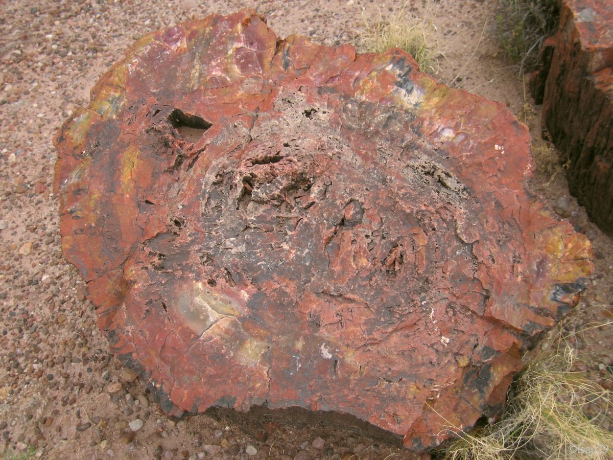
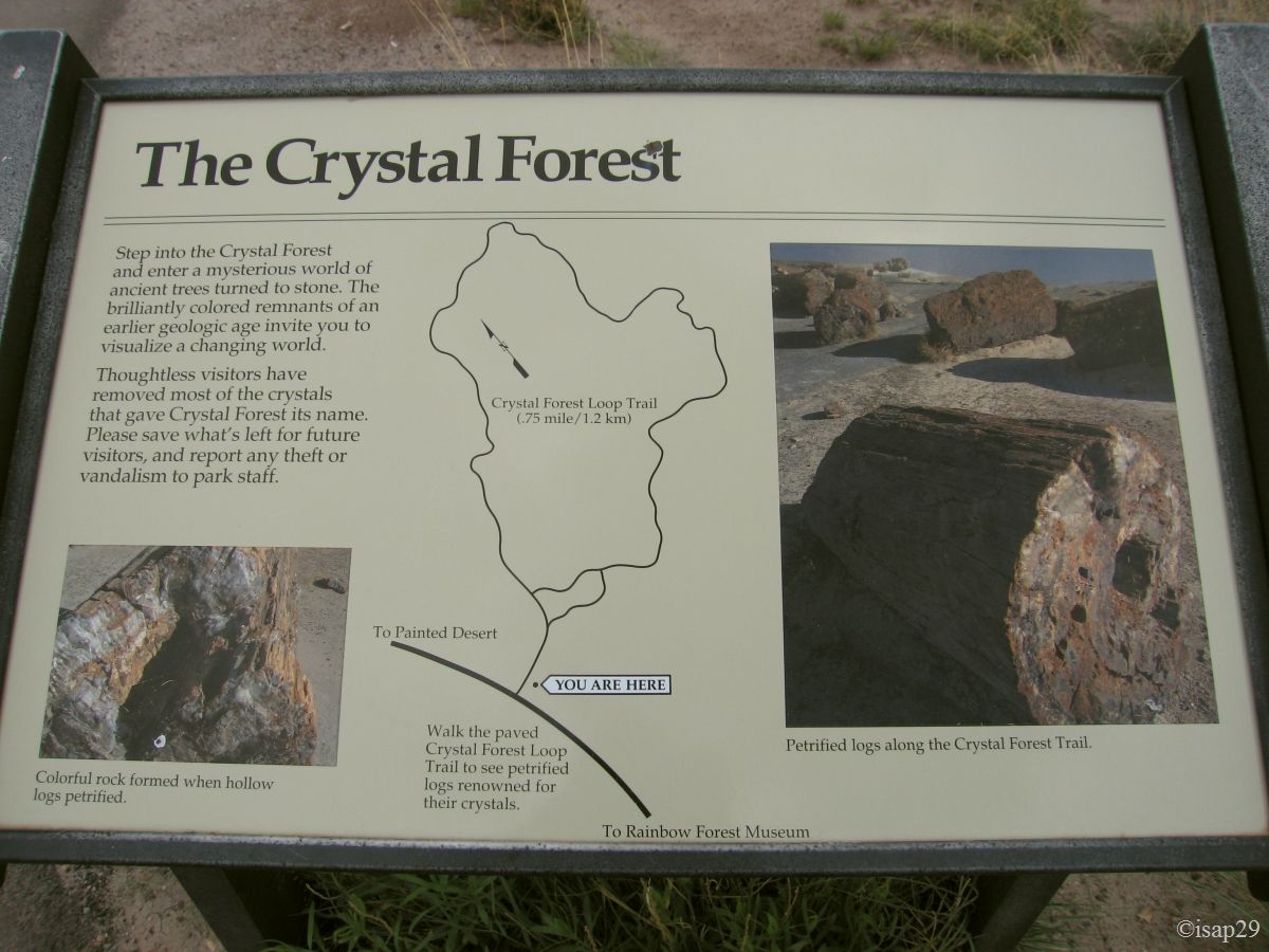
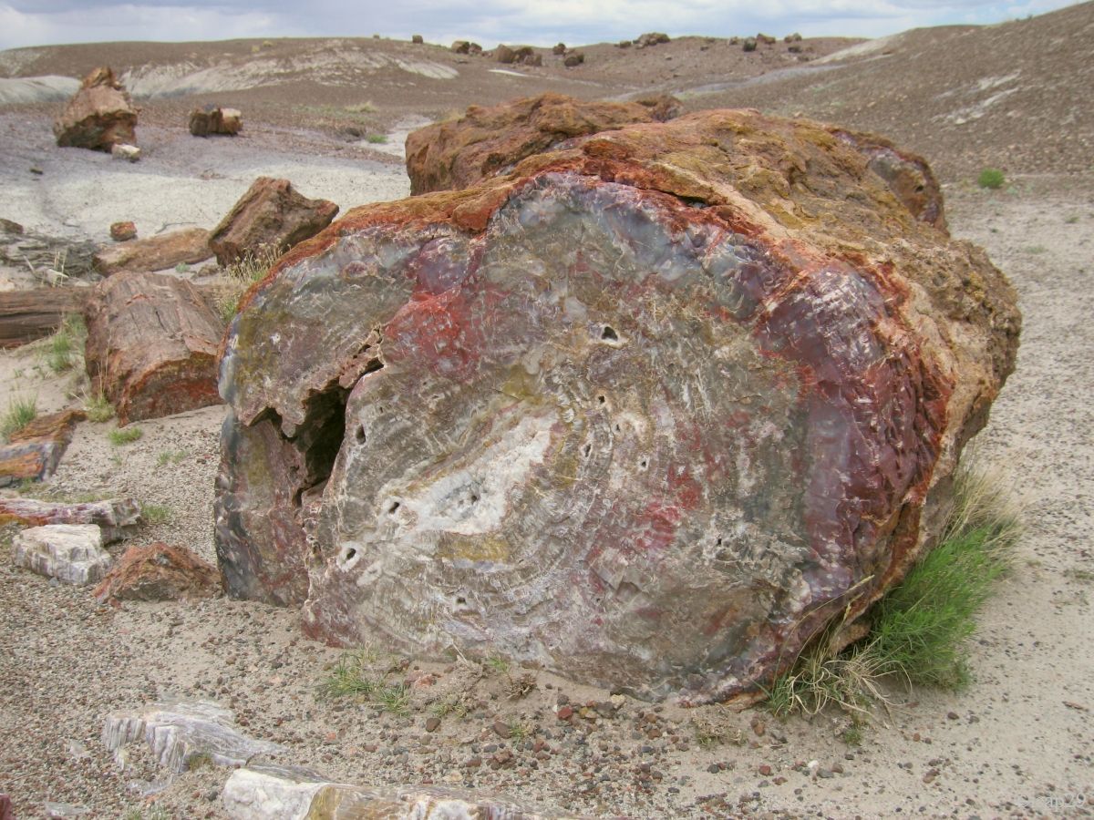
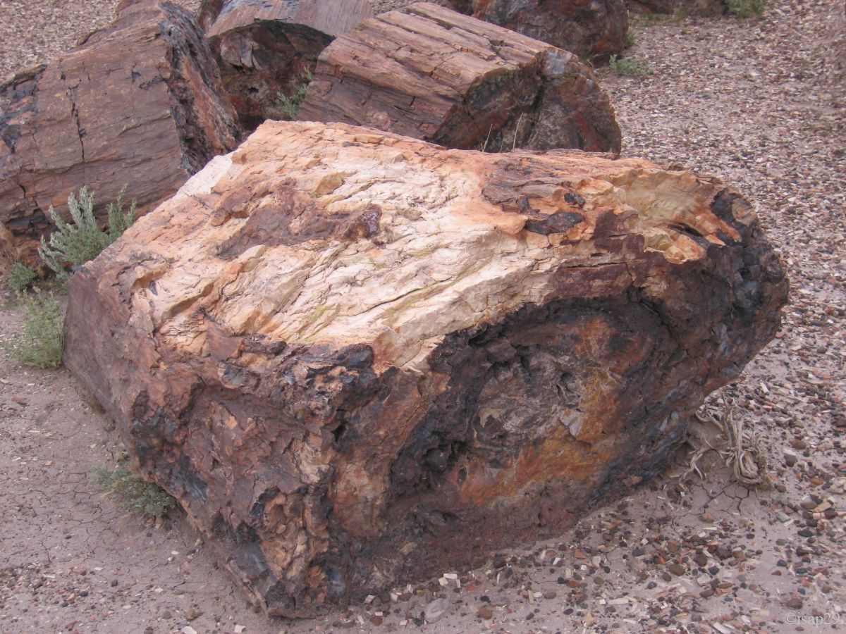
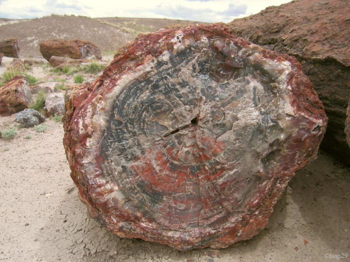
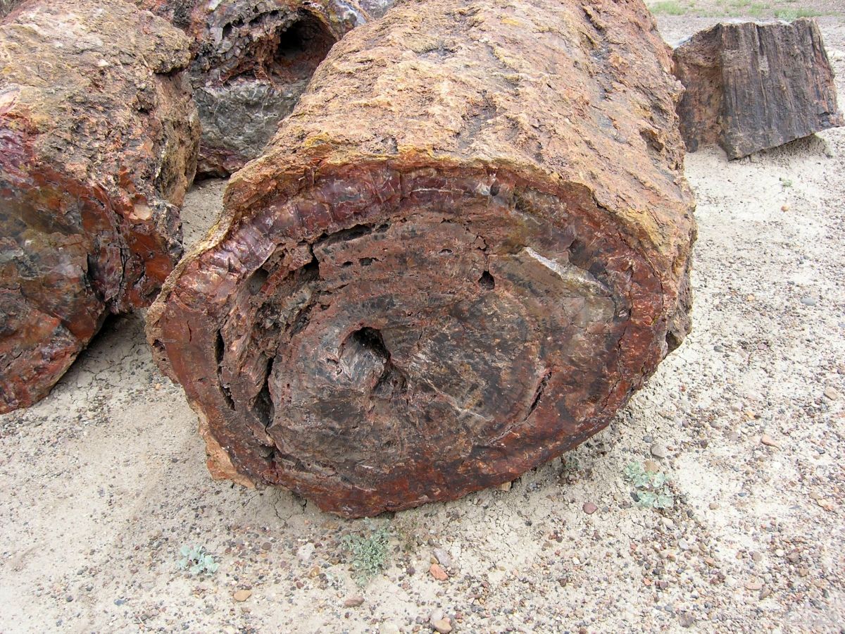
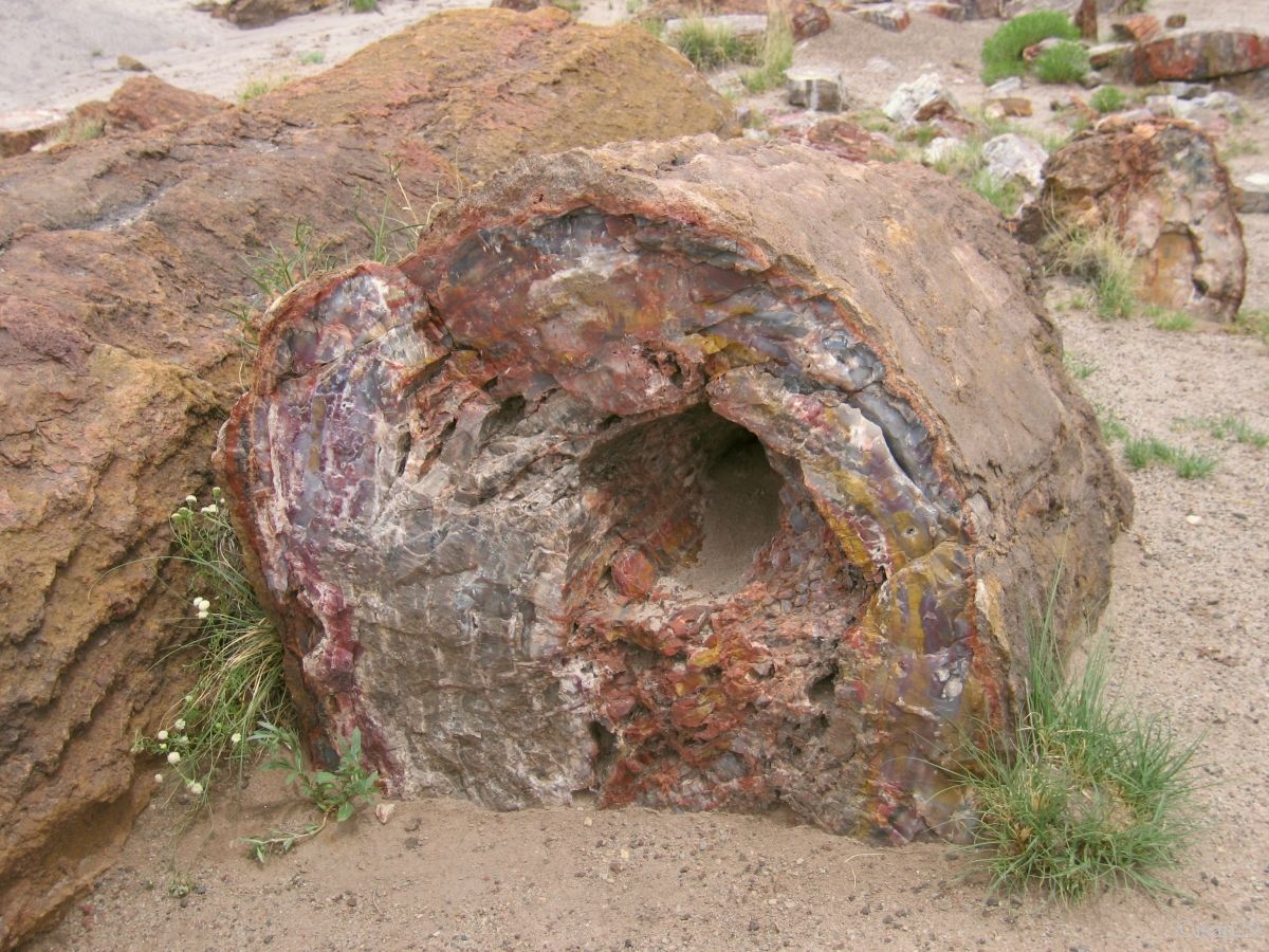
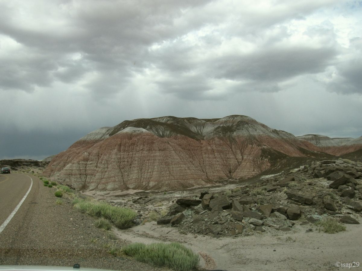
We continue with Crystal Forest where we already find more people and it becomes sometimes difficult to take a picture with nobody on it. "Wreckhouse" winds! A large mound sits on the other side of the road.
In front of us, we have a whole forest (laid down!) of trunks, frozen for eternity and with nice colors, but it's true that we both enjoy mineralogy.
Petrified Forest - Crystal Forest (14 photos)
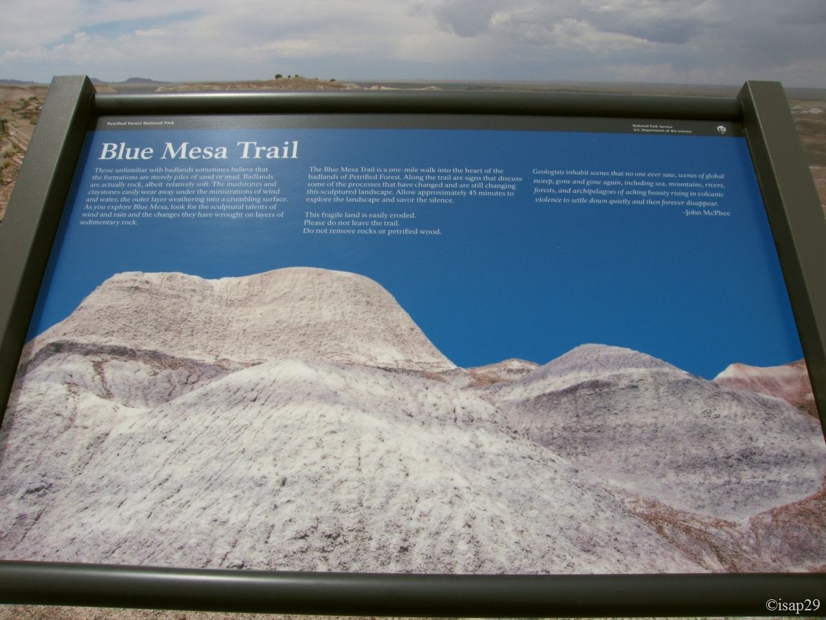
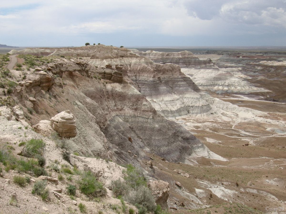
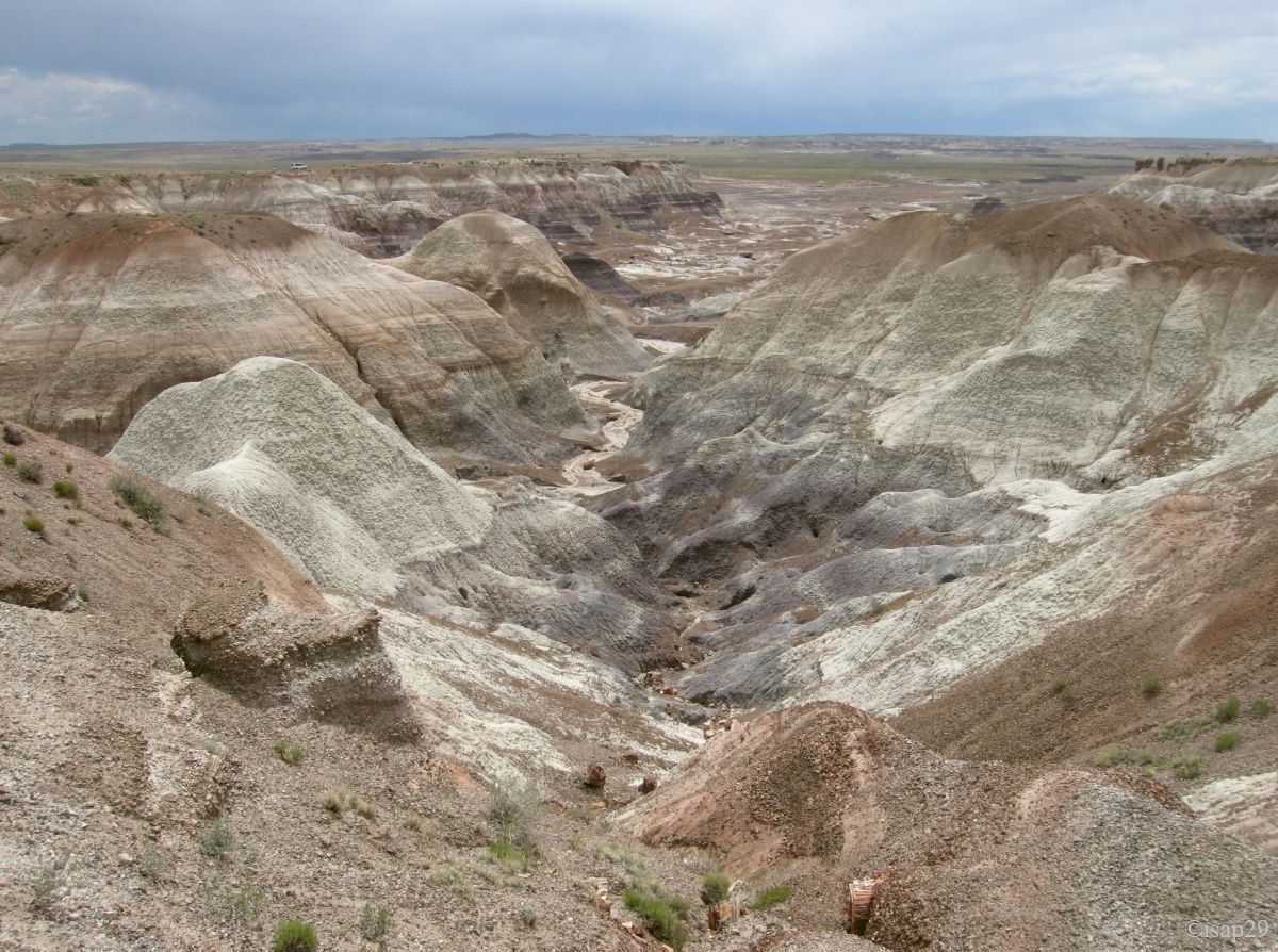
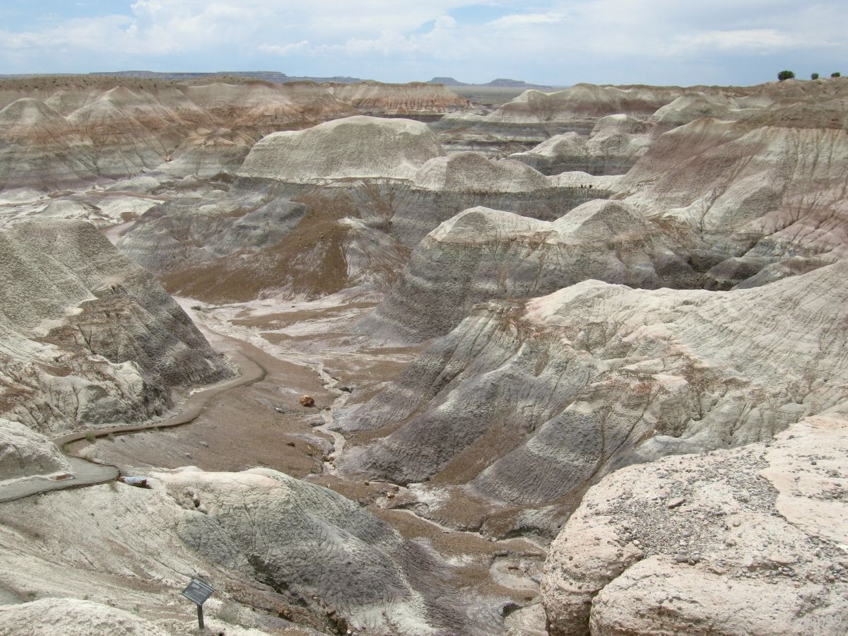
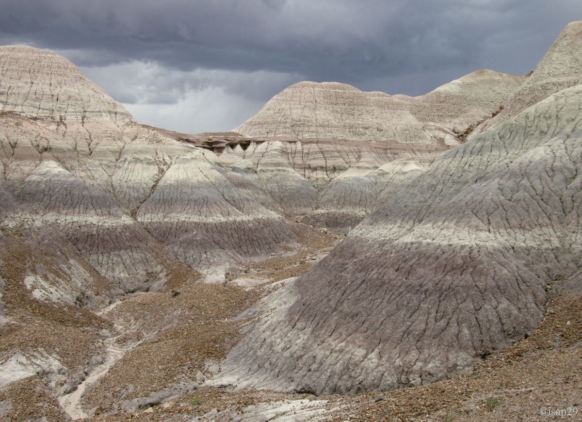
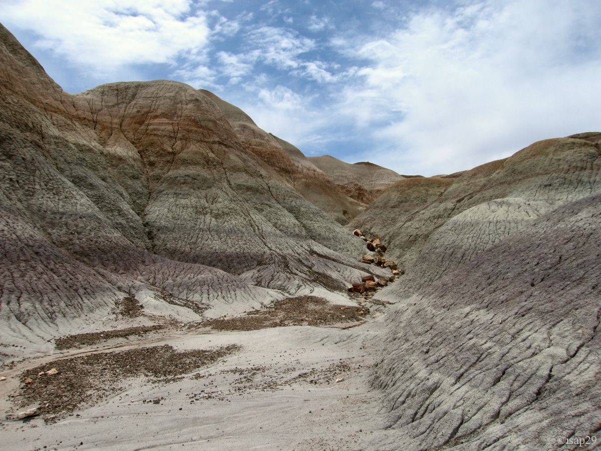
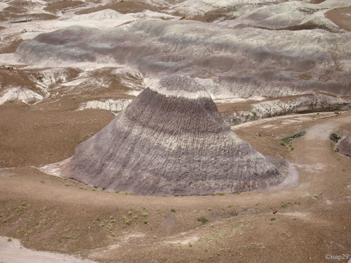
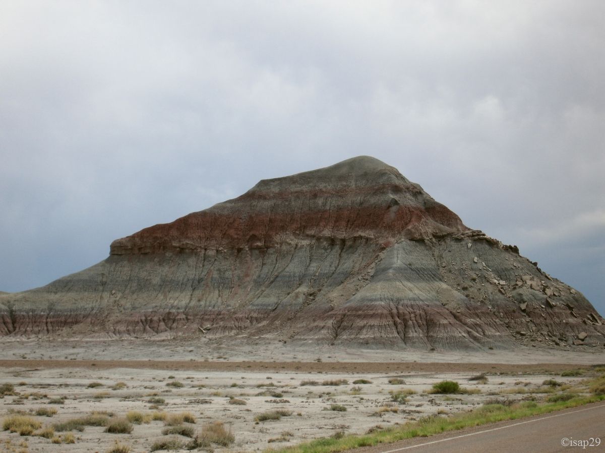
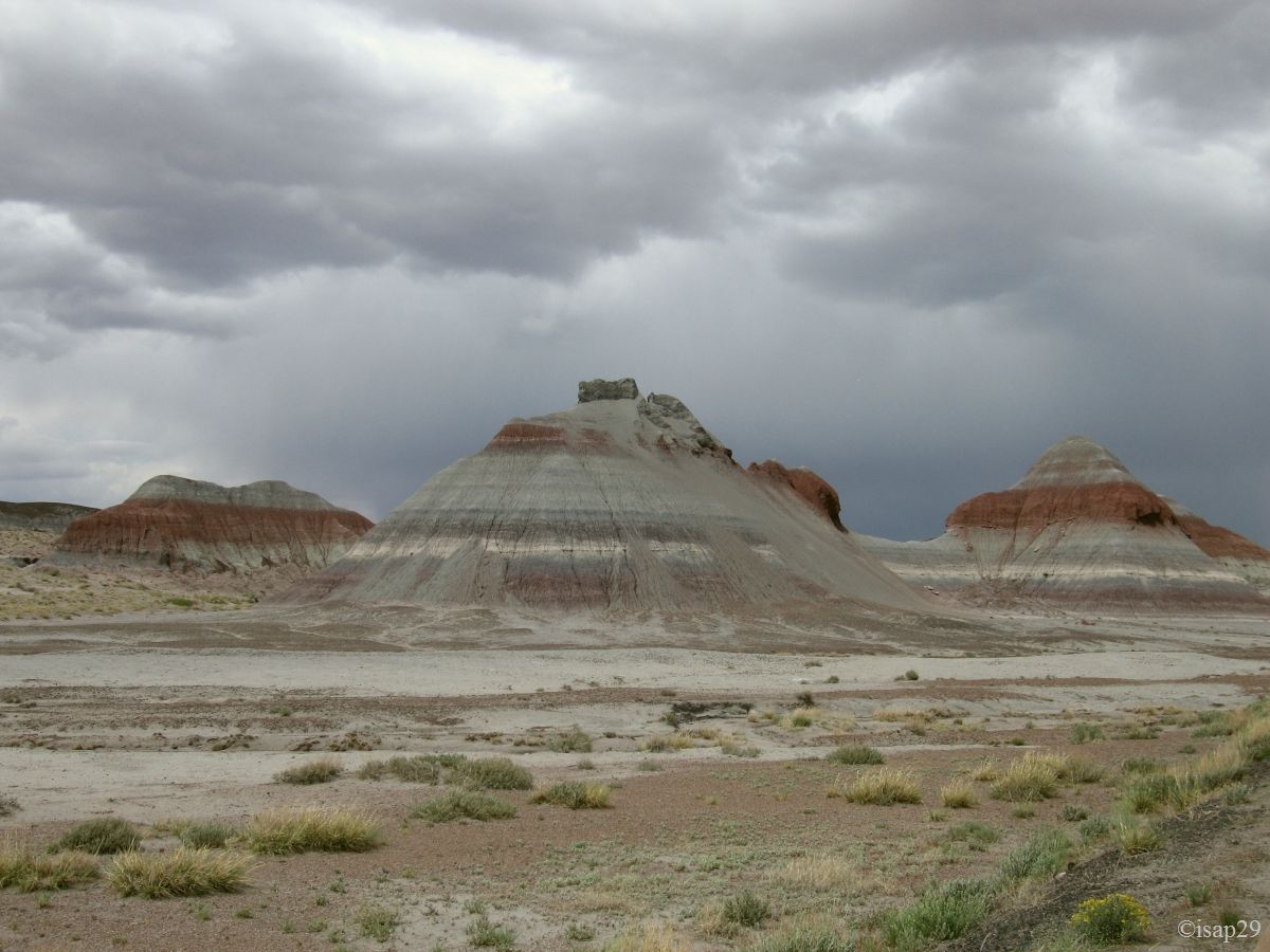
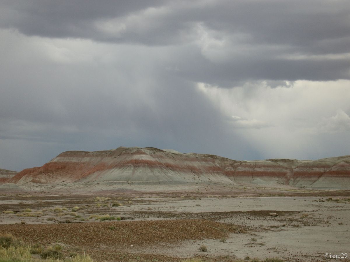
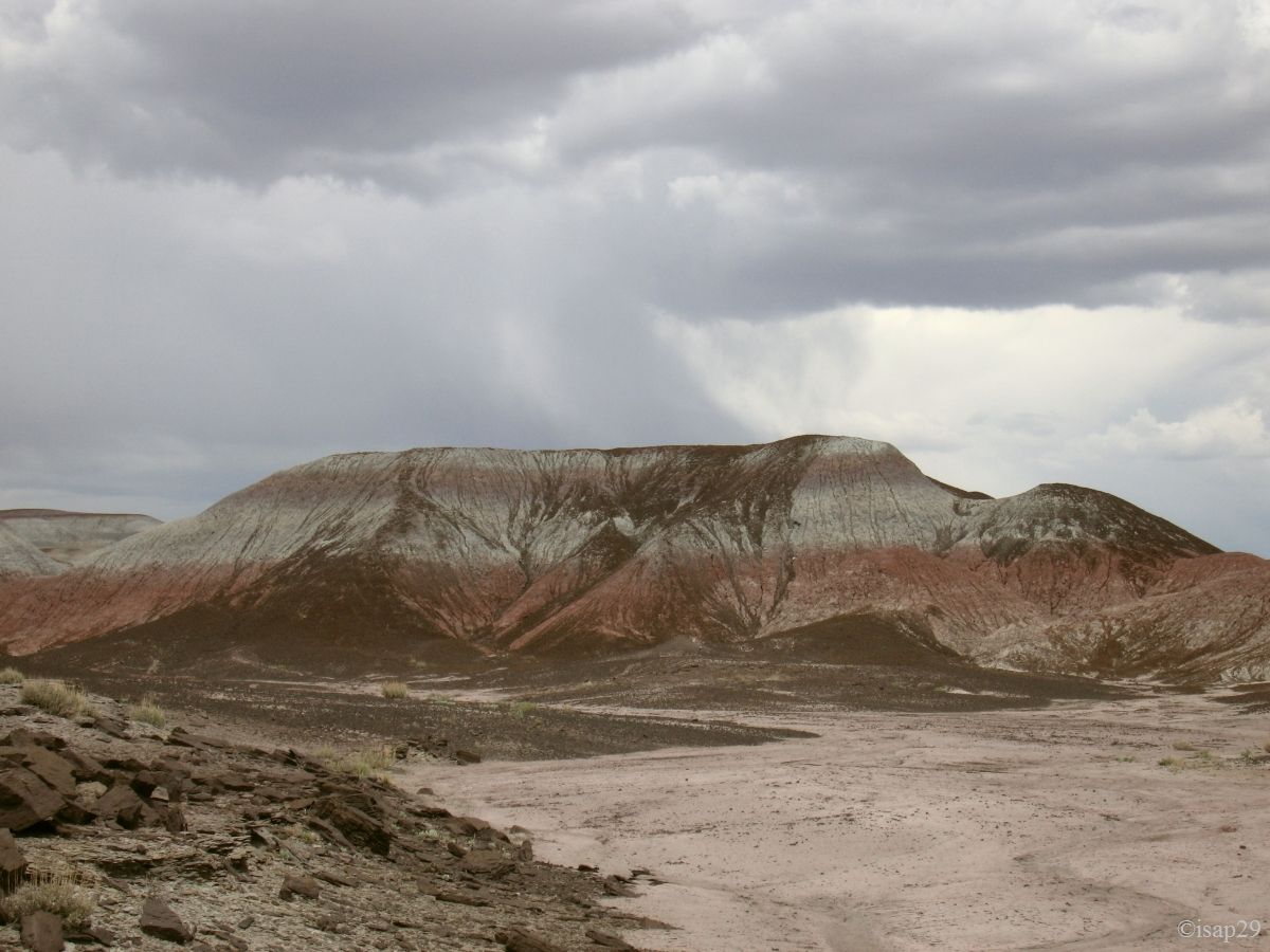
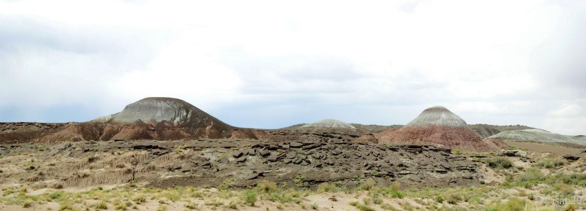
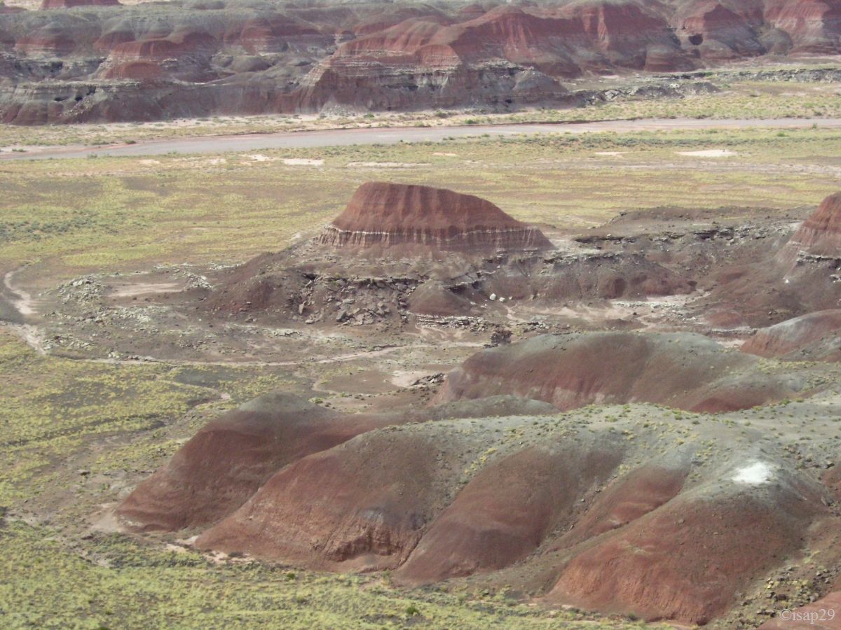
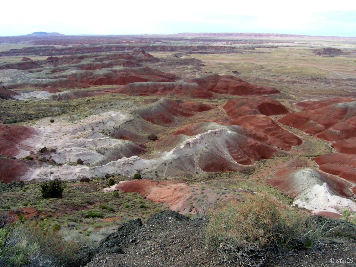
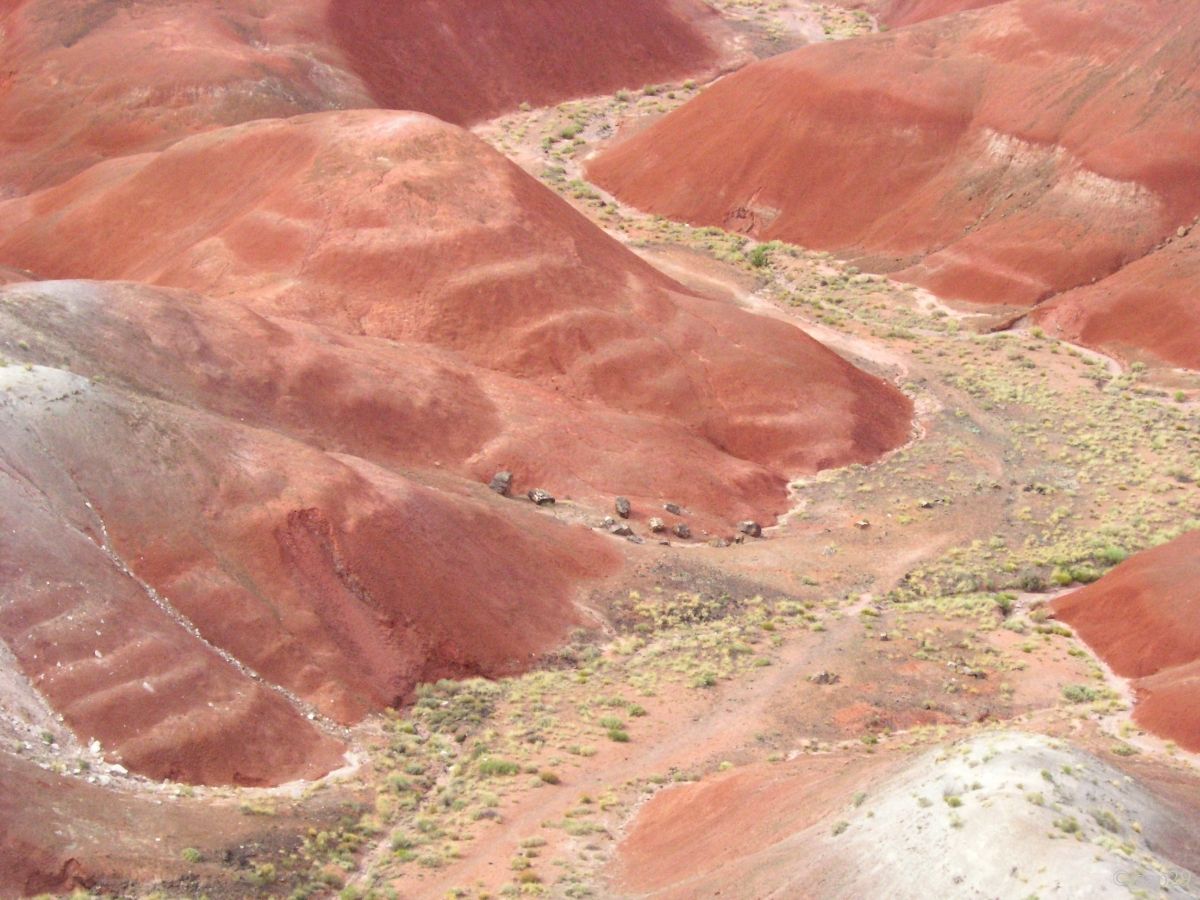
Departure for Blue Mesa with a sky increasingly cloudy. The road moves away from the main strip and offers some beautiful views. Stop on the parking lot before going down on the small path that winds, down in the canyon.
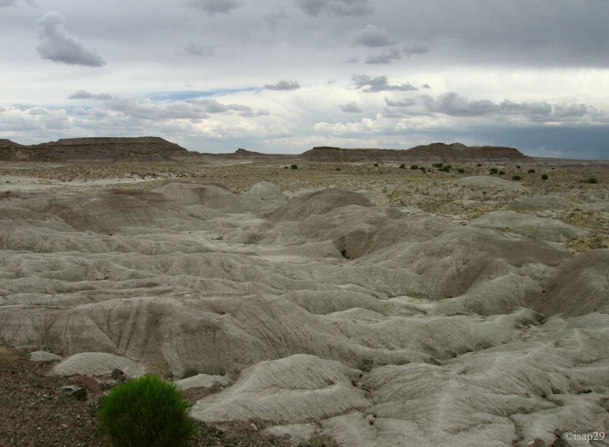
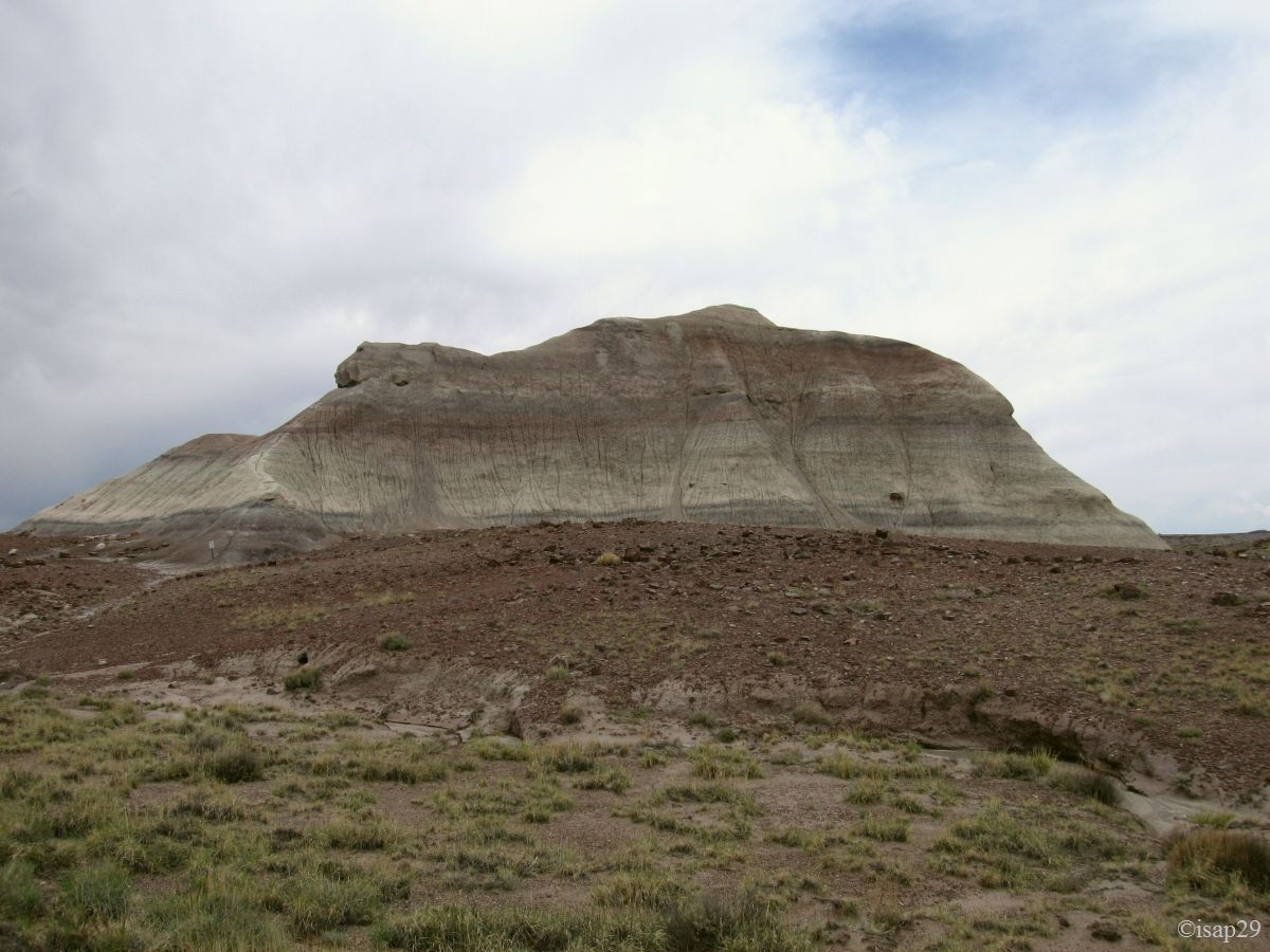
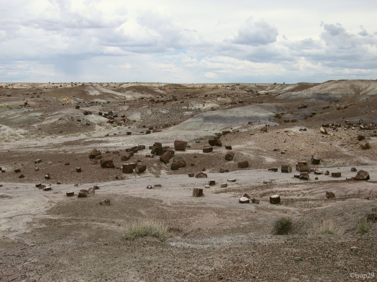
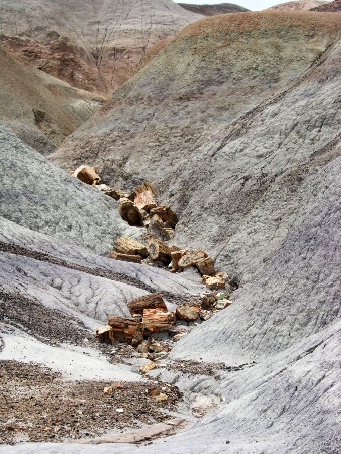
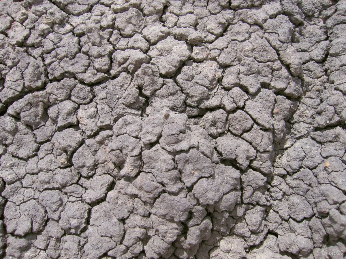
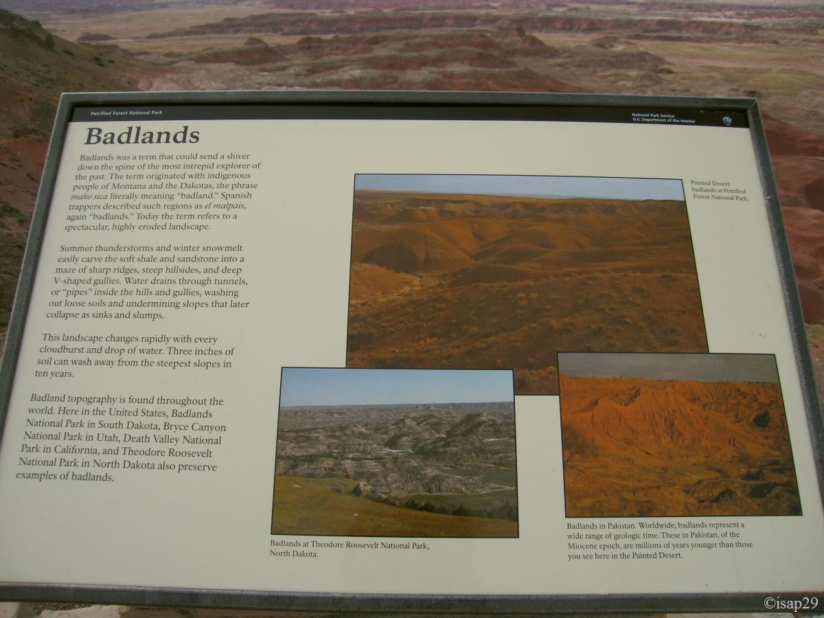
The lack of light does not emphasize the colors as it should, but it is a very interesting hike in this kind of new ground for us, the badlands, kind of solidified mud over the ages and where erosion is very strong, which considerably limits vegetation. This erosion also allows us to see that the majority of "stones" on which we walk are actually remnants of petrified wood, dating from about 225 million years.
The layers with dominant gray, green and blue correspond to times when the water level was important, while the reddish layers correspond to periods with relatively low level, allowing the iron compounds, such as hematite, for example, to oxidize ("rust").
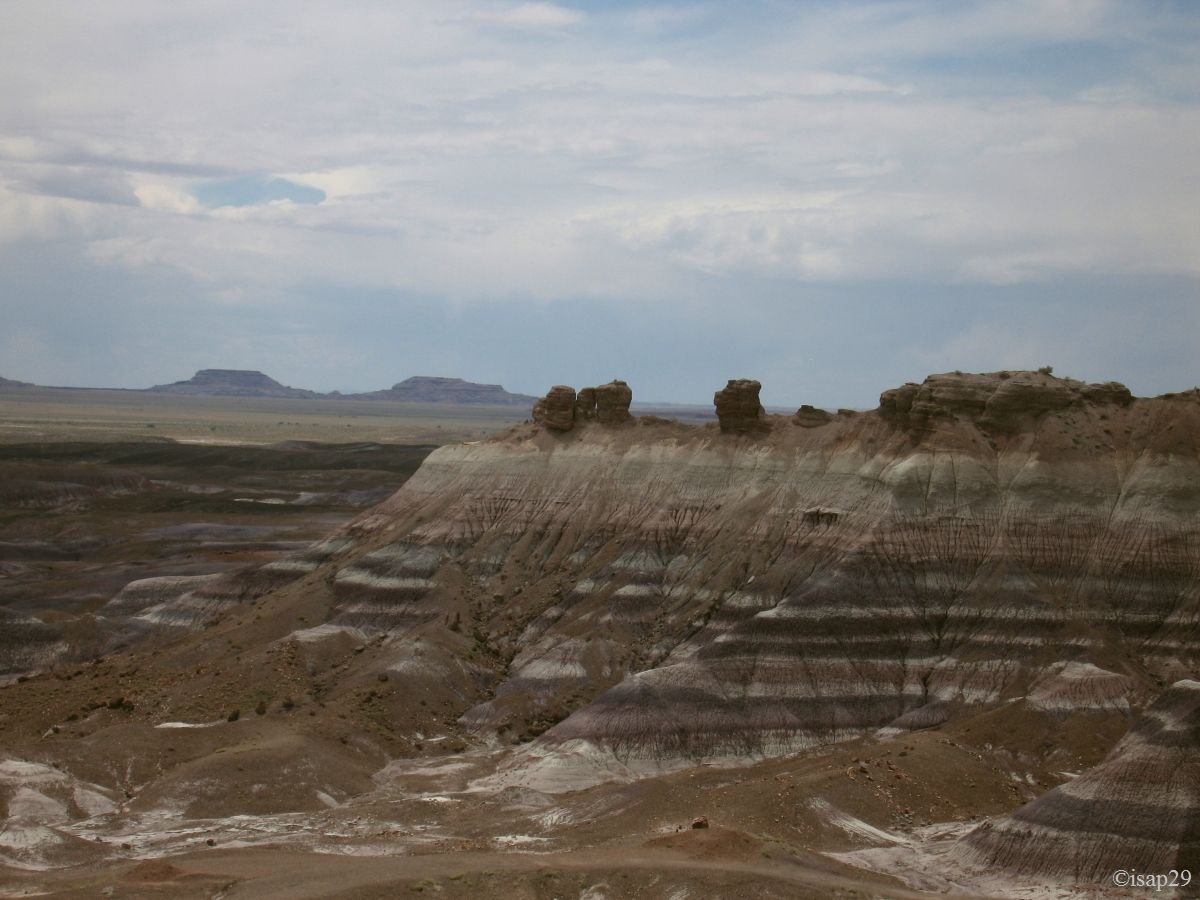
We even discover, at bottom, some tepees, before seeing the "true ones" a little bit further down the road.
-ajust.jpg)
_B-15-ajust.jpg)
-ajust.jpg)
-ajust.jpg)
-ajust.jpg)
_ajust.jpg)
_ajust.jpg)
_B-15.jpg)
Petrified Forest - Blue Mesa (18 photos)
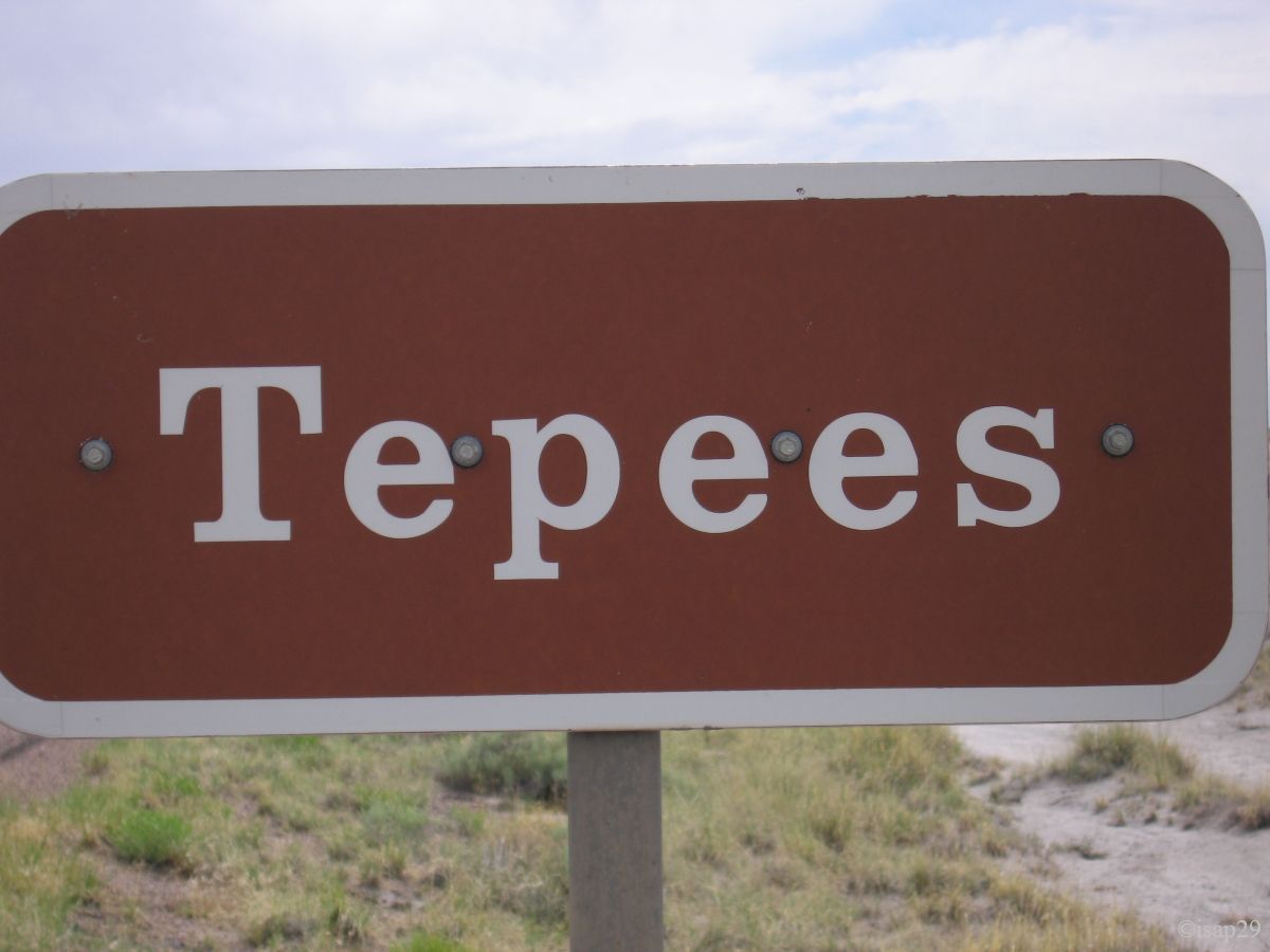
Back on main road which crosses the park, we now arrive in the area of Tepees.
Petrified Forest - Tepees (7 photos)
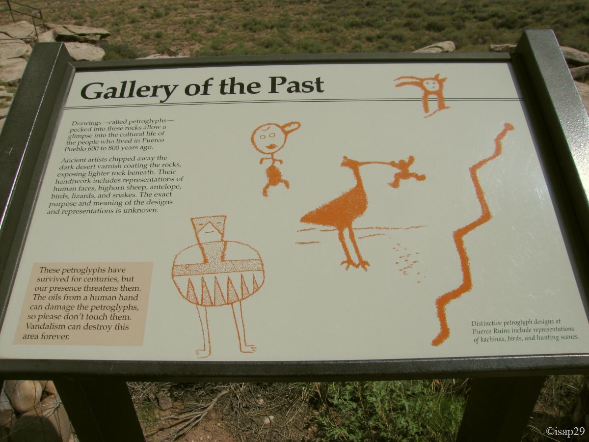
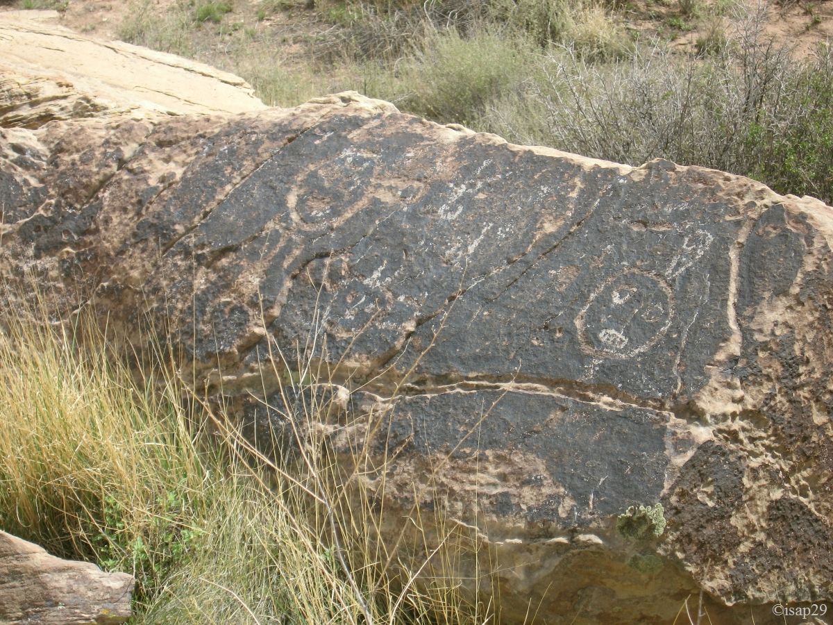
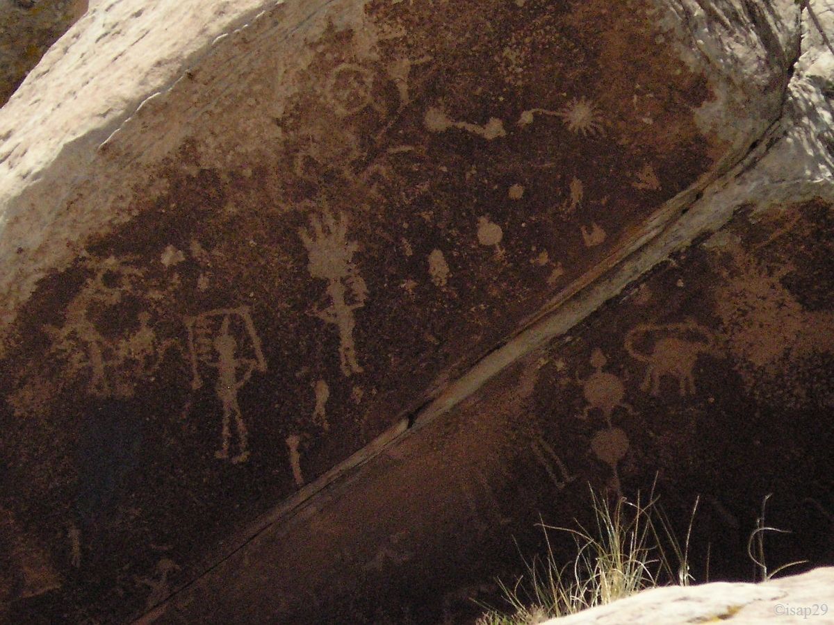
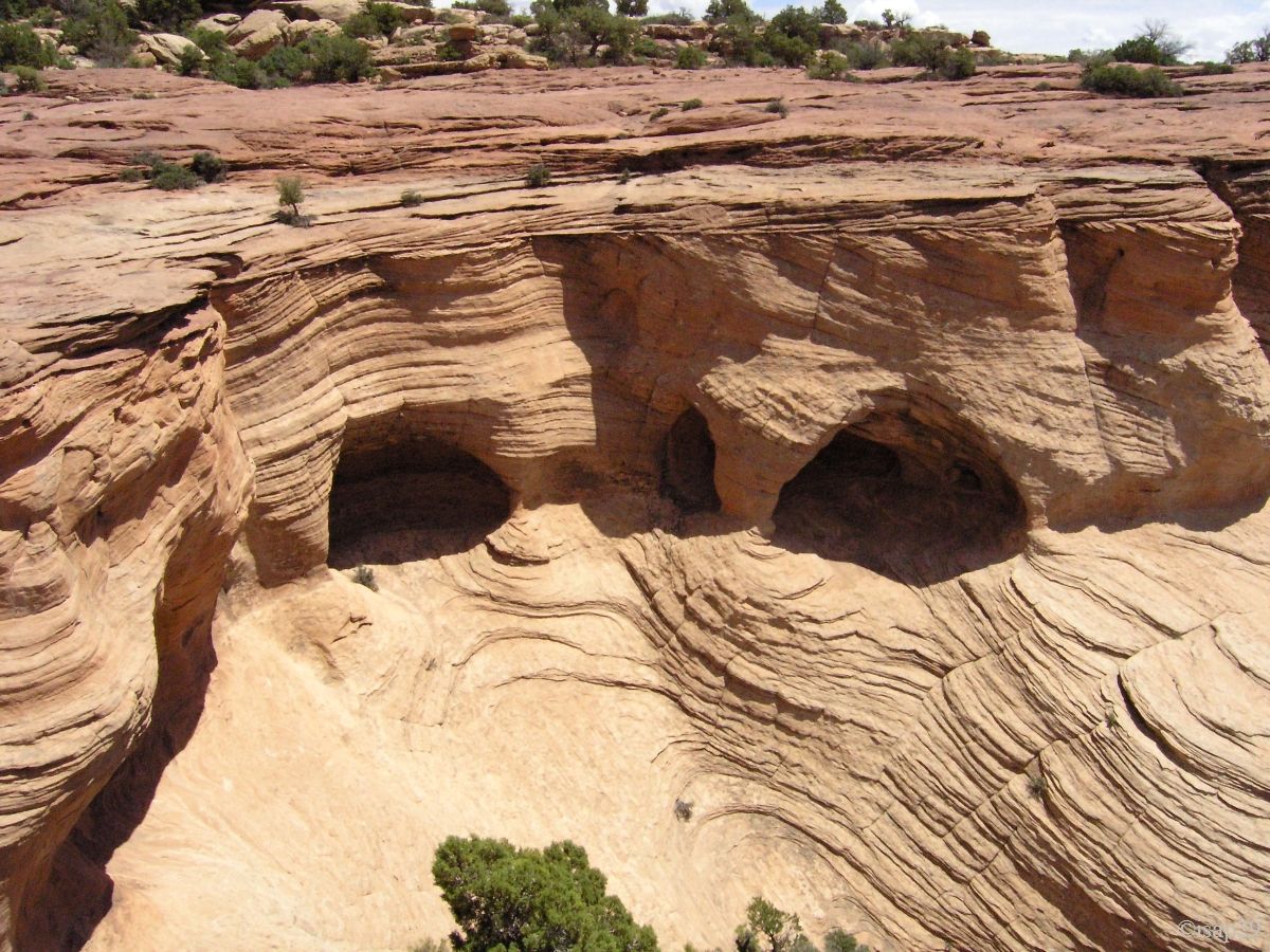
At Newspaper Rock, petroglyphs are so protected and remote that a telephoto is essential.
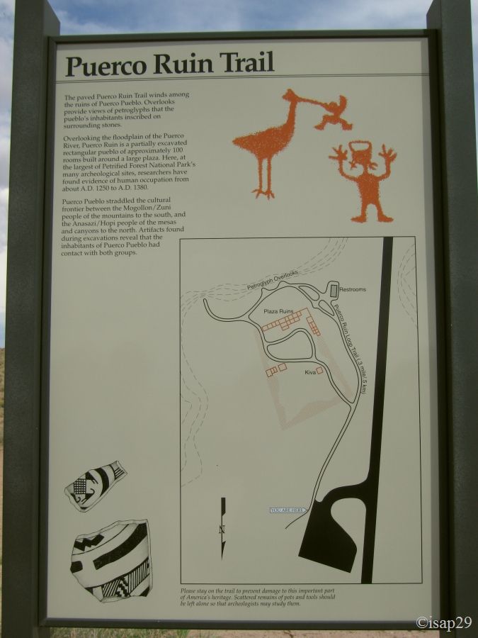
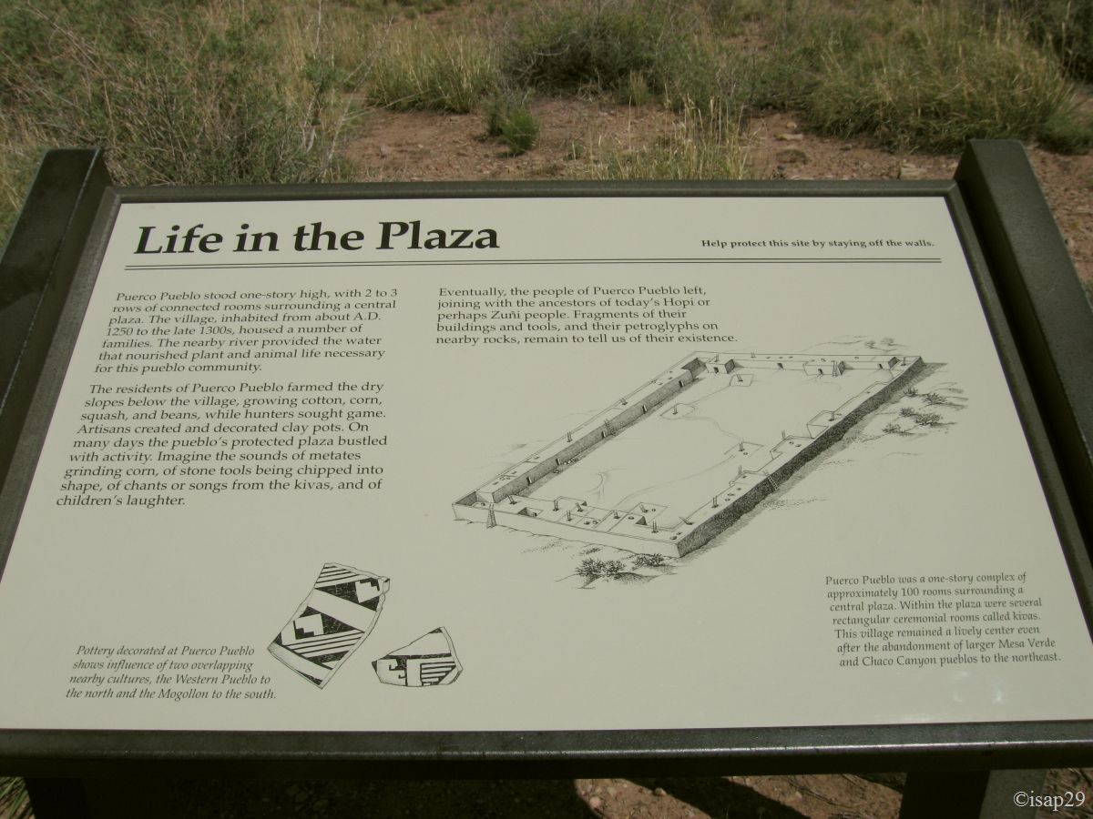
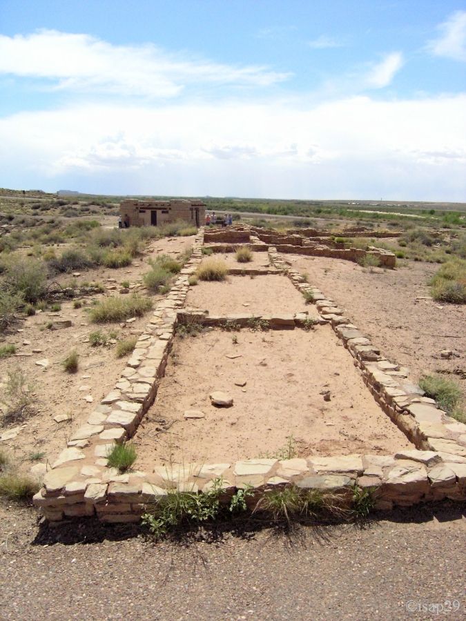
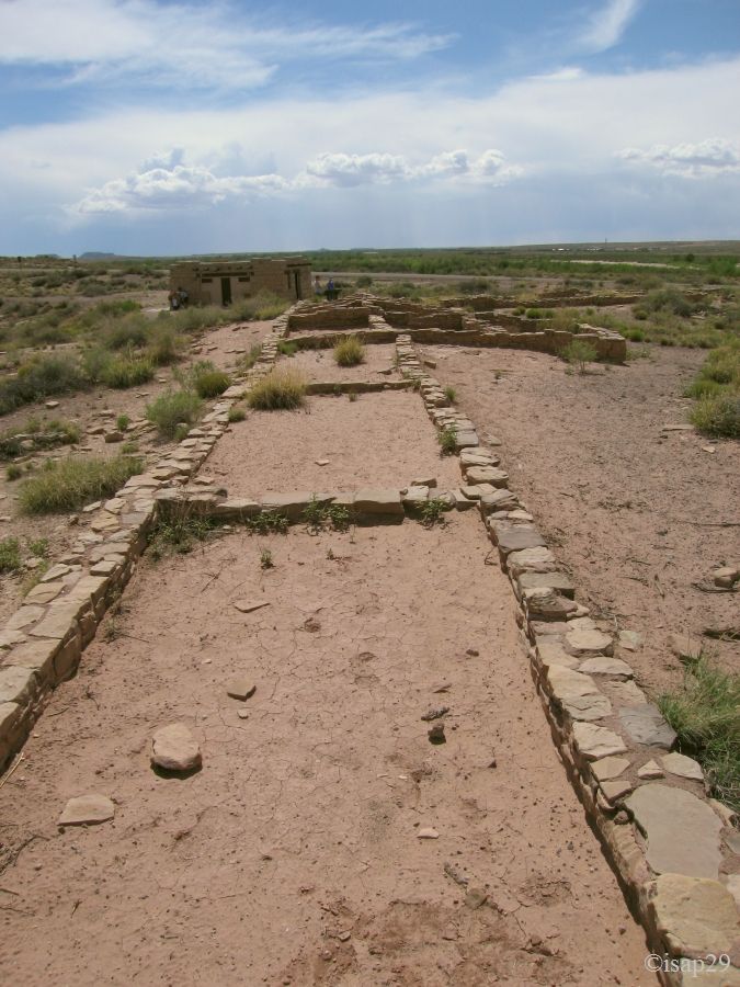
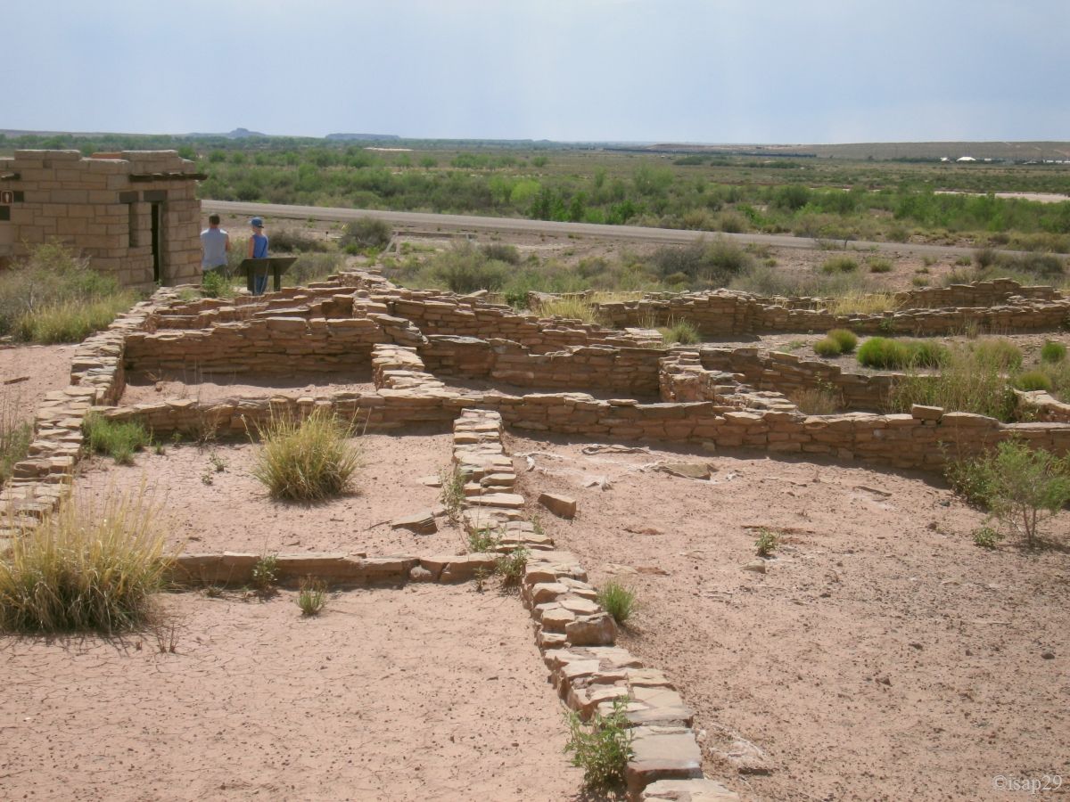
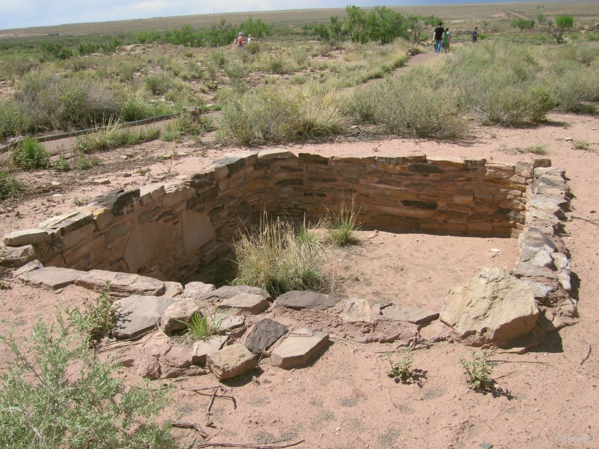
The next stop at Puerco Pueblo allows us to see other petroglyphs a little closer, but the telephoto is still useful. The ruins of houses complete the visit. These ruins date from 1200 AD (1215 to 1380) and were used by Pueblo Indians.

-ajust.jpg)
.jpg)
.jpg)
Petrified Forest - Newspaper Rock & Puerco Pueblo (15 photos)
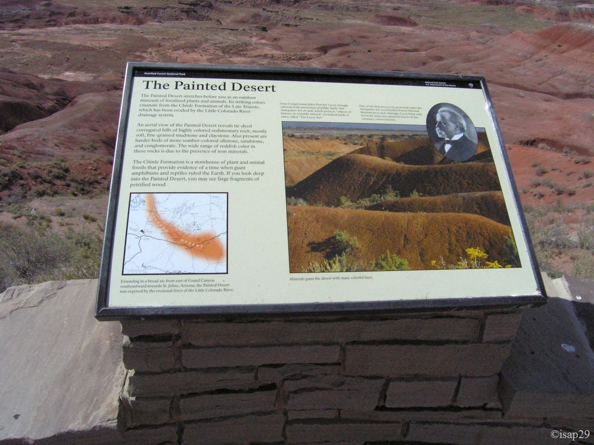
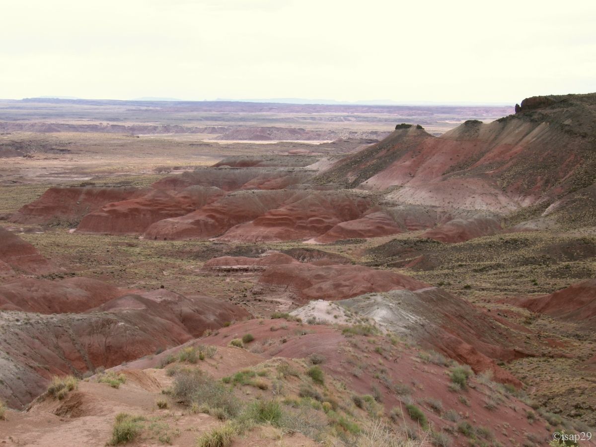
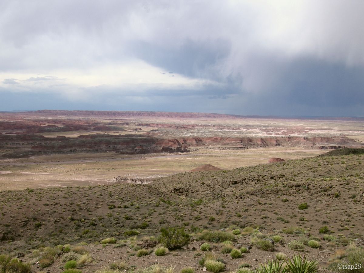
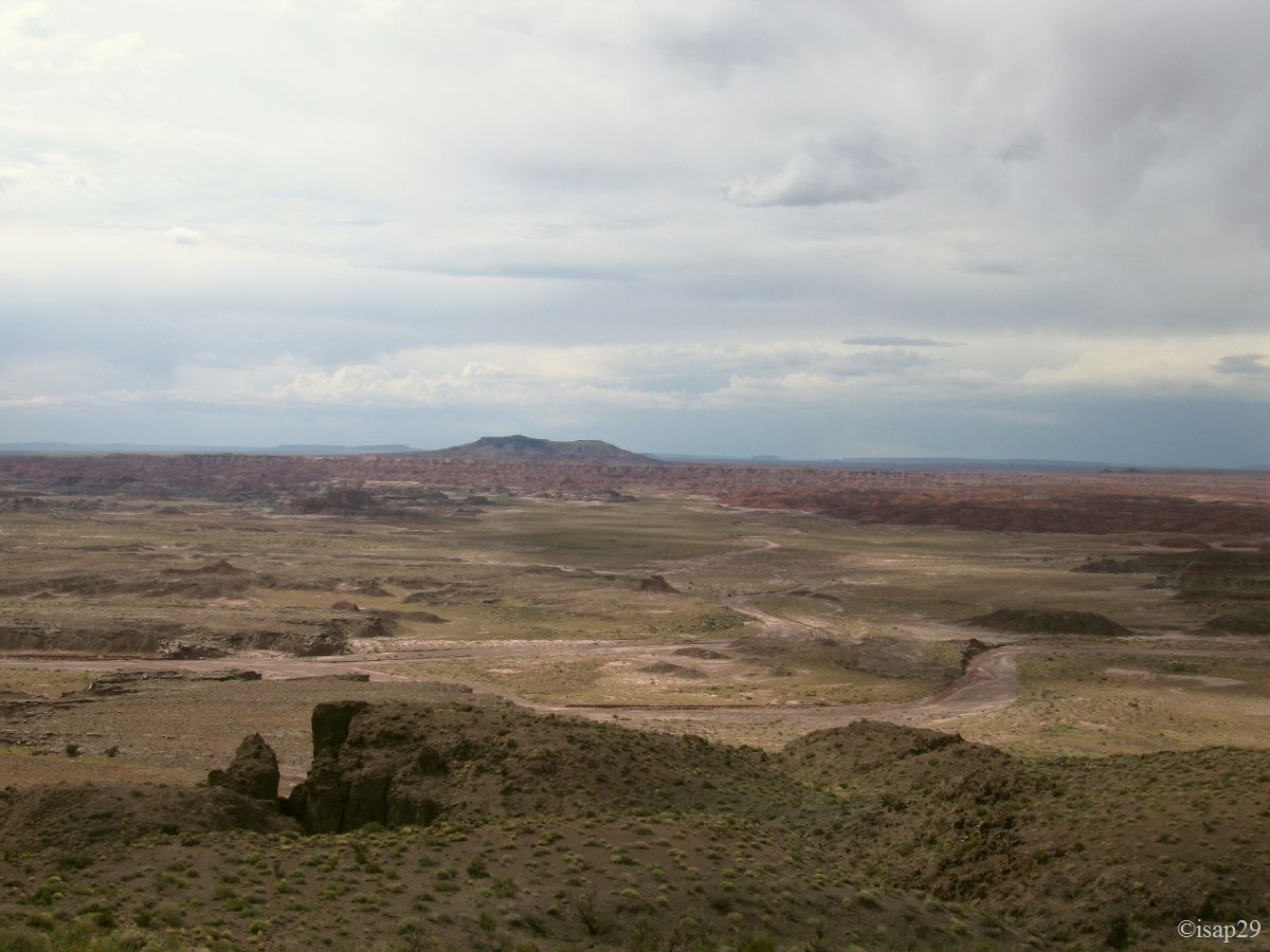
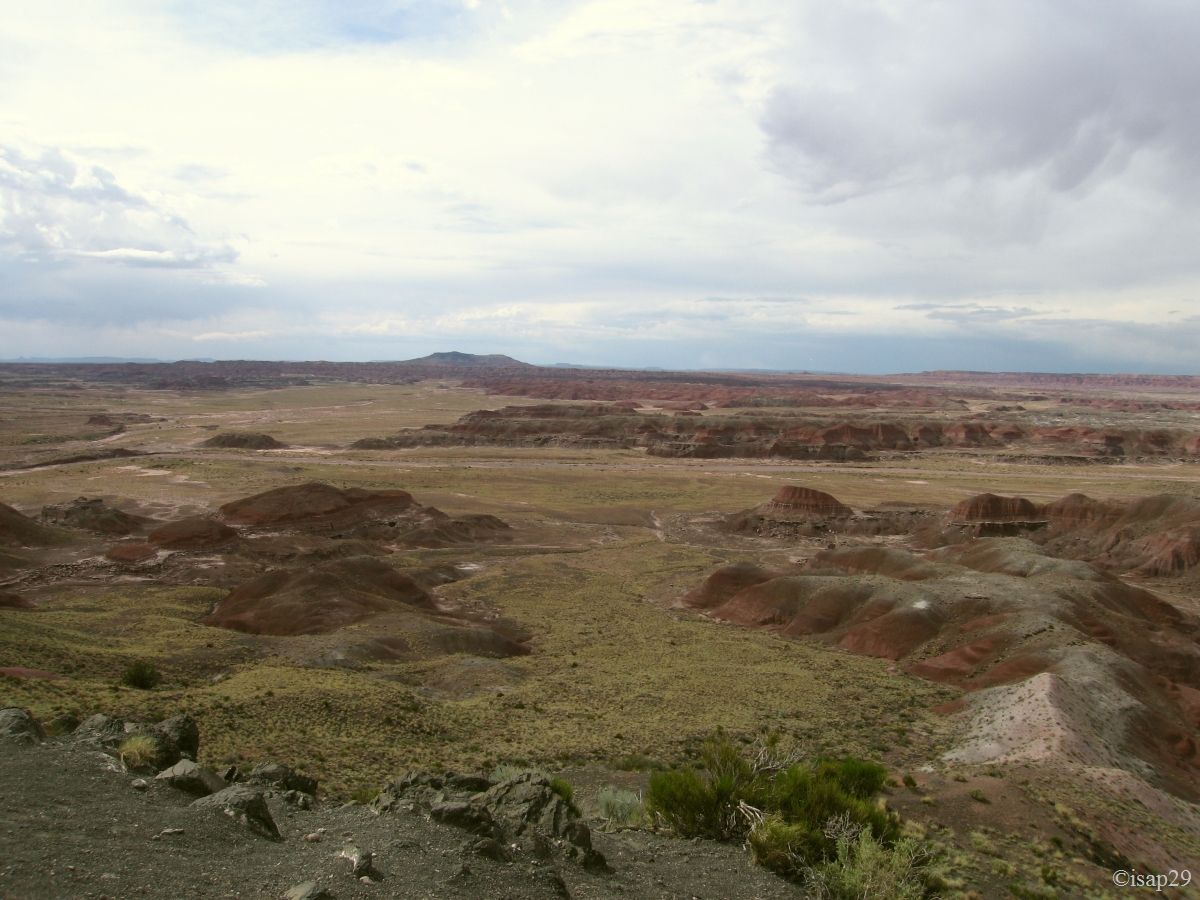
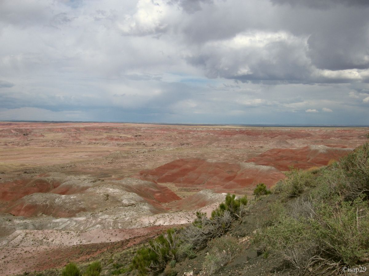
After passing over the I40 and the famous Route 66, we approach the Painted Desert part. Arrived at Lacey Point, it's 3pm and we start to be a little hungry! Quick snack on the go; the sky is becoming more and more cloudy and, towards north, lightning streaks across the sky.

.jpg)
Painted Desert - Lacey Point (3 photos)
We stop at the various viewpoints along the road.
-ajust.jpg)
.jpg)
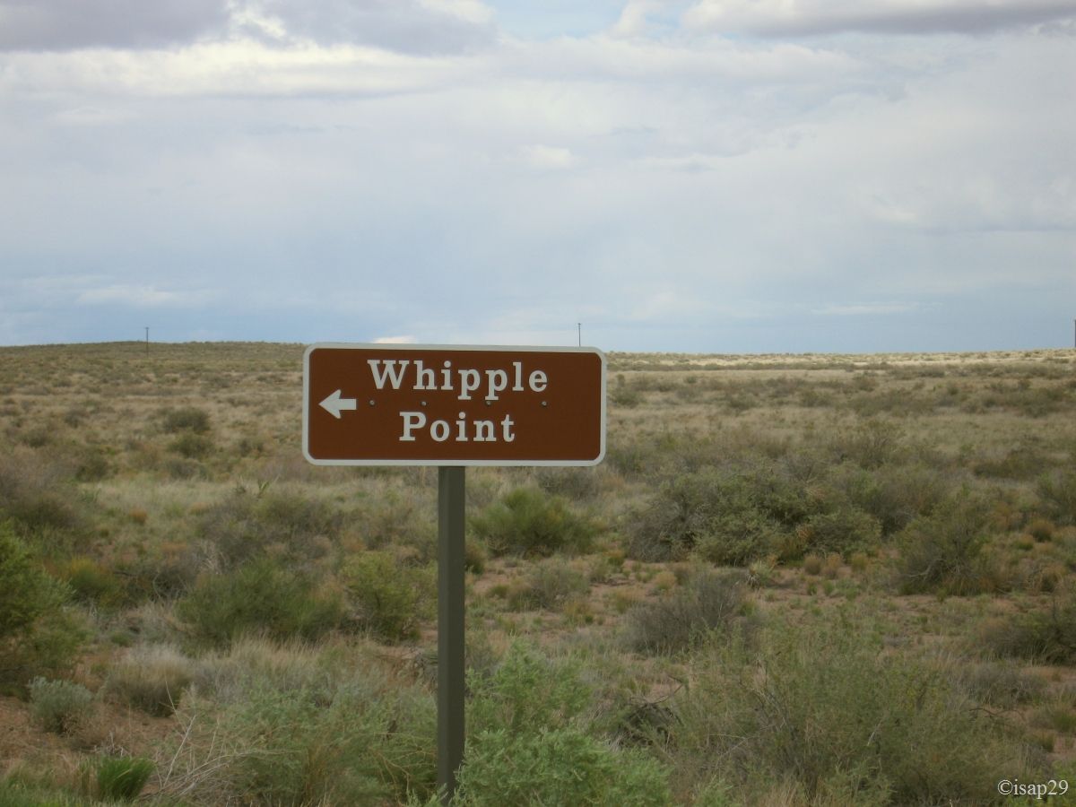
Painted Desert - Wipple Point (5 photos)
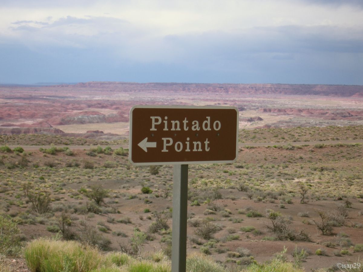
Painted Desert - Pintado Point (3 photos)
-ajust.jpg)
.jpg)
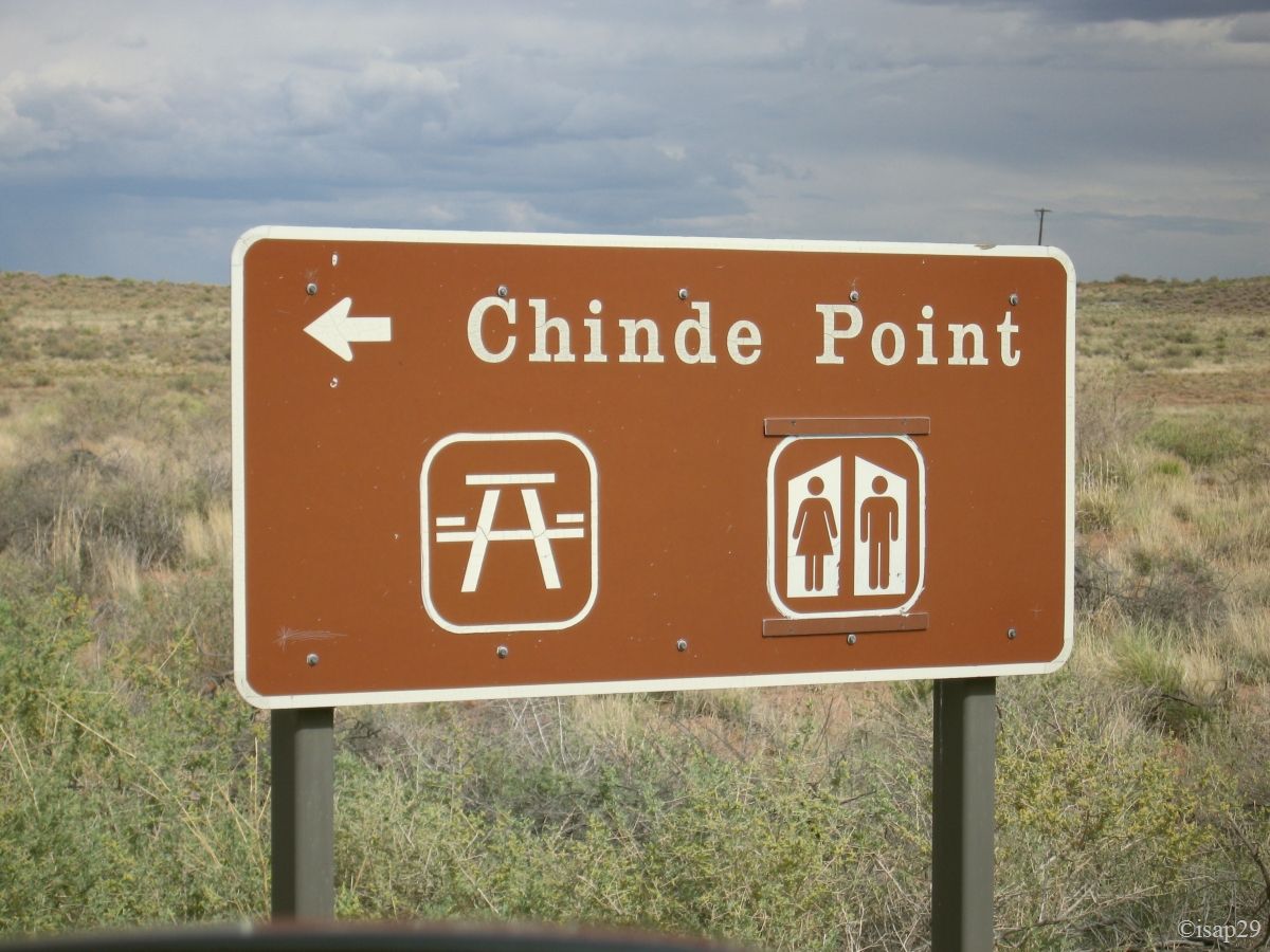
Painted Desert - Chinde Point (7 photos)
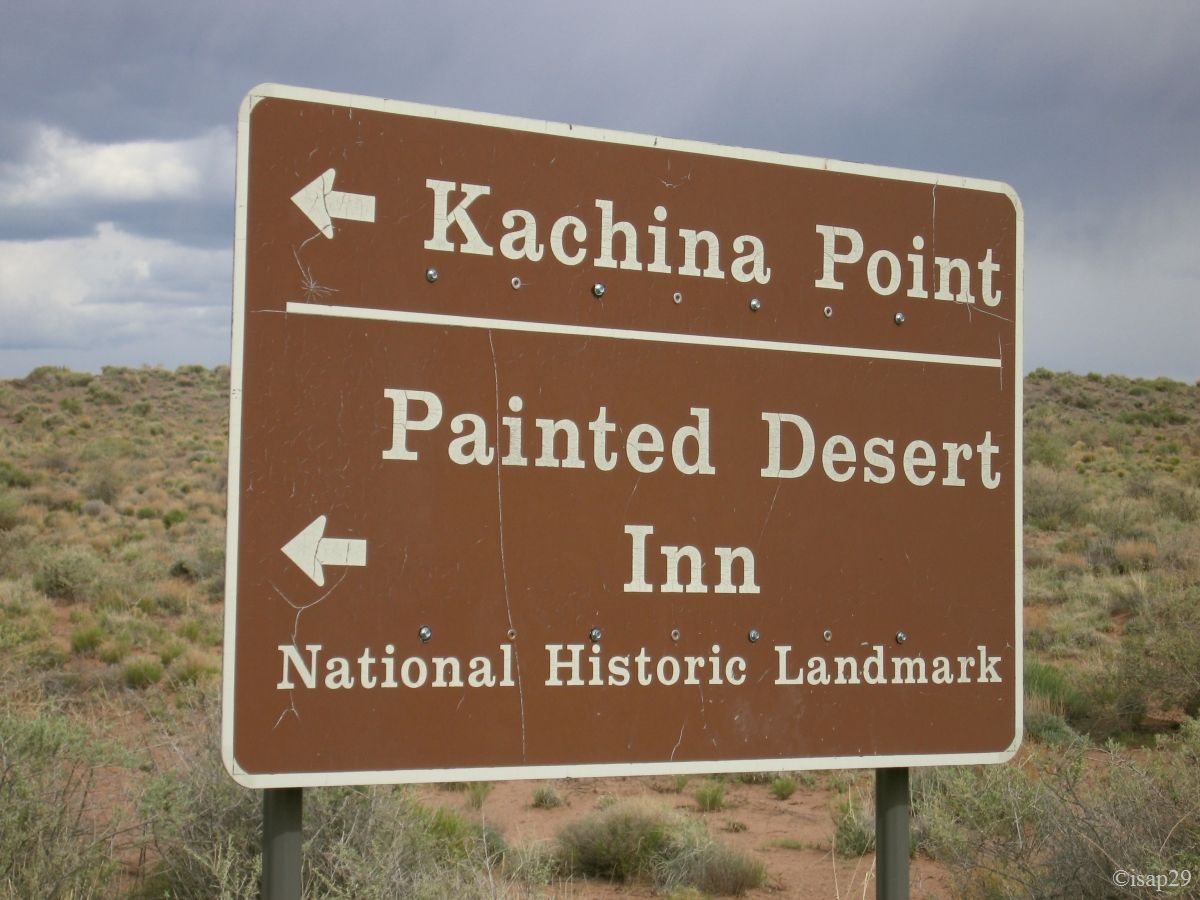
At Kachina Point, we imagine to go a little down in the wash, but after having tackled the descent, the heat, the slope and the high risk of storm quickly make us turn back. This portion of the park deserves its name; colors are beautiful, perhaps even strengthened by the stormy sky.
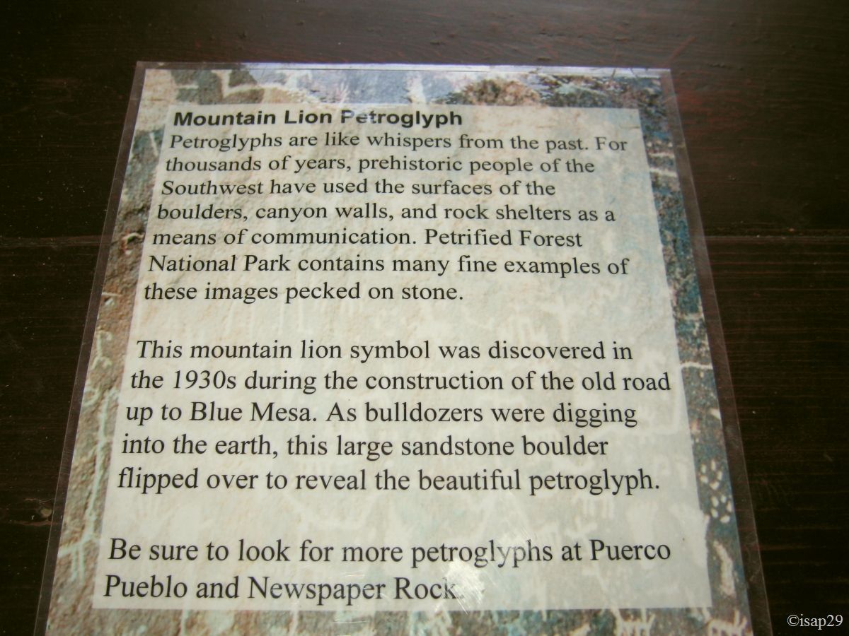
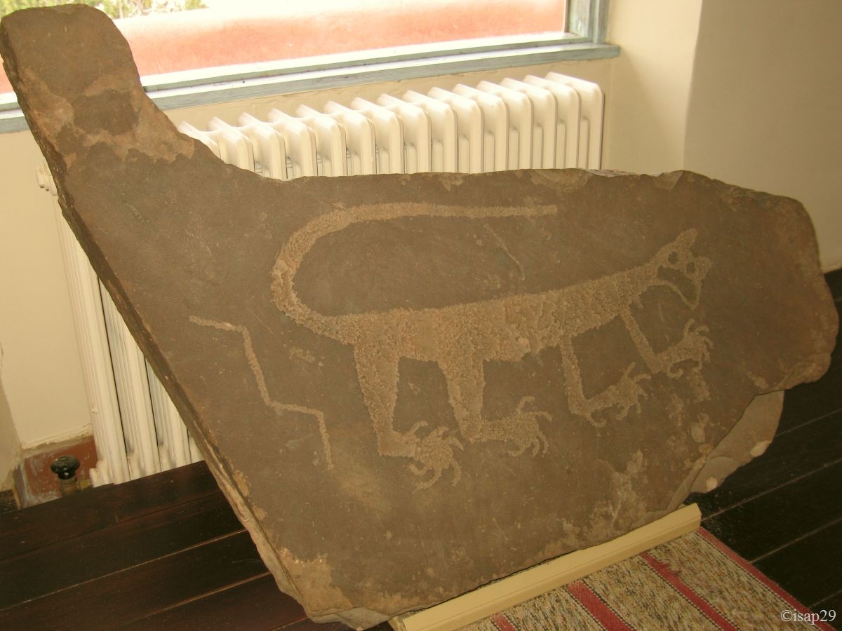
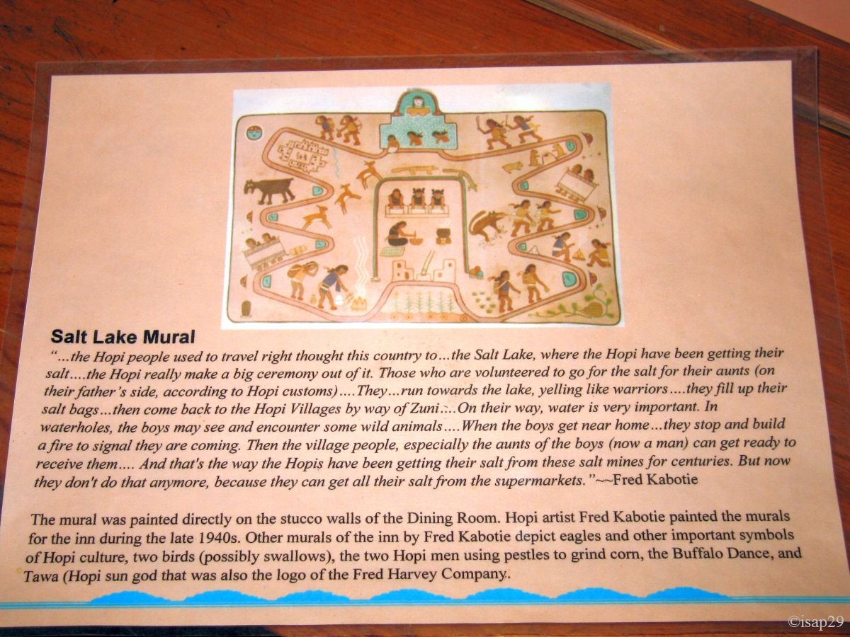
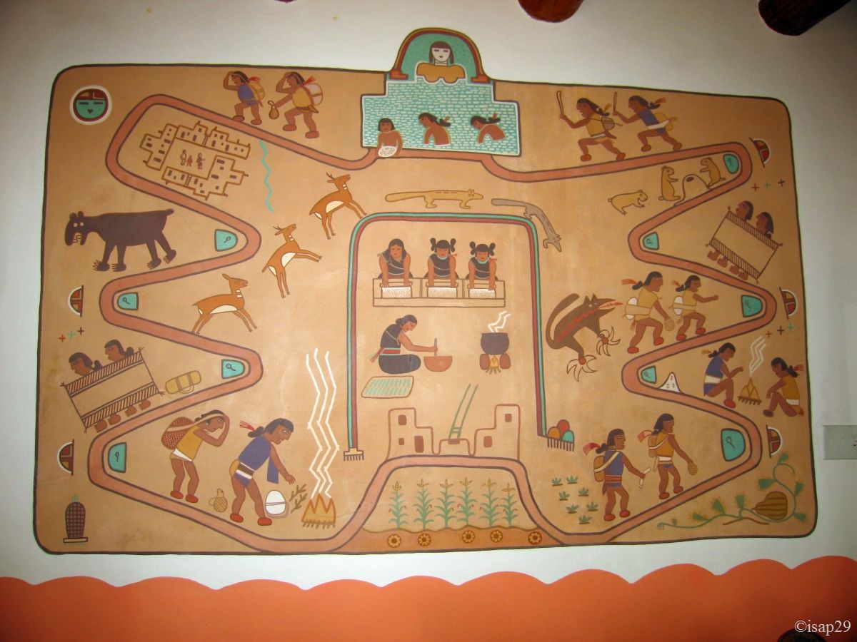
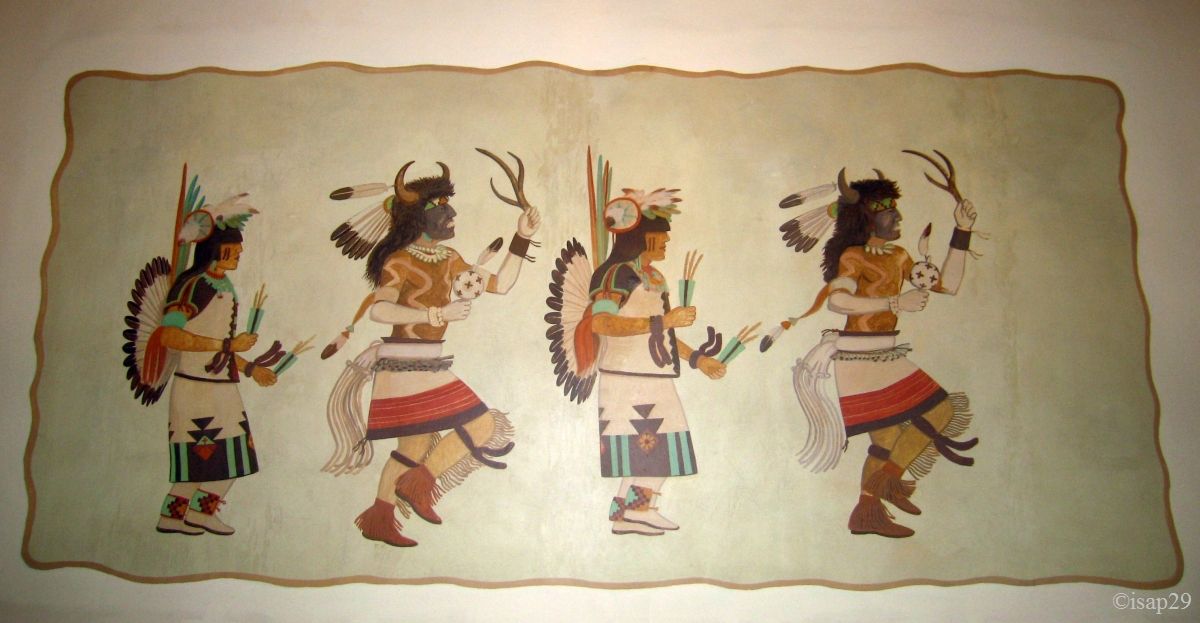
We make a short visit to the Painted Desert Inn, where we find a great petroglyph of mountain lion (puma) and a beautiful Hopi mural paint.
-ajust.jpg)
-ajust.jpg)
_B-18.jpg)
Painted Desert - Kachina Point et Painted Desert Inn (14 photos)

_B-18.jpg)
-ajust.jpg)
_B-18.jpg)
-sat15-contrast20.jpg)
Painted Desert - Tiponi & Tawa Point (8 photos)
We leave the park around 5 pm and, as we could not go away with pieces of petrified wood (forbidden), we go towards the store (Petrified Wood Co. Jim Gray's) to see
a stock and buy a (small) piece; it's very beautiful once polished! It's too bad that our luggage is limited in weight in airplane .
Back at the hotel where we take possession of our room. It's where we have our first true linguistic contact with deep America. To the question "At what time is breakfast?" our interlocutor answers us "six teurdy"! Well ... that's what we understand! "Six" is ok, but "teurdy"? After some hesitations, we understand that it's 6:30 am, but I insist to understand the famous "teurdy"; it's simply "thirty" with the local accent and thankfully we have persevered because we'll hear this "expression" several times thereafter.
The hotel is Americas Best Value Inn, but we don't recommend it (and yet we are not difficult).
Tuesday, May 26
Wake up at 5 am and we backup our photos on the PC and external hard disk; we take advantage of Wi-Fi to upload some photos on Picasaweb for everyone who "follow" us in France and California. Breakfast and around 8 am departure for Canyon de Chelly.
En route, we stop at the Hubbell Trading Post, but we come away at a run when we see the displayed prices: the tourist is not Croesus, isn't it
 ?
?
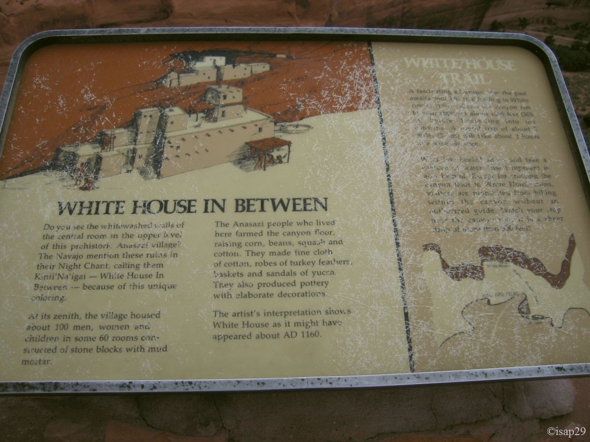
We arrive at Canyon de Chelly; still inhabited by the Navajo and even cultivated. Thus, only one hike is authorized in the canyon without Indian guide: the ruins of the White House.
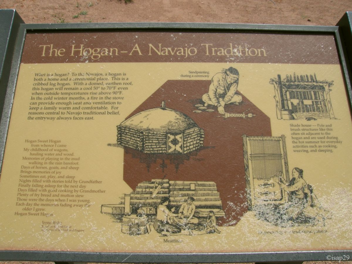
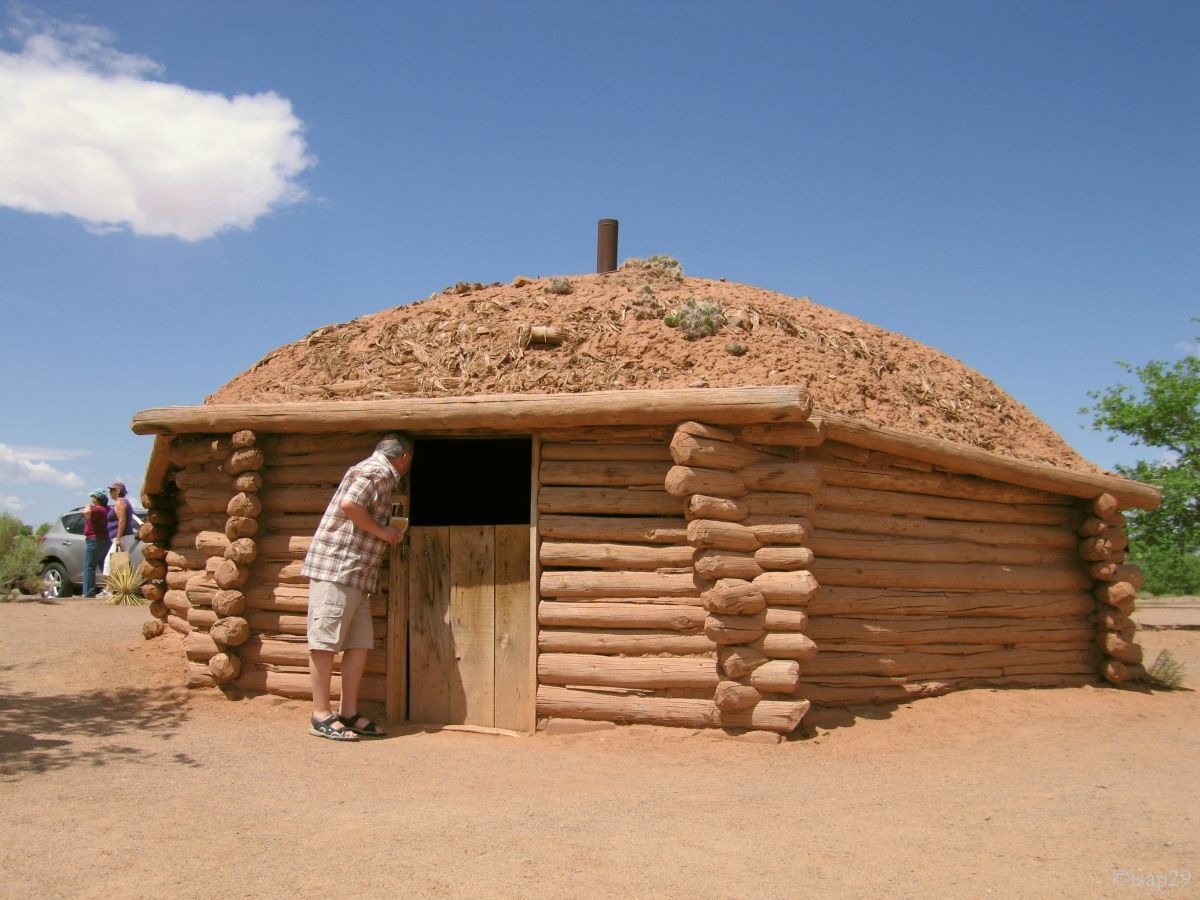
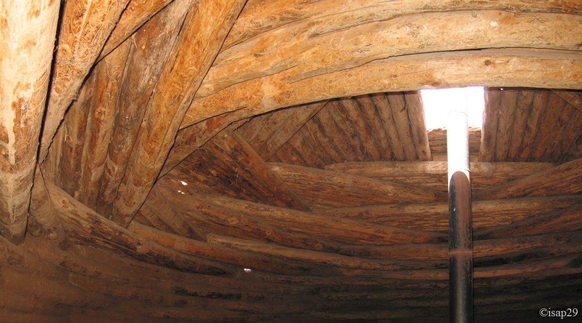
After a bus a little bit "cool", we stop at the Visitor Center and near it we discover a hogan, a traditional dwelling of the Navajo Indians, built of logs and with a ground roof to reduce heat.

Canyon de Chelly - Visitor Center (5 photos)
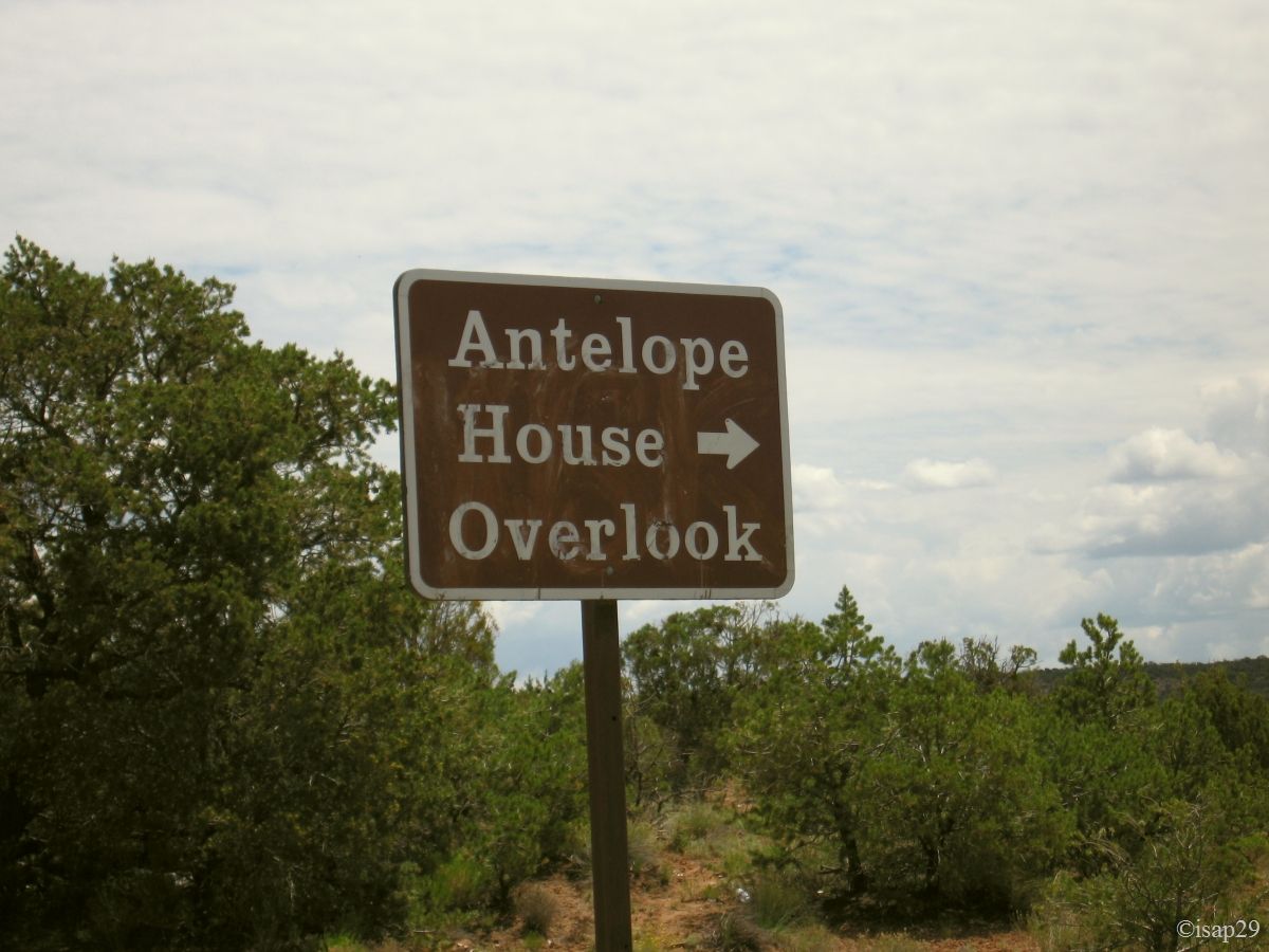
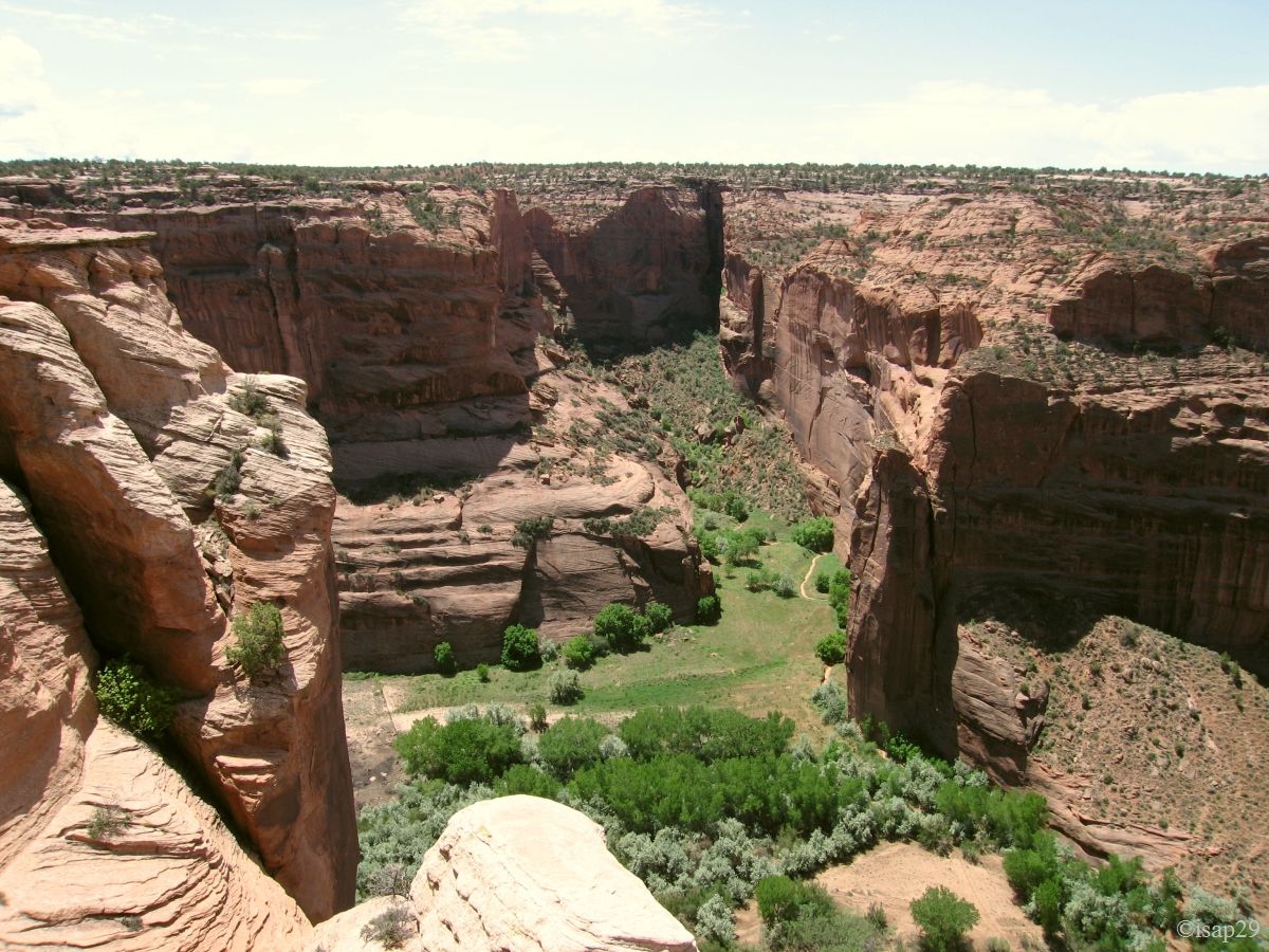
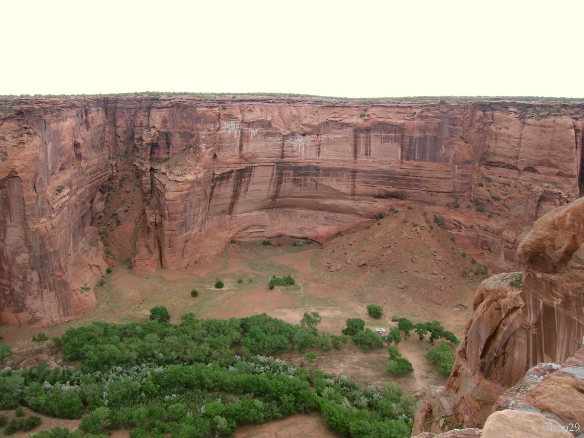
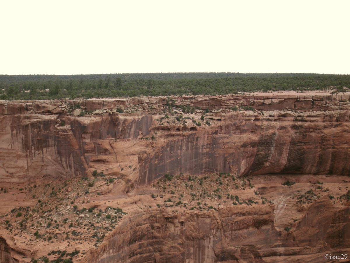
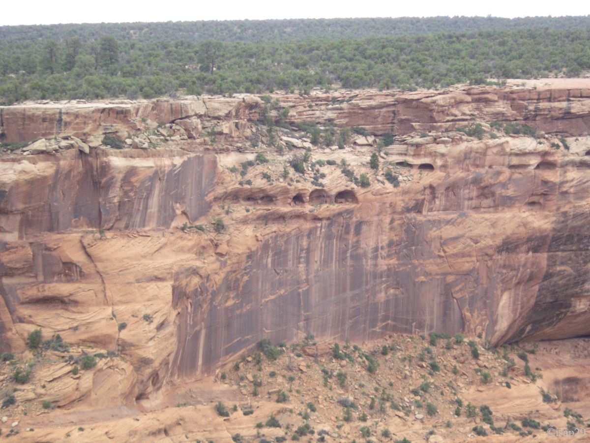
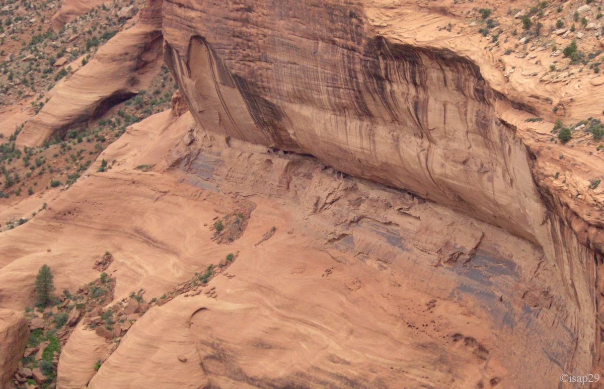
We begin our visit with the northern side of the canyon. Many secondary roads are closed, but fortunately that of Antelope
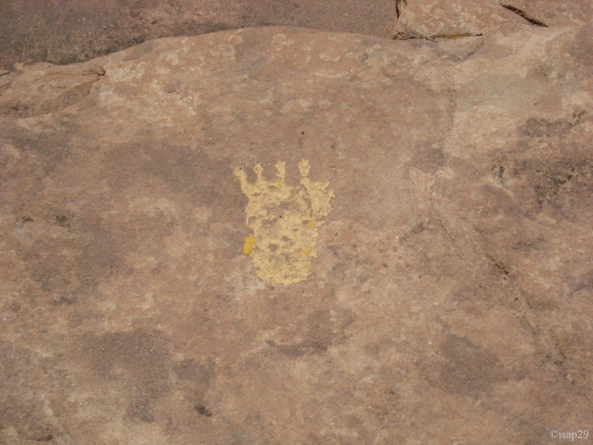
House is accessible. The path is shown to us by "feetographes"
and sometimes carved into the rock. After some wonderful views of the Canyon del Muerto, we discover the ruins at the bottom of cliff;
by cons, we look everywhere in vain but we don't see the petroglyphs. Two Americans looking like us tell us on what kind of rock
we should find some (the famous "desert varnish"), but nothing to do, despite the binoculars; what a pity.
-ajust.jpg)
Canyon de Chelly - Rim nord - Antelope House (7 photos)
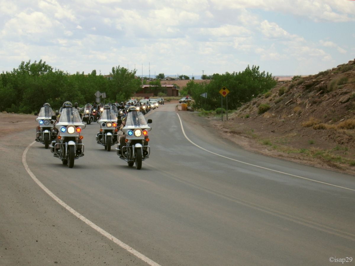
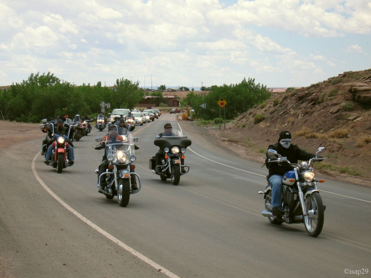
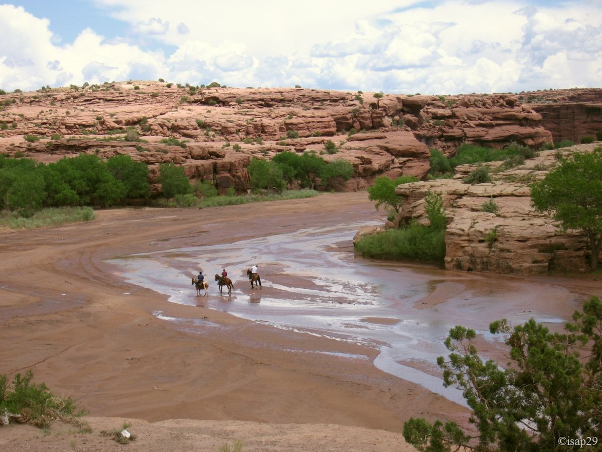
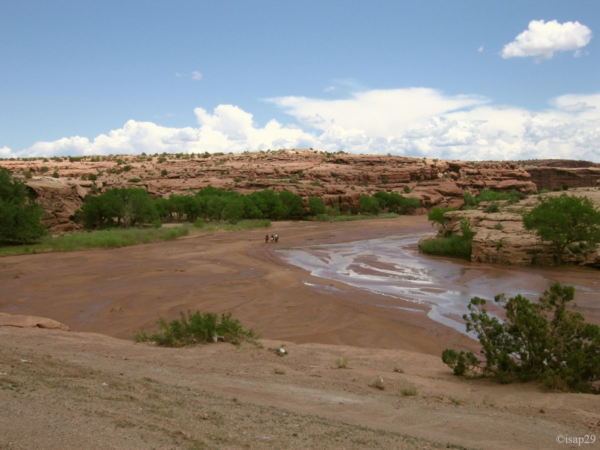
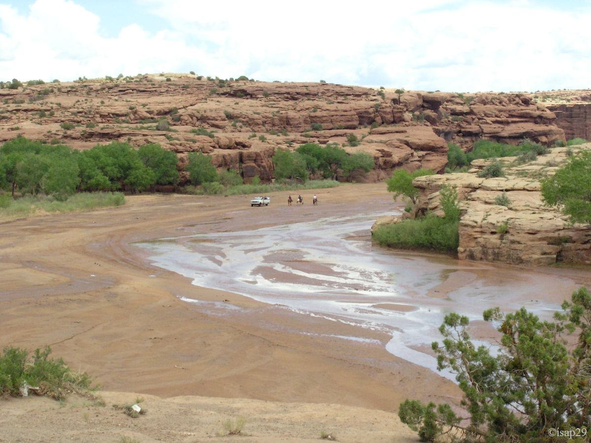
Back to the south rim with some beautiful sights on the entrance of the canyon and on horseback riders (and 4WD). A parade of official cars (quite a procession) blocks traffic and it must be a local ceremony because some bikers seem to be Indians.
Canyon de Chelly - Rim nord - end (6 photos)
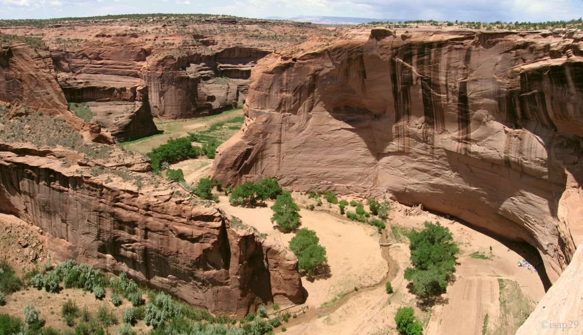
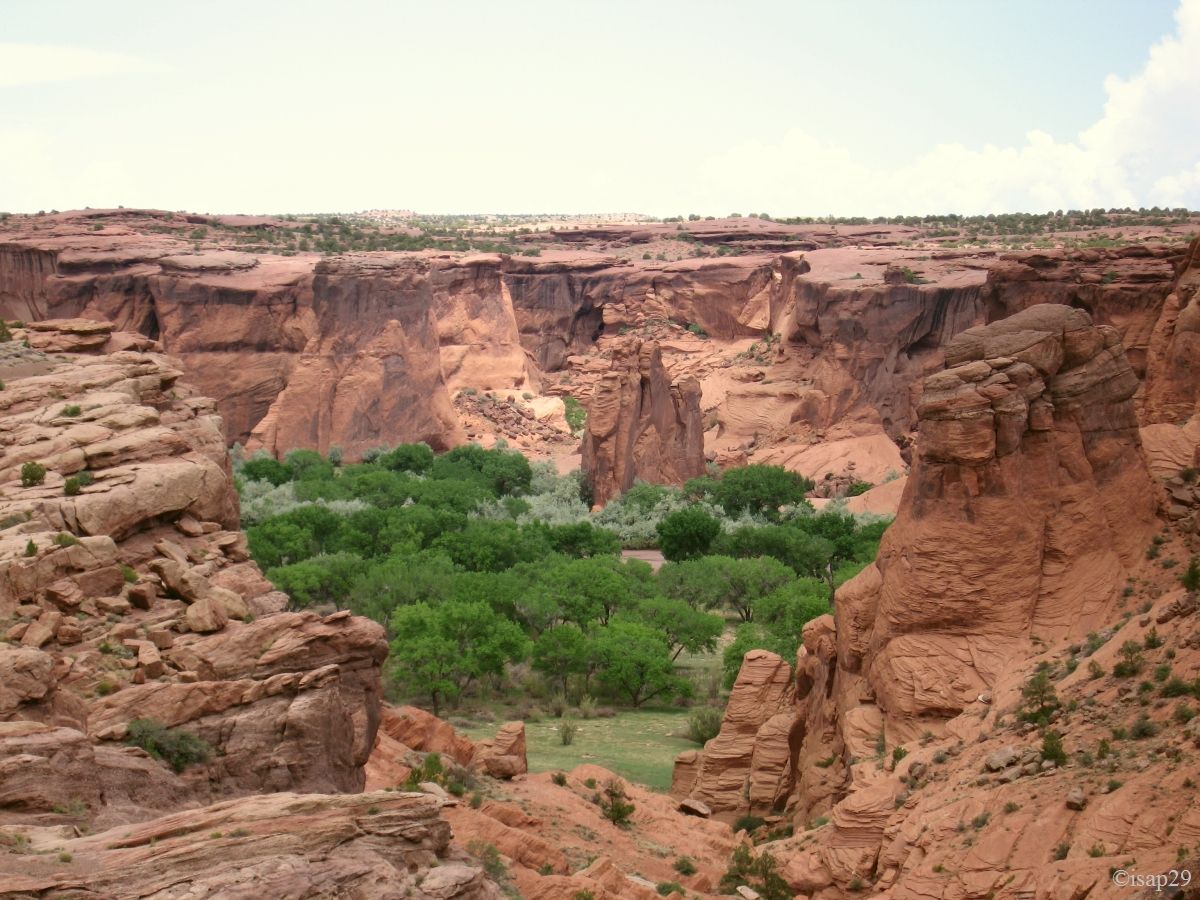
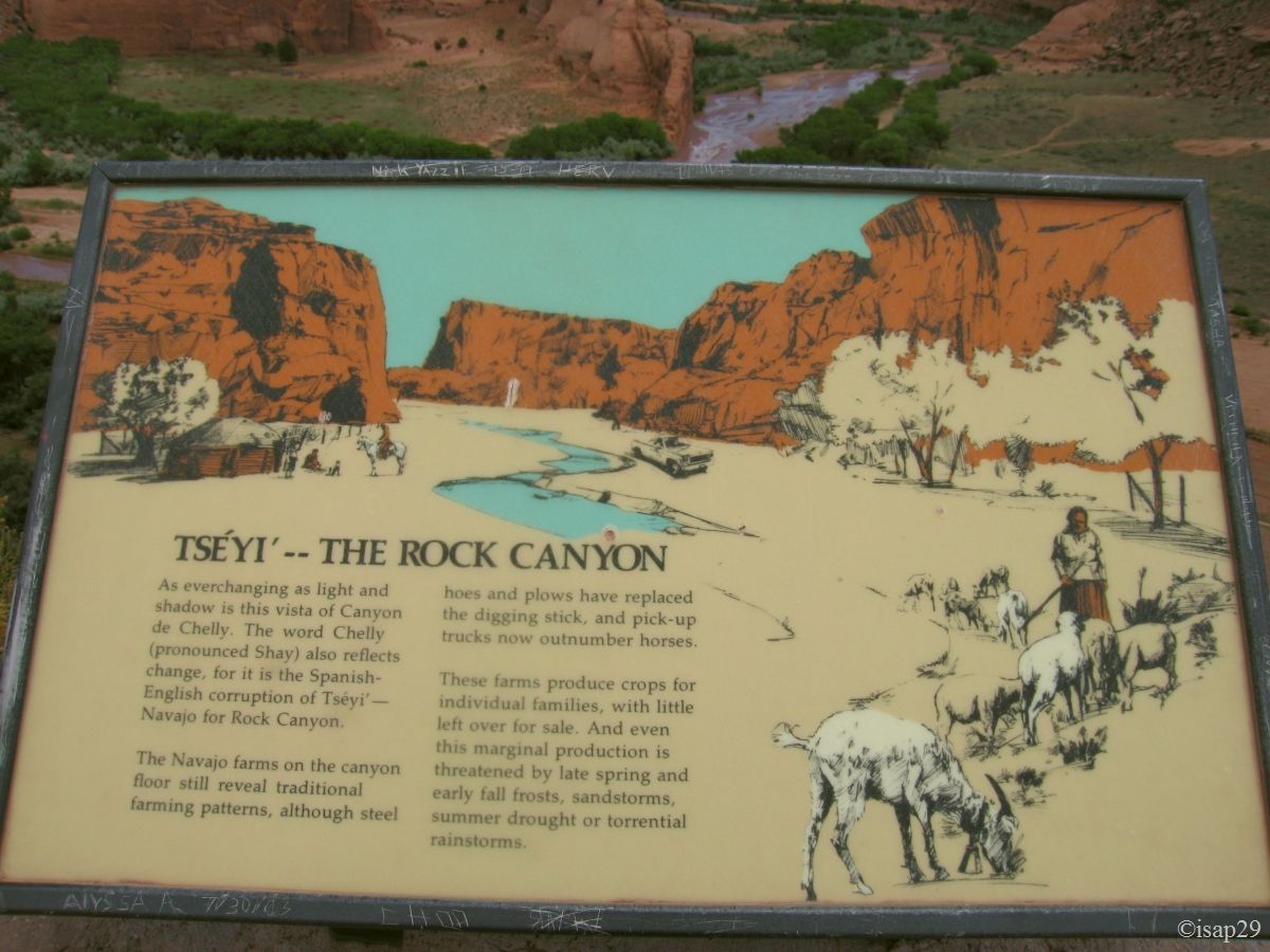
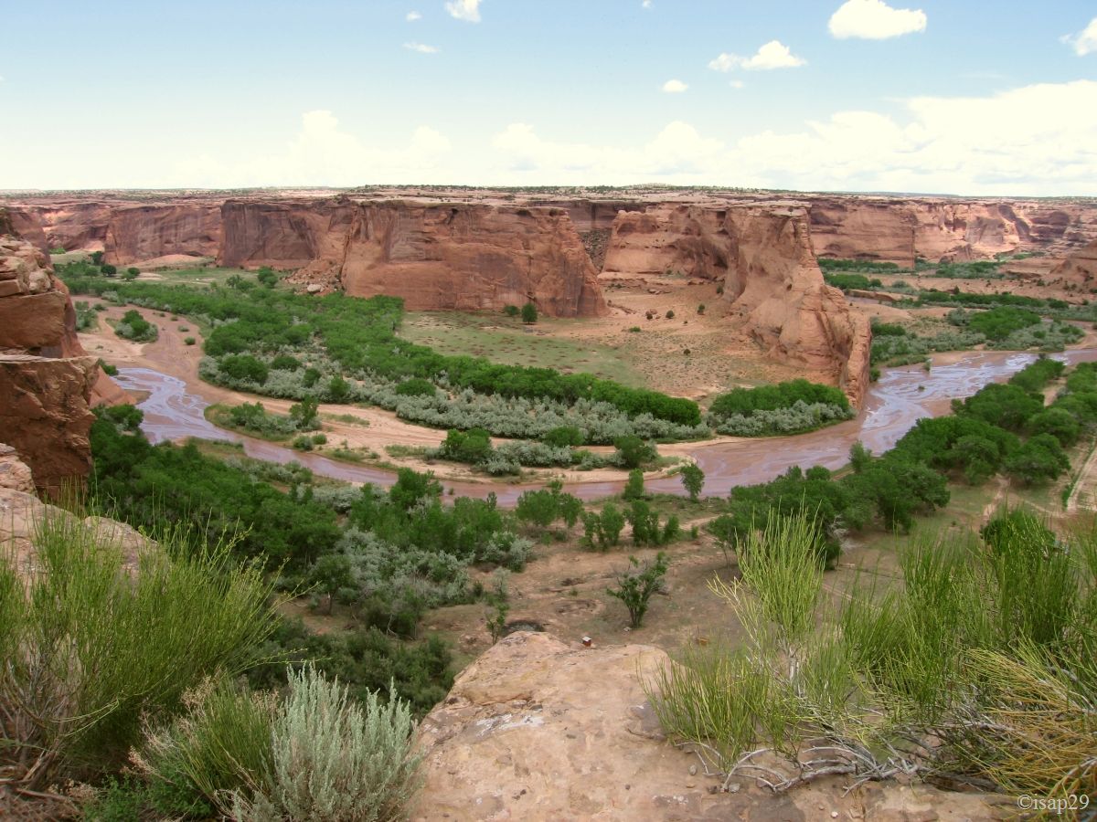
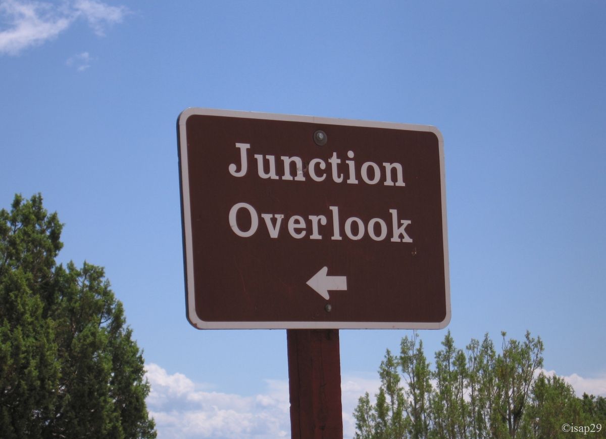
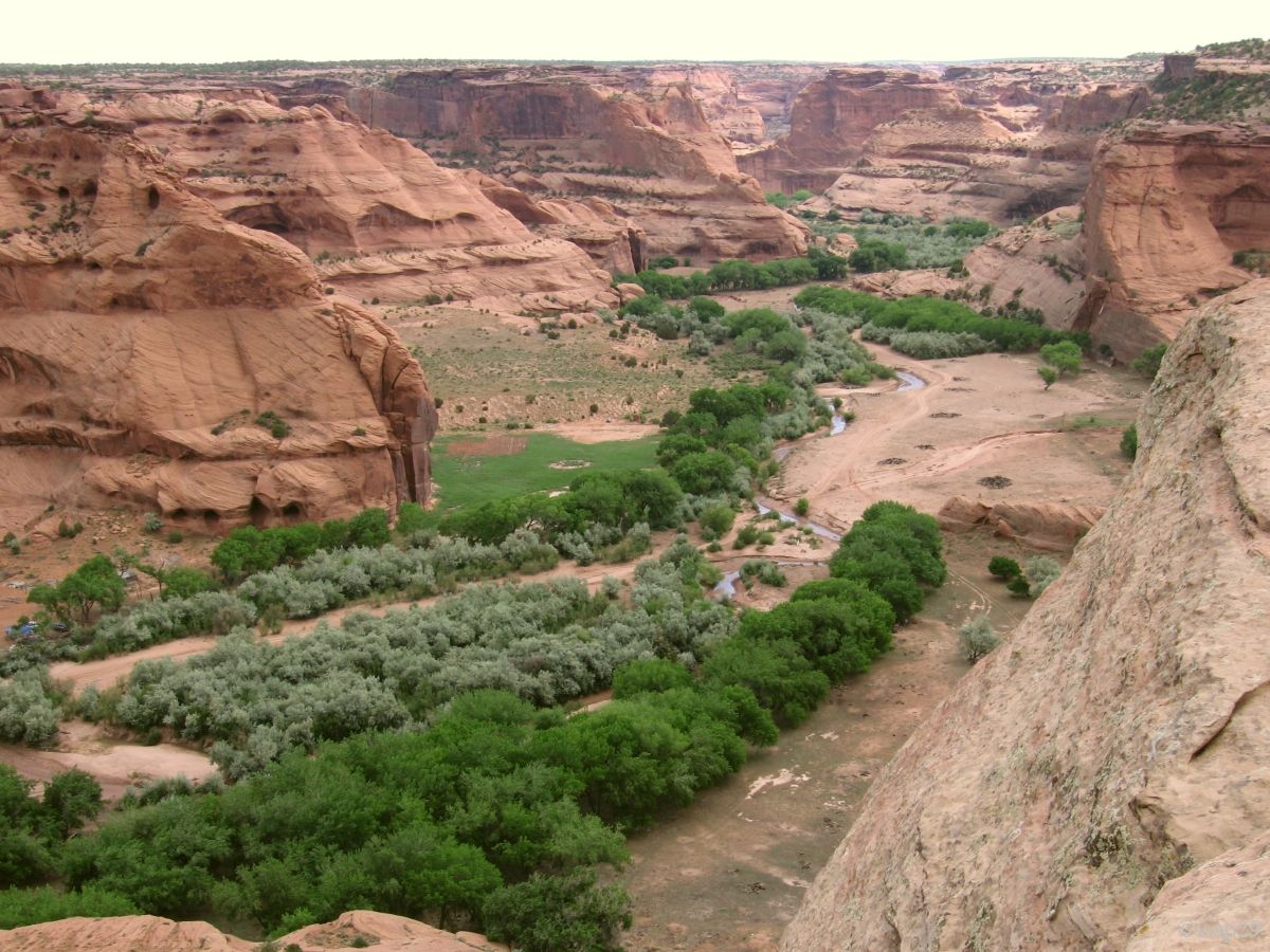
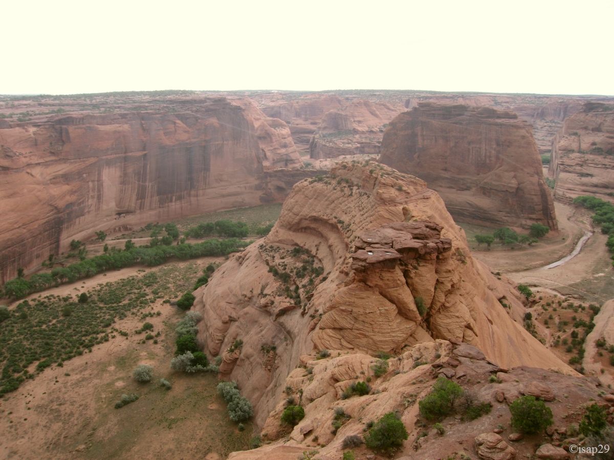
We begin our tour of the southern part of the canyon by stopping at the various points of view. These views allow us to understand partly the local geology and to see the land farmed by the Navajo Indians.
-ajust.jpg)
.jpg)
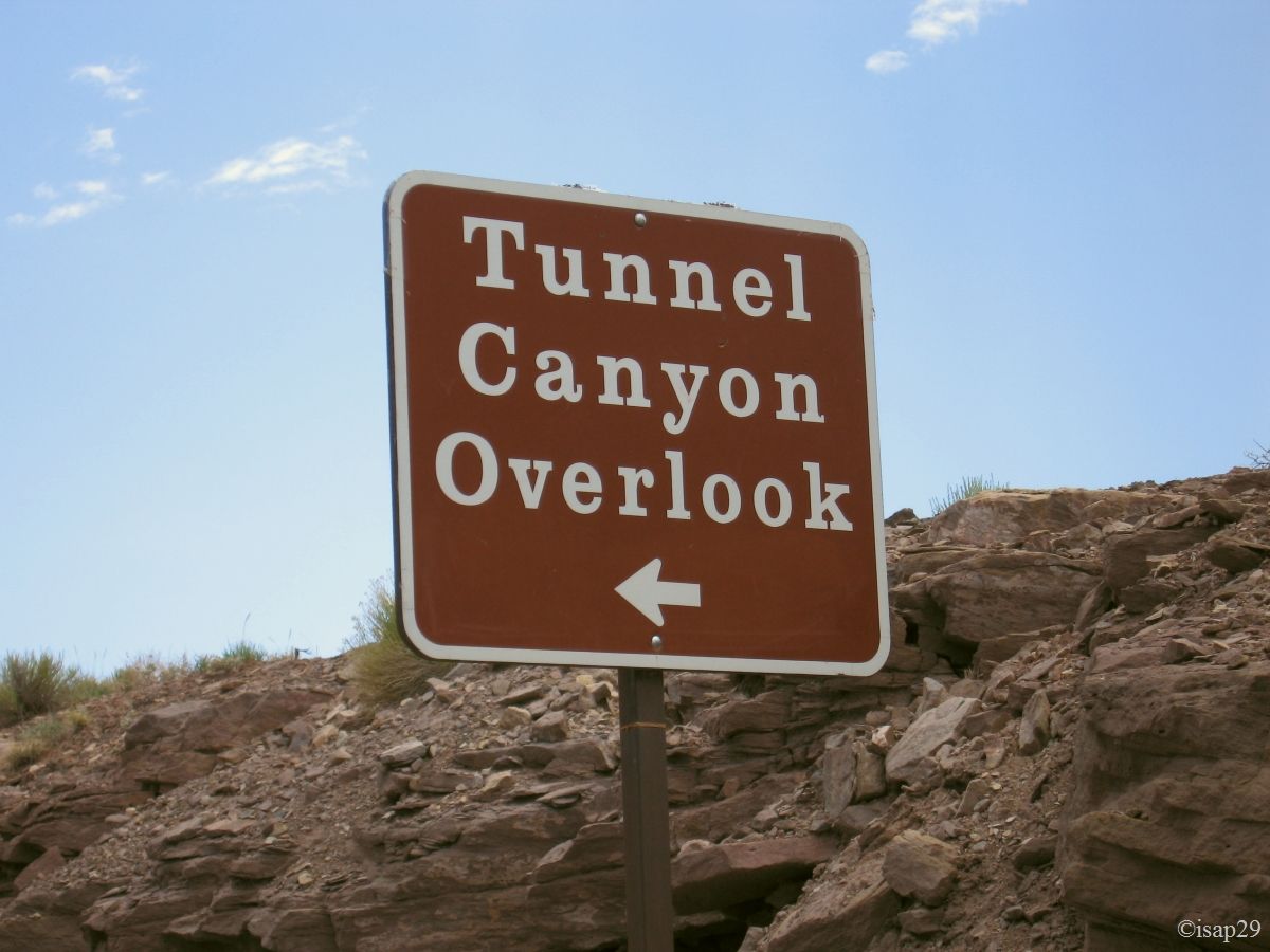
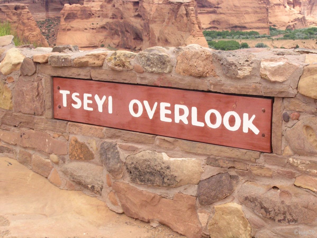
Canyon de Chelly - Rim sud - Tunnel Canyon, Tseyi & Junction Overlook (13 photos)
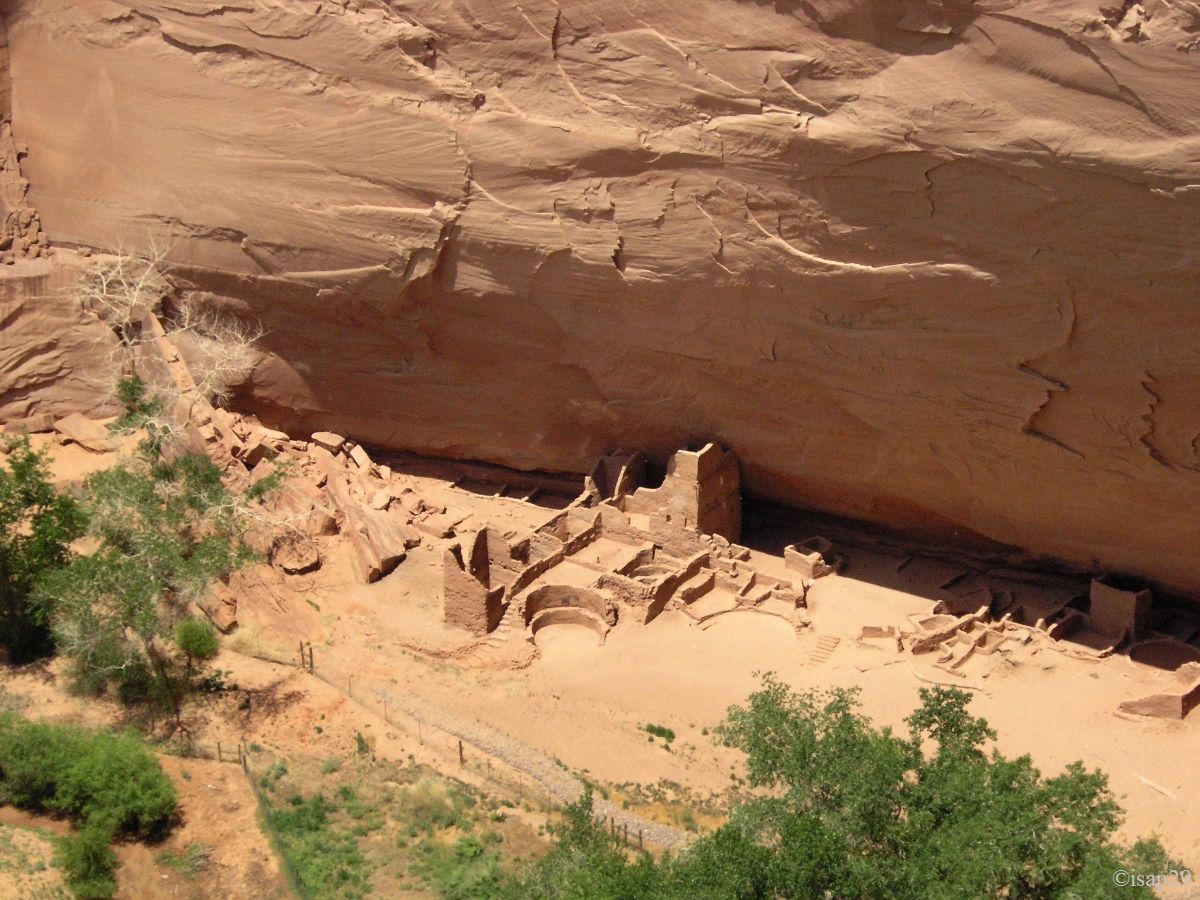
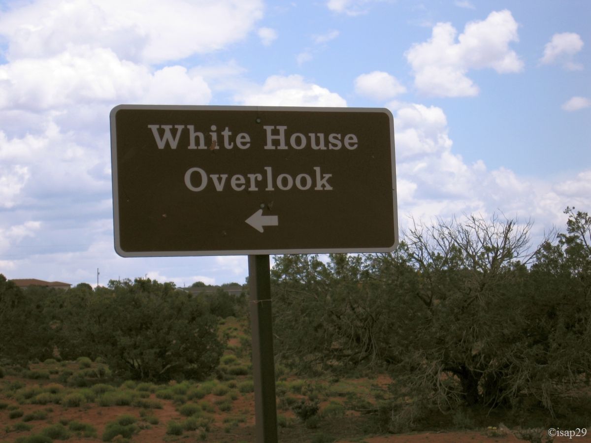
Around 12:45 pm, we stop on the parking lot of White House Overlook where we planned to descend into the canyon for the hike to the ruins. We see them quickly, far away from the point of view, but we run back to our car under the rain!
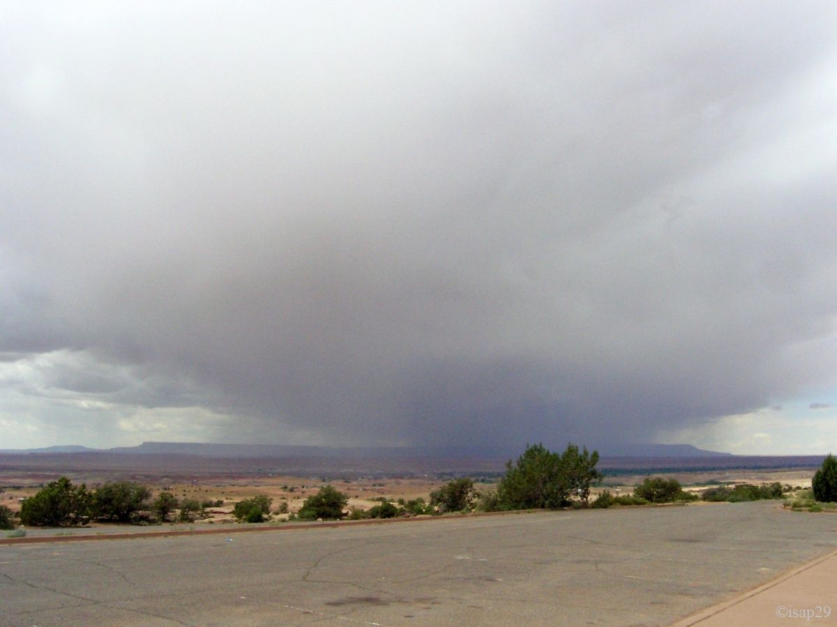
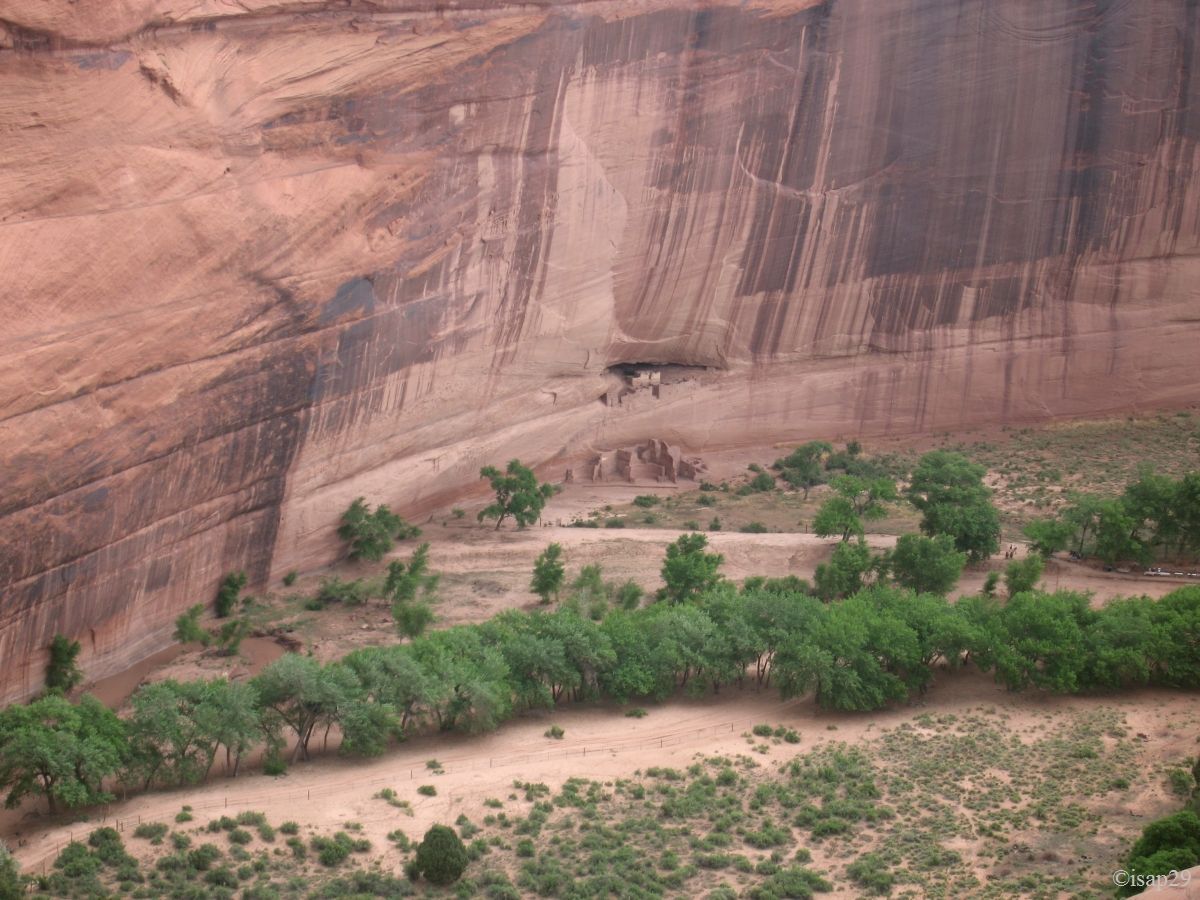
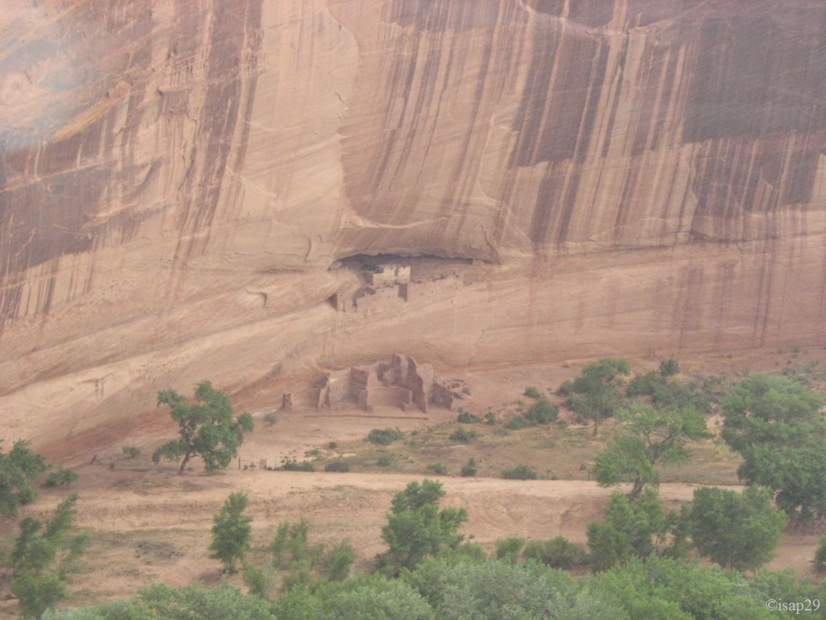
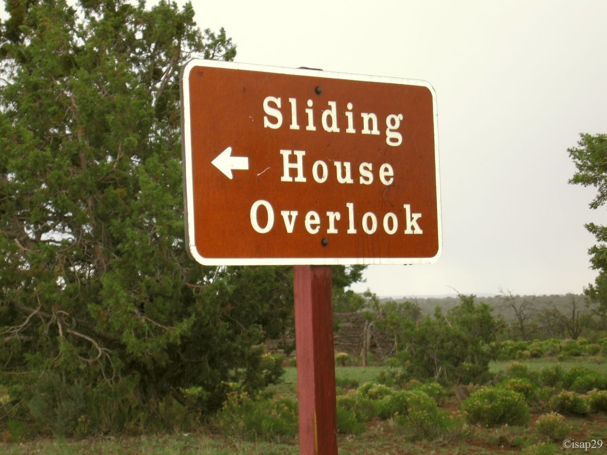
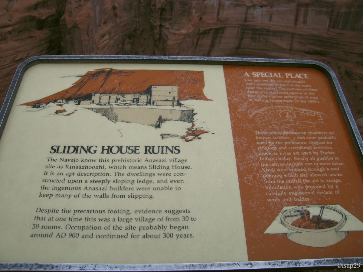
We take this interlude to have a snack, confined but sheltered from the rain. At 1:52 pm, watch in hand, we finish lunch but it's still raining: we can't go down to the ruins at this moment. We continue our visit with Sliding House Overlook. It is still raining and it's now no more than 54 °F.
Canyon de Chelly - Rim sud - White House & Sliding House (10 photos)
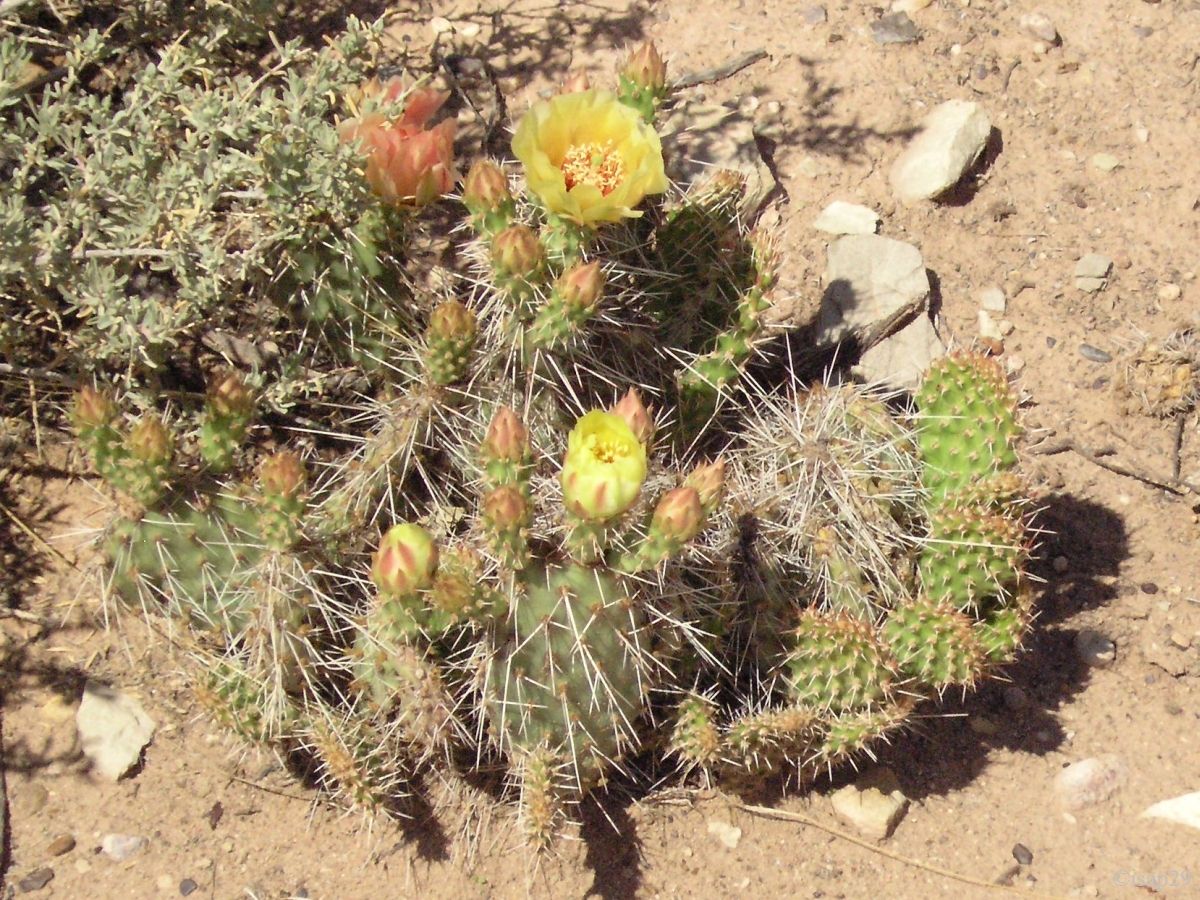
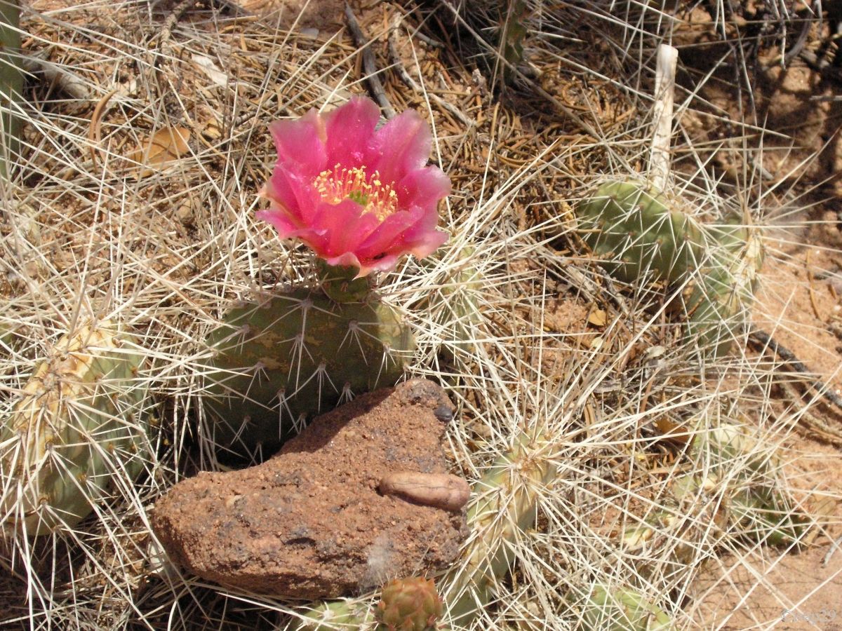
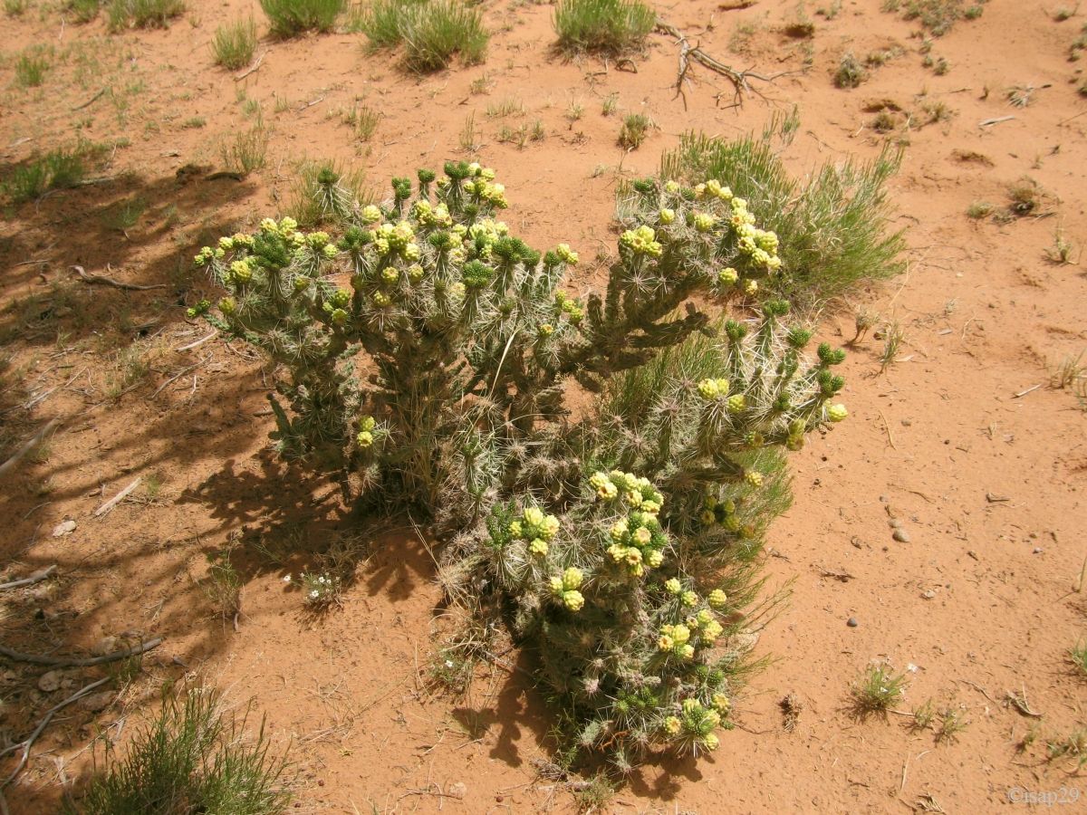
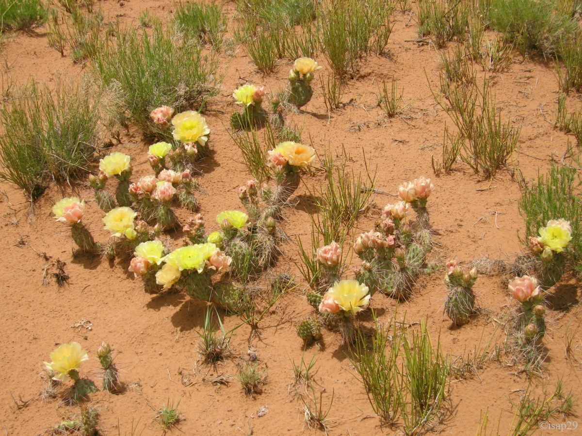
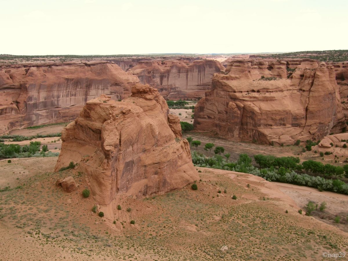
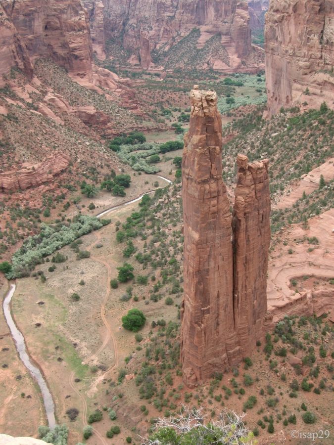
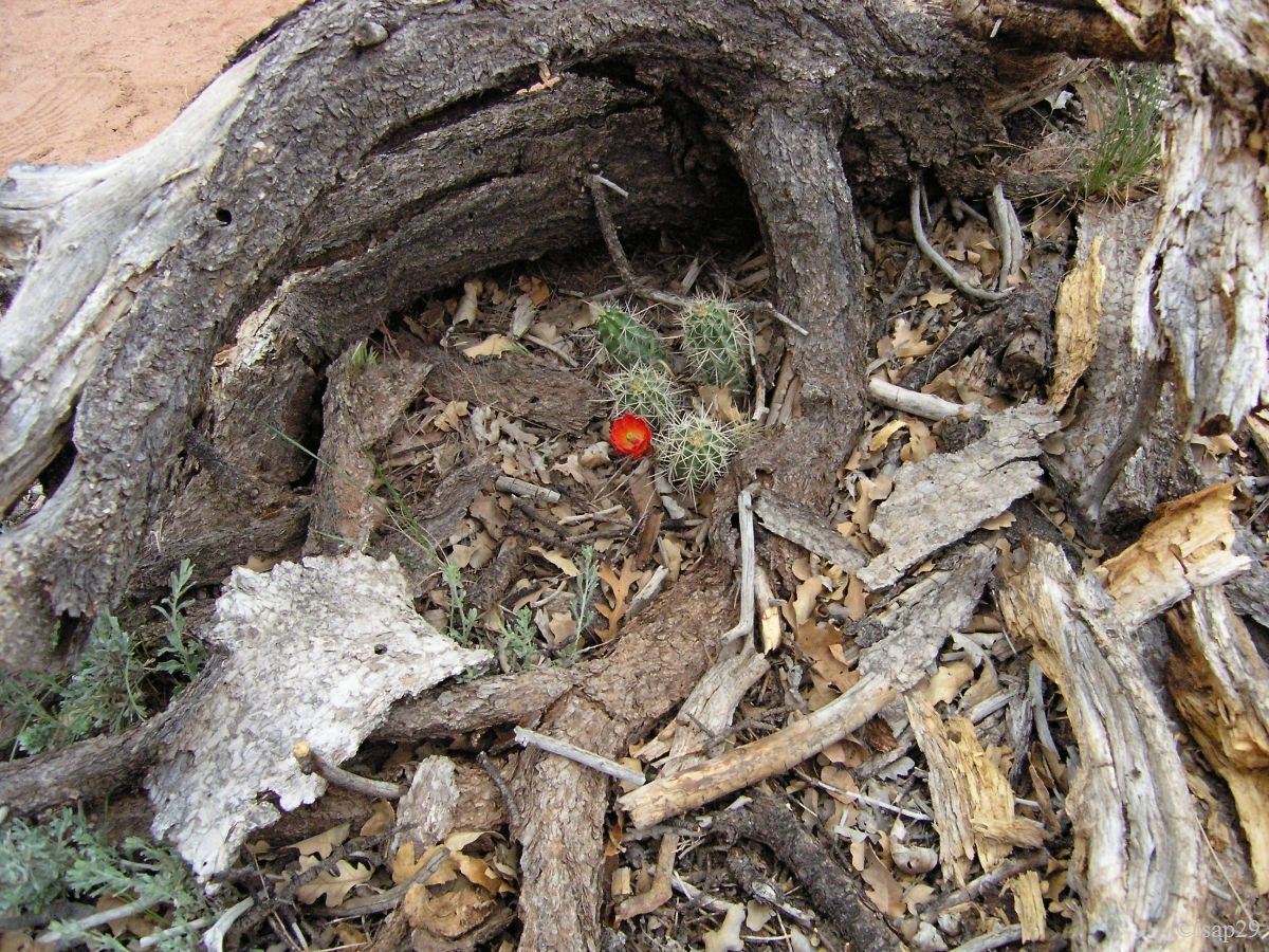
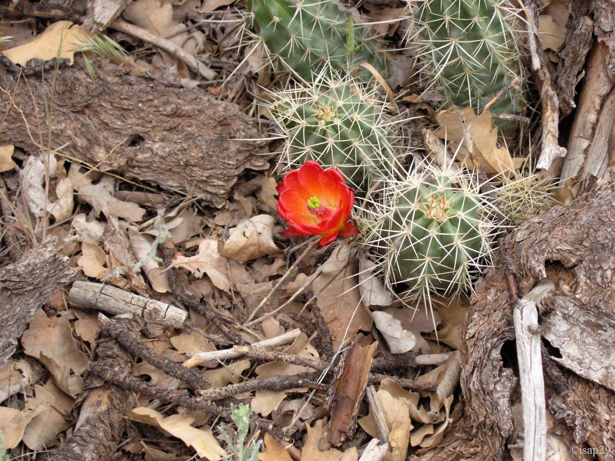
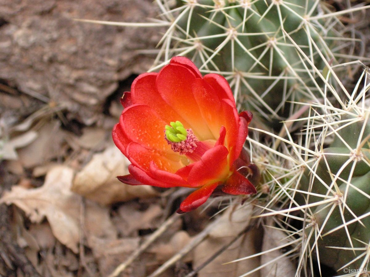
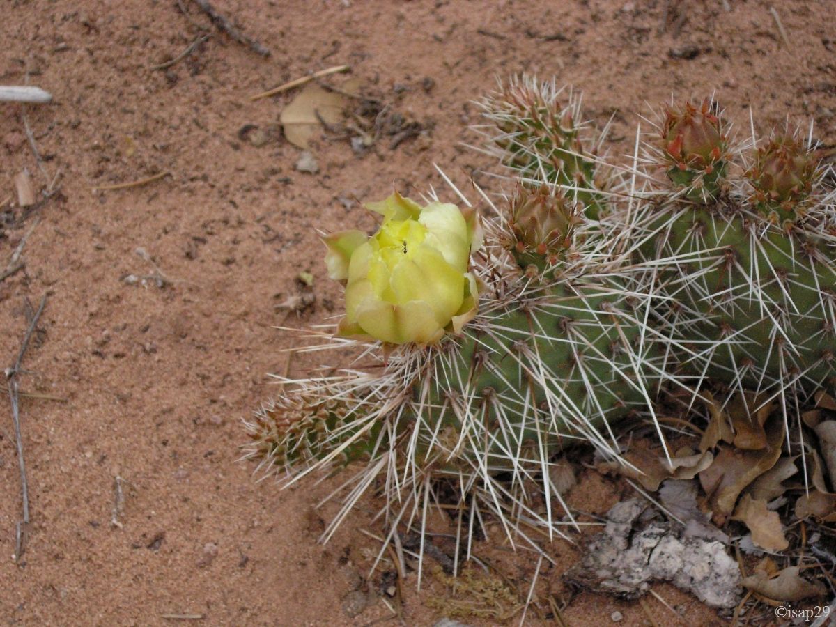
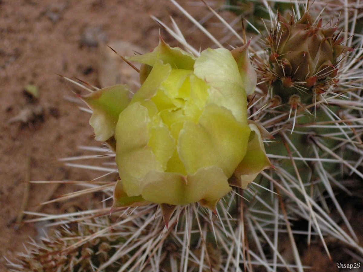
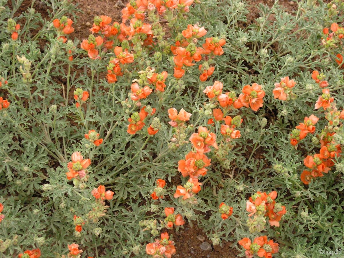
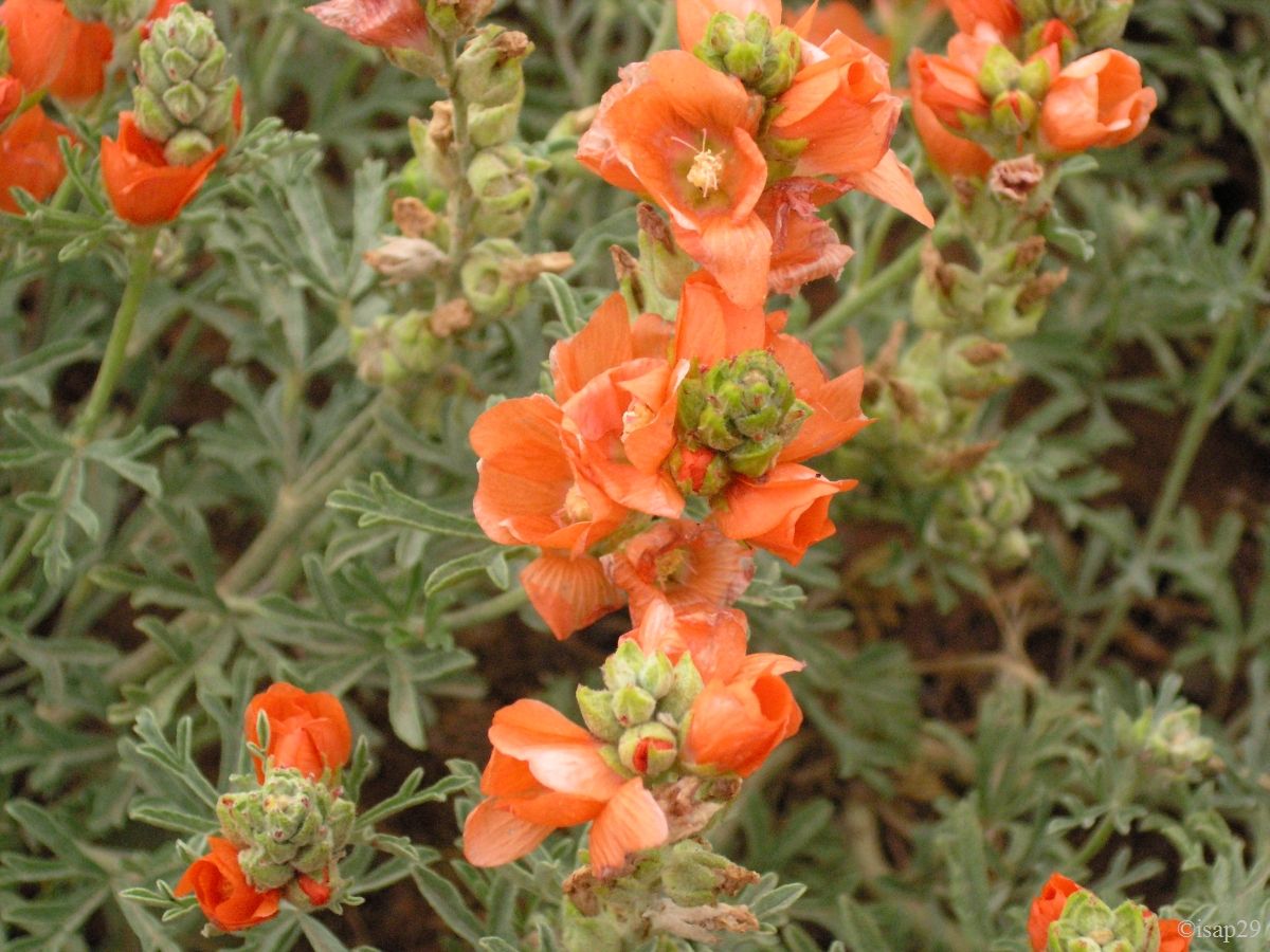
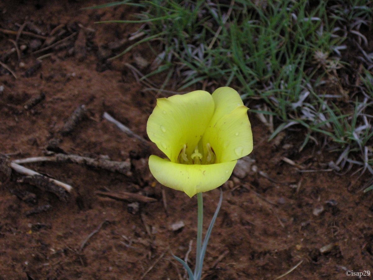
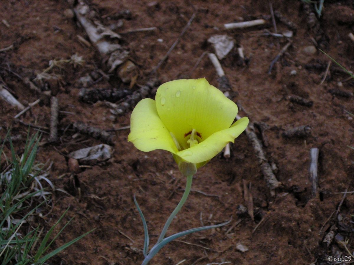
Always under rain, we continue to Spider Rock, last place of our visit to this beautiful canyon that personally I find with more human size than the Grand Canyon. This place has also served in part to the shooting of the western film "MacKenna's Gold" with Gregory Peck and Omar Sharif. On the way back, the rain stops, but it is too late for the hike (and the descent would surely be impractical) and we take the opportunity to photograph some flowers.

-gamma0_7.jpg)
Canyon de Chelly - Rim sud - Spider Rock (16 photos)
We make a last stop in restroom at the Visitor Center, but unfortunately it's already closed. We take the time of stop to put our watches at Utah's hour where, apart from Monument Valley, we'll spend the next 18 days. It's now 5:15 pm Utah.
Here we are on road to Goosenecks State Park, our "vacation resort" for the next 2 nights.
