
Goosenecks SP, Valley of the Gods
& Monument Valley
![]() version française
version française
Pictures are small in size and grouped in gallery; just a click on it and you'll have all the gallery in bigger size!
Easy navigation with left or right arrow on the keyboard; leaving the gallery photo by Escape.
Do not forget to switch to full screen (F11). Javascript is required.
Journey map

Approximately:
- from Canyon de Chelly (A) to Goosenecks SP (B) : 115 miles and 2h20 drive
- from Goosenecks SP (B) to Monument Valley (G): 32 miles and 0h50 drive, ditto for the way back

Tuesday, May 26 (continued)
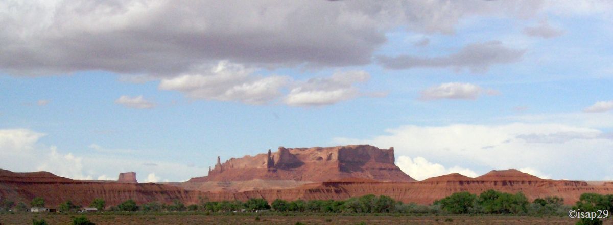
On the beautiful road through Carson Mesa, we encounter worthy landscapes of Monument Valley, until the end of Rock Point ; photos taken from the car while driving don't pay homage to the landscape.

Road to Goosenecks State Park (3 photos)
Just entered Utah, we find a road sign "Open Range" ( for lovers of western films,
indicating that livestock can be anywhere, even on the roadway. We'll often meet this panel and, sometimes, livestock on the road.
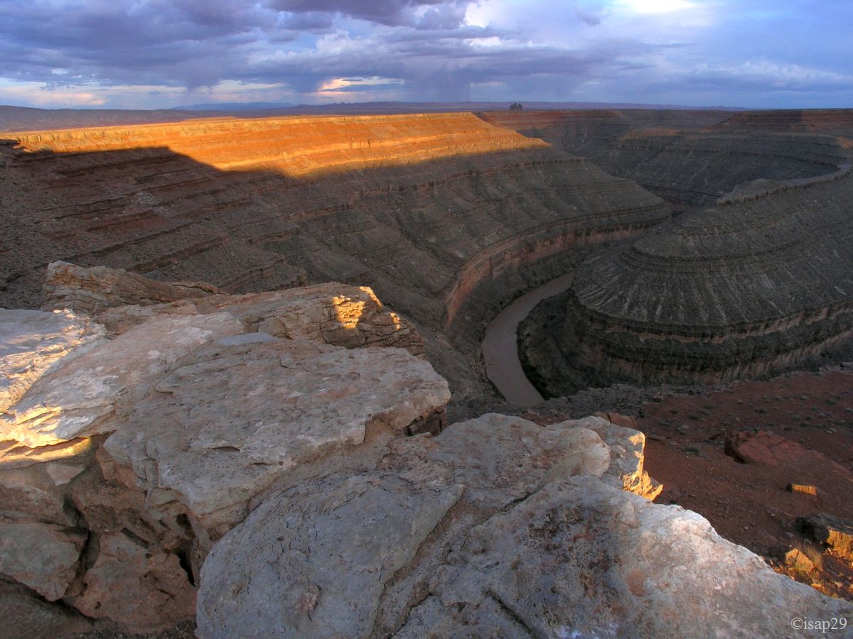
We arrive at the primitive campground of Goosenecks SP around 7:30 pm; the outside temperature is 73 °F. After a quick installation (we now have the habit), we'll see these famous Goosenecks; they are meanders of the San Juan River, but very tight. Their depth makes that the sun, too low on horizon, can't illuminate the canyon in its entirety. We'll redo the photos rather late in the morning even if the sun has a tendency, at these times, to "crush" the landscape.
We contemplate this show until the fall of day when the sun, on the horizon, illuminates a few moments the landscape.

_ajust.jpg)
Goosenecks State Park - first night (8 photos)
Around 8 pm, a native, in a large trailer parked at the edge of the cliff, broadcasts what appears to be Indian music (at a very correct level);
totally laid back, a ti-punch in hand, we look at the night falling on these quirks of nature. During dinner, a gust of wind makes fly away my napkin.
Startled and unflappable, I don't move; Isabel then rushes to catch it up, slips on pebbles and ... wham, falls flat on her face, dismally. No, no,
she tells me that's not the ti-punch  ! Result: a twisted ankle and the front left leg completely
scratched; not amazing, the beginning of tanning! Fortunately, this incident will not affect for the rest of our journey (although 2 months later
Isabelle still bears traces).
! Result: a twisted ankle and the front left leg completely
scratched; not amazing, the beginning of tanning! Fortunately, this incident will not affect for the rest of our journey (although 2 months later
Isabelle still bears traces).
Wednesday, May 27
Wake up at 6 am; it is already 72 °F and bright sunshine. As noted yesterday, a too raking light can't permit to see the depth of the canyon. So we'll come back after Muley Point.
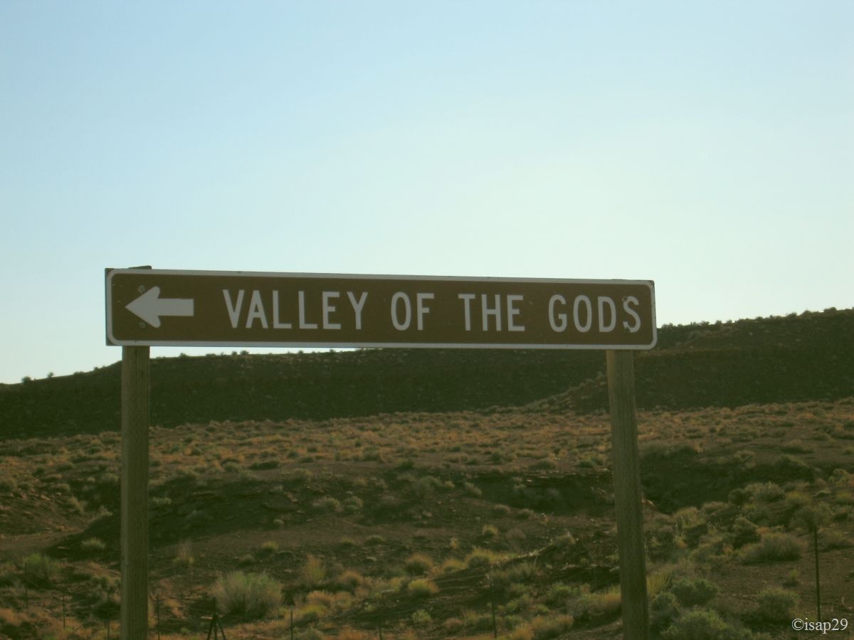
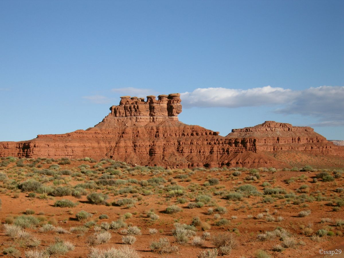
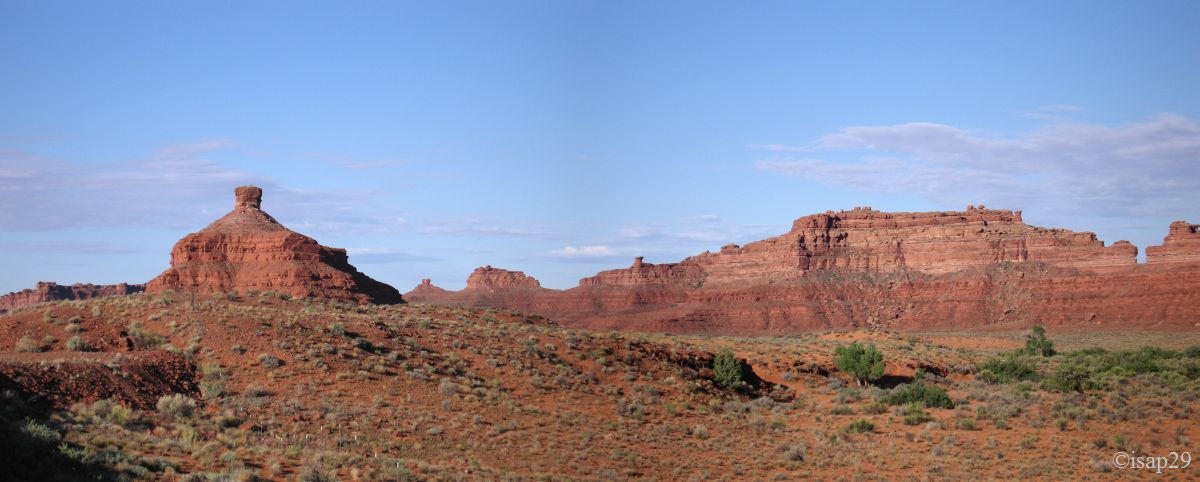
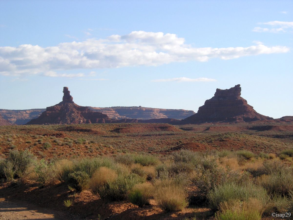
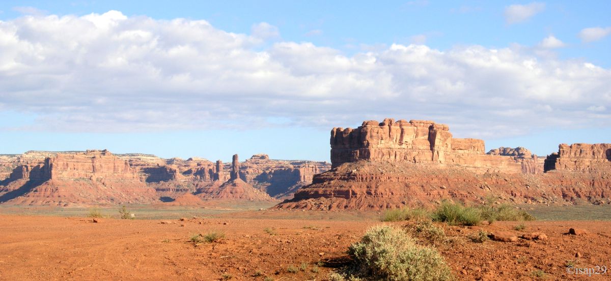
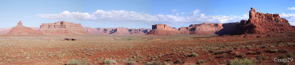
At 7:45 am, we tuck into Valley of the Gods by its east entry, our first contact with a "true" dirt road. A small creek (Lime Creek) on entry, to put us in shape, and here we go. The track does not appear to present major difficulties: no water, no mud, no deep ruts, we just have to watch out for ruts and holes as well as passages of dry torrents (washes) where the violence of flood was able to degrade the soil or drop off large blocks. Beautiful views on these eroded cliffs that, it seems, are like a miniature Monument Valley. Nice appetizer!
Near the entrance, a billboard provides the layout of the track and the description of the main massifs.
Valley of The Gods (29 photos)
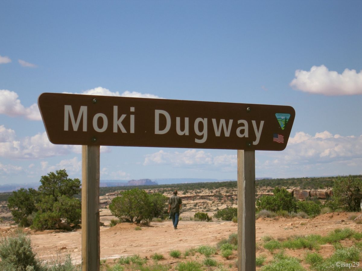
We leave this valley at 9:30 am, after a quick hello to the B&B which was closed (and costs a bit high) and turn right to climb the Moky Dugway. We are on a plateau and have impression of going to a cul de sac, abutting on the cliff in front of us; we look in vain to right and left, we don't see where the road may pass. We really go to the foot of the cliff to see the first laces. The road quickly turns into a gravel track (except the switchbacks), but no problem to drive; simply do a little careful because there is almost no guardrail. Several breakpoints are set to take pictures.
This road has been dug in the 1950s to allow trucks carrying uranium ore to come and drop in Mexican Hat; I imagine the drivers descending this track, their trucks fully loaded!
From above, the landscape is beautiful; we overhang the plateau and we see very well the track of Valley of the Gods that we just left.
Moky Dugway (3 photos)
Shortly after, we take the left runway towards Muley Point, to see new meanders on the San Juan River and a distant sight on Monument Valley. Again, the track does not present any difficulty and we're rapidly reaching the site. We're a little disappointed because no sight on river, even if the meanders are many. The remote sight on MV, that we don't yet know, did not leave its mark on us either.

-ajust.jpg)
-ajust.jpg)
_B-18.jpg)
Muley Point (5 photos)
As we haven't seen the meanders of San Juan River at Goosenecks SP properly enlightened, we leave Muley Point for Goosenecks SP down the Moki Dugway; it's always more impressive than the climb. We arrive at 11:30 am with a temperature of 72 °F. The sun, much higher, now illuminates the whole meanders, to the bottom; shoot and lunch in this majestic setting.

-ajust.jpg)
Goosenecks State Park - the return (6 photos)
Some vendors (Navajo in principle) took up positions on the site and we buy two necklaces to a grandmother who seems to make some ones in front of us. A group of French bikers tells us that prices are very reasonable.
We start for Mexican Hat around 12:30 pm (our cameras are always on California time). At the end of the road to Goosenecks, the landscape looks like sand paintings, beautiful.
The rock that gave its name to Mexican Hat is located on the left side of the road, but we will not turn around because the ruts are too deep.

Mexican Hat (7 photos)
We leave Mexican Hat and move towards Monument Valley. The approach provides us with beautiful scenery and, as we both love western films, brings back memories.
The first contact is Monument Pass and we stop to start our safari photos: the reputation of MV being no longer to do and we had so much seen in movies that we were afraid of being disappointed. Nay, quite the contrary!
Open Range roadsigns are not there only for folklore, there are livestock, domestic or wild, and be careful.
As it's still early, we take the opportunity to go on the right way, towards Goulding to discover the neighborhoods of this park. I thought I could go round by Rock Door Mesa and back on Hwy 163 but no, the sand track leads us inexorably westward. U-turn; an Indian woman, in a large 4WD, stops near us, looking a little surly but ultimately very friendly, asking us if we have a problem.

2.jpg)
-ajust.jpg)
.jpg)
Monument Pass (8 photos)
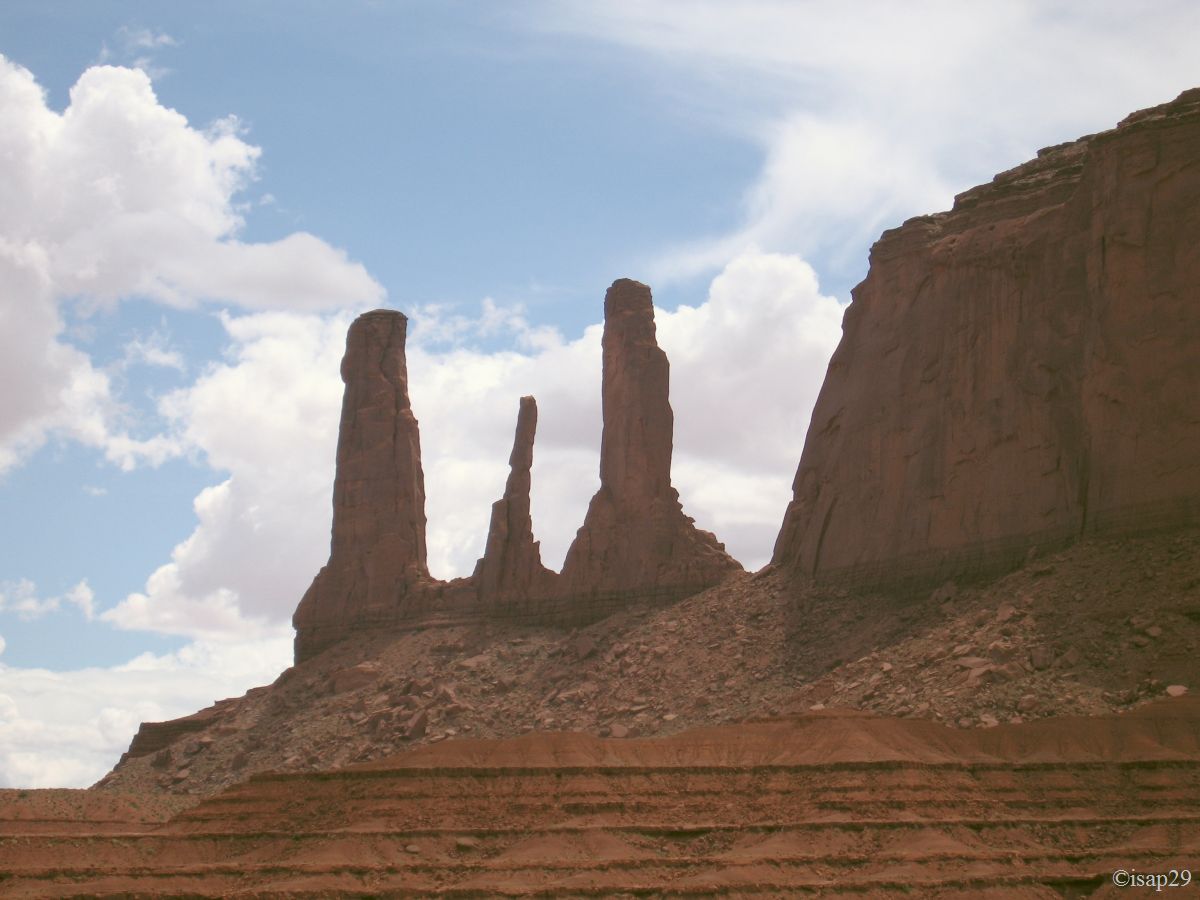
So back to our monument of the day, Monument Valley. It's 2:15 pm and 75 °F. We pay our $10 entry as the pass does not work because we are in Navajo territory! We park in a parking lot in full sun, among the works on site due to the new hotel.
First pictures on this beautiful land, but we must wait our turn because there are people! We see Sentinel Mesa, West Mitten Butte, East Mitten Butte a little further away, and Merrick Butte on the right with the trail that winds down below.

_B-18.jpg)
.jpg)
Entrance of Monument Valley, discovery! (5 photos)
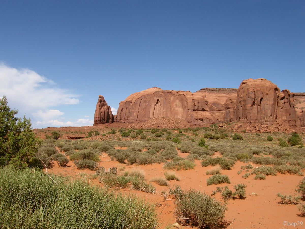
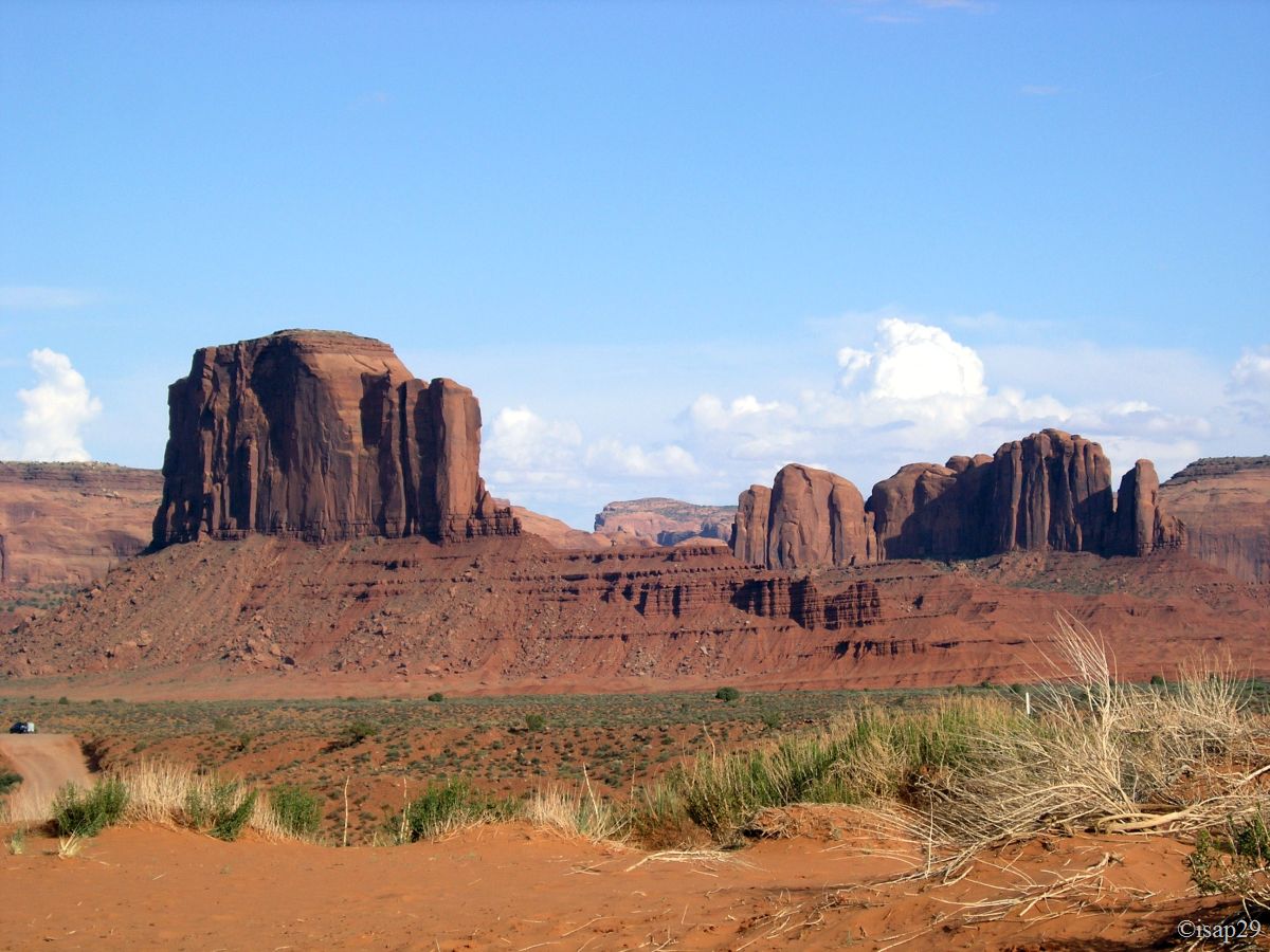
Due to time, I hesitate a bit on the wake of the events and, finally, we decide to take the track for a quick first round and a second one later, more "thorough" and with a "best" light. After all, our first turn will be quite "normal" and the second more "speed".
Apart from the first 5 points, that can be done back and forth, for the others we have no choice because the track is only one way. So, we move towards the "mittens" (Mitten Buttes): just look at the form to understand their name.

.jpg)
Monument Valley - first steps(9 photos)
.jpg)
.jpg)
.jpg)
Monument Valley - one way - first round (19 photos)
After a pleasant interlude at the Visitor Center and its air-conditioned, we decide to go back on track and to limit ourselves to places we found interesting, so as to be back at VC for sunset. Large storm clouds stagnate over Monument Pass; provided they don't bother us!

.jpg)
Monument Valley - one way - second round (10 photos)
We're back to 7 pm (Utah time) on the terrace of the Visitor Center for waiting for the sunset; this terrace is next to the new hotel, The View, which offers a splendid sight to those who sleep there. But even if we wait for a long time, we'll never see the beautiful colors seen on some sites or books (miracles of Photoshop?). By cons, to see the progression of shadows and color changes is very interesting; the tripod is also very practical.

.jpg)
Monument Valley - sunset (14 photos)
The eyes still shining with excitement and wonder, we leave this beautiful park around 8:30 pm for our second night at Goosenecks SP (it's still 75 °F) where we arrived 35 minutes later (66 °F) after crossing the tail of a thunderstorm and a beating rain. Philip had suggested us to sleep at Muley Point because the wilderness camping is allowed, but we did not want to drive the Moky Dugway by night and tired (we're standing since 6 am).
A quick frugal meal and lights out at 10 pm.
