Moon House & Road Canyon Ruins
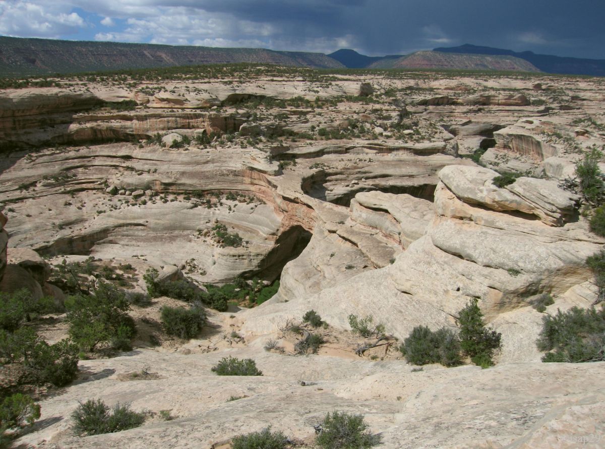
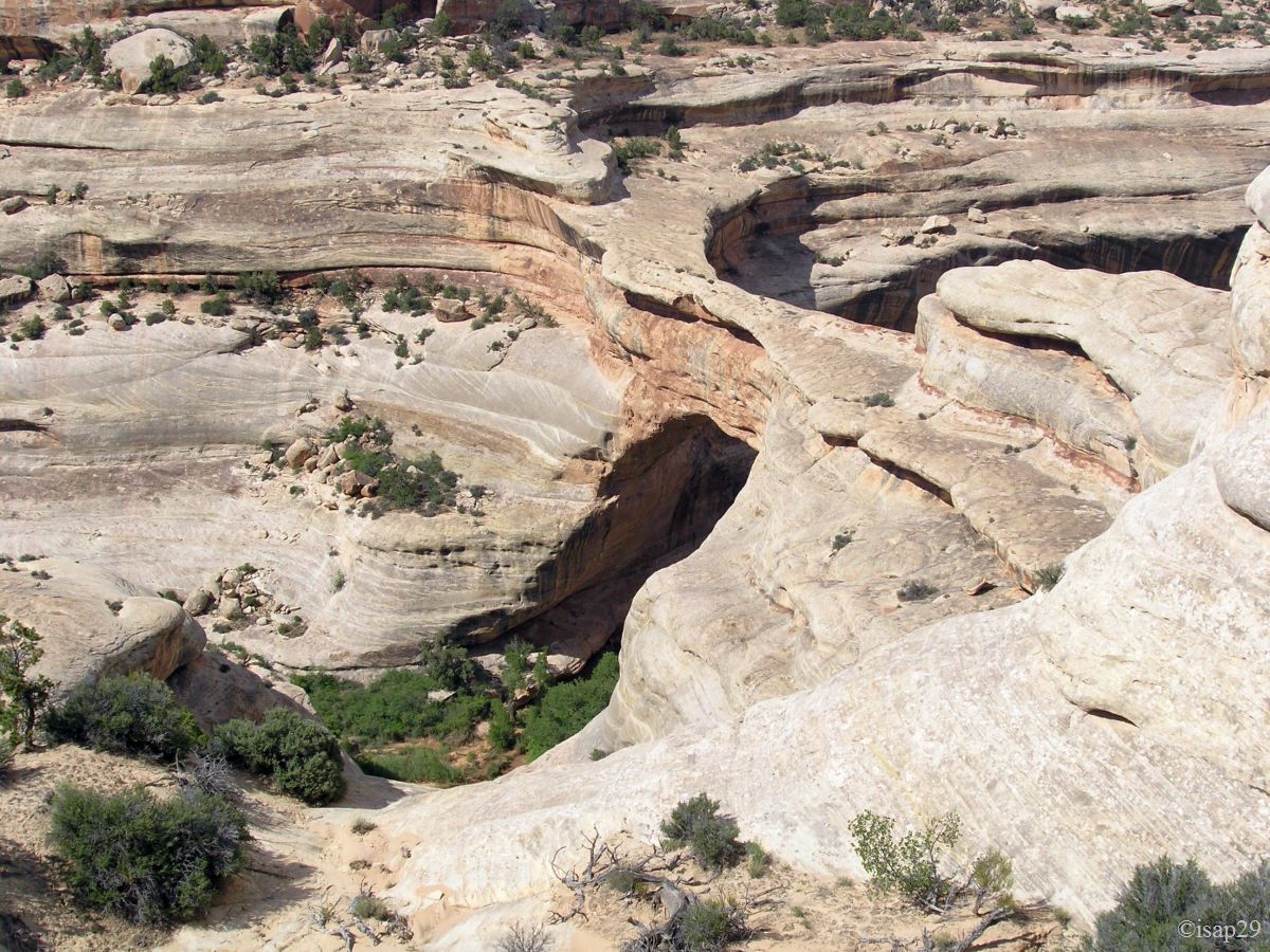
Natural Bridges NM
![]() version française
version française
Pictures are small in size and grouped in gallery; just a click on it and you'll have all the gallery in bigger size!
Easy navigation with left or right arrow on the keyboard; leaving the gallery photo by Escape.
Do not forget to switch to full screen (F11). Javascript is required.
Journey map
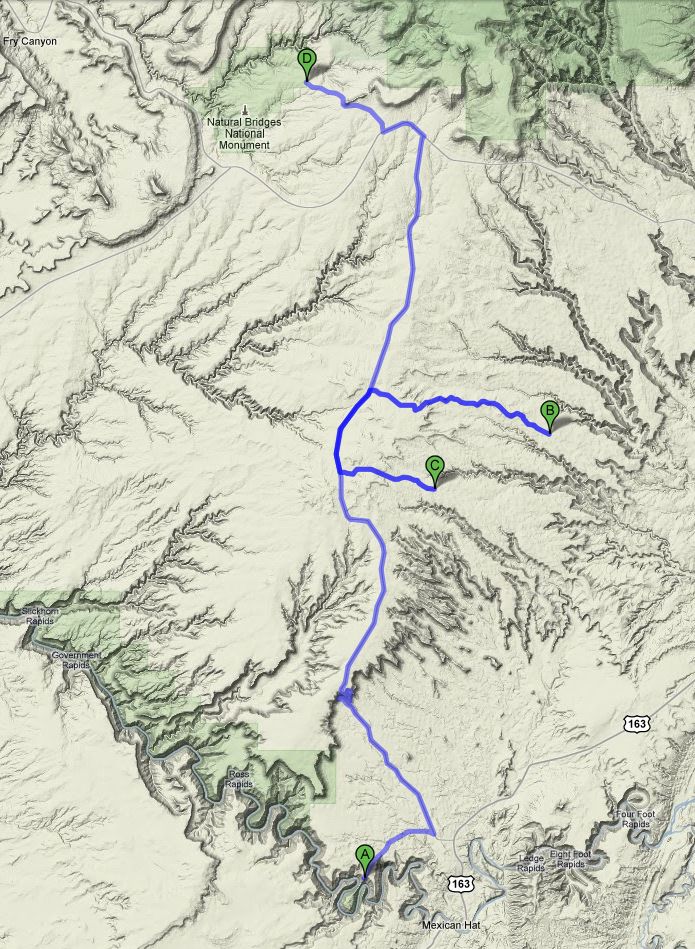
Approximately:
- from Goosenecks SP (A) to Moonhouse Ruins (B) : 34 miles and 1h40 drive
- from Moonhouse Ruins (B) to Road Canyon Ruins (C) : 16 miles andt 1h drive
- from Road Canyon Ruins (C) to Natural Bridges NM (D) : 23 miles and 0h50 drive
Thursday, May 28
Waking up at 5:15 am, it is still night and a fresh wind roams. Some time later, the sun rises with almost no clouds. We finally set our cameras to local time.
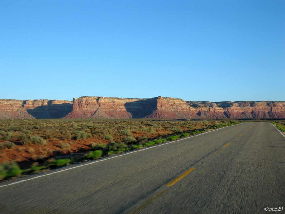
Departure at 6:30 am to Moonhouse Ruins via the Moky Dugway already followed the day before. The foot of Cedar Mesa is well lit by the rising sun.
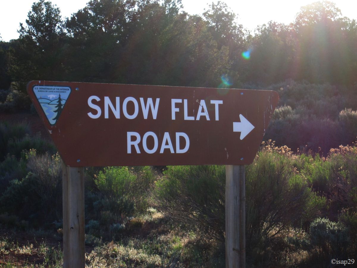
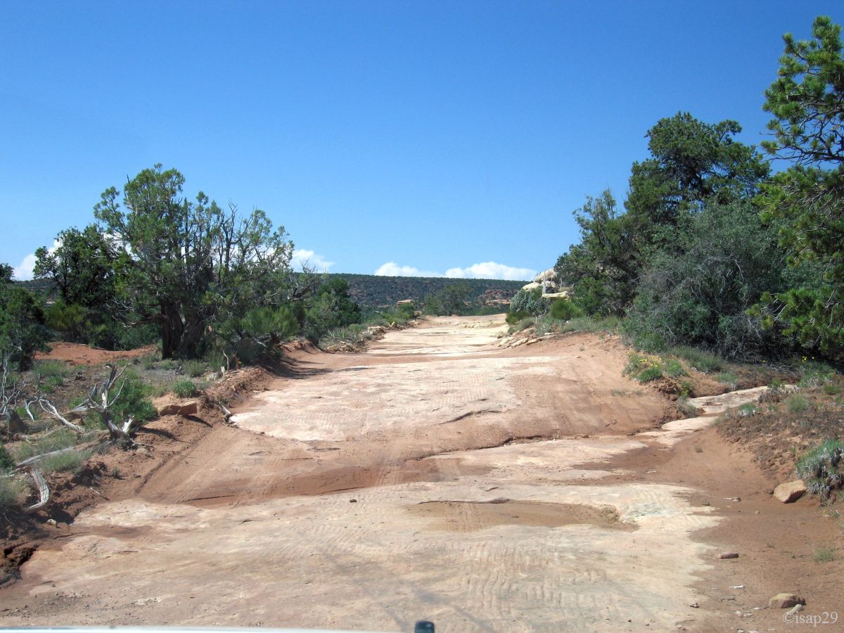
After a few miles, we drive alone our first "true" track, Snow Flat Road or Mormon Trail; ouestusa.fr announcing some delicate portions and as our car isn't a 4WD, I drive with some caution.
A brief stop at the "toll" where we fulfill our permit ($4), the track is quite rolling and I accelerate a bit. Several ponds cut the track and are quickly crossed,
the windows of our car closed (splash attention  ) because we don't want to be stuck in the middle of ponds.
The latter, in the way back, will leave its traces on the car body until we return in Thousand Oaks!
) because we don't want to be stuck in the middle of ponds.
The latter, in the way back, will leave its traces on the car body until we return in Thousand Oaks!
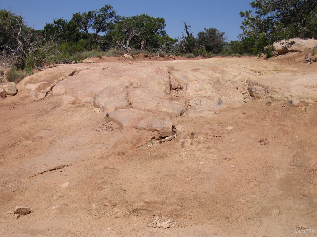
After an indeed delicate passage for us (Isabelle came down to guide me), we arrive at the parking lot on the right of the track. We stop and inspect the rest of the track: no question of continuing with our car, it would be crashed at the outset.
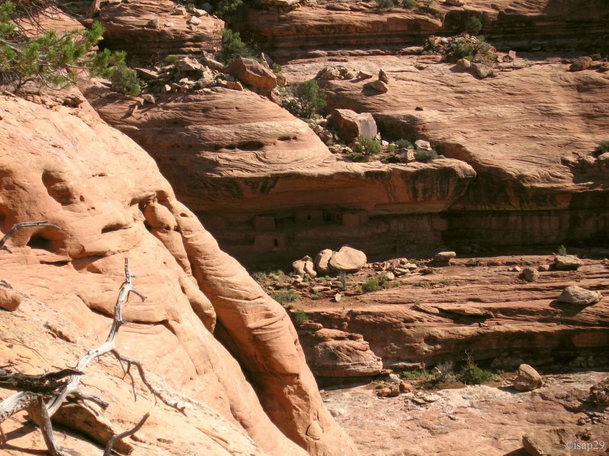
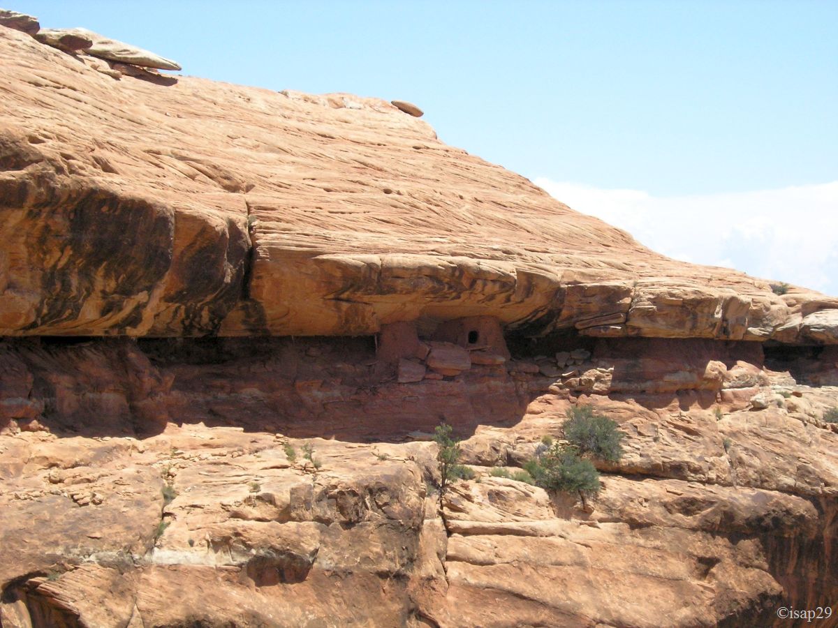
Backpacks, sunscreen, change of shoes, recording the point in our outdoor GPS and we're off for 25 minutes of walk along the track. Then, after a little search, we arrive
at the edge of the cliff where we see the ruins (telephoto or binoculars required).
"We'll have to get off at the bottom and climb back up right opposite," asks Isabelle !
We begin the descent around 9:25 am with occasional slope of more than 30 degrees. Despite the documentation found on the net we turn back a little later because we're afraid (yes!) not to be able to go back (Philip reassured me since that time).
_B-18.jpg)
Moonhouse Ruins (7 photos)
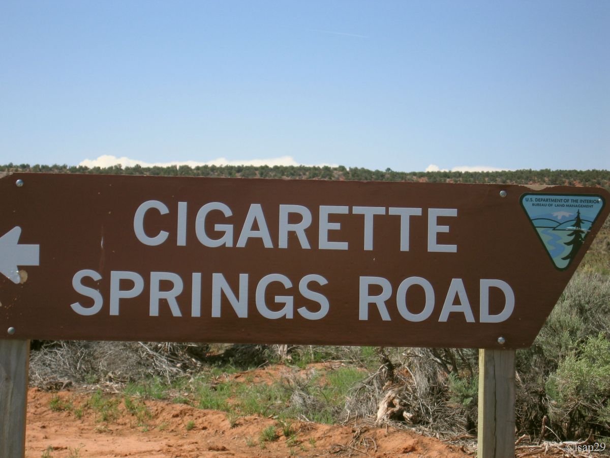
Back to the car, a little frustrated. We resume the runway then the road to continue on Cigarette Springs Road. We hope, this time, have access to the ruins of Road Canyon.
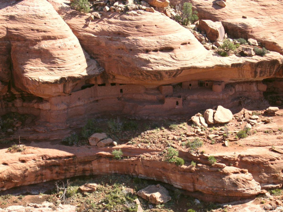
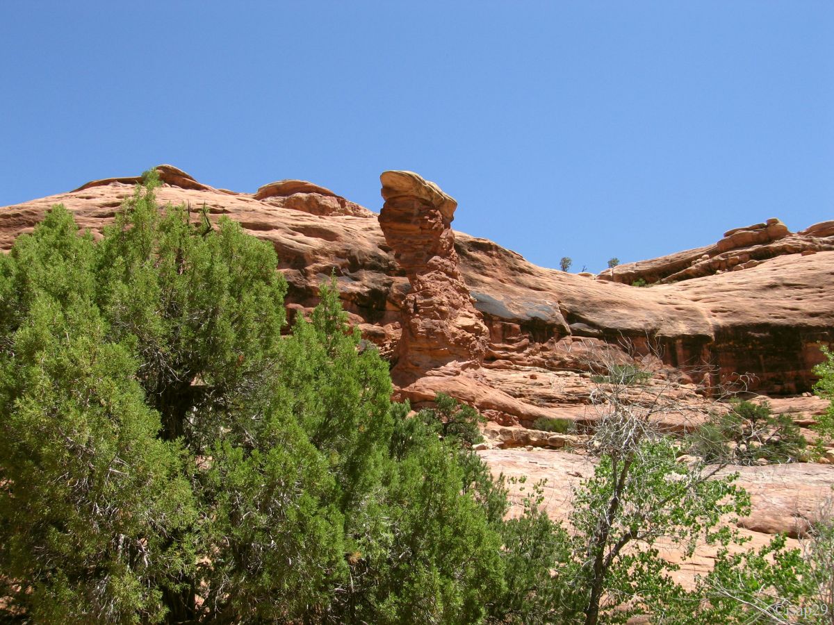
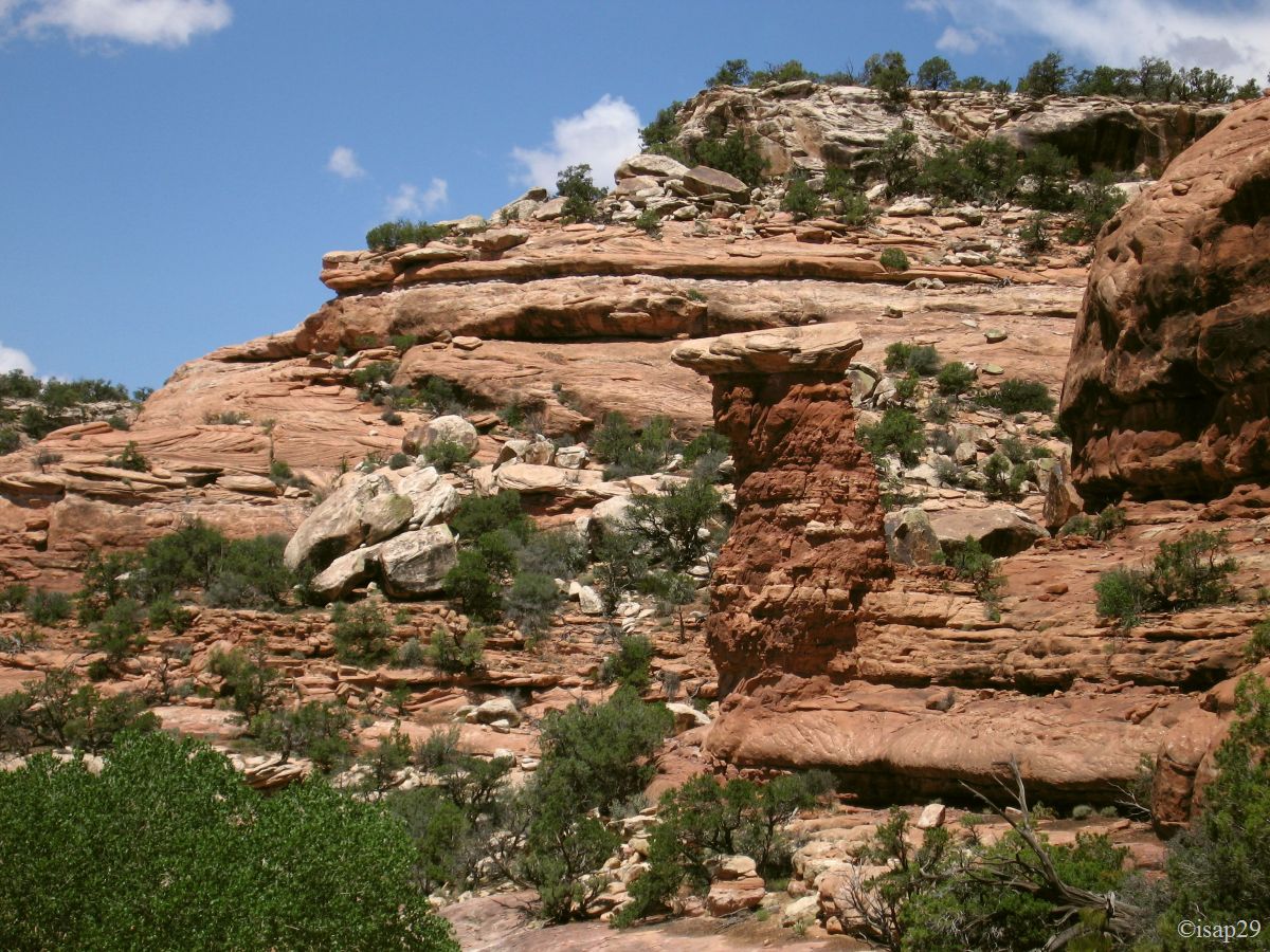
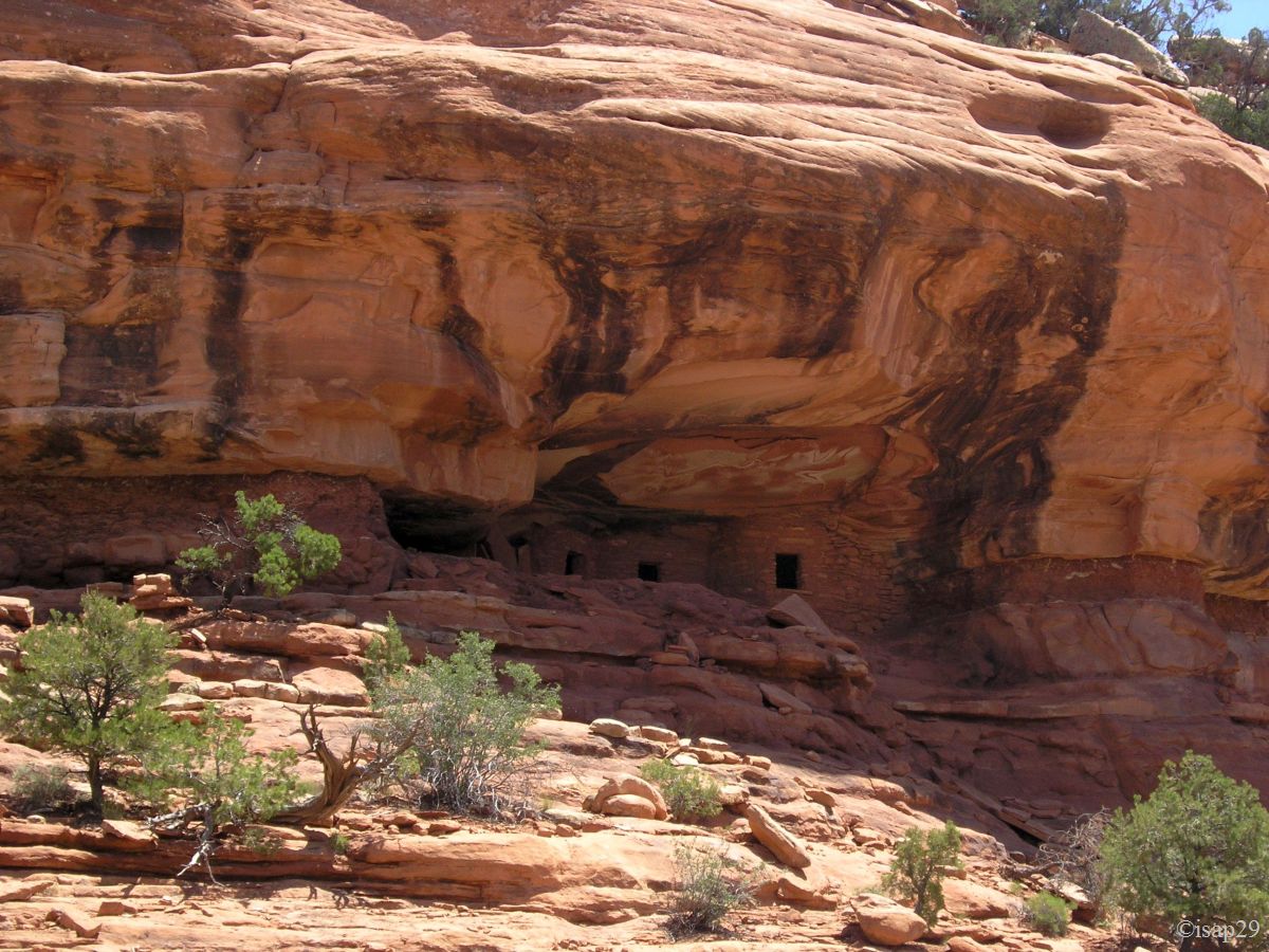
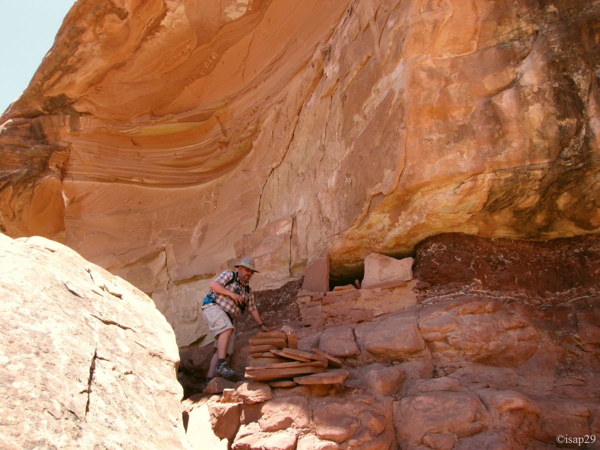
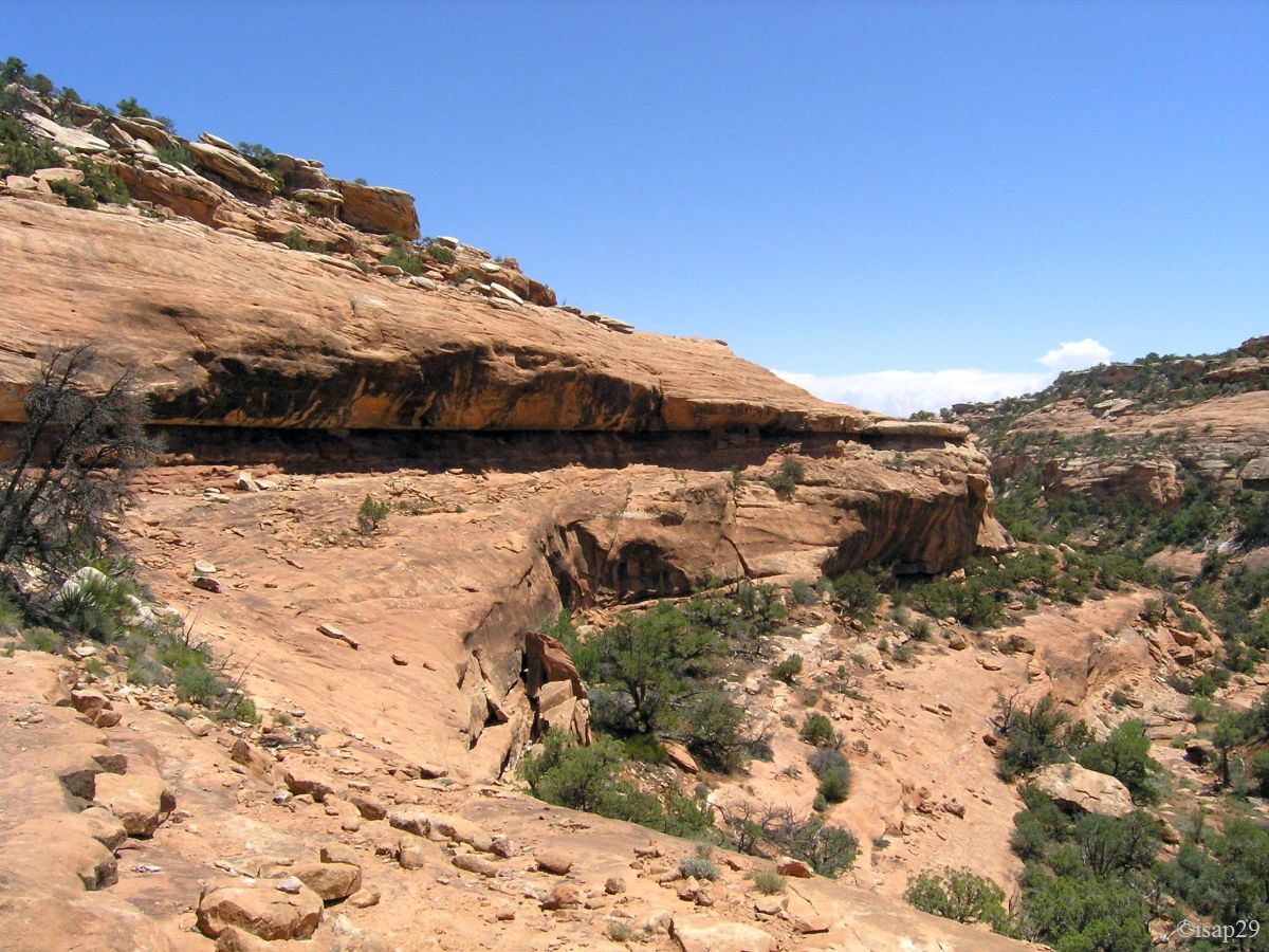
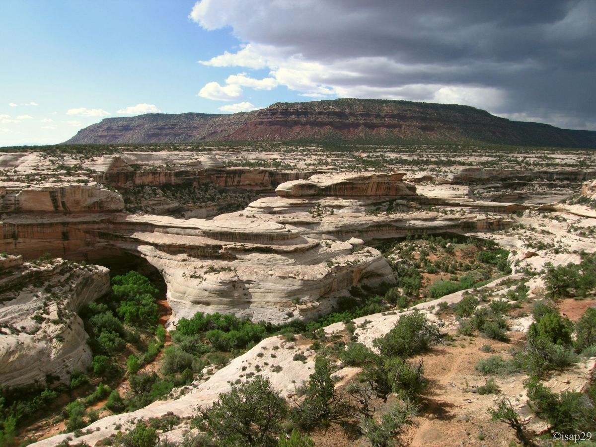
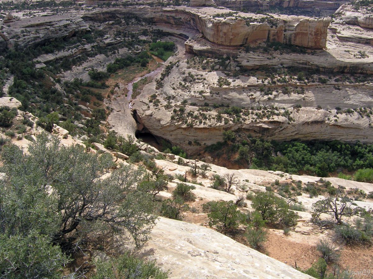
We leave our car at 11:30 am and begin hiking on the plateau. Then, after a bit steep descent, we walk in a secondary wash which joins Road Canyon. After passing several people who confirm that we are on the right path, we see the "massive hoodoo" from which it is easy to see the famous ruins and this, less than an hour after our departure.
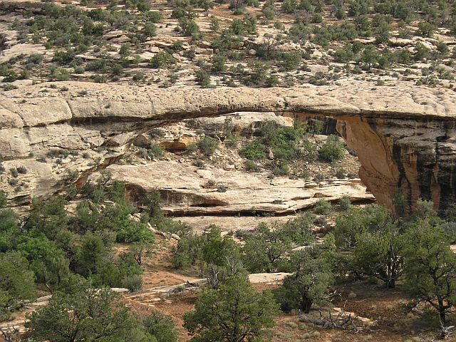
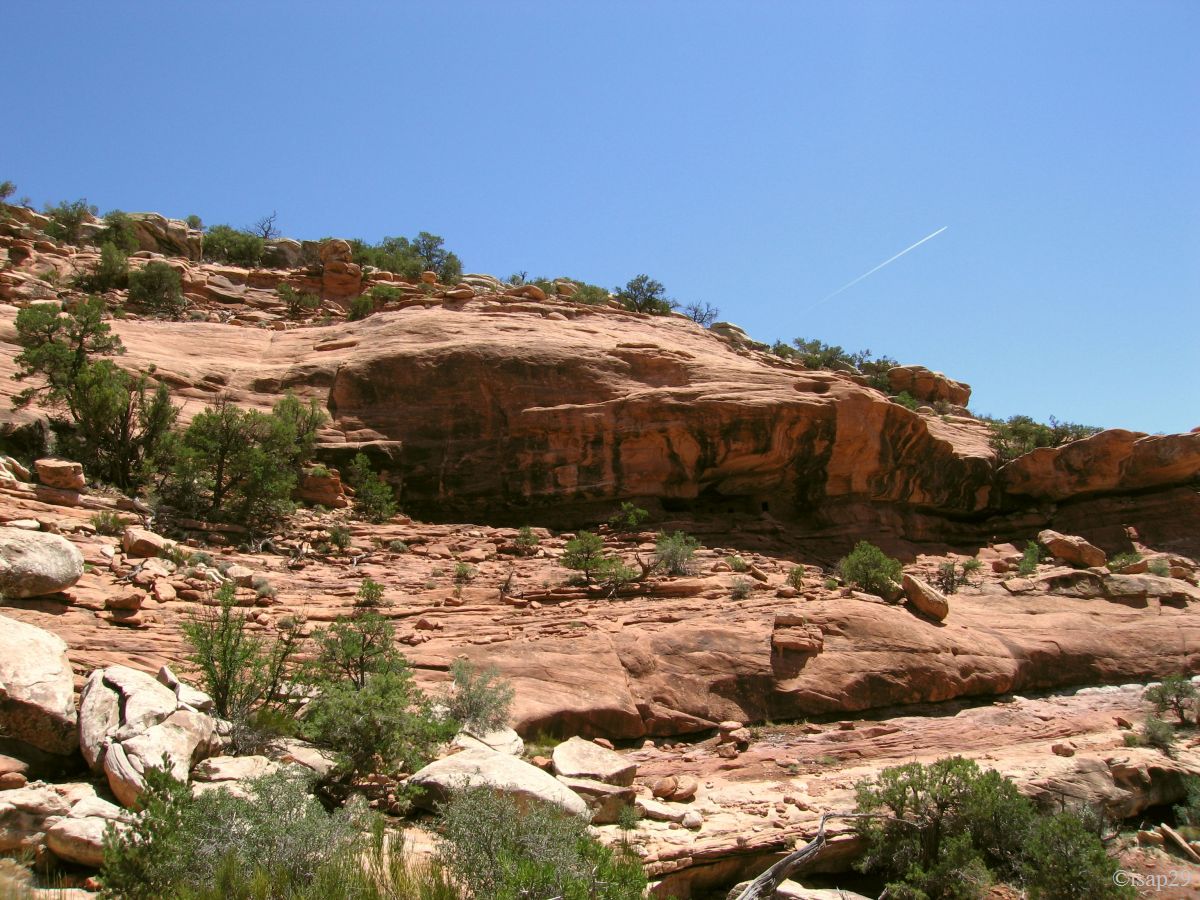
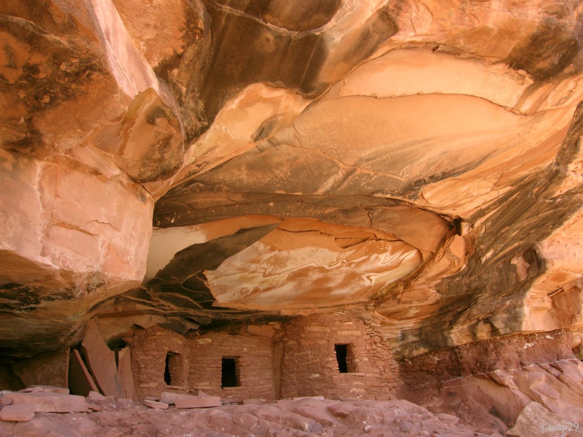
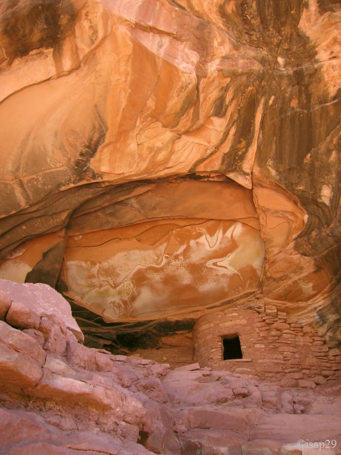
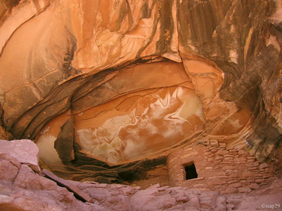
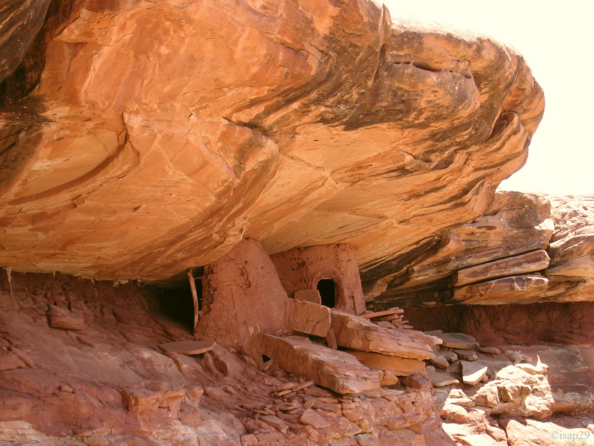
The ruins are located under an overhang near the top of the cliff. A little climb in bright sunlight on the rocks and finally we reach these ruins which are, in fact, granaries. T hey had nimble legs, the guys.
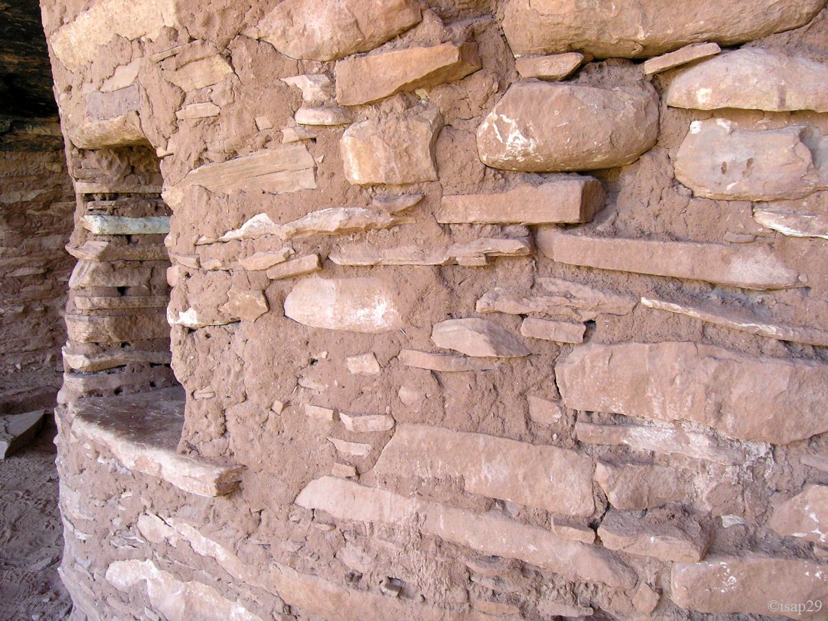
These ruins are in a good state of preservation and, in some places, we can see their structure. The ceiling, which is their originality, breaks away in large flat scales hence their name: "fallen ceiling".
-anc88.jpg)
-ajust-R20_B-20.jpg)
Road Canyon Ruins (13 photos)
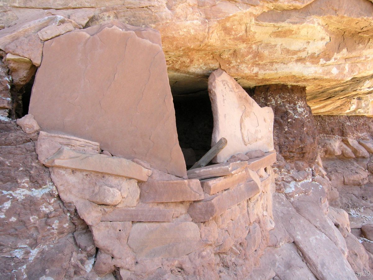
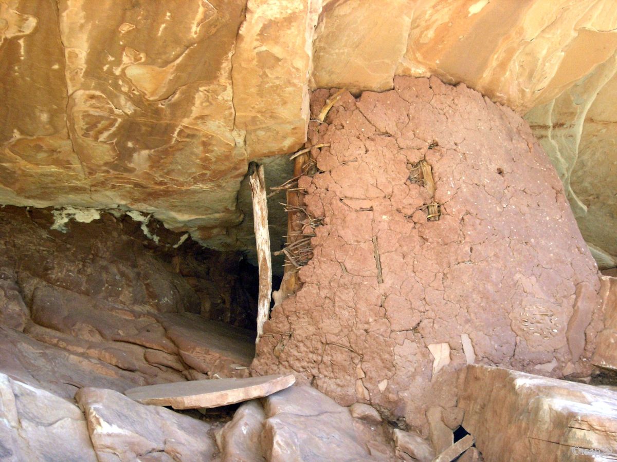
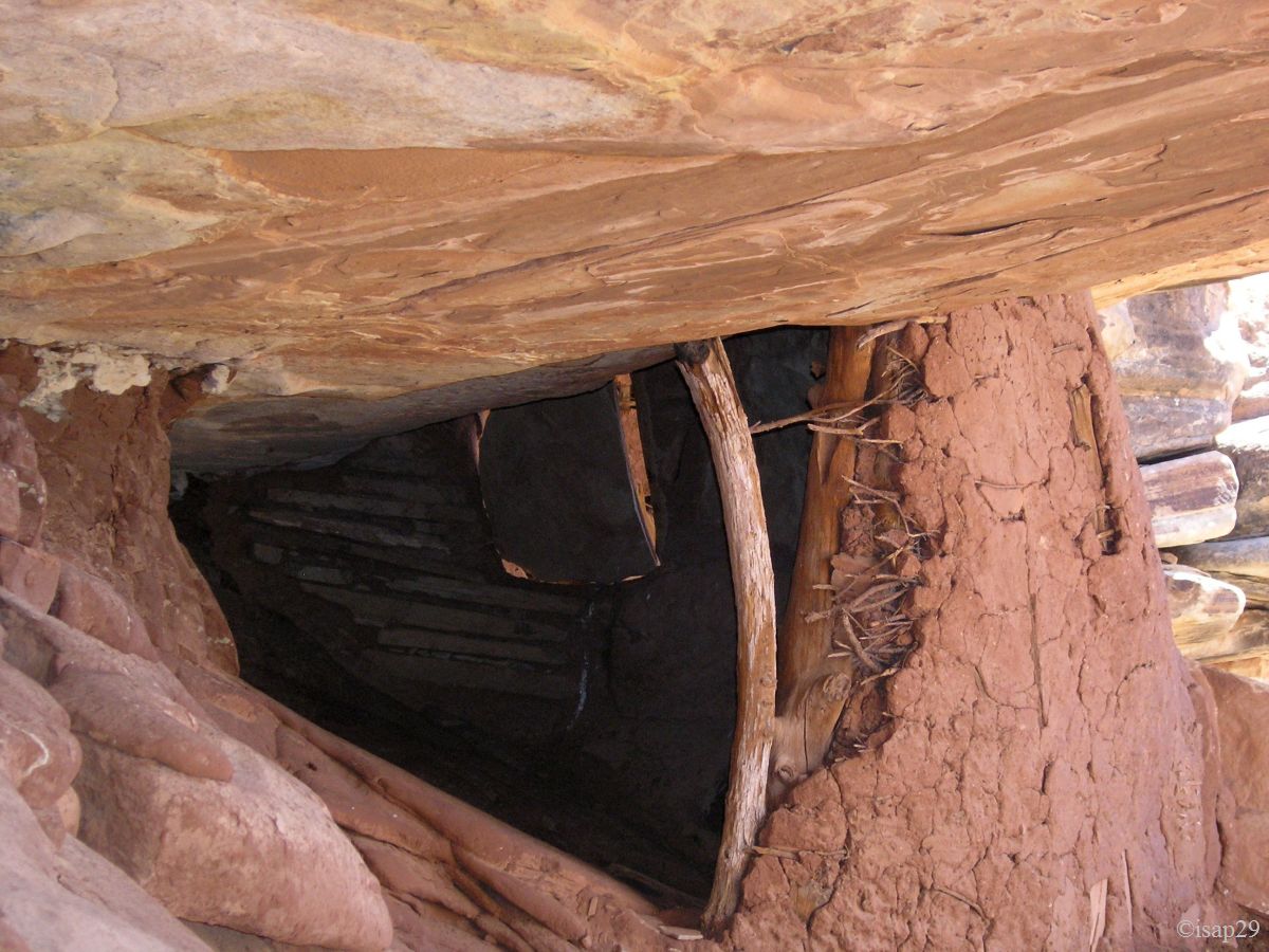
There are other ruins, a little further along the ledge. It takes a little attention, but we see them quickly. A tiny attic is on our way. These second ruins are not the same workmanship and are rather in adobe with a wooden frame.
During our lunch break, we stay in the shadow under the overhang while enjoying the scenery.
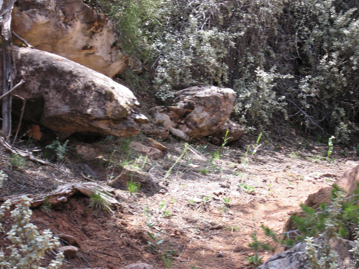
On the way back, in the bottom of Road Canyon, a big squirrel plays hide-and-seek with us. I'm trying, unsuccessfully, to display the temperature on our GPS but it's very hot, at the bottom of the wash.
Road Canyon Ruins - second ruins (9 photos)
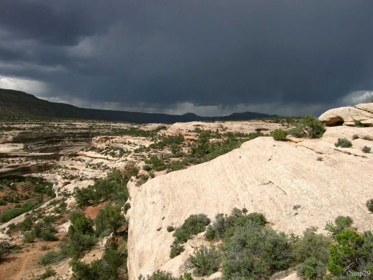
We're back to car shortly after 2 pm, but as heavy clouds arrive, I prefer to return to the paved road before the rain turns the track into a skating rink, we'll eat later.
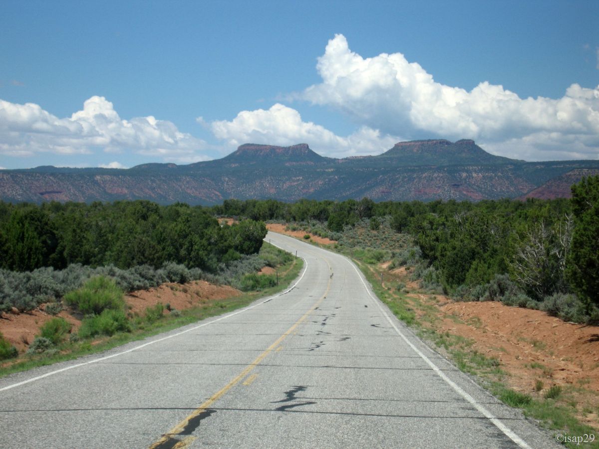
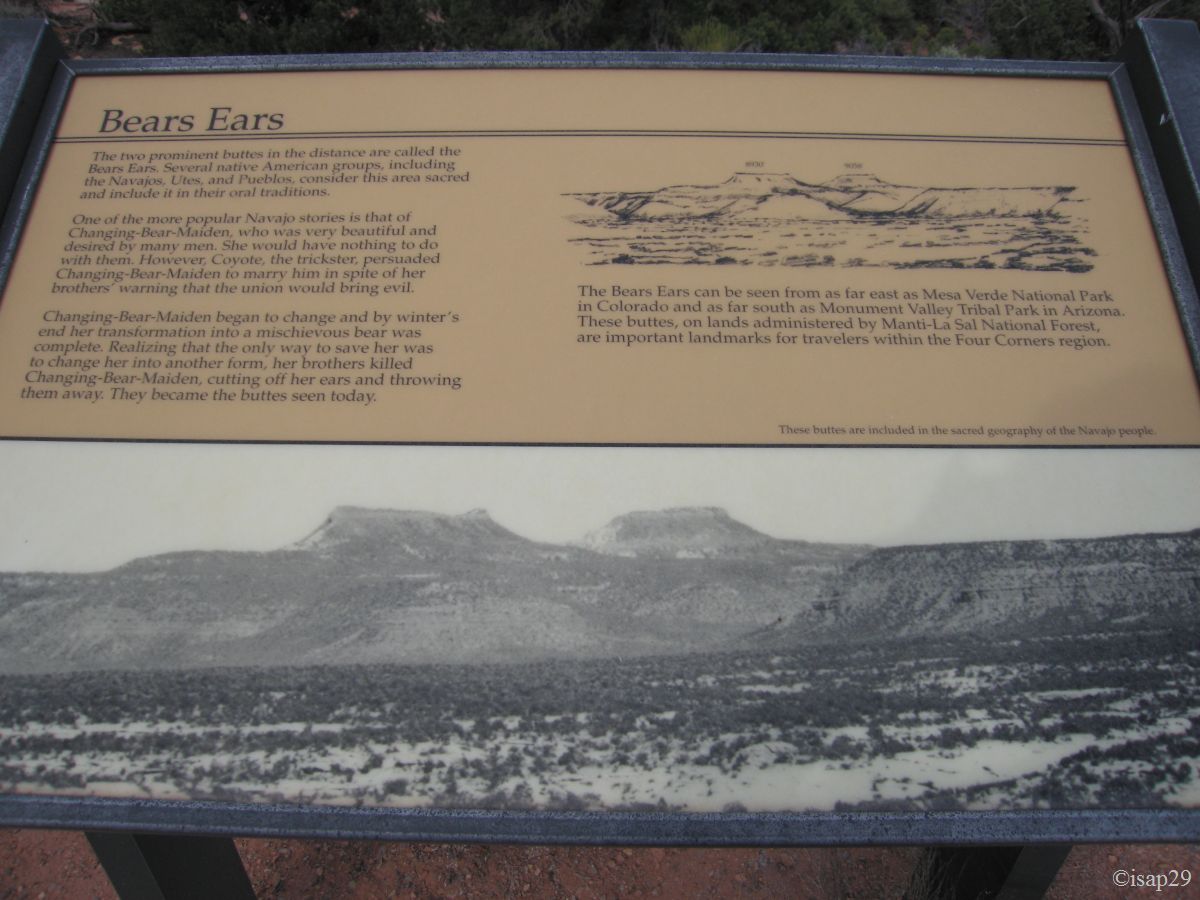
We head to the National Bridges National Monument and its campsite where we'll spend this night. On the road, we see two mounts in the distance; we'll learn later, thanks to information boards and Rangers, that it's the Bears Ears.
A first round of the camp and drat, no free space. We decide to test the method Philippe (we don't have tent) and bingo, it works: a trio of
American cyclists accept our "house" on their site, provided to keep table and fire pit. You can imagine that this doesn't pose any problem to
us .
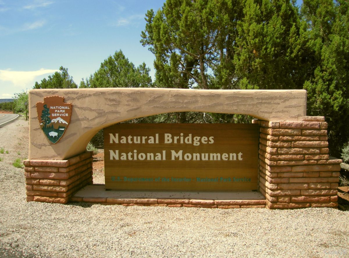
Natural Bridges National Monument (4 photos)
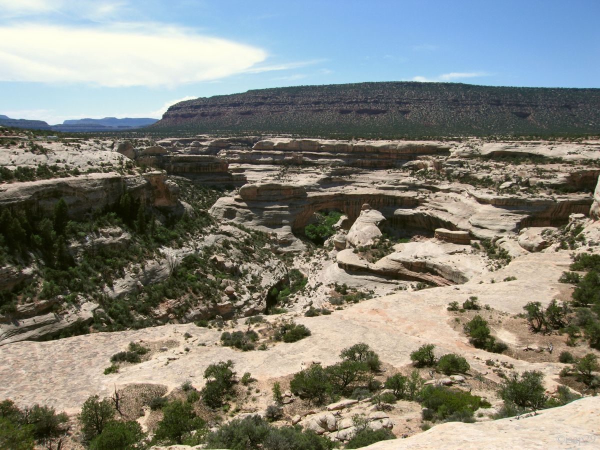
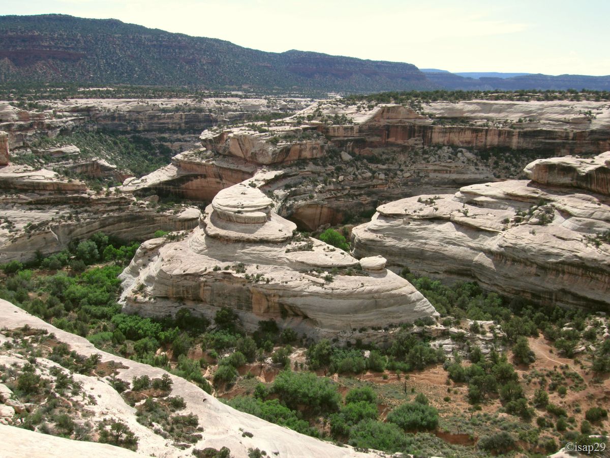
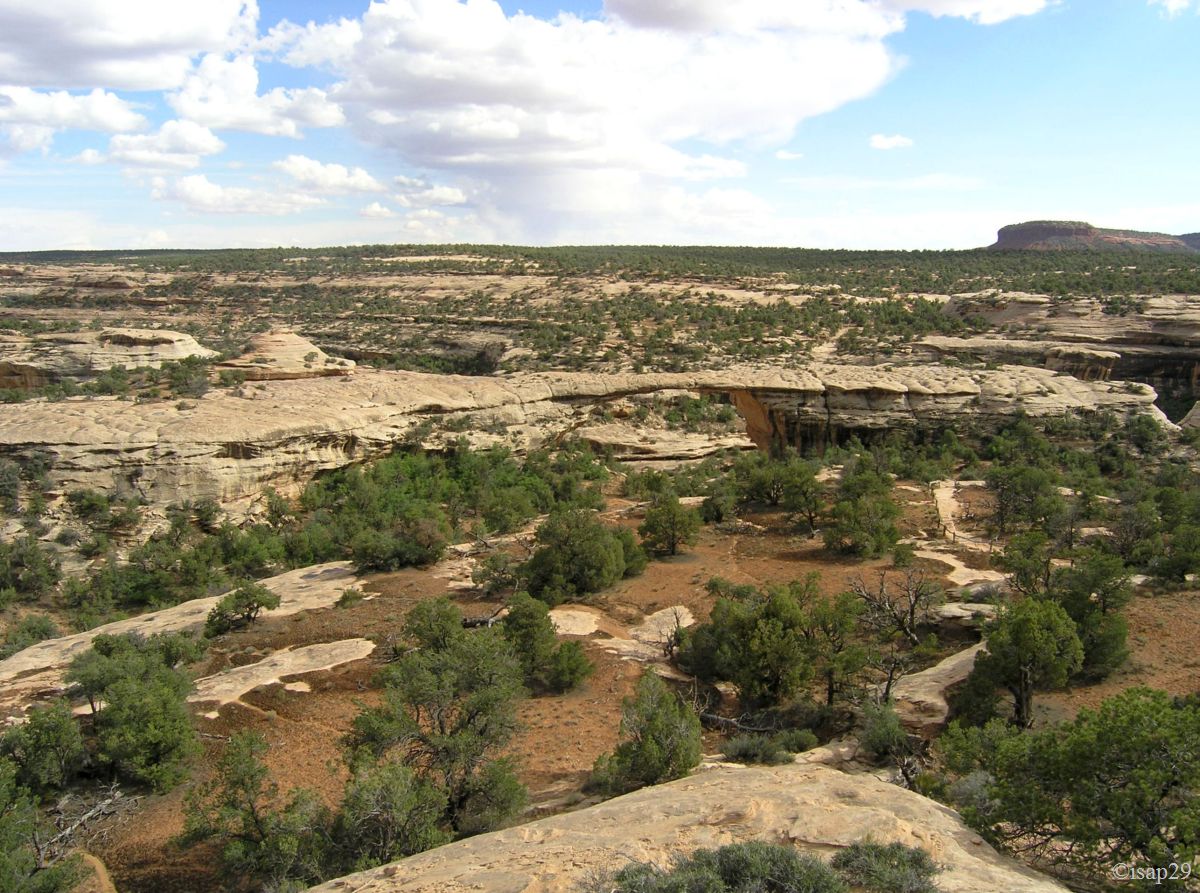
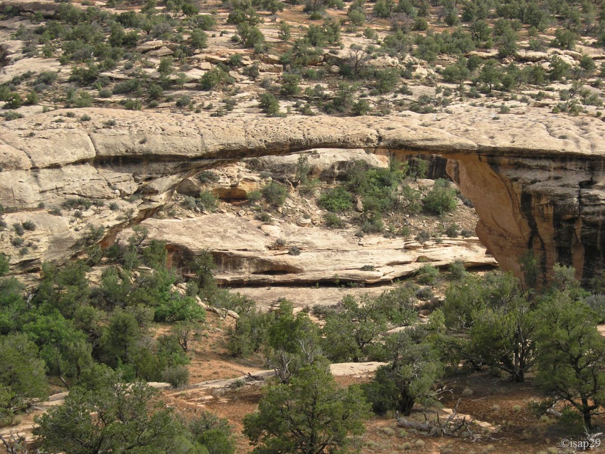
Now that our bed is provided, we leave to the discovery of the 3 bridges of this monument. Unlike arches which are formed "alone", bridges are created by a river existing or having existed. As it is already 3:30 pm and that, moreover, the storm is rumbling, no hiking and yet there was something to do (ruins and petroglyphs, among others).
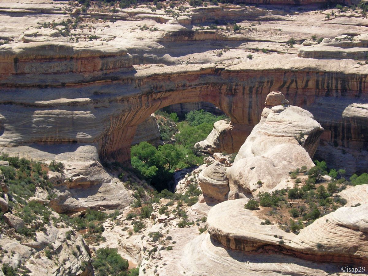
A one-way road with points of view allows us to go around the 3 stone bridges. We start by finding Sipapu Bridge, first bridge on the road.
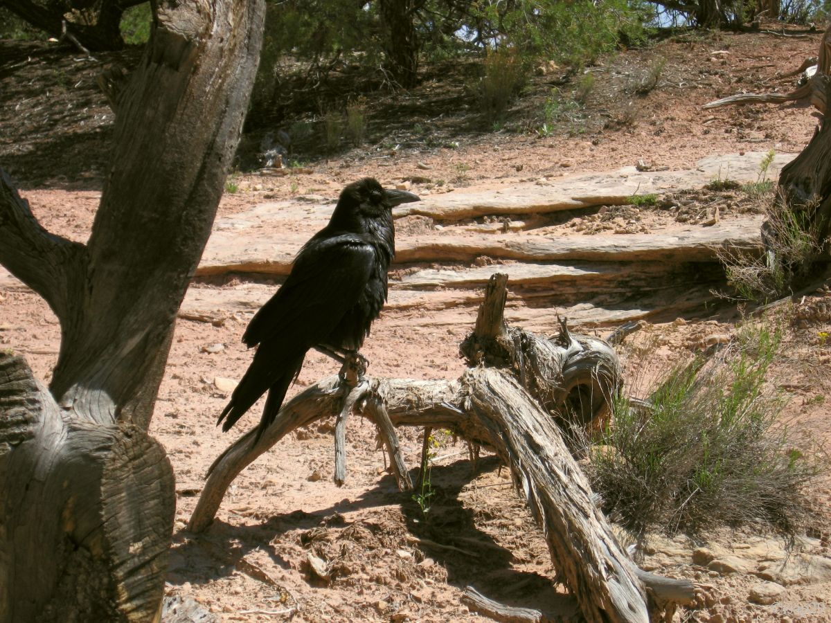
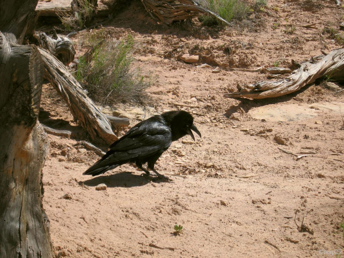
A few pictures later, we take a well deserved snack (it's about 4 pm) in the company of a raven, probably more interested in our remains than by us; as we dawdle a bit, it finally flies away, annoyed.
Natural Bridges NM - Sipapu Bridge (8 photos)
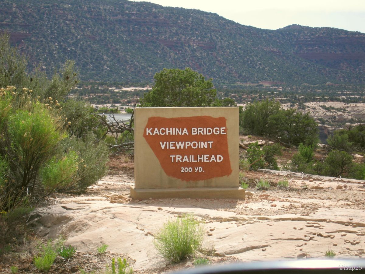
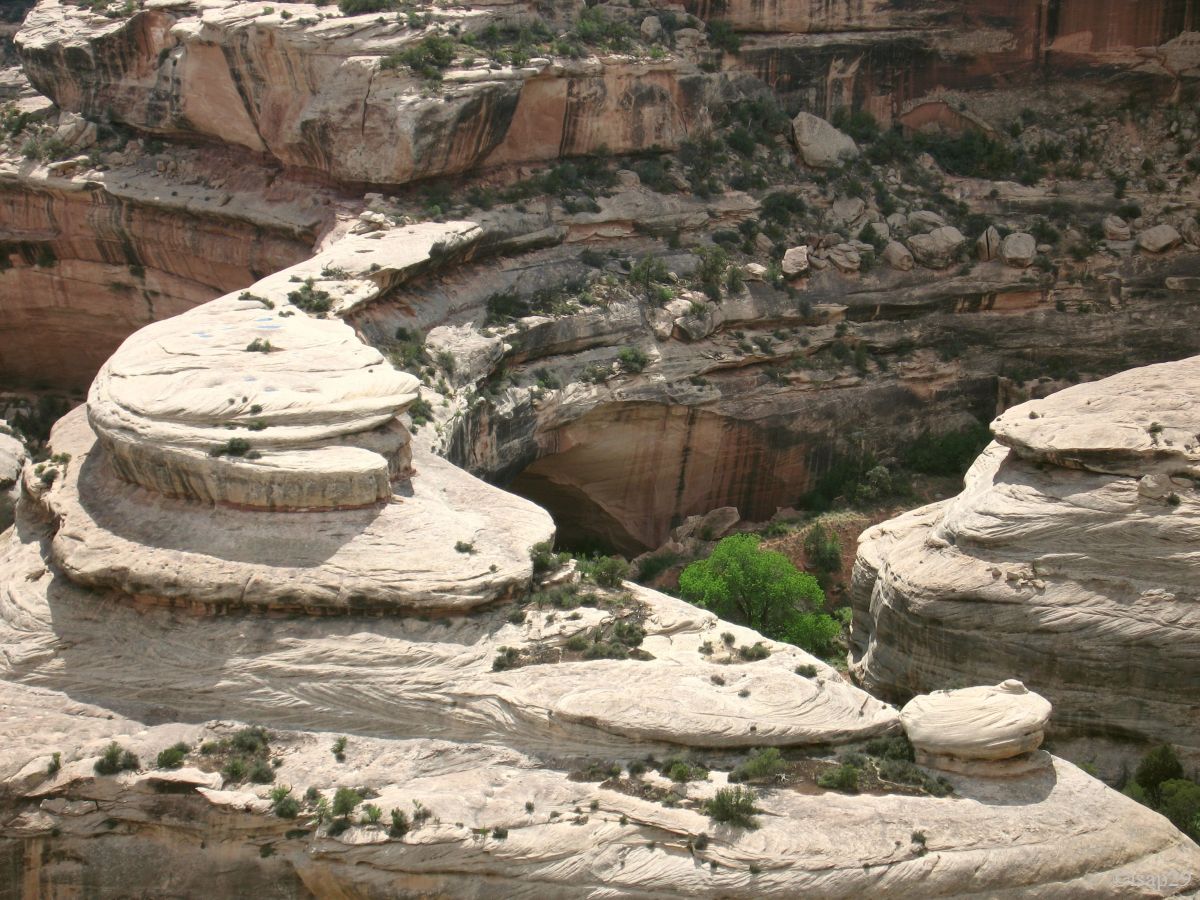
It's now up to go to Kachina Bridge (the storm is always scolding); I take this opportunity to talk with a rather old ranger who finishes his daily walk, a little breathless.
It's 5 pm and we leave Kachina with 75 °F and wipers on  .
.
Natural Bridges NM - Kachina Bridge (10 photos)
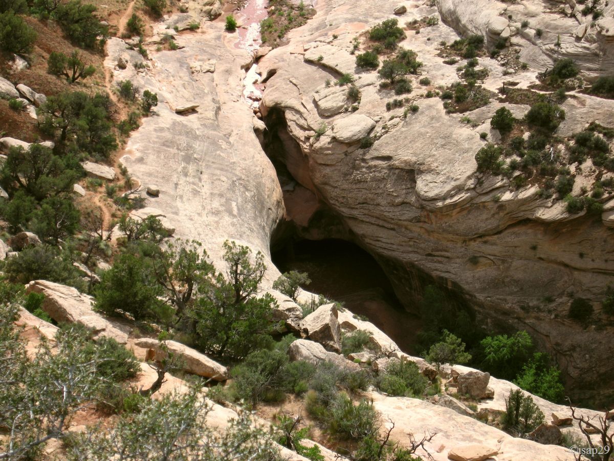
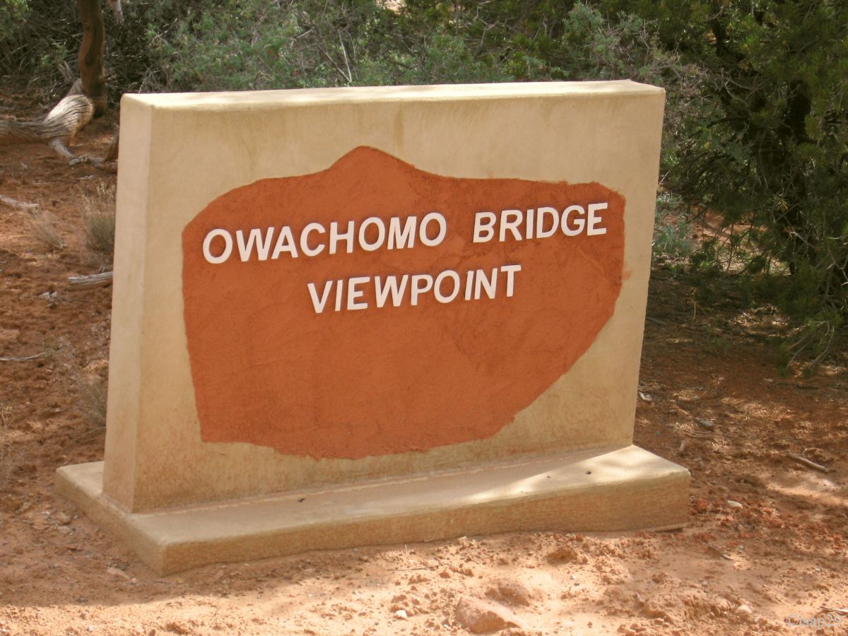
We end our tour by Ovachomo Bridge; the storm seems to slide sideways and the sky is bright again behind him. This bridge is not very high but the thickness of its "deck" is no more than 10 feet, so it may collapse at any moment.
Natural Bridges NM - Ovachomo Bridge (3 photos)
We pass at the Visitor Center for our usual collection of documentation and postcards and take the opportunity to refill our cans of water
(5 gallons each, our first can is empty); at 6:15 pm we're back at camp. A ranger makes the tour of campsite to announce a conference report
on the geology of the park at "8-teurdy"; we deduce immediately that it will be at 8:30 pm .
We begin to sort our photos on the PC when one of 3 Americans (our "landlords") tells us that we can use the table of the site. I go with a bottle of wine and we spend the next hour, Isabelle having joined us, to talk with them while drinking a glass friendly. They are on vacation and take the opportunity to travel the region by bike. During the discussion, I make them discover our books « Photographing The Southwest » that, of course, they don't know.
Meal and sleep around 10 pm.
