Coyote Buttes South
![]() version française
version française
Pictures are small in size and grouped in gallery; just a click on it and you'll have all the gallery in bigger size!
Easy navigation with left or right arrow on the keyboard; leaving the gallery photo by Escape.
Do not forget to switch to full screen (F11). Javascript is required.
Journey map
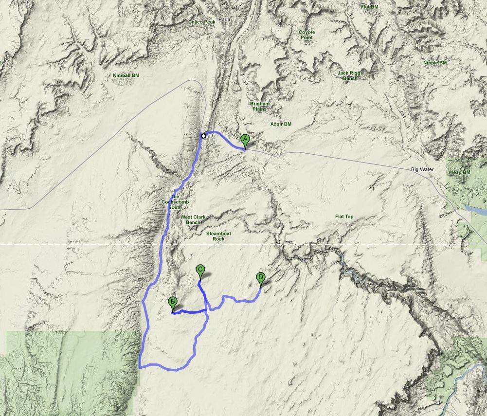
Approximately (approximate figures, it was not our car) :
- from Paria Outpost (A) to Paw Hole (B): 36 miles and 2h10 drive on dirt road
- from Paw Hole (B) to Cottonwood Cove (C): 5 miles and 20 mn drive on dirt road<
- from Cottonwood Cove (C) to White Pocket (D): 8 miles and 30 mn drive on dirt road<
hursday, June 11
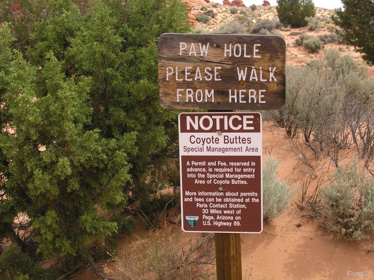
Wake up at 7:45 am; on the schedule today, South Coyote Buttes with Paria Outpost. This area is very sandy and without knowledge of
riding on sand, it's better to use the services of a guide, as he knows his area. A permit, bought on the net, is required for this hike,
the number of people per day being limited.
Breakfast prepared by Susan and departure at 9:45 with a German couple, very friendly for that matter. Our guide for the day is Kurt;
he will provide us more information on the local flora (we are among the few to worry about the issue, it seems?).
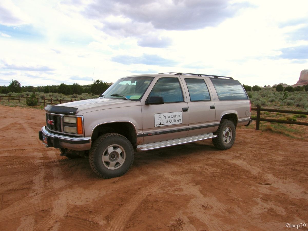
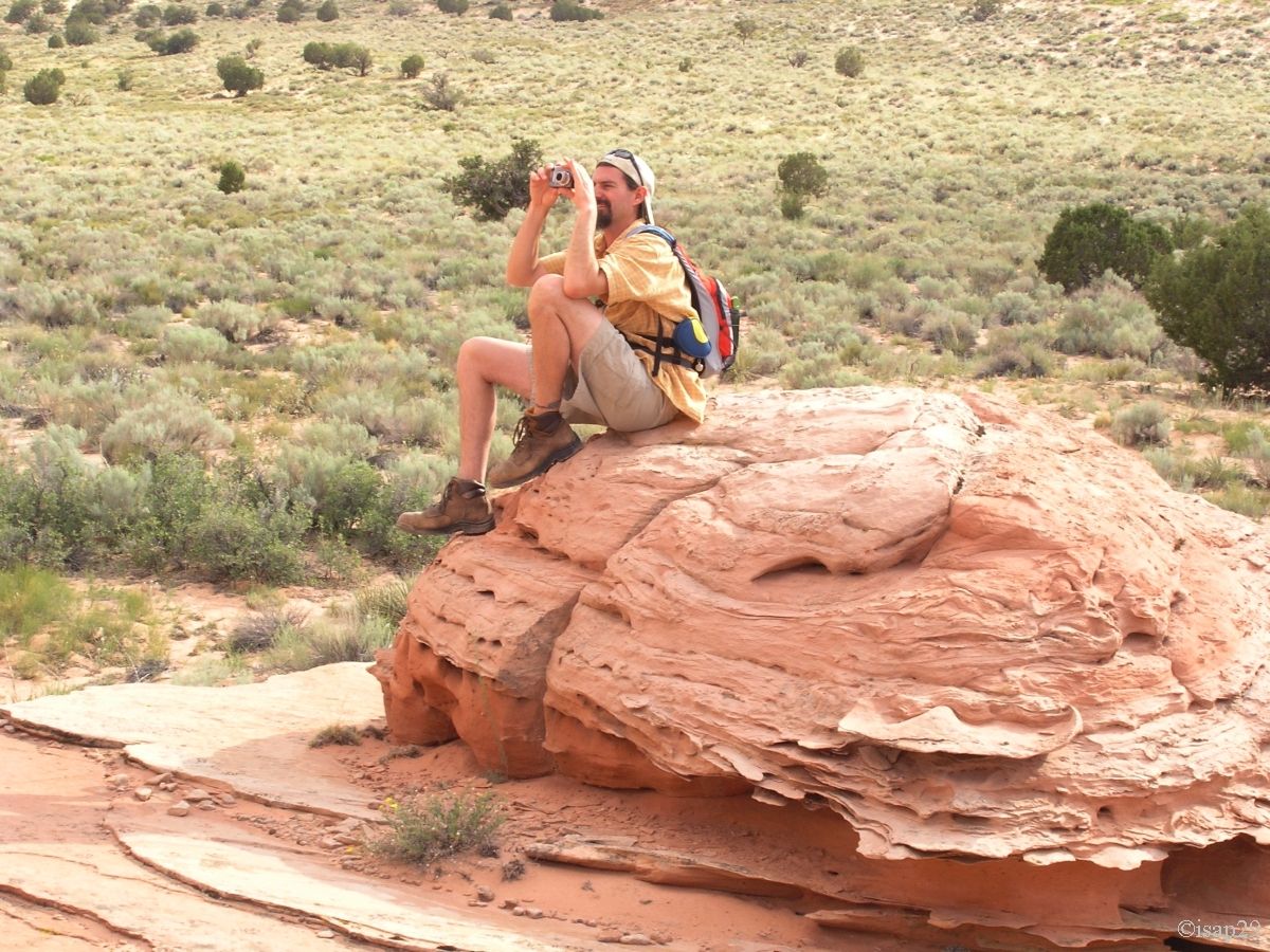
We find our car for the day and there, yes, it's a 4WD, a real one where you have almost a stepladder to climb into it.
 Just look up the step!
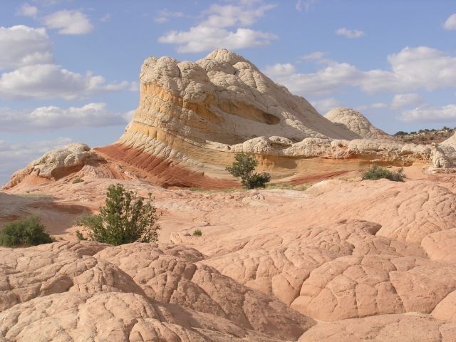
We begin the same track as the day before (Houserock Valley Road), pass the parking for The Wave 10:35 and we leave the main trail to the
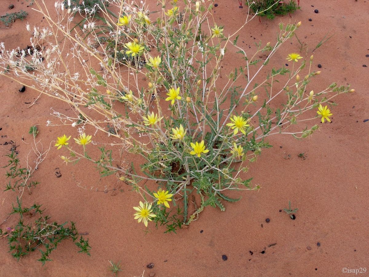
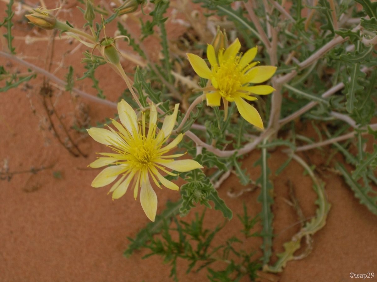
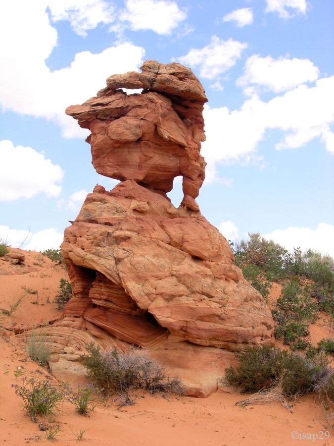
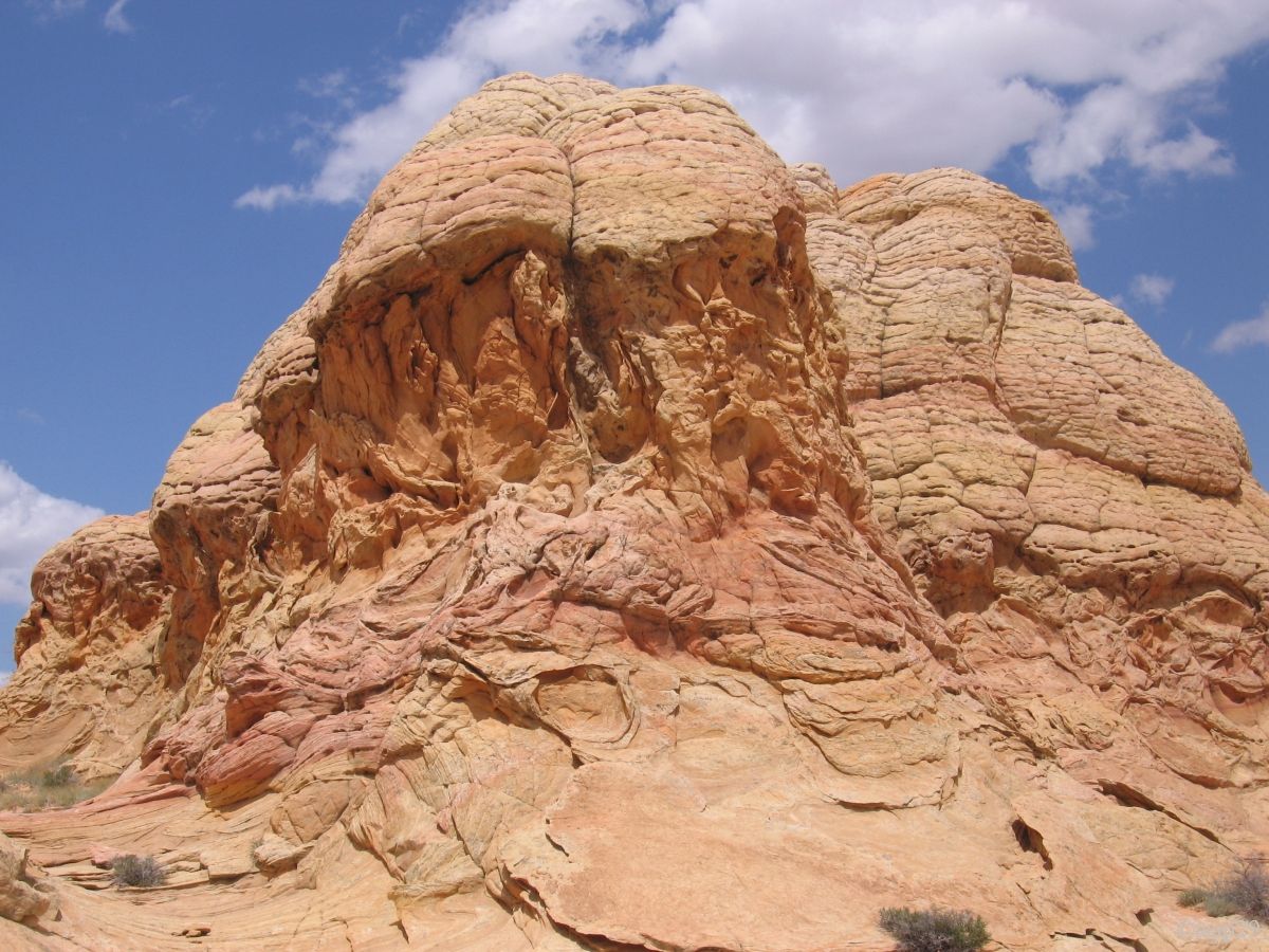
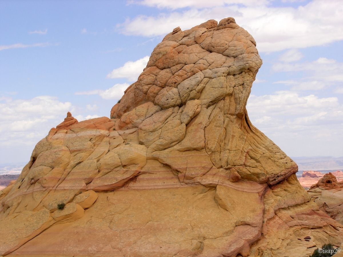
left (Route 1079) to reach Paw Hole a quarter of an hour later, where we'll stay not too long ago. The rock formations look like large
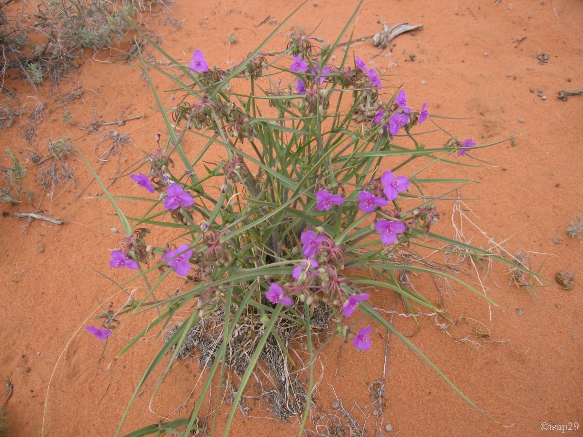
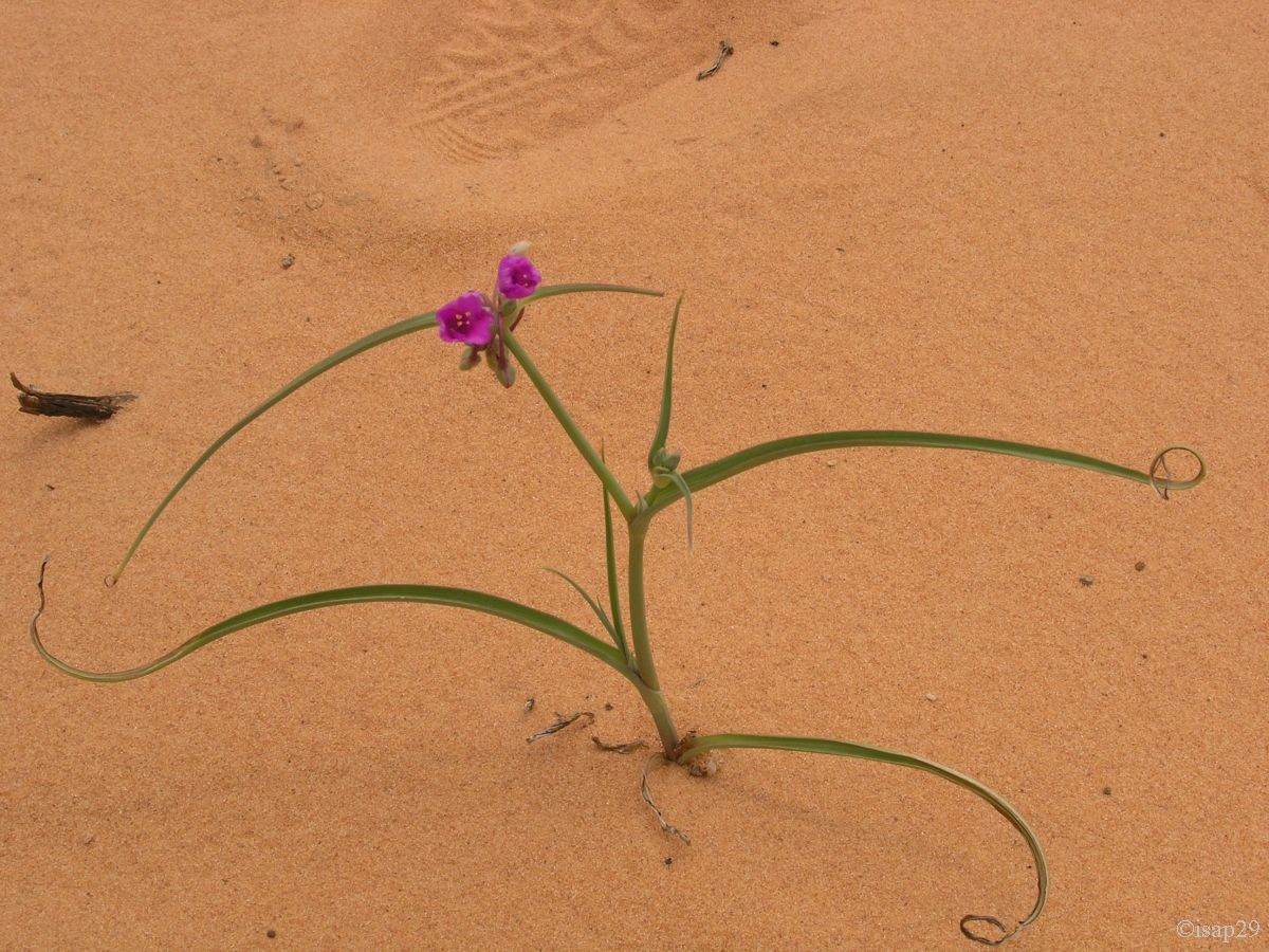
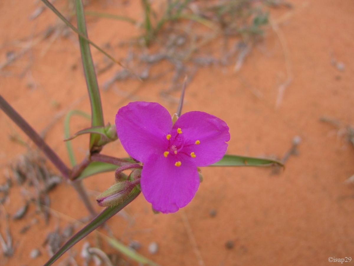
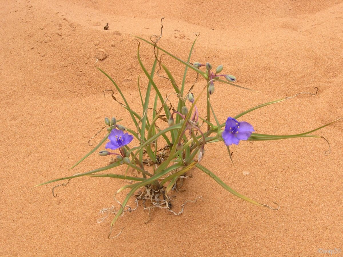
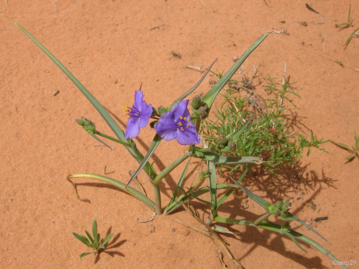
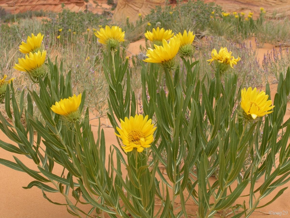
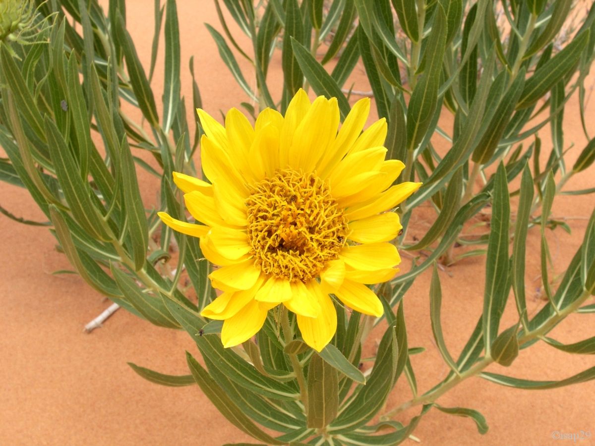
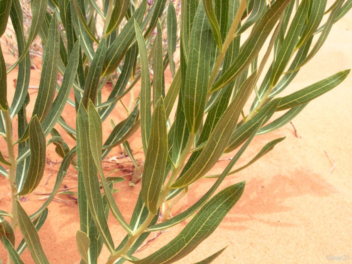
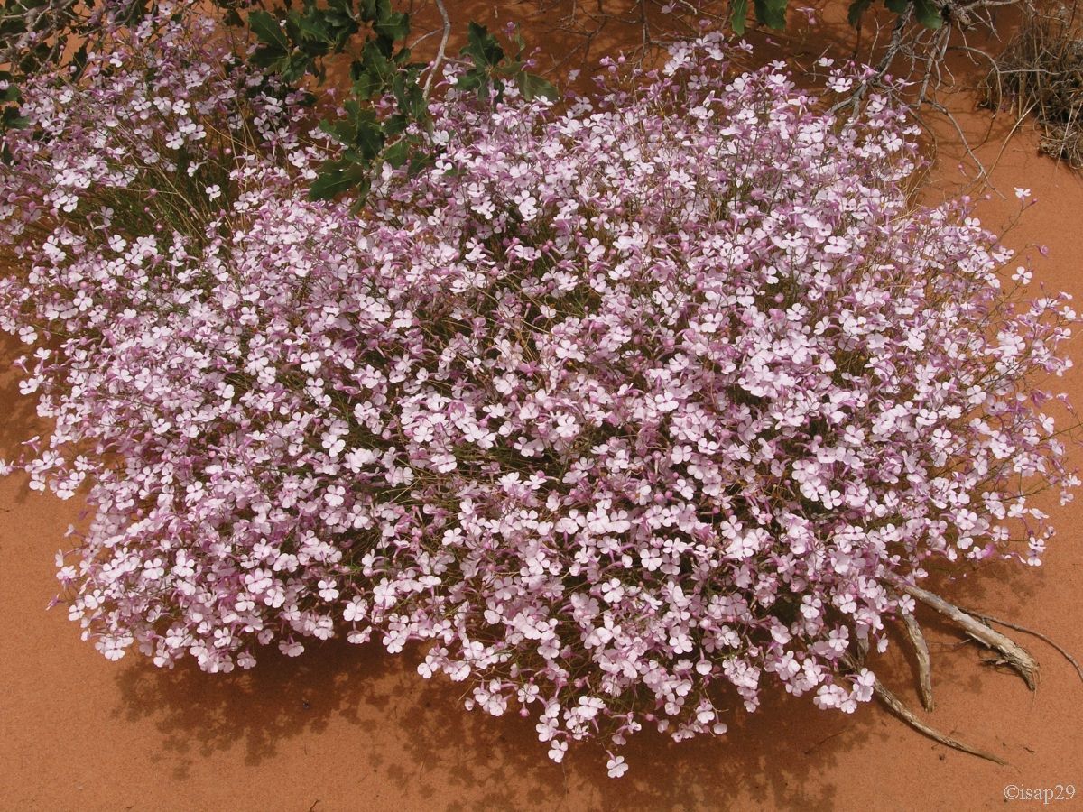
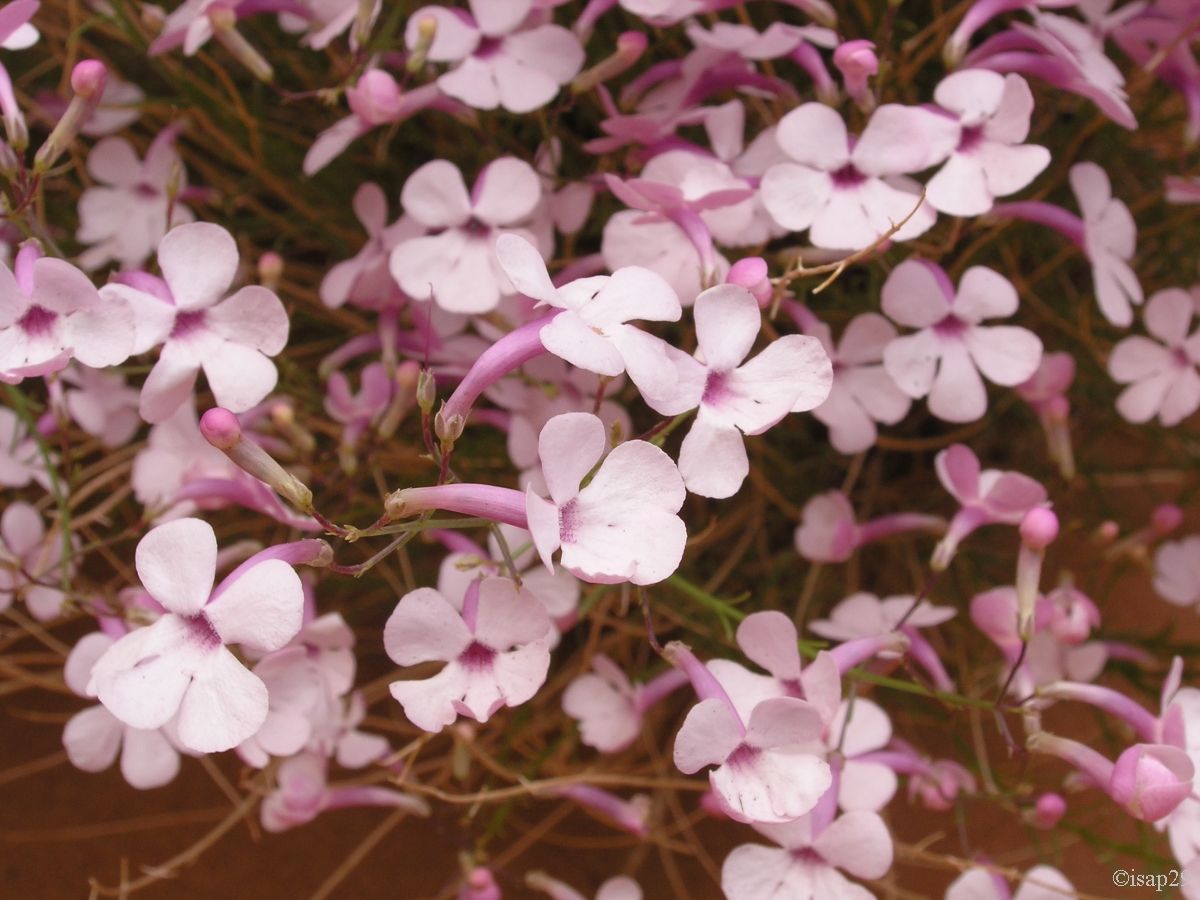
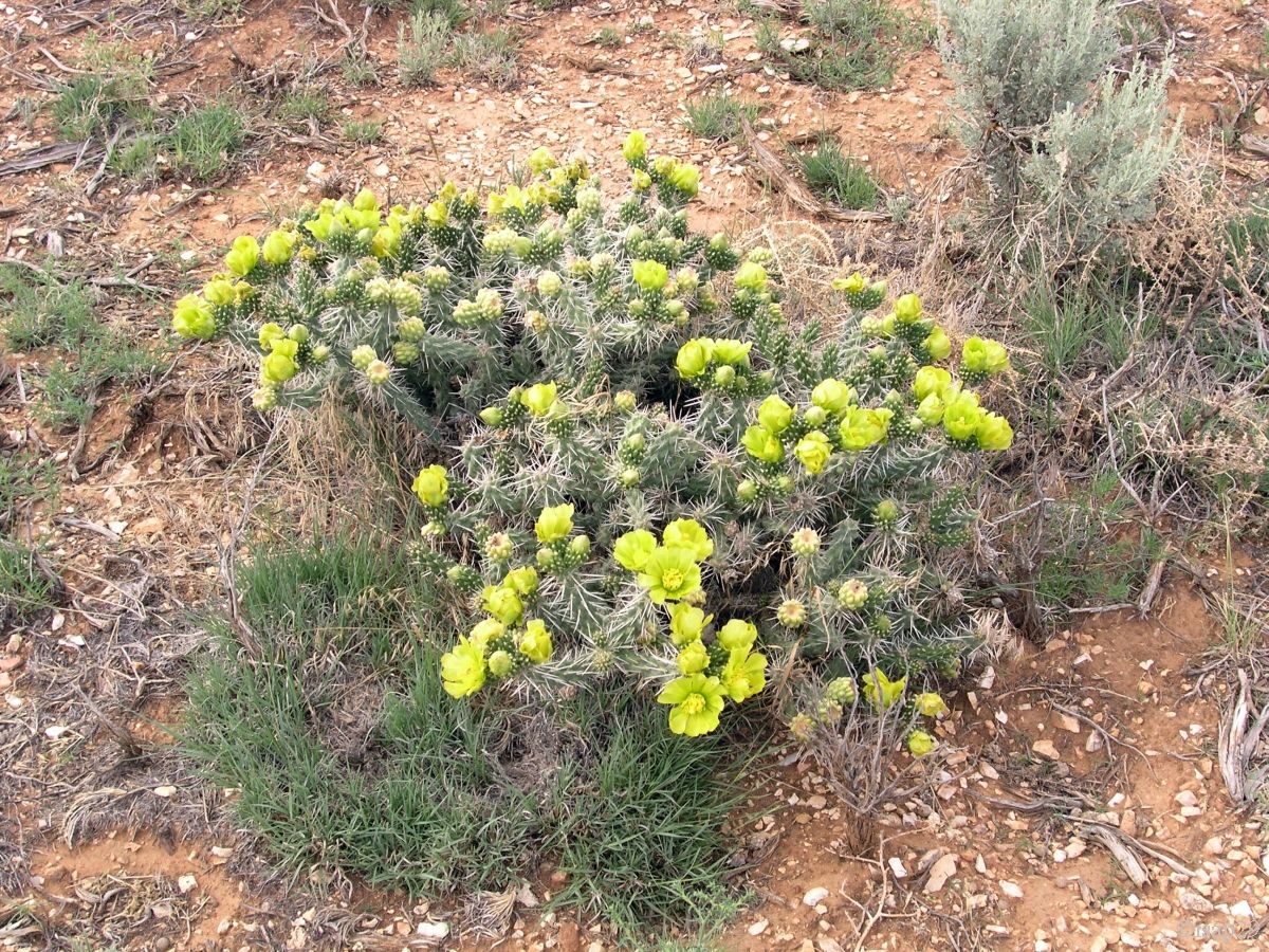
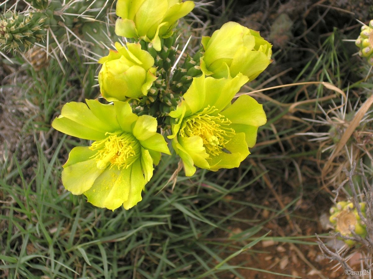
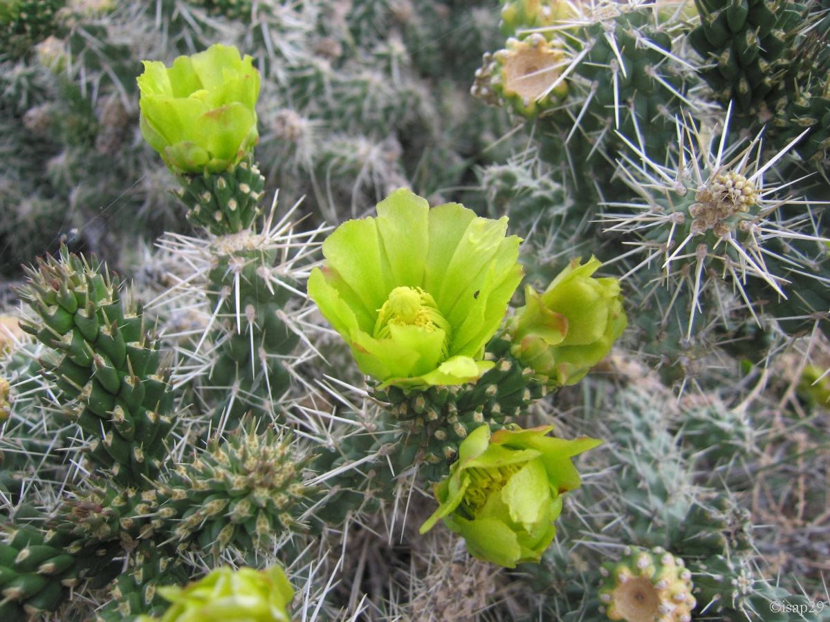
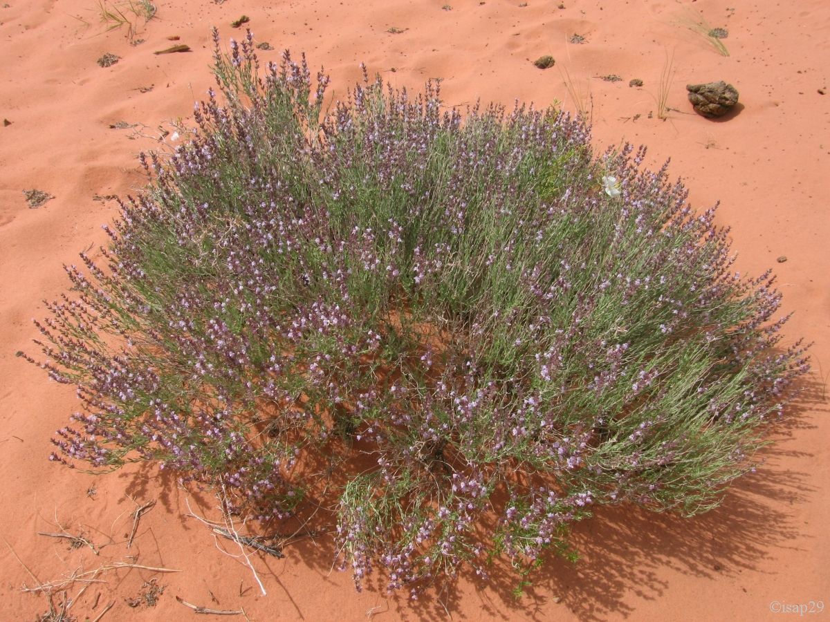
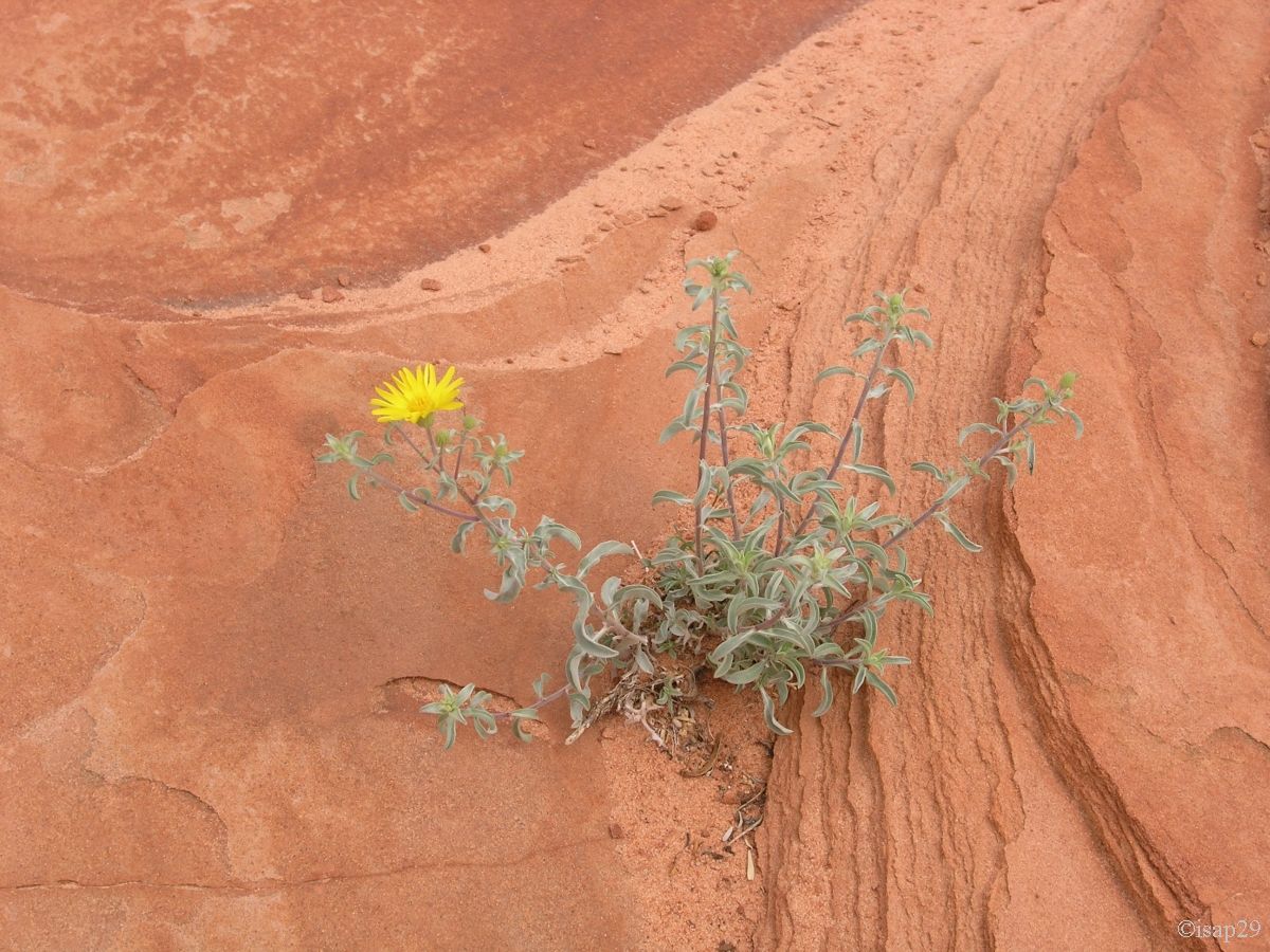
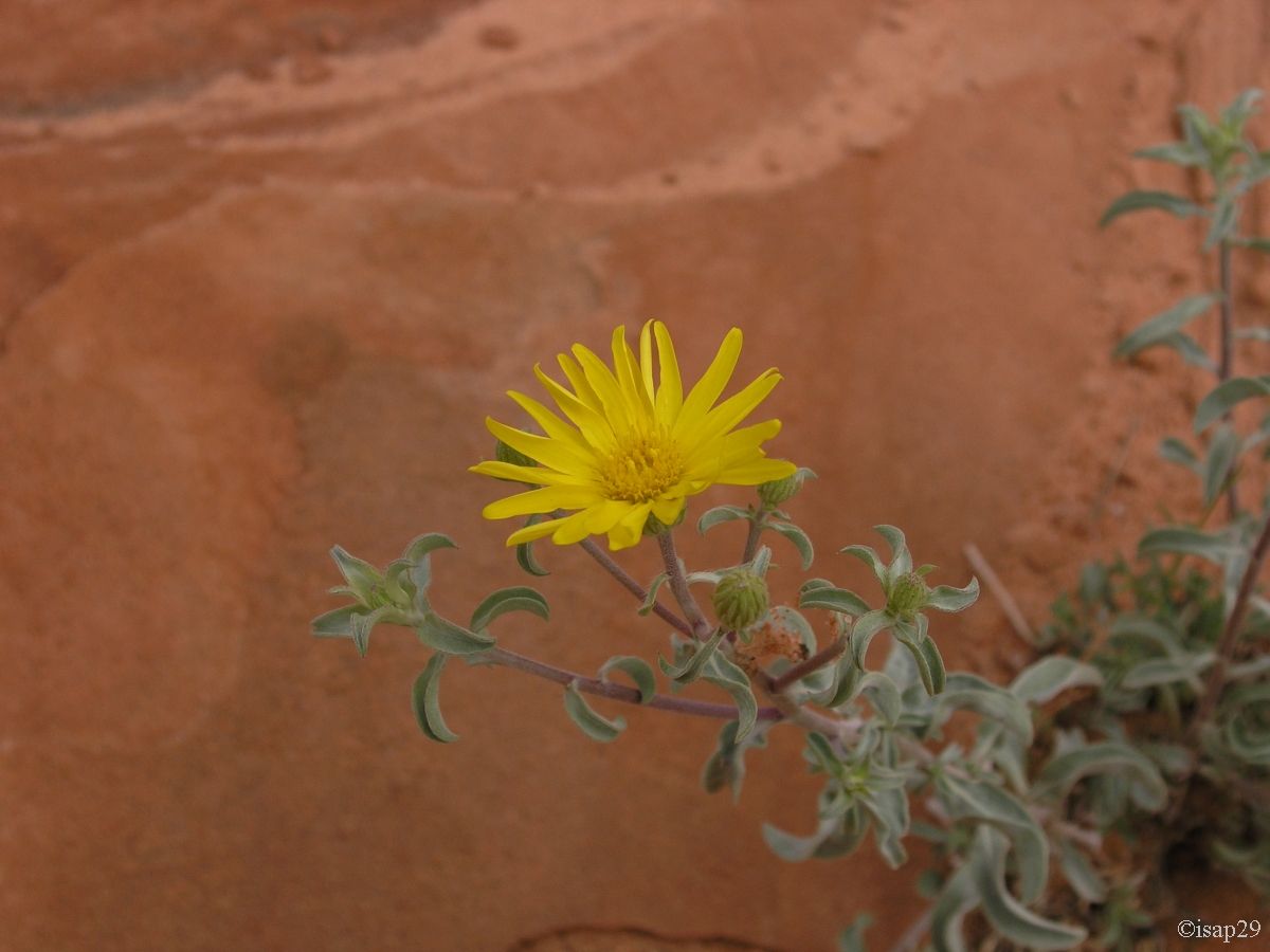
Teepees, the soil is sandy and many flowers (here we have grouped all the flowers of the day).
Paw Hole and flora of CBS (24 photos)
We leave Paw Hole and at 11:26 am, in the middle of nowhere, we turn left; the beginning of the sandy track is dotted with Evening Primrose.
Shortly after, Kurt stops the car to put in a safe place an Indian vase (relic) barely chipped and I had (only) the chance to see it but no photo.
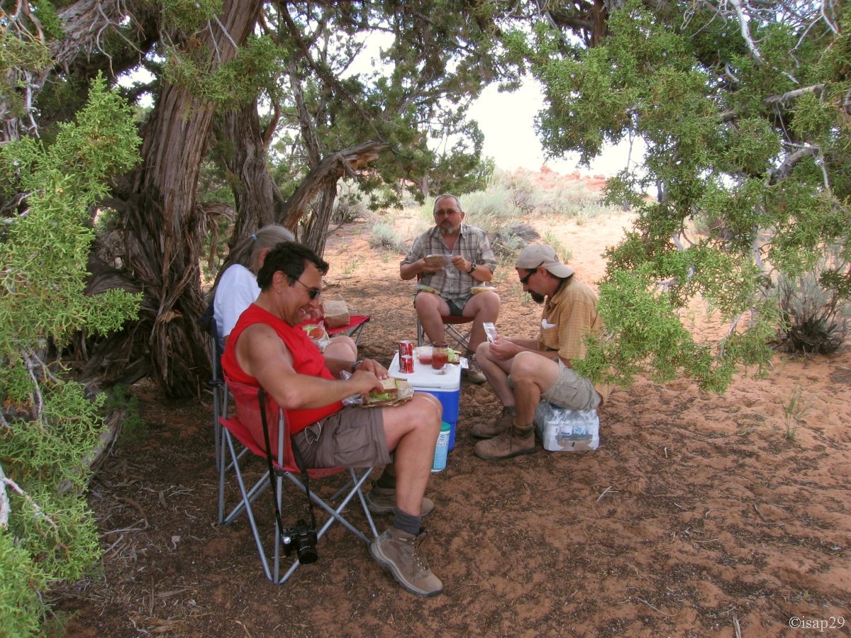
A little later, he parks, announces a hike of at least 3 hours and asks us if we want to eat now, bring a picnic or eat in return; our German
neighbors and we decide to eat here when we'll be back. A German asks us if we want "snakes"! ??  We suspect that this isn't snake and when Kurt shows us a cereal bar, we accept without
understanding (only later, Isabelle will discover on our dictionary that "snake" means "snacks"). Like what, the mastery of the language, it's not that!
We suspect that this isn't snake and when Kurt shows us a cereal bar, we accept without
understanding (only later, Isabelle will discover on our dictionary that "snake" means "snacks"). Like what, the mastery of the language, it's not that!
Creamed everywhere, backpacks full of water, hiking shoes and hats, we leave at 11:45 for Cottonwood Cove, and almost from the beginning ,
many spiderworts in 2 different colors.
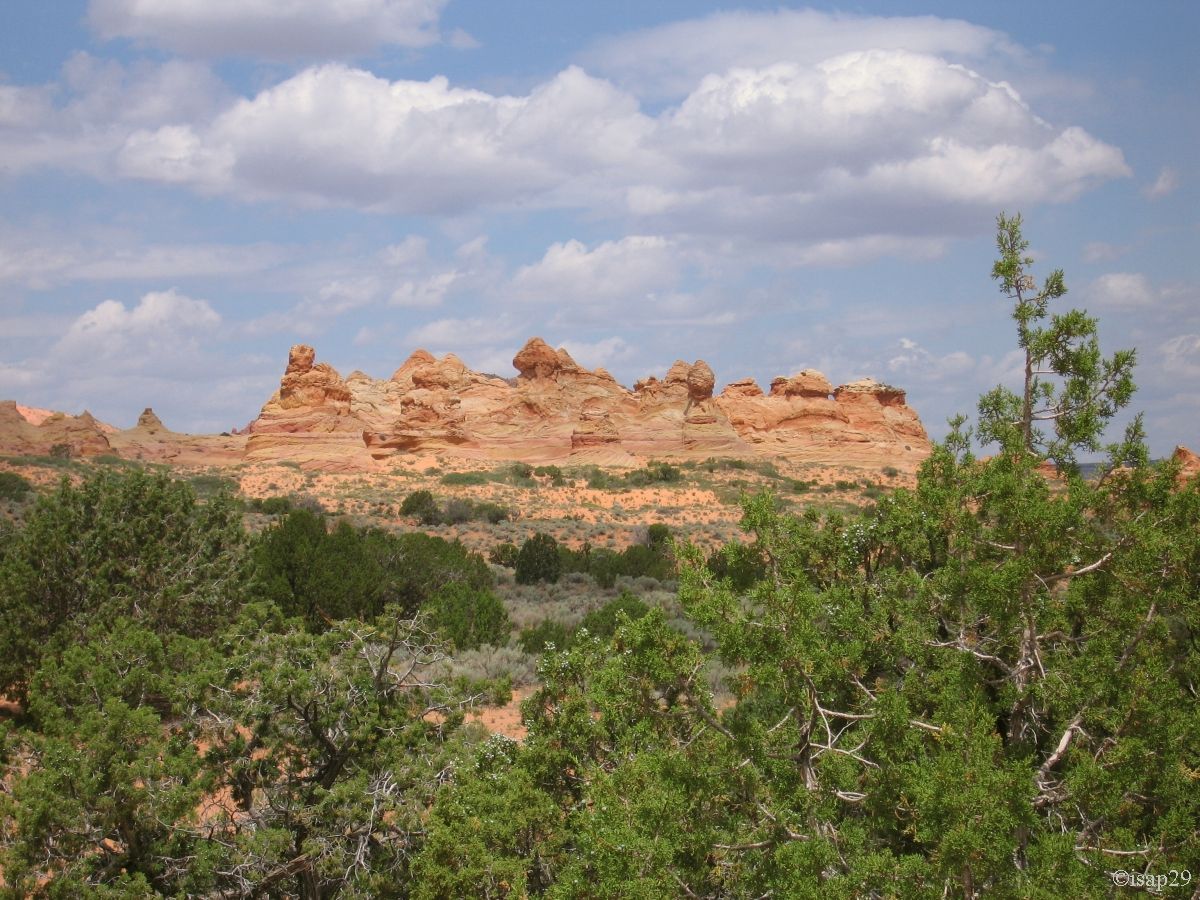
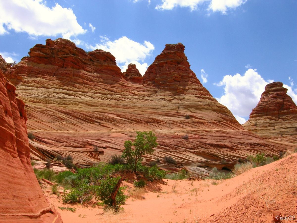
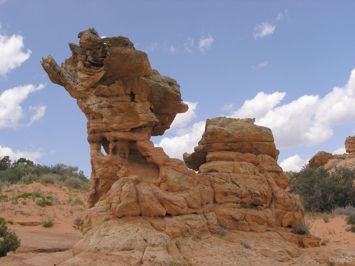
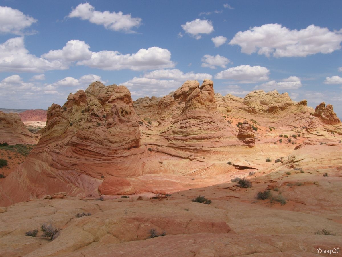
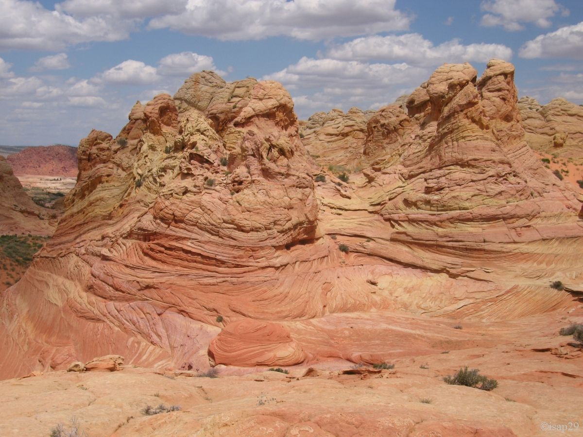
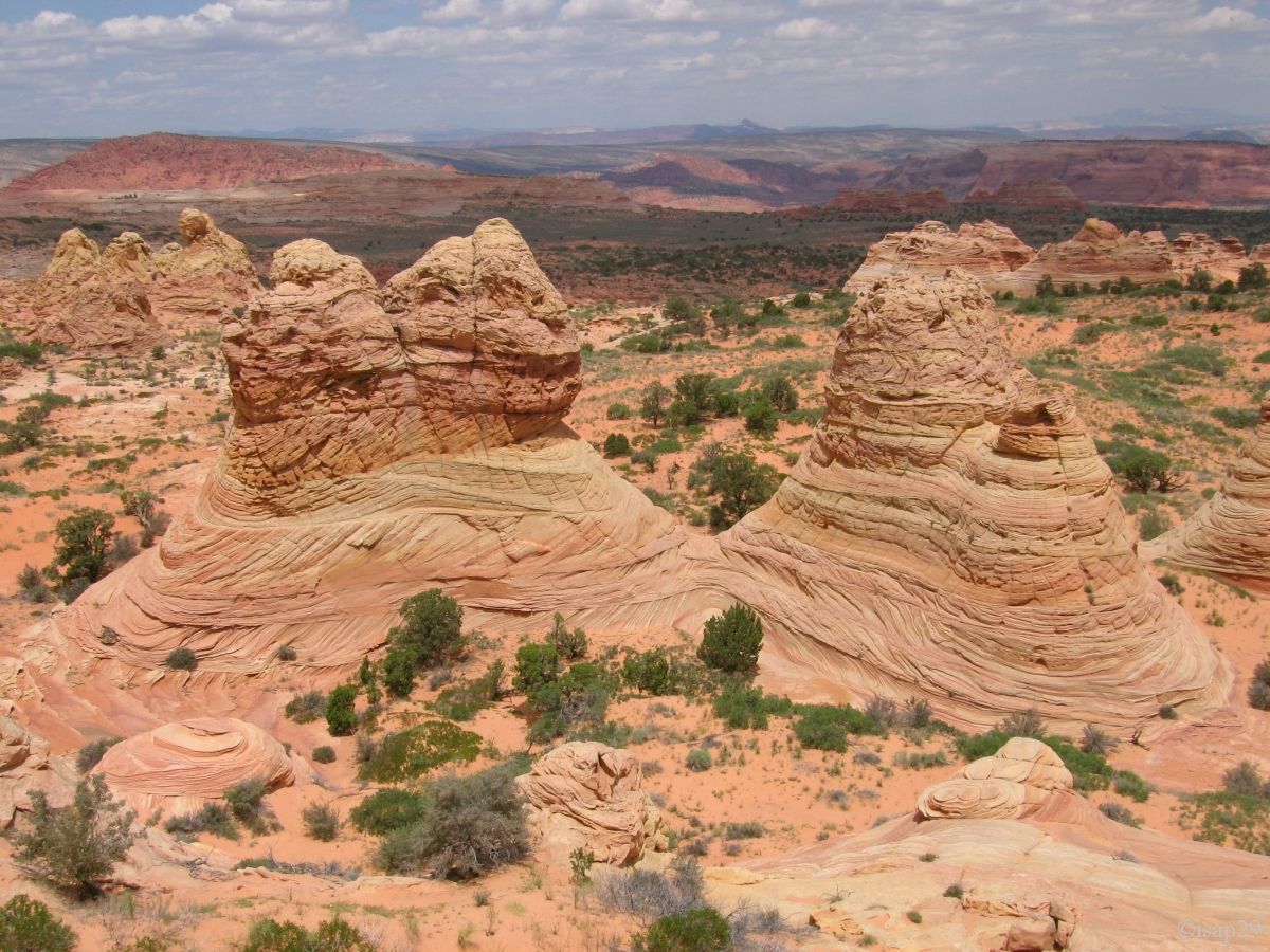
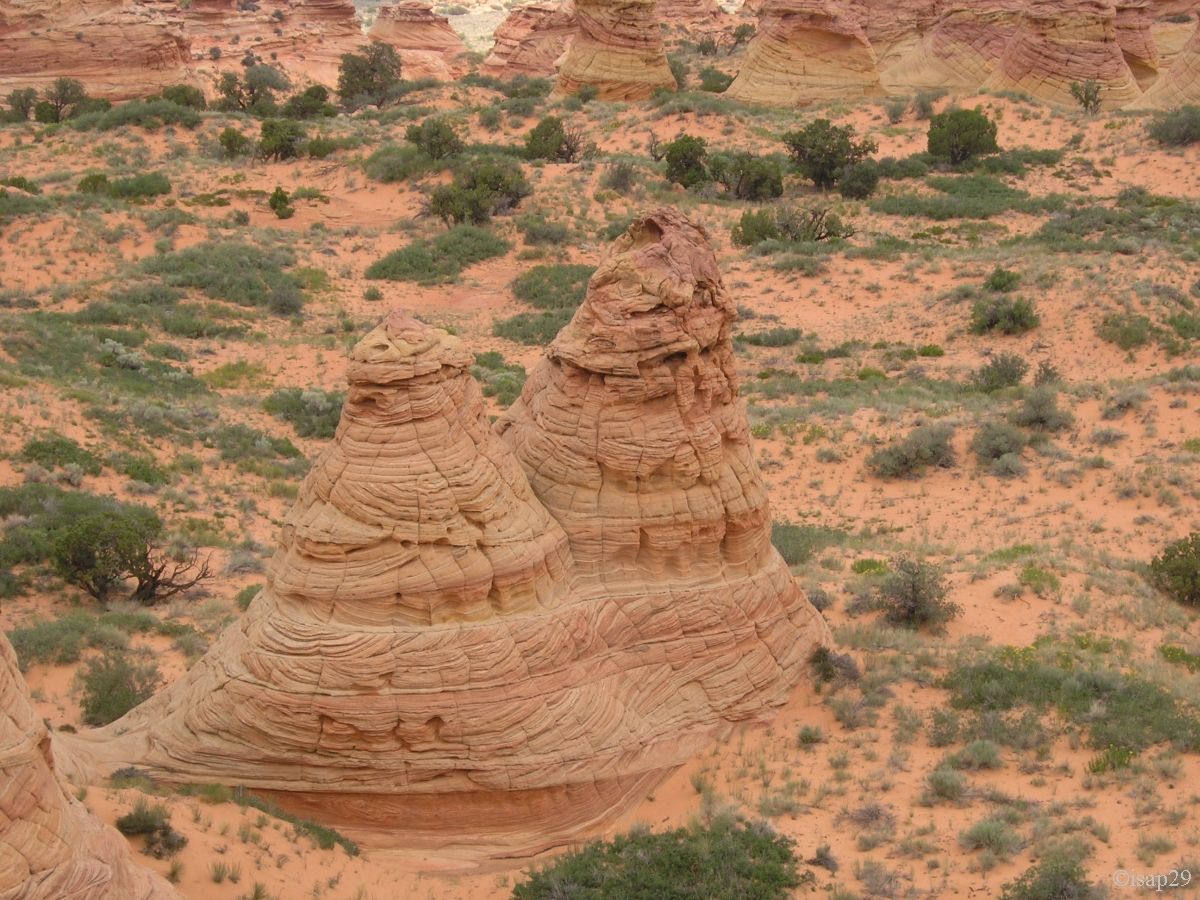
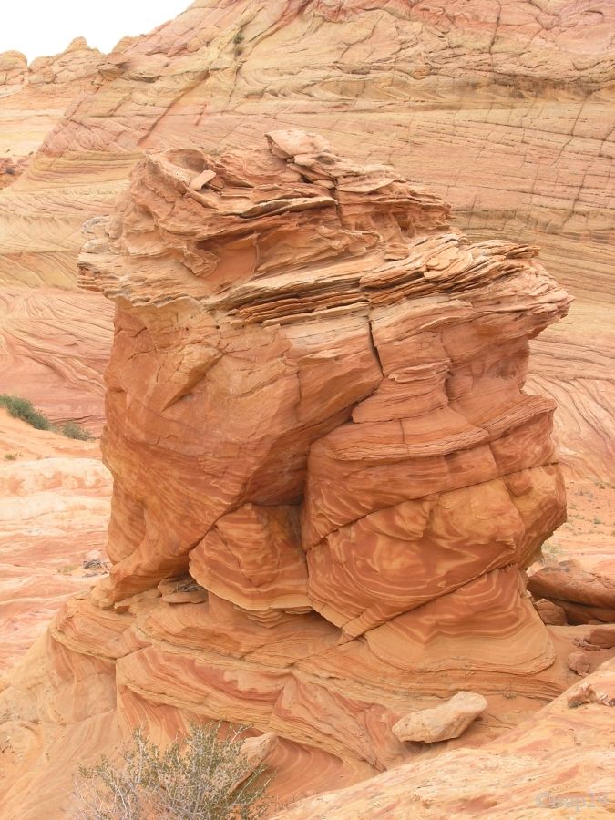
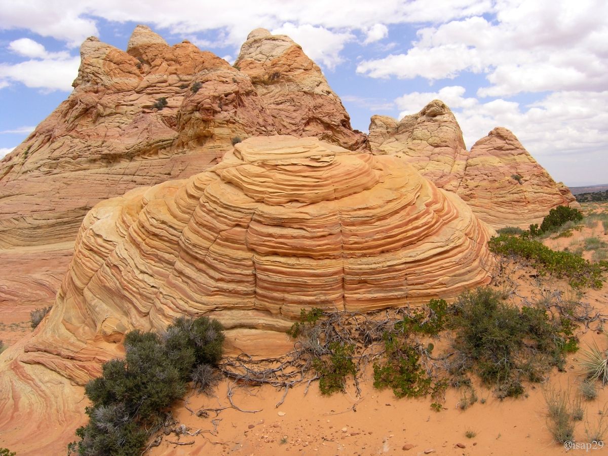
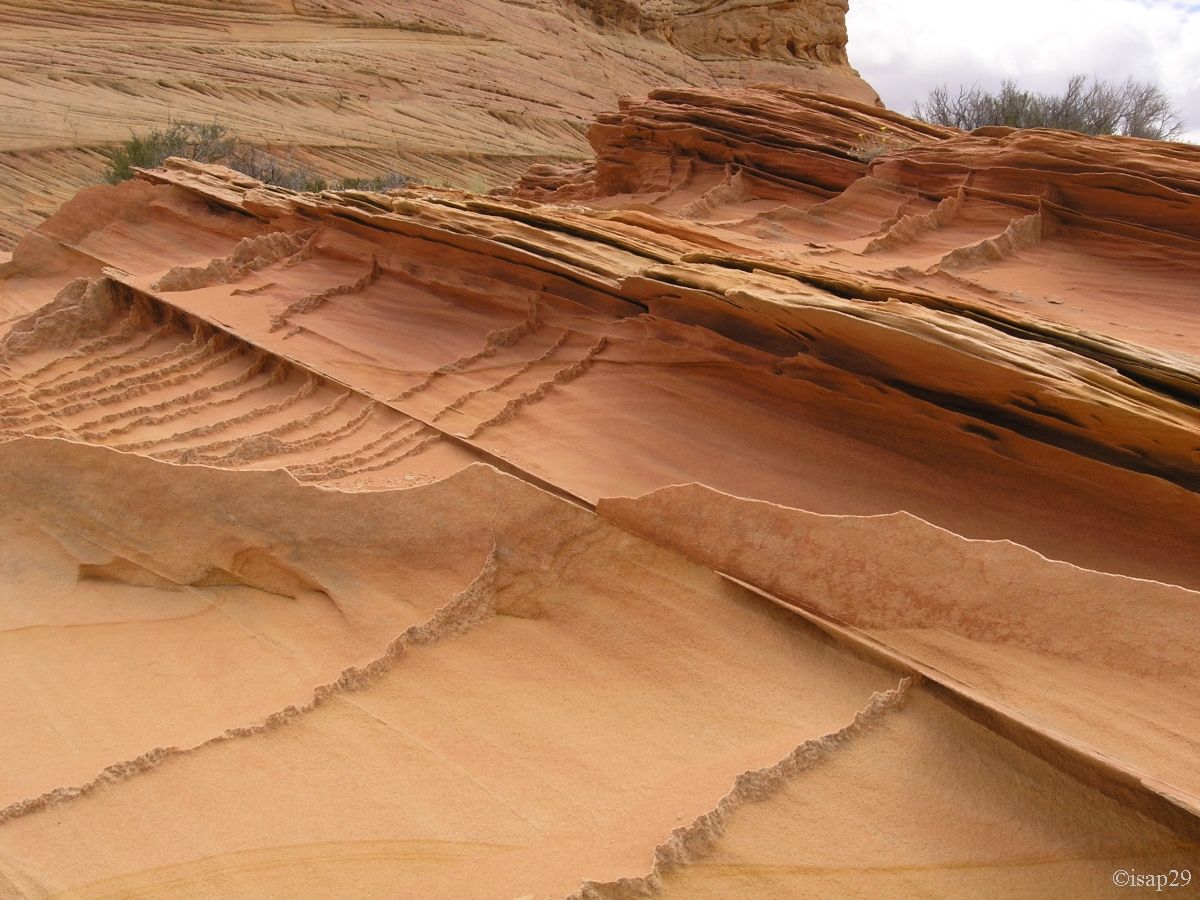
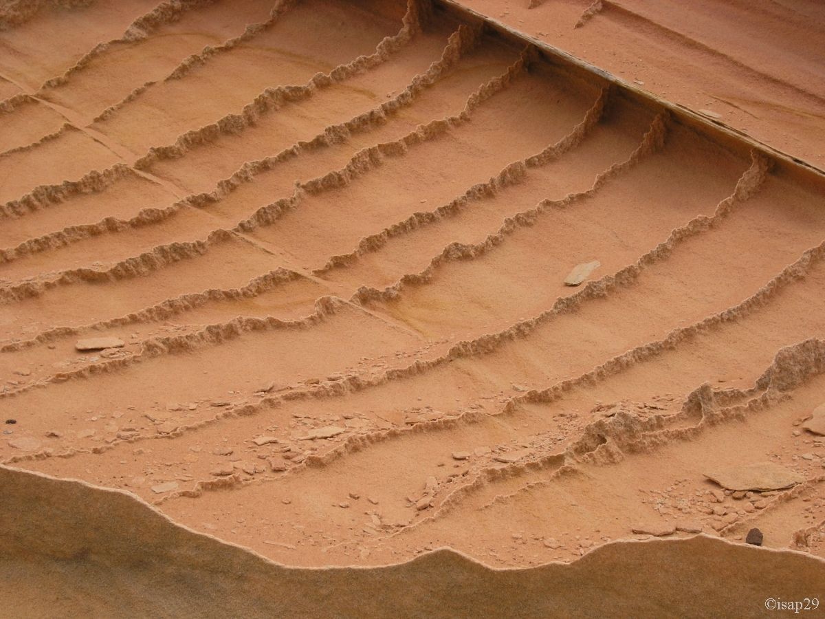
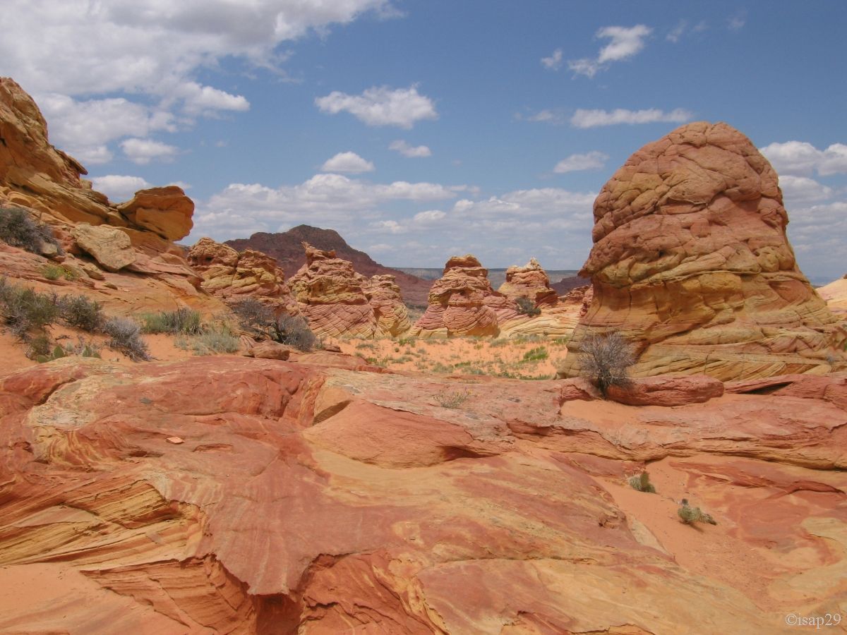
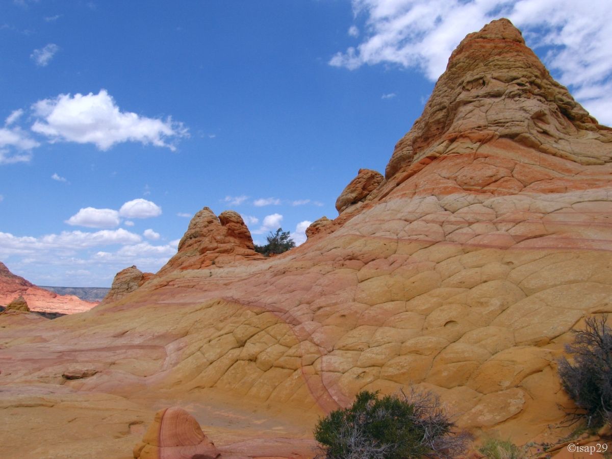
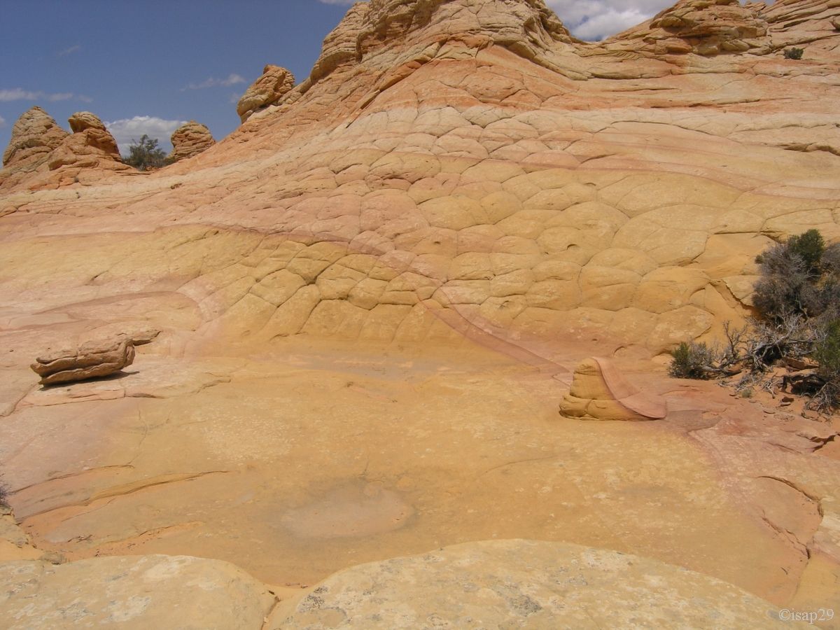
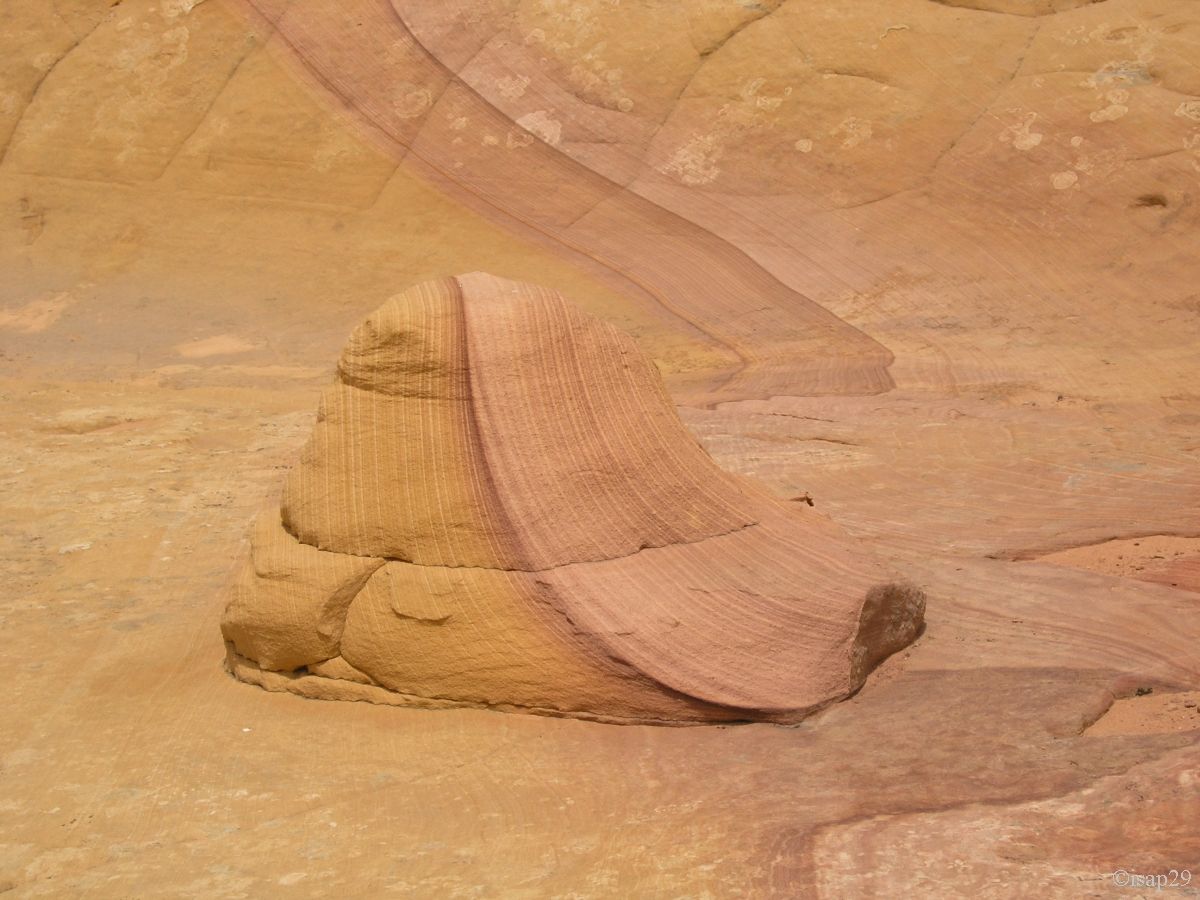
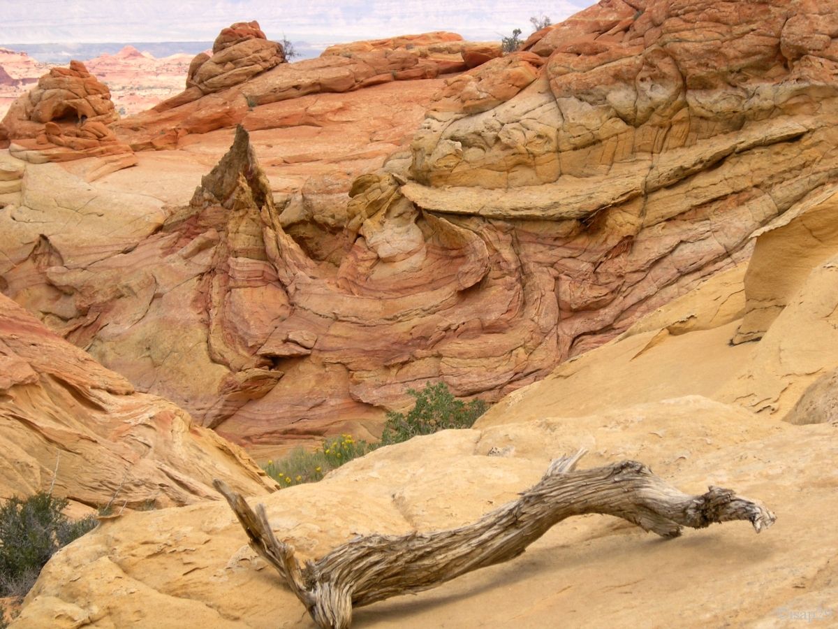
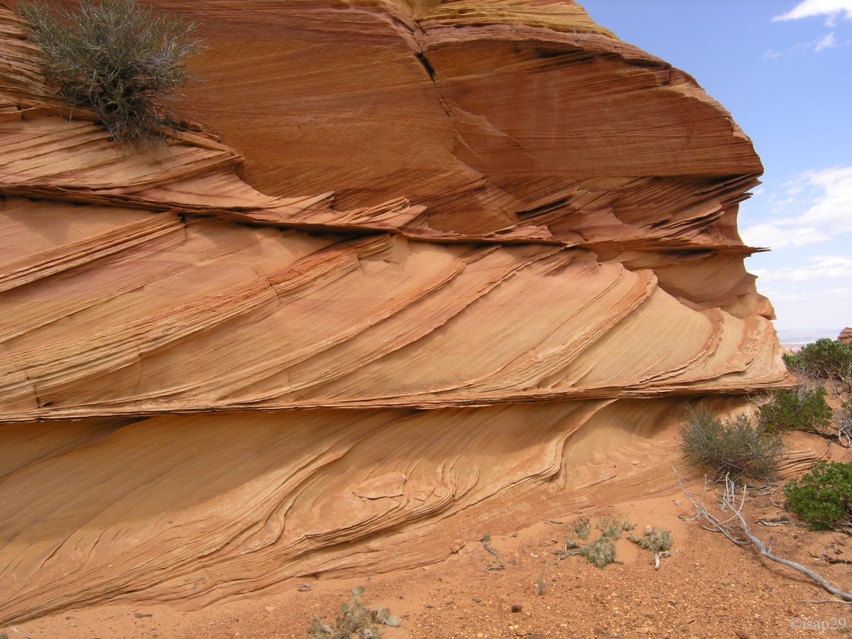
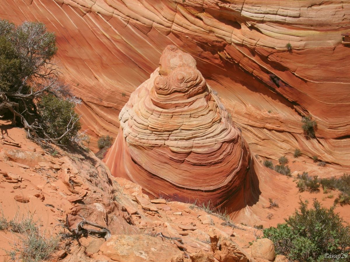
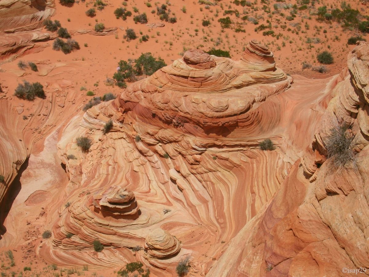
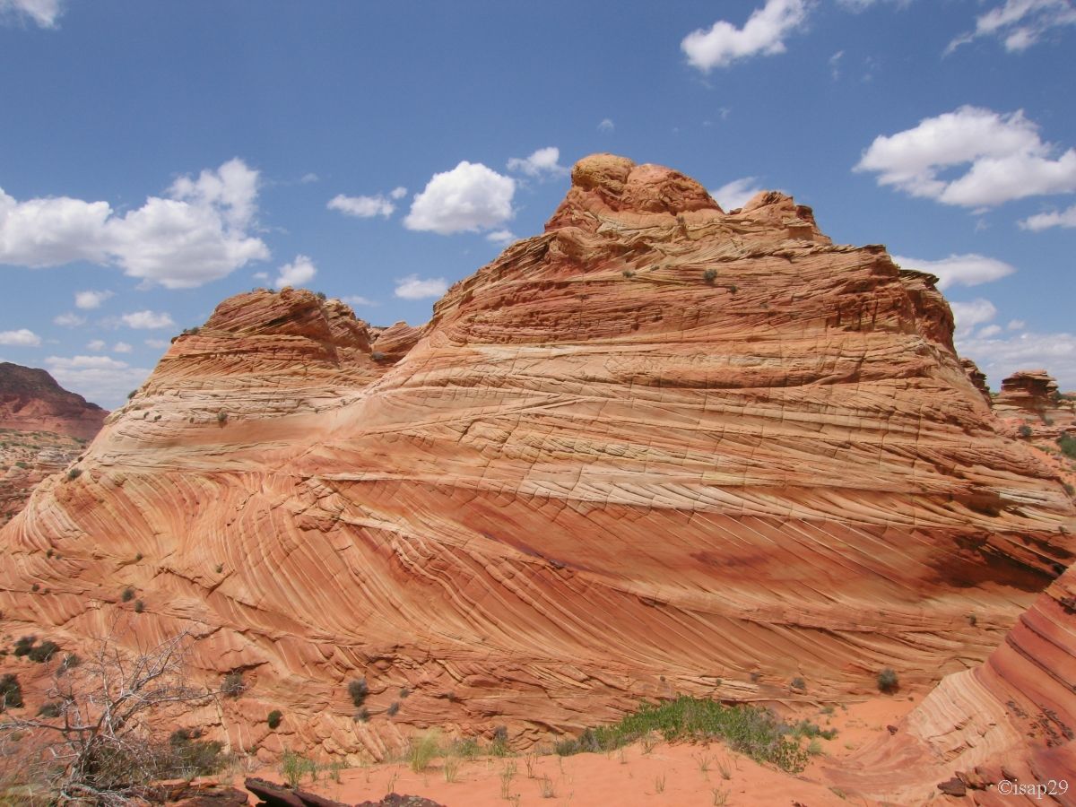
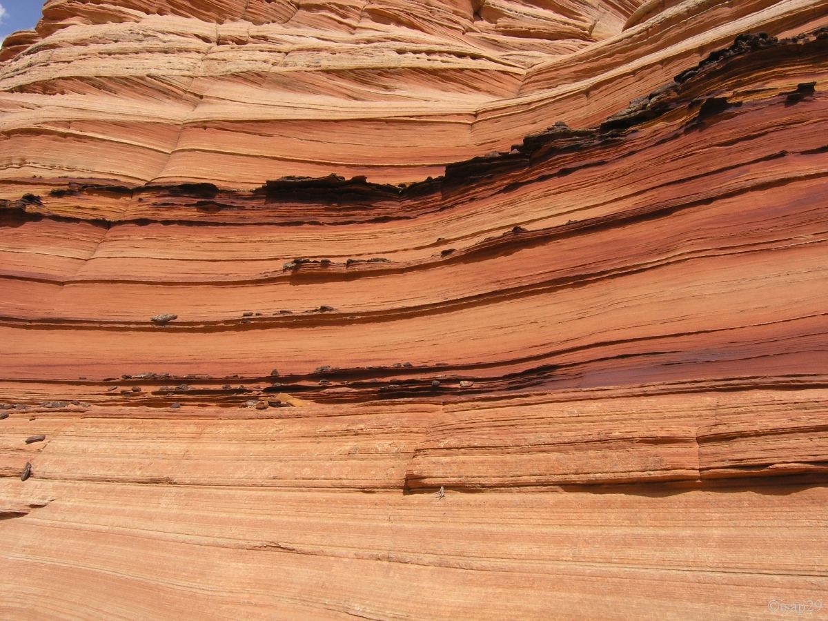
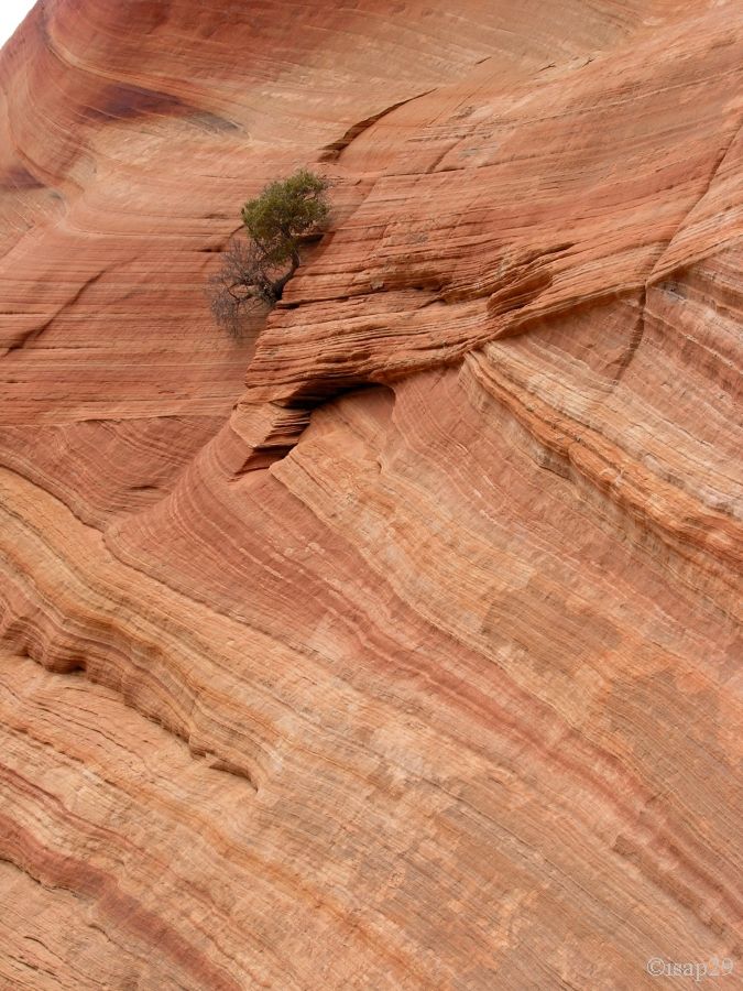
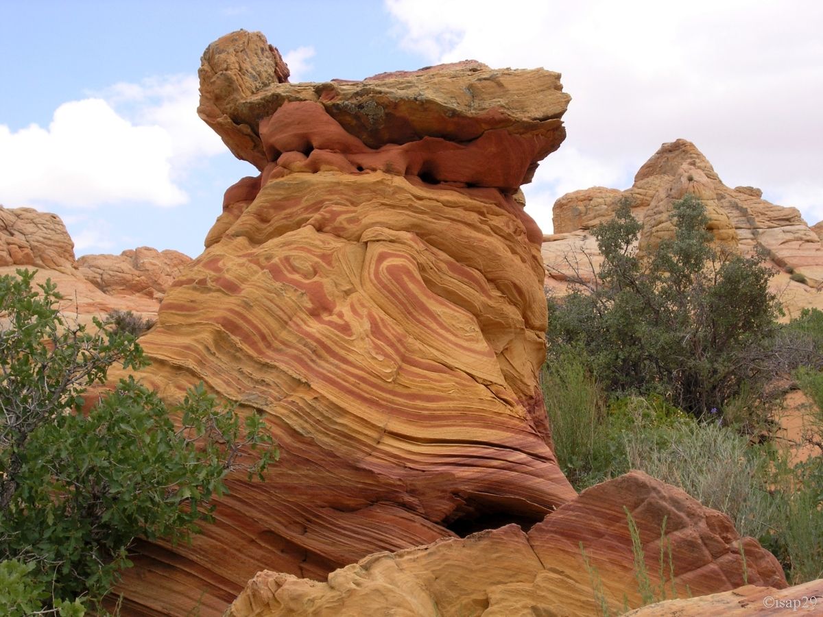
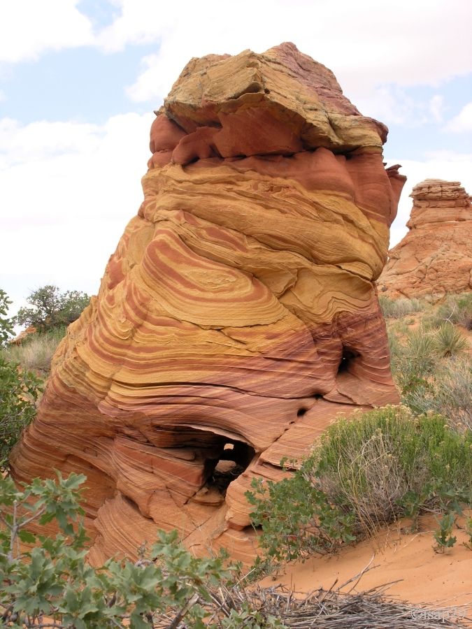
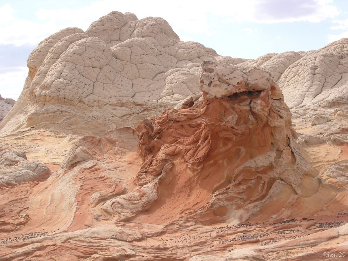
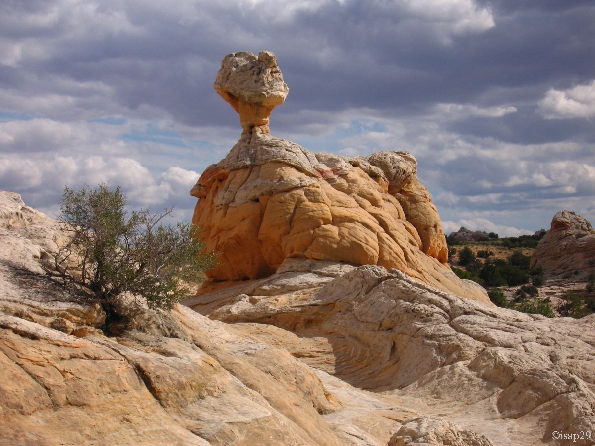
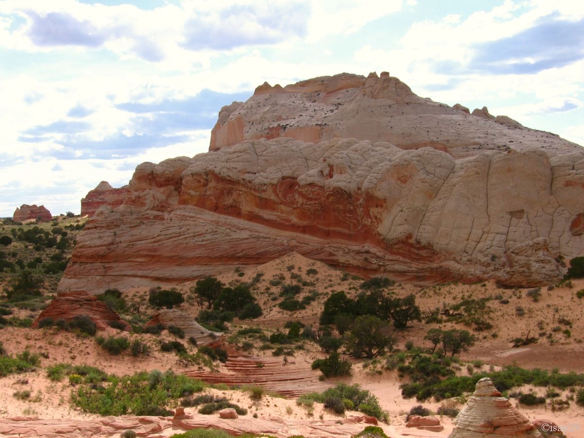
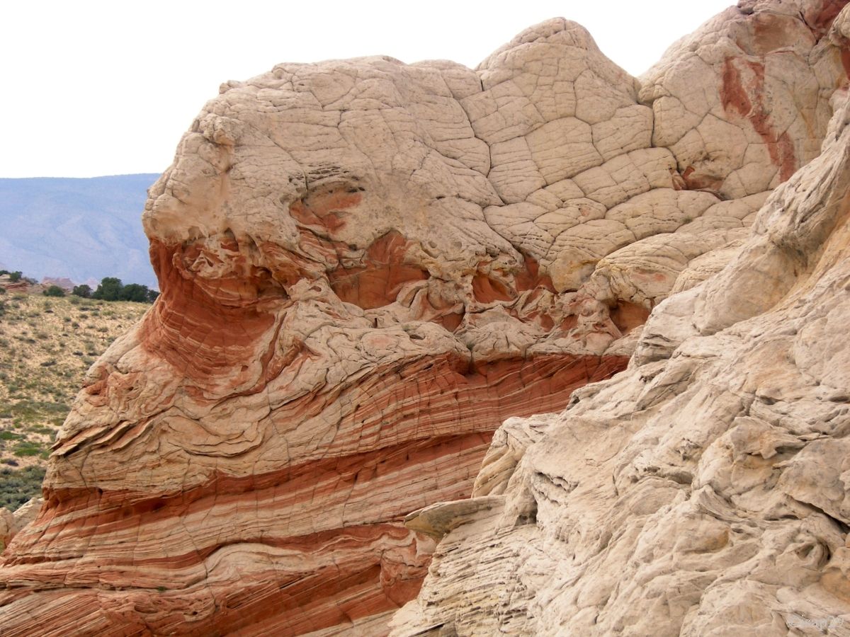
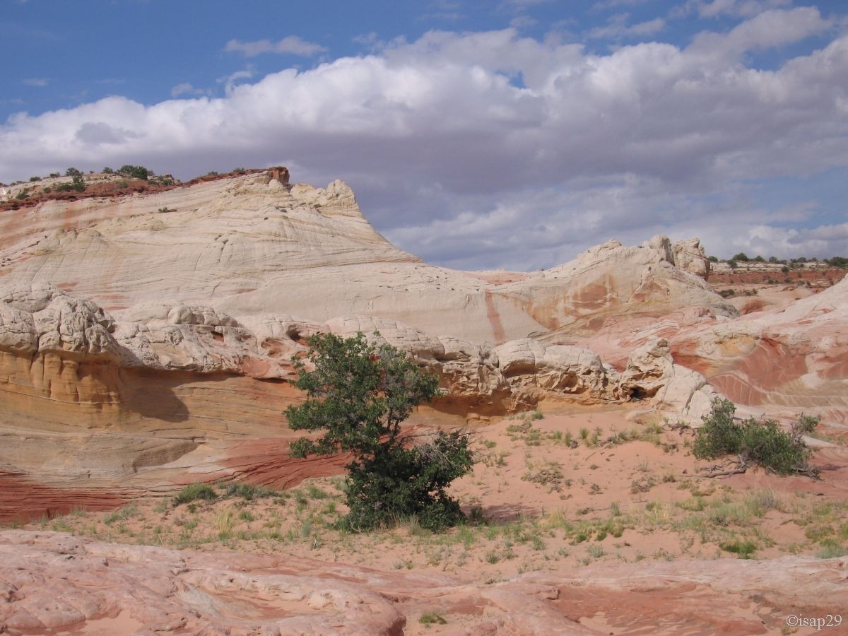
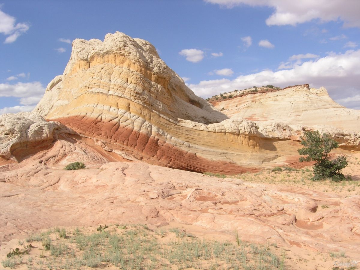
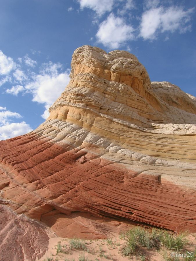
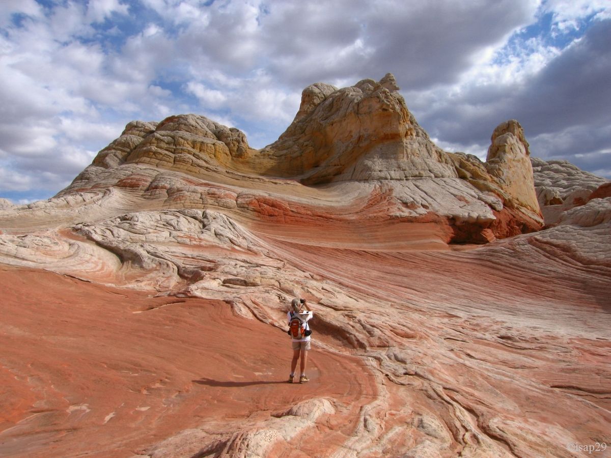
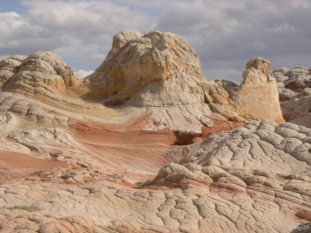
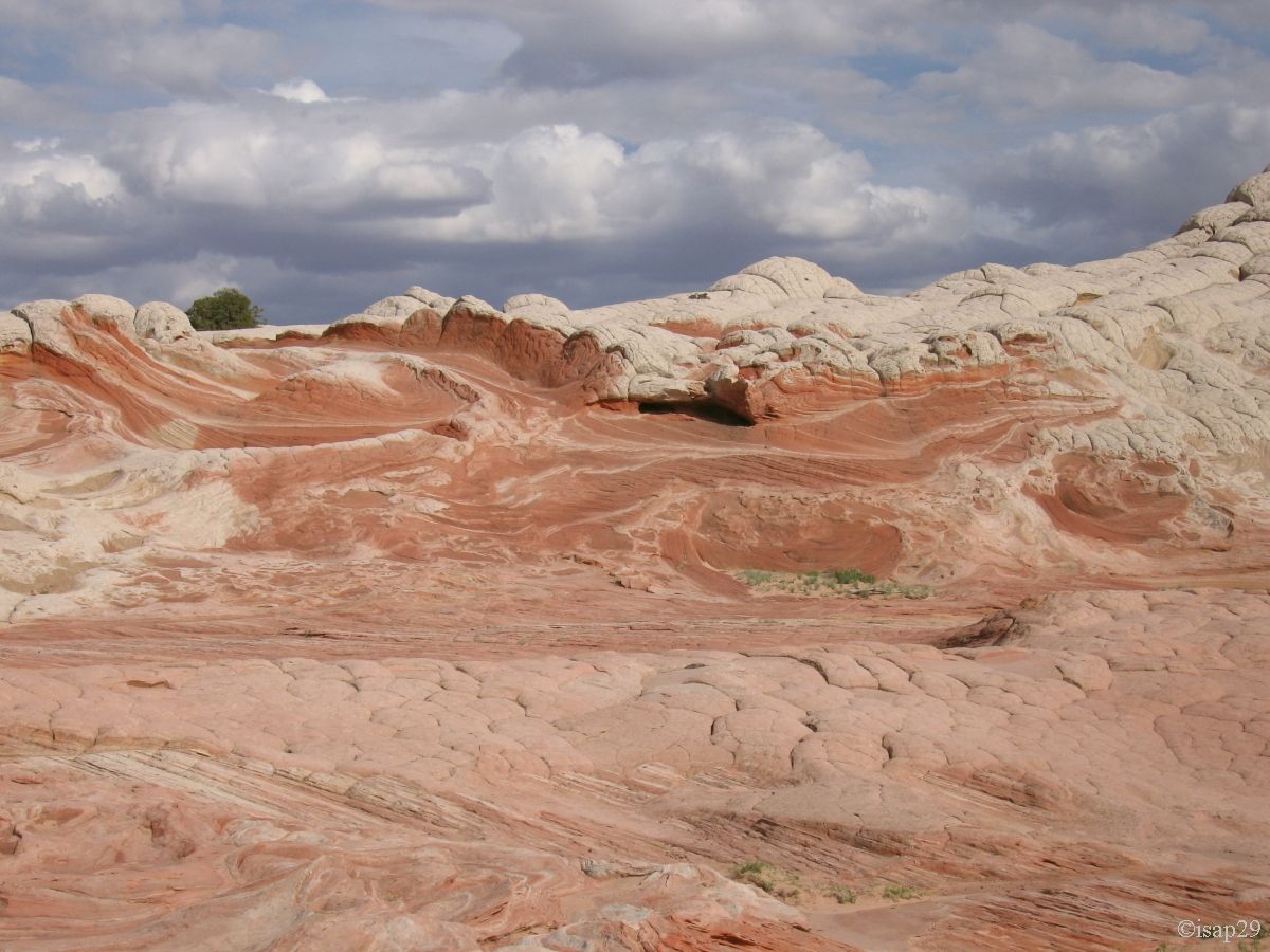
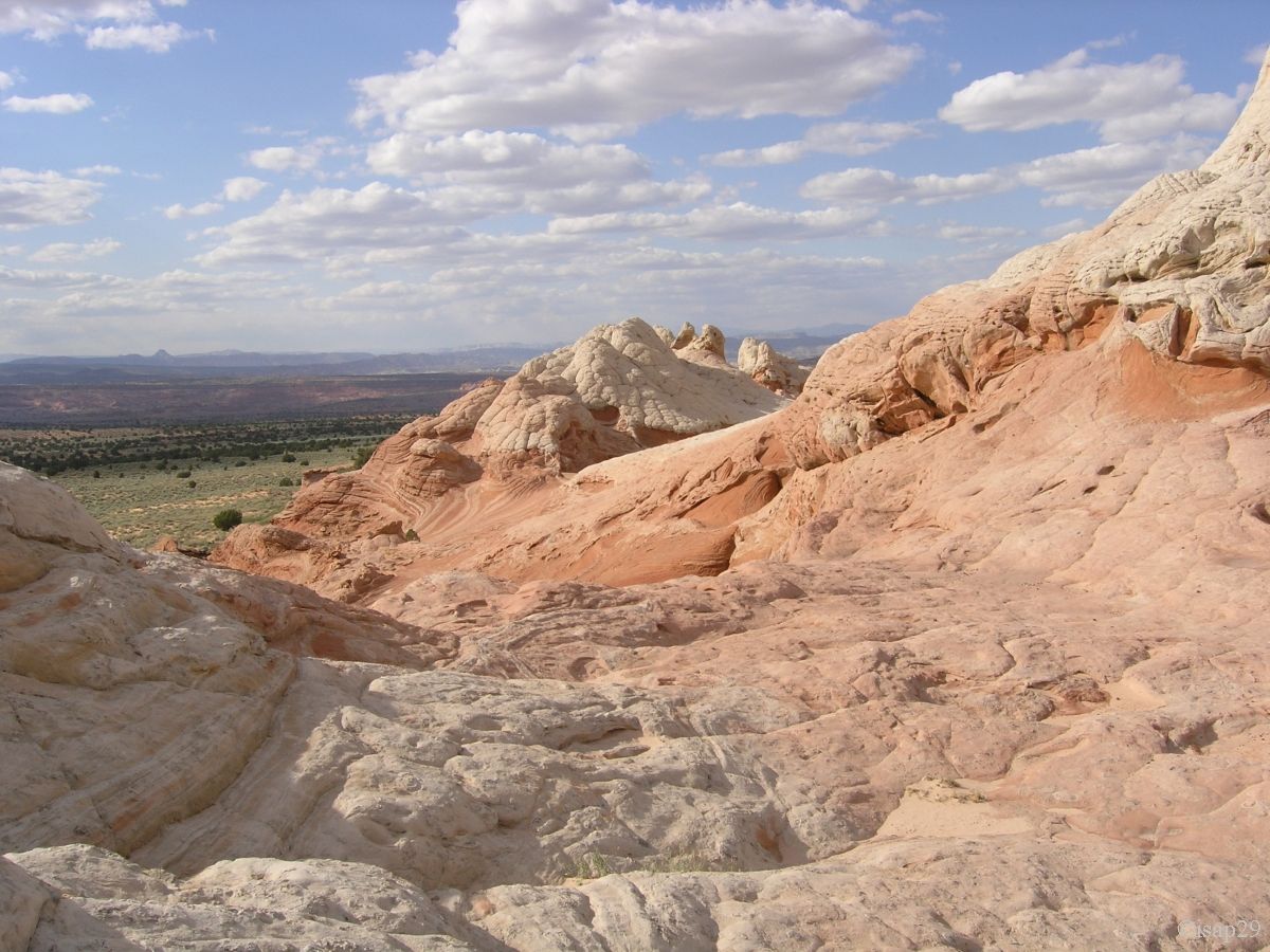
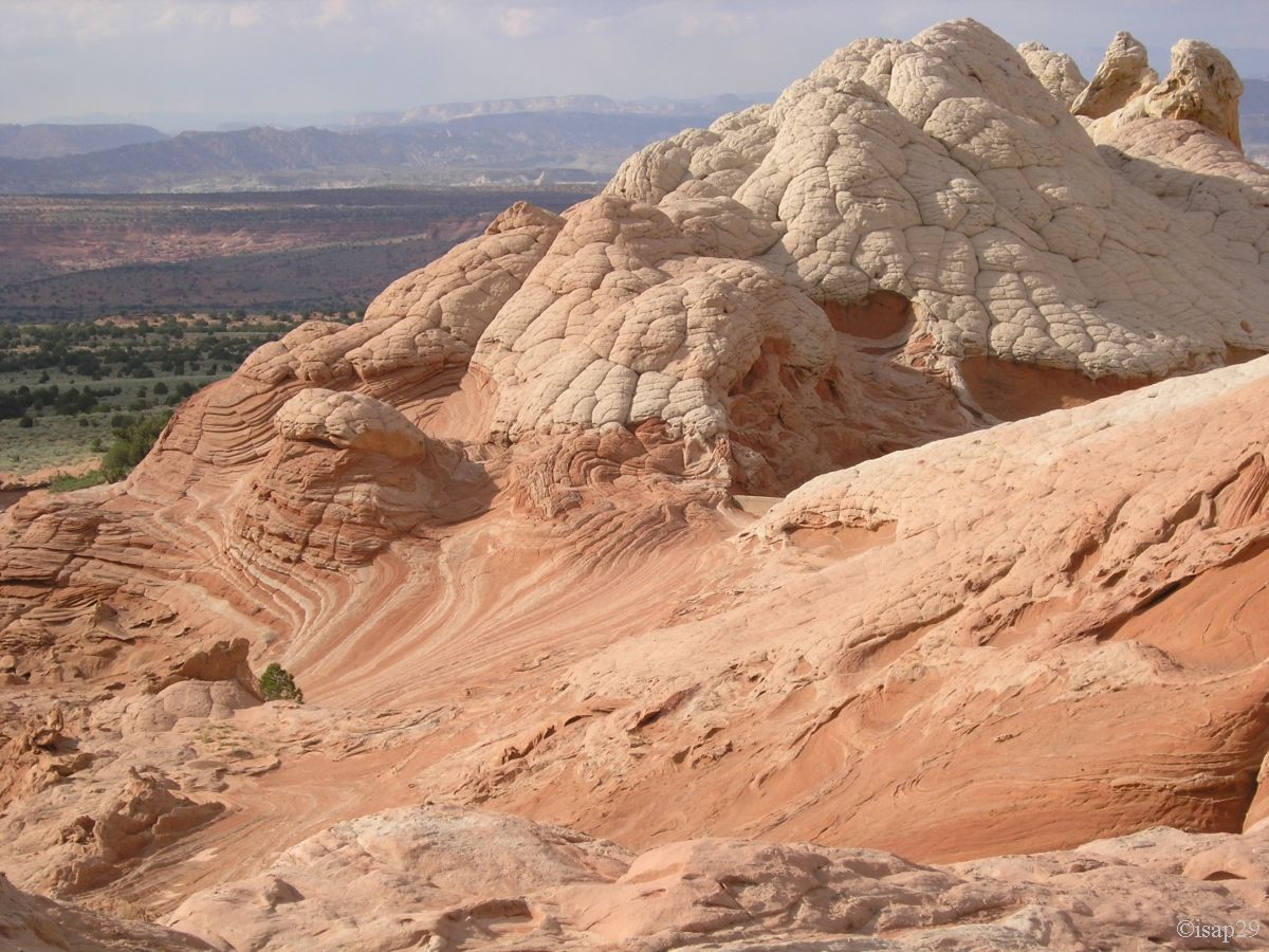
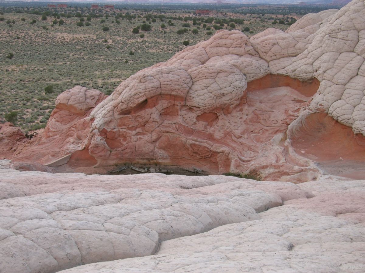
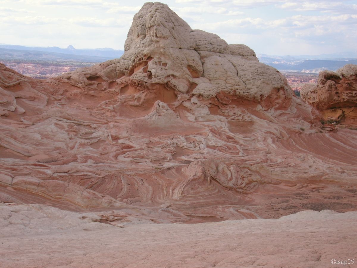
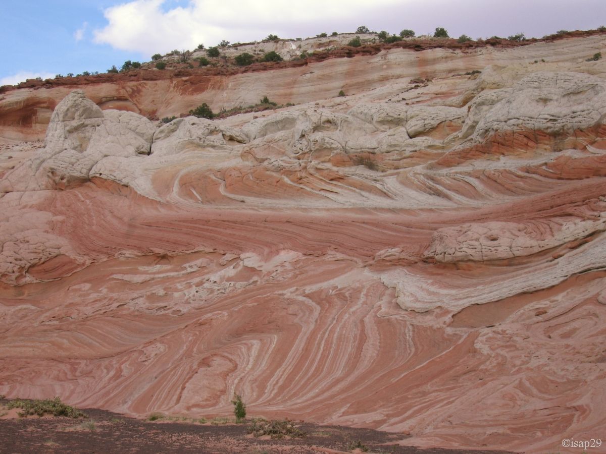
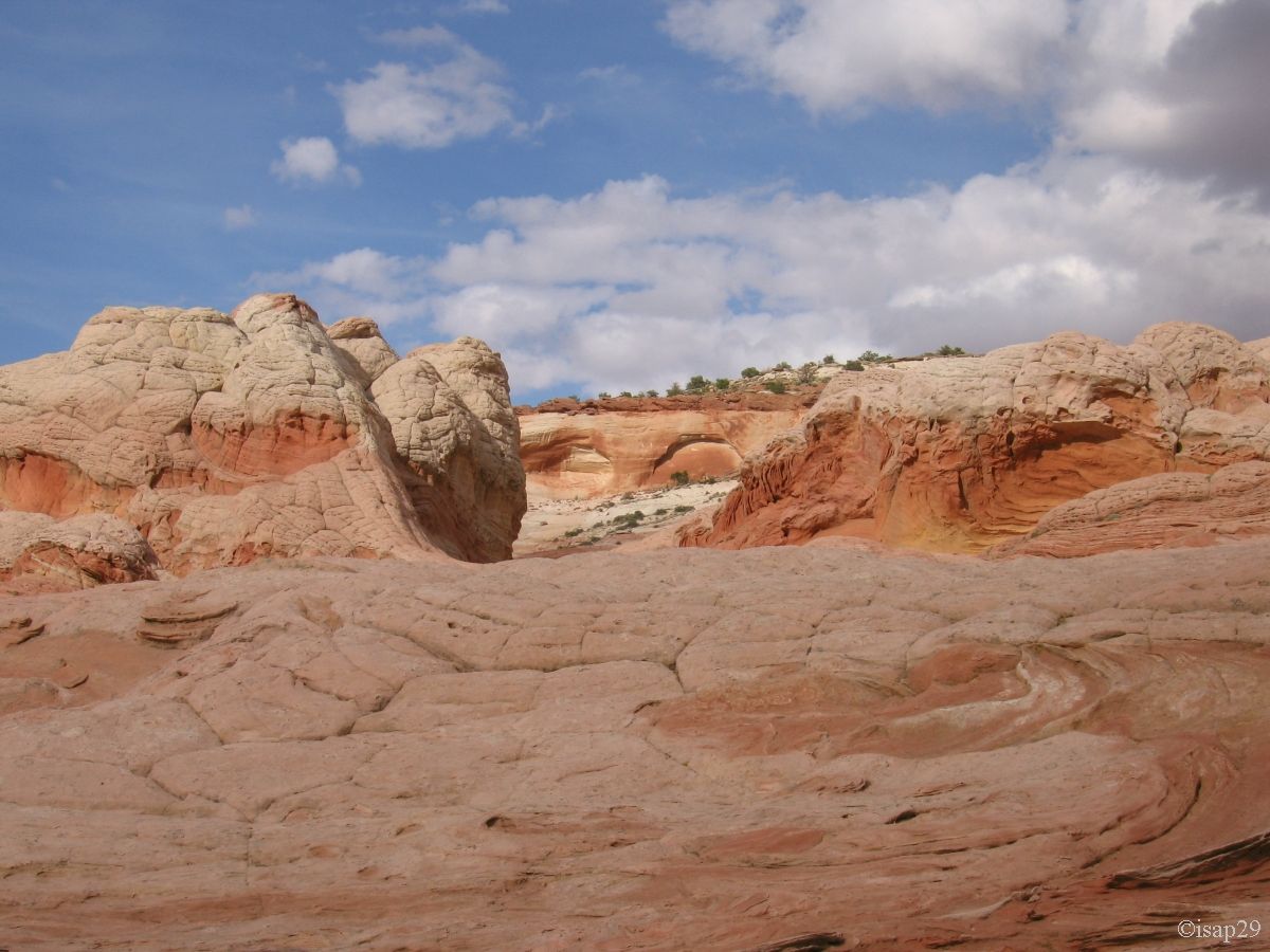
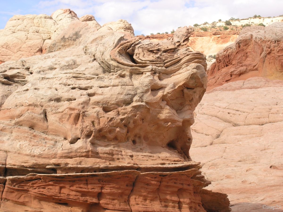
And then begin the miracles of the erosion in their splendor, in two tones festival. Multiple cones and edges appear straight out of a soft ice-cream
machine, raspberry & vanilla scents! The pictures speak a thousand words.
.jpg)
Cottonwood Cove - 1 (29 photos)
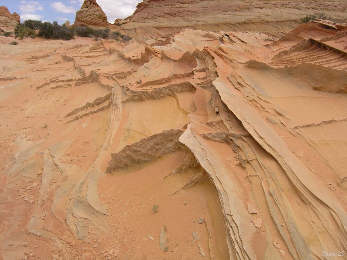
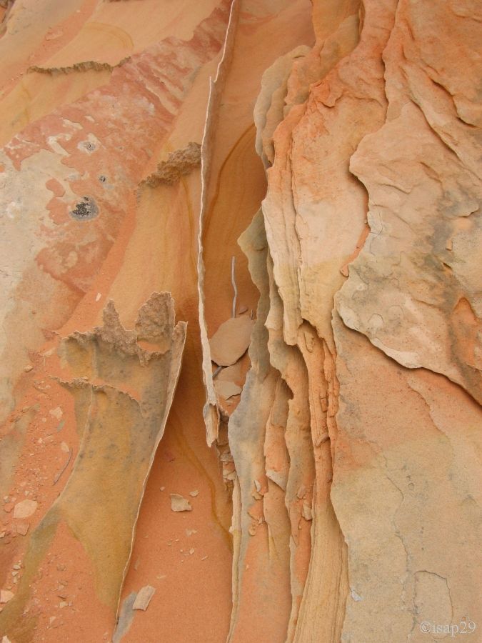
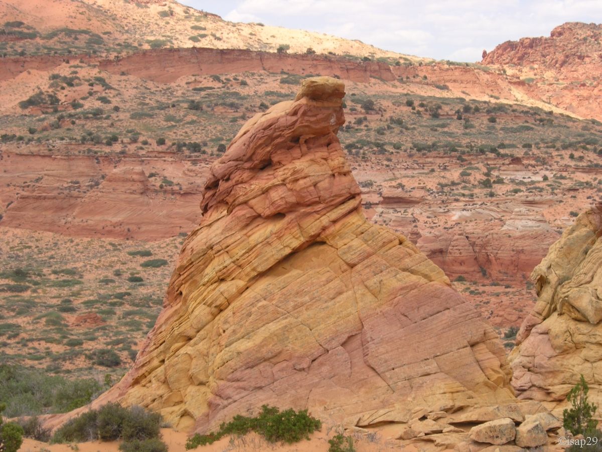
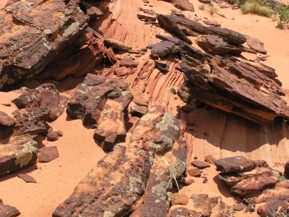
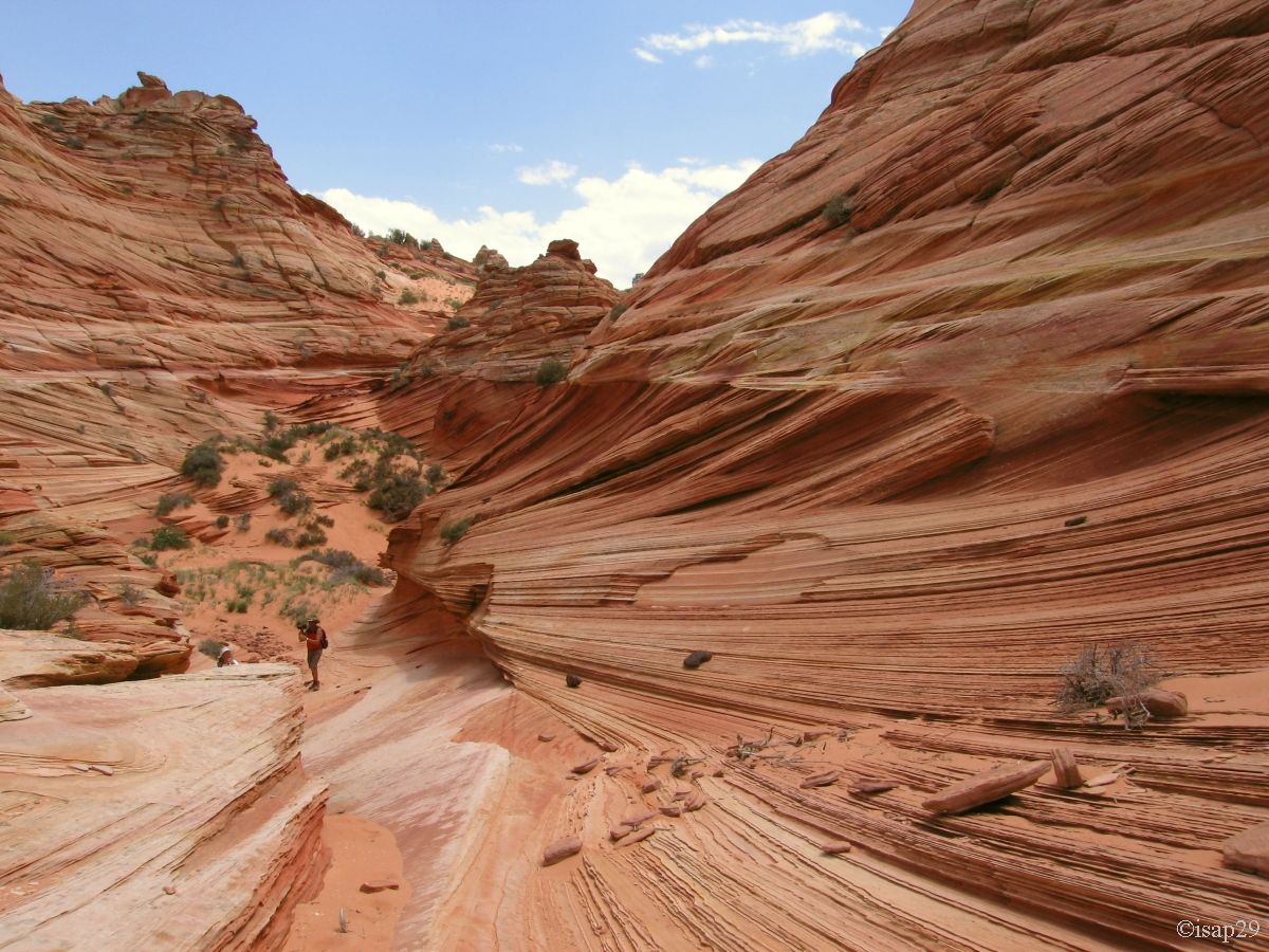
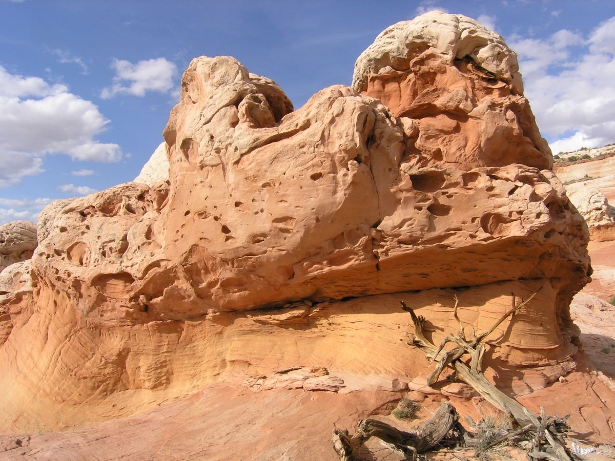
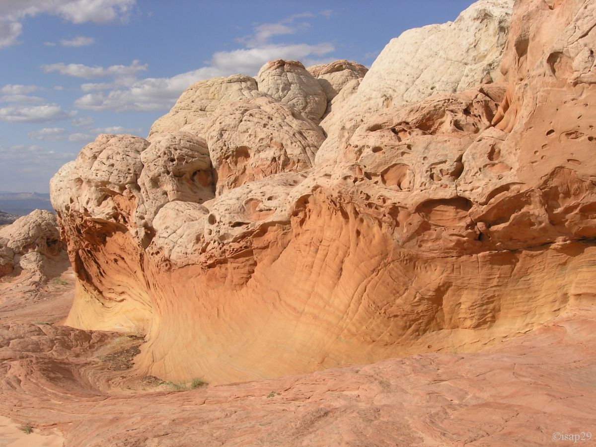
Around 1:15 pm, we cross with care (Kurt asks us to follow in his footsteps) an area called "Fin Land": the rock is very fragile and
has many edges shaped blade that the slightest step can break.
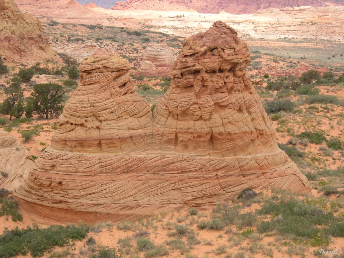
A little later, a remake of the scene of La Grande Vadrouille (French film) when the road marking machine goes off the road, but still in 2 tones (vanilla & raspberry).
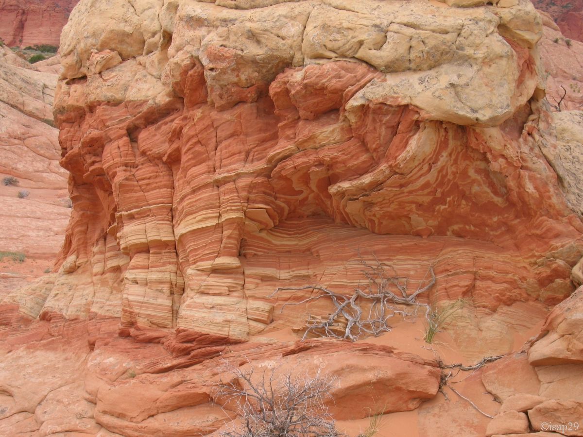
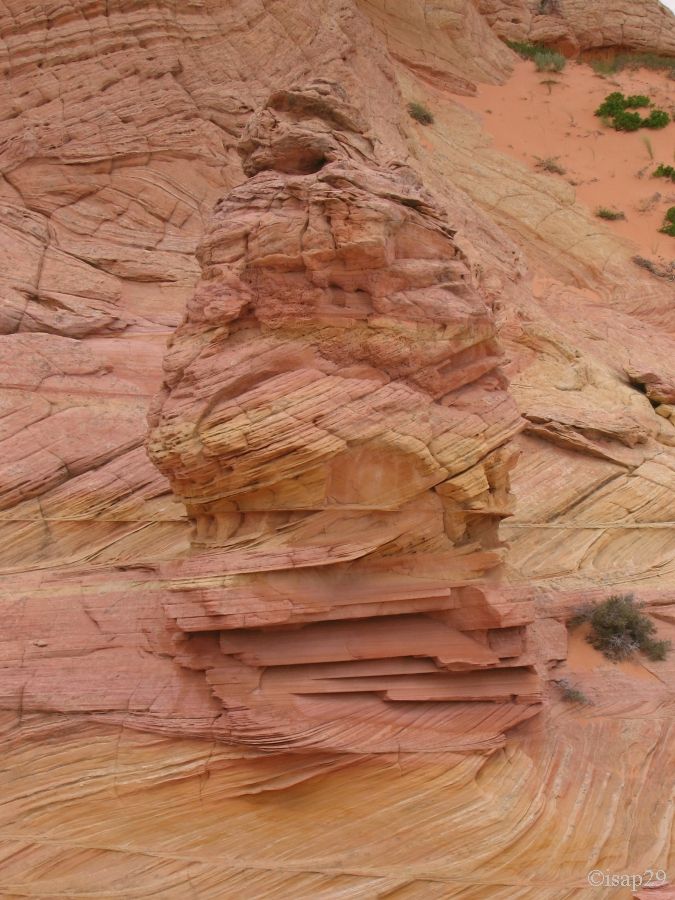
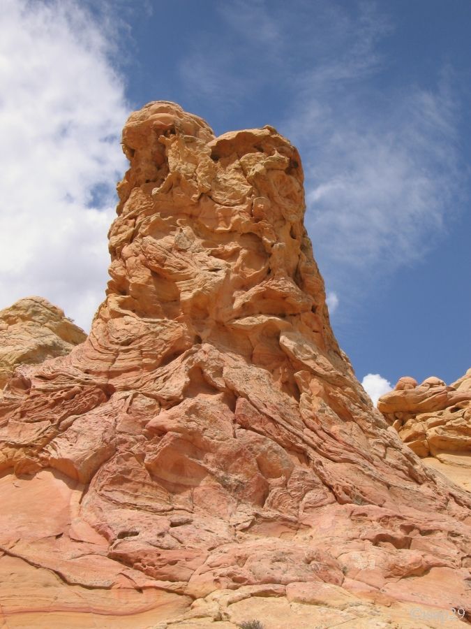
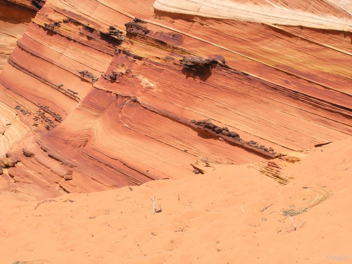
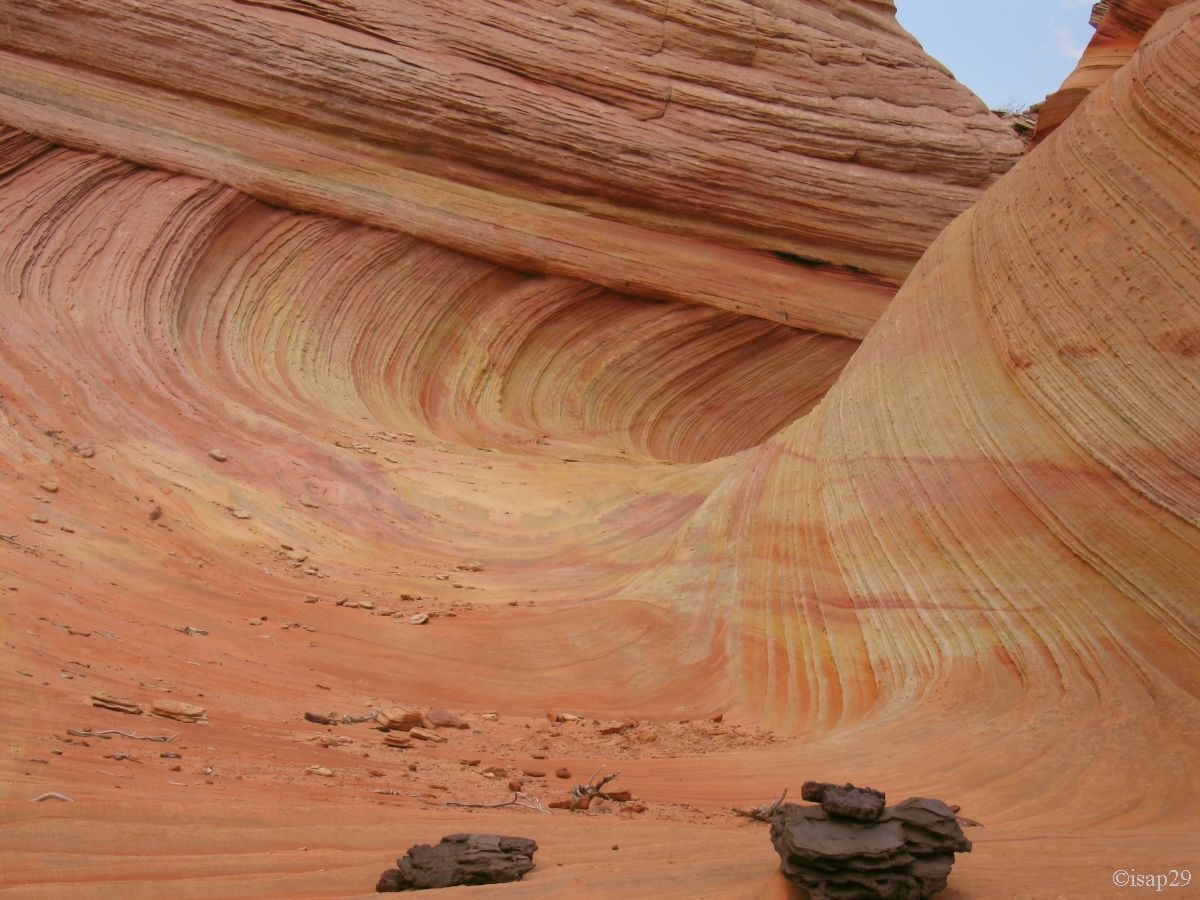
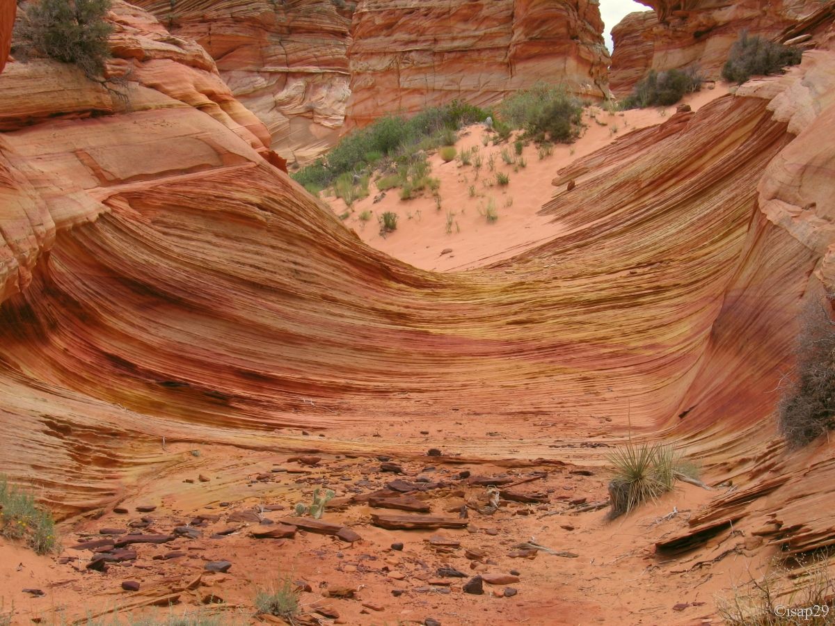
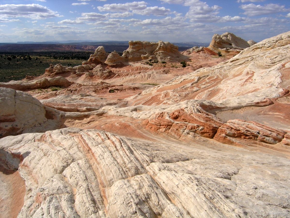
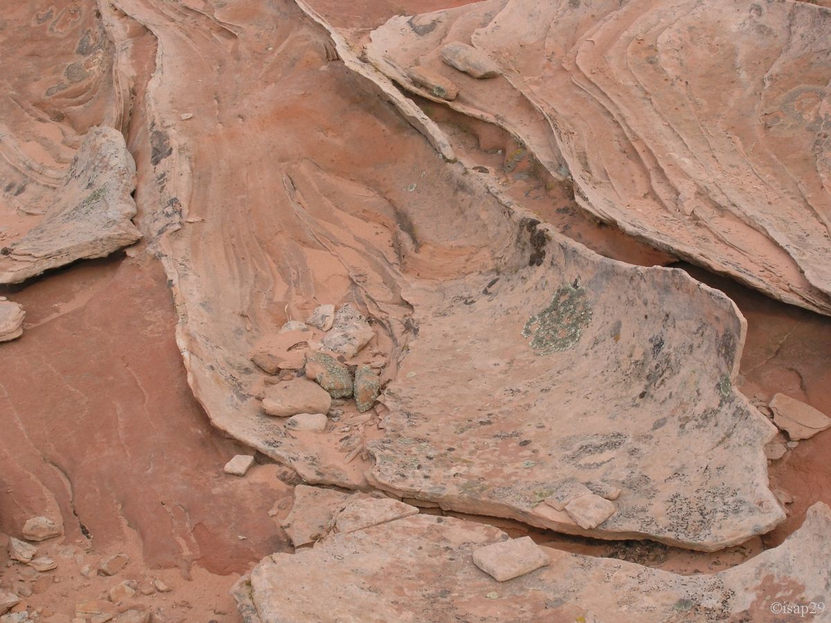
Around 2:20 pm, we reach an area where the metal oxides (iron and manganese in principle) provide a special touch to the rock: a cameo from red to dark purple.
Kurt, rummaging through the debris (I suspect he knows what he does) quickly shows us a stone arrowhead (not able to do a photo).
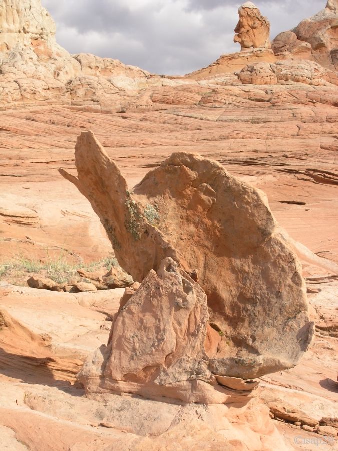
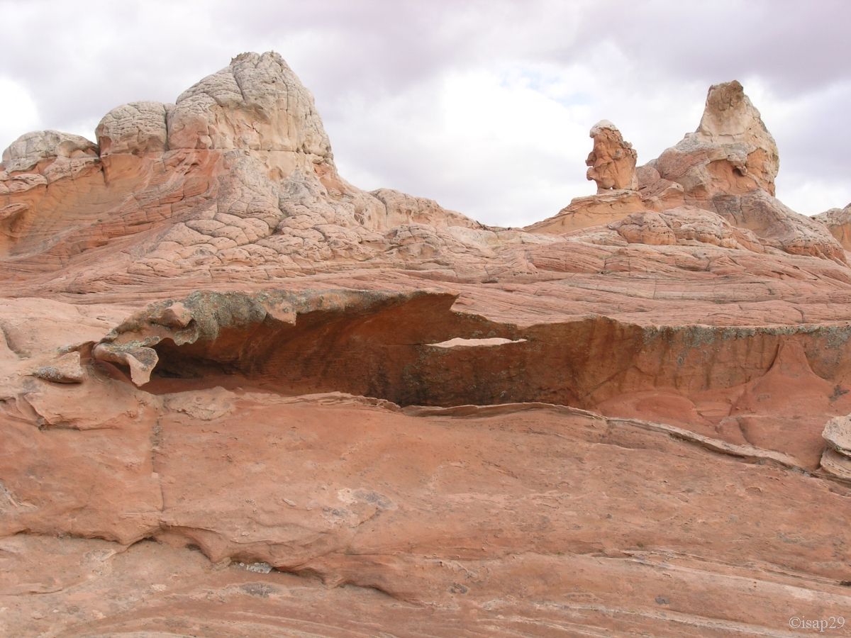
In the same area, for us who could not see The Wave, one of its cousins attracts us: The Third Wave?
On the way back, a gorgeous raspberry-vanilla soft ice-cream . ((it's becoming an obsession!).
And after a short walk in sand, we arrive at the car for a little picnic; it's 3:45 pm and we have hiked 5.5 miles.
.jpg)
_B-15.jpg)
Cottonwood Cove - 2 (31 photos)
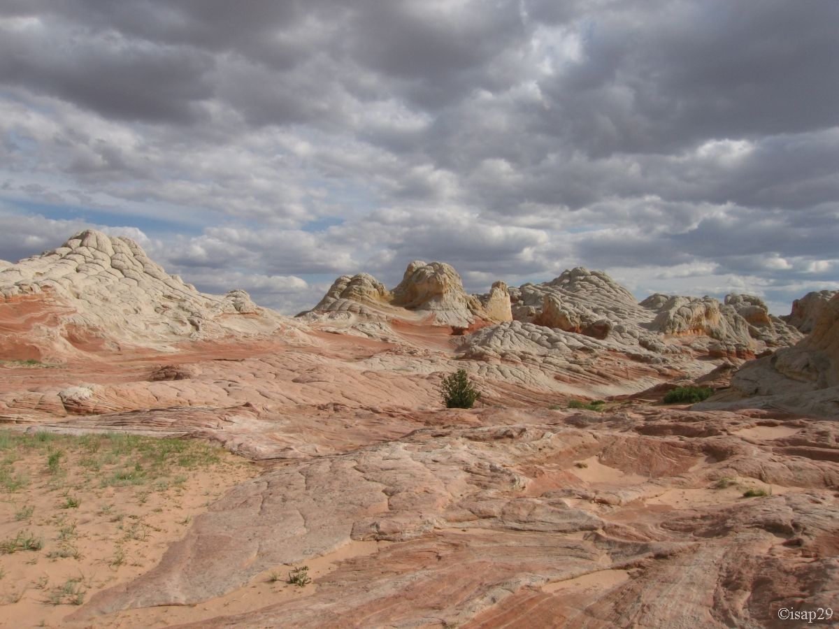
45 minutes later, we leave for the last site of the day, White Pocket.
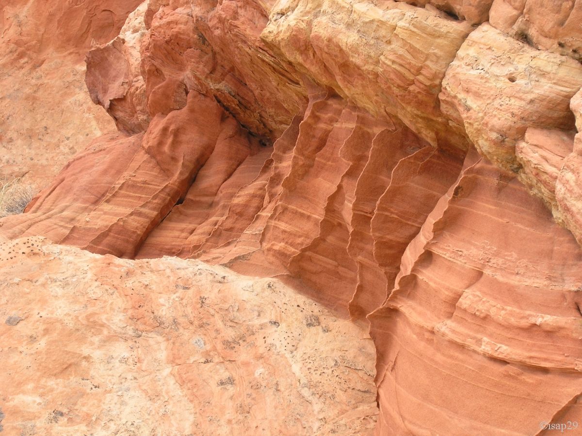
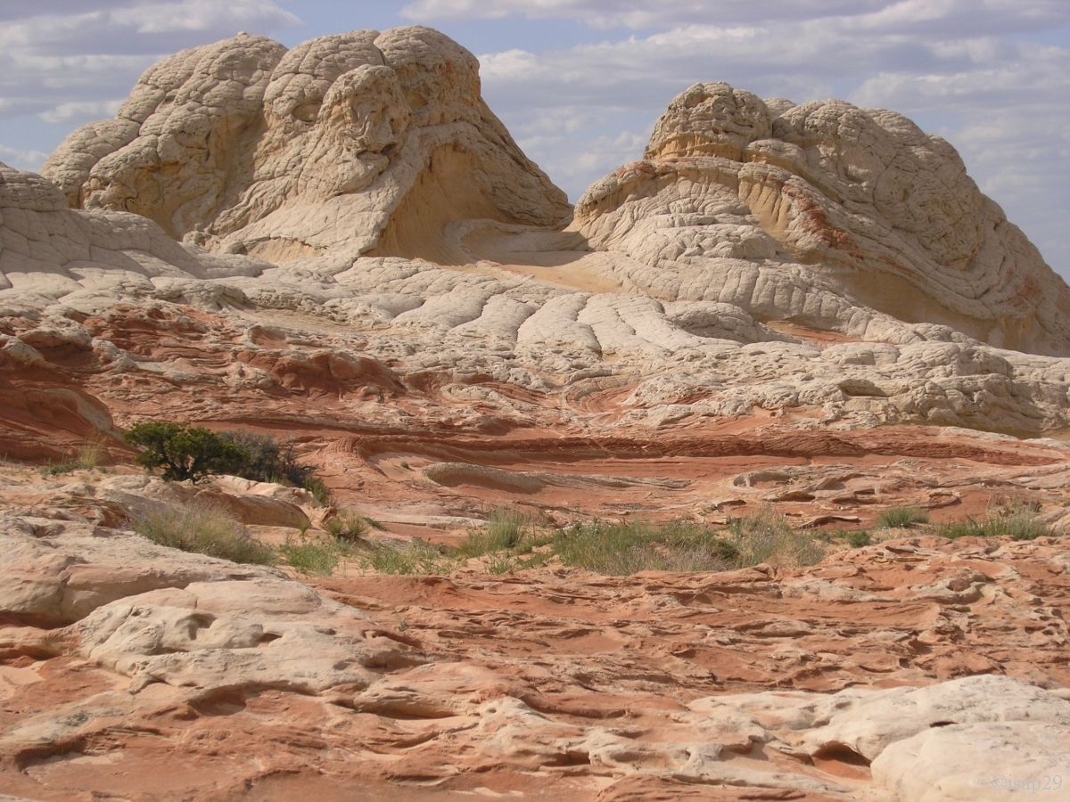
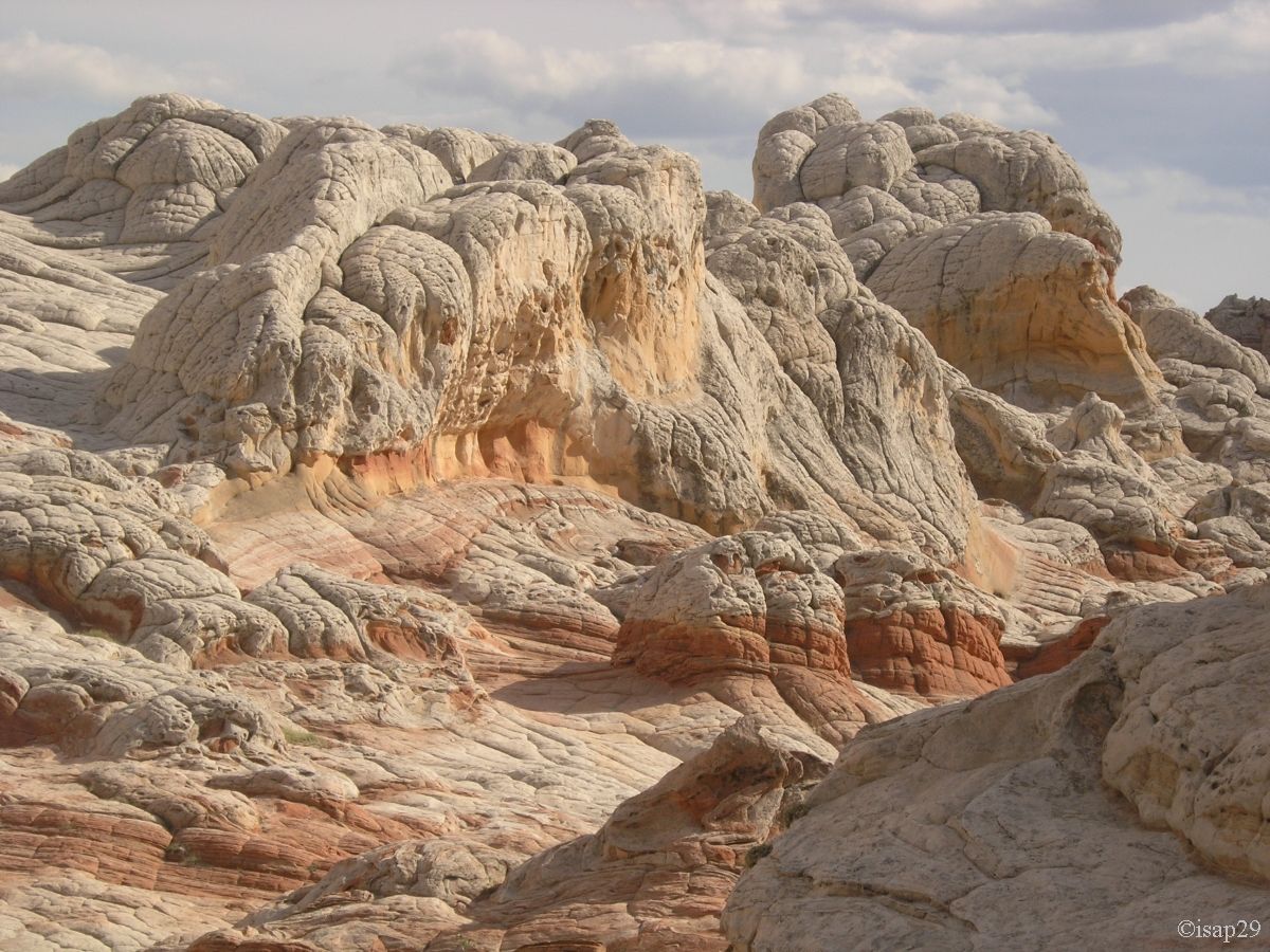
On arrival, we find a kind of white plateau a bit bumpy, with reddish areas and sometimes ocher yellow, just below the white layer.
Once again, the pictures speak for themselves so it's beautiful, but we must often play with the clouds, many and facetious.
Kurt, our guide, lets us almost alone in this vast hugeness, with no other noise than the sound of our footsteps, content to guide us
while taking, too, some pictures. A total communion with nature and what a nature!
_gam1-4.jpg)
_B-10.jpg)
_B-10_gam1-2.jpg)
-ciel.jpg)
White Pocket (38 photos)
Back to car and we leave at 6:50 pm. On the way back, Kurt rides a little faster and, on the bumps on the track, Isabelle speaks of pulp and Orangina,
I don't understand why .
I go down at all fences to open and close them after ourselves and Kurt likes, it saves us time and avoiding him to step out of the car. The vehicle is in 4WD position
and, despite this, some passages are difficult to overcome. We will have 55 minutes to return to House Valley Road and, at 8:30 pm, and we arrive at Paria Outpost, pleased with our day.
We have never seen so many manifestations of erosion in all its forms.
Kurt, happy to discuss one of his hobbies, brings me one of his books on local flora and, as we're discussing, Steve tells us we're lucky to see much flowers.
Indeed, he says that spring has been quite rainy and June unusually cold.
We dine with turkey legs cooked by Steve on his barbecue and, as usual, there's too much. Steve puts all leftovers in a dish in the fridge for our departure the next day (doggy bag).
